
On Ambergris Caye, the evening belongs to the town of San Pedro, where restaurants and bars light up along the waterfront and boats rock at the piers. Both sit beside the same barrier reef, yet they suit different travelers, and the choice between them shapes the whole trip.
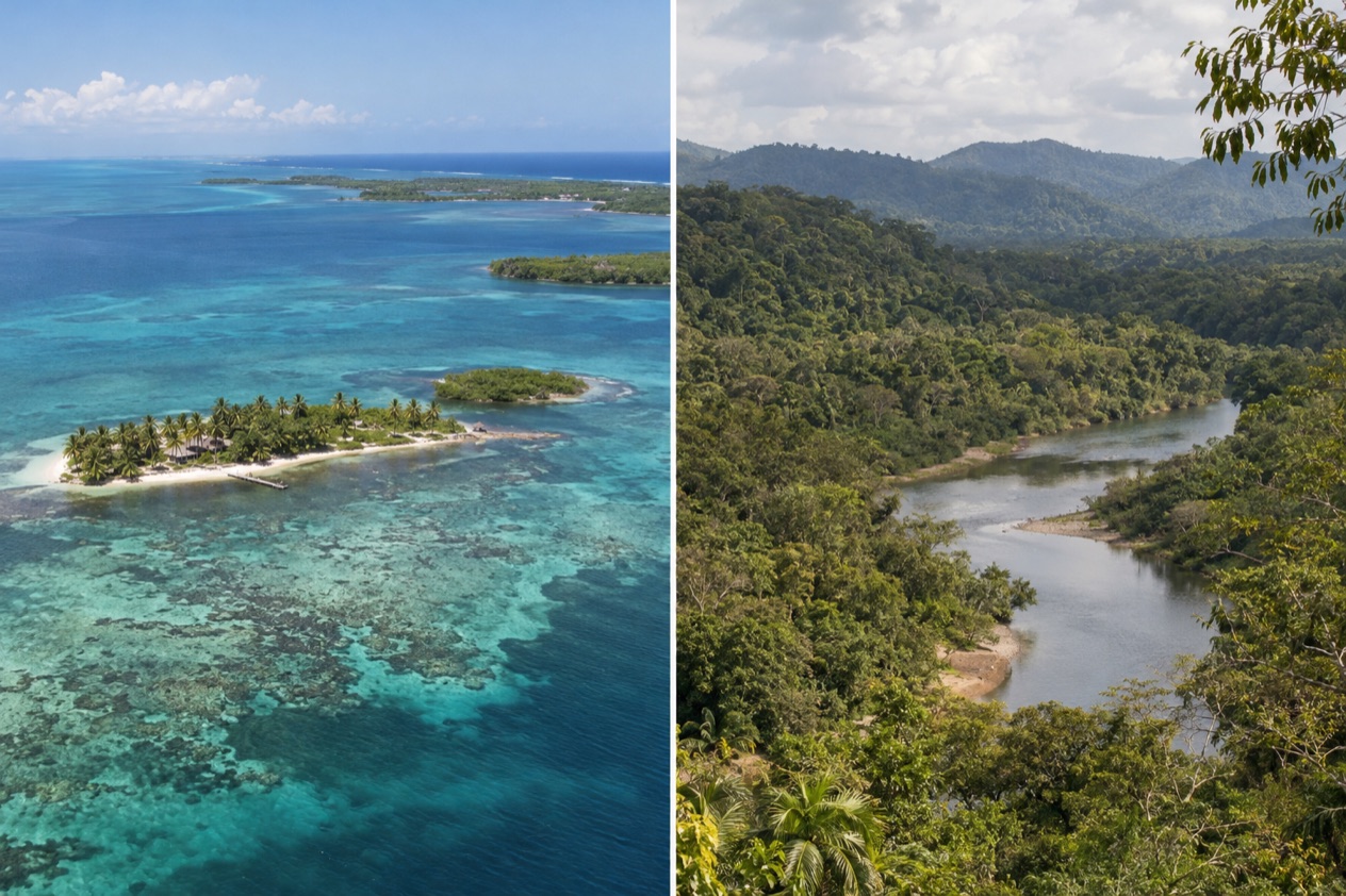
Which is better, Ambergris Caye or Caye Caulker?
Ambergris Caye suits travelers who want a bigger island with more places to stay, a lively town and a long list of reef excursions, while Caye Caulker suits those who want a small, unhurried village where the pace is set by bicycles and flip-flops. Neither is the better island in general. The better one is the one that matches the days you picture.
Ambergris is the largest of the several hundred cayes in the northernmost waters of Belize, and it carries the weight of that size: resorts, a town, an airstrip and a reef that is the main reason people come. Caye Caulker is a small island with a village, a modest population and a hotel scene that has grown out of its long backpacker history.
| Category | Ambergris Caye | Caye Caulker |
|---|---|---|
| Size | About 25 mi long and 1 mi wide | About 5 mi long |
| Main town | San Pedro, a township since 1984 | Caye Caulker Village |
| Beaches | Beaches along the barrier reef side of the island | Sandy beaches and clear water, the reef 1 mi to the east |
| Vibe | A busy tourist town with resorts and a long list of excursions | Free of hustle and bustle, a sleepy village on the backpacker circuit since the 1960s |
| Things to do | Hol Chan Marine Reserve, Shark Ray Alley, Bacalar Chico | Caye Caulker Marine Reserve, manatee tours to Swallow Caye, lobster and seafood |
| Weather | Warm year round, with a hurricane season from June 1 to November 30 | Warm year round, with a hurricane season from June 1 to November 30 |
| Getting there | Flight from Belize City of about 20 minutes, Tropic Air and Maya Island Air | Flight of about 15 minutes, or water taxi of about 45 minutes from Belize City |
| Best for | Resort stays, diving, a wider choice of restaurants and bars | Slow days, snorkeling, backpackers and travelers who like a small village |
Beaches and the sea
Ambergris Caye faces the Belize Barrier Reef, and the reef and the beaches are named as the island’s main attractions. The reef is the second largest in the world after Australia’s Great Barrier Reef, and in the north it runs close to shore. That closeness is the thing to picture: a line of reef offshore, boats heading out to it from the piers of San Pedro, and a shoreline lined with resorts, piers and palms.
The island is long and narrow, so the character of the coast changes as you move along it. Around San Pedro, the waterfront is a working, lived-in strip of docks, bars and beach clubs.
Farther north, the island narrows toward Bacalar Chico National Park and Marine Reserve, which occupies the northern end and reaches from Chetumal Bay to the Caribbean Sea. It is the quiet, protected edge of the island, a part of the barrier reef system recognized by UNESCO.
Caye Caulker has sandy beaches and crystal clear water, and the barrier reef is easily accessible, about a mile to the east. The island sits within the Caye Caulker Marine Reserve, which covers more than 9,000 acres and takes in mangroves and littoral forest, lagoon marshlands, sea-grass beds and coral reef.
Snorkelers and divers are the ones who feel that variety most. The western side, the protected bay of La Ensenada, is where one theory says boats were once caulked, which gave the island its name.
Which wins depends on what you want from the shore. For a long stretch of coast with resorts, piers and a choice of beach spots, Ambergris has more to offer.
Sargassum can reach Caribbean shores, and the Belize Tourism Board describes it as a seasonal seaweed that comes and goes, so the beach you see on a given day may differ from the photos.
Things to do
The reef is the center of the visit on both islands, and the two share Hol Chan Marine Reserve, which lies close to both Ambergris Caye and Caye Caulker. The differences show up in everything that surrounds the reef: how many things there are to do on land, how the evenings go and which day trips start from your dock.
Ambergris Caye and San Pedro
Hol Chan Marine Reserve lies about four miles south of San Pedro. Its name is Maya for little channel, and it was established in July 1987 as the first marine protected area in Belize. It protects coral reef, sea-grass meadows and mangrove swamp, and in 1999 Shark Ray Alley was added to protect the sharks and rays that gather at a feeding point there.
At the far north of the island, Bacalar Chico National Park and Marine Reserve was designated in 1996 and covers 28,169 acres. It is one of seven sites within the Belize Barrier Reef System World Heritage Site. Beyond the water, San Pedro itself is the draw for evenings, with its restaurants and bars, and for resort stays, since the island has resorts and a helicopter service that reaches the local airstrip and various resorts.
Caye Caulker
The Caye Caulker Marine Reserve is described as a diver and snorkeler’s paradise, and it is the first thing most people book. Manatee tours go to Swallow Caye Wildlife Sanctuary. Swimming with the manatees is not allowed, and some days it may be harder to see them than others, so the outing is about watching from the boat rather than a guaranteed sighting.
On land, the island’s old trade is a pleasure in its own right. The sleepy village once lived mainly on lobster fishing, and seafood is a must for anyone who loves it. With over 50 hotels, restaurants and shops, the village has what you need, and the rest of the day is for walking, cycling slowly and watching the water from a dock.
Day trips and the atolls
The barrier reef system includes three Caribbean atolls: Turneffe Atoll, Glover’s Reef and Lighthouse Reef. Lighthouse Reef is the most easterly diving area in Belize and is home to the Great Blue Hole, made famous by Jacques Cousteau in 1970.
Turneffe Atoll lies directly east of Belize City and is the nearest of the atolls to that city. Both islands look out toward this reef system, which is why divers often use either as a base.
Weather and the best time to go
The two islands share one sea and one sky, so the seasons arrive together. The figures that anchor the year come from Belize City, and they show a place that is warm in every month.
In January, highs average 83.2°F and lows 68.0°F, with 4.97 inches of rain over about ten days. In July, highs average 89.3°F and lows 77.0°F, with 5.73 inches of rain over about twelve days.
| Belize City | Average high (°F) | Average low (°F) | Precipitation (in) | Rain days |
|---|---|---|---|---|
| January | 83.2 | 68.0 | 4.97 | 10.3 |
| July | 89.3 | 77.0 | 5.73 | 11.8 |
What that means for a traveler is simple. January is the gentler month, with evenings cool enough for a light layer and days warm enough for the water. July is hotter and stickier, a month for early starts, long breaks in the shade and time on the water to cool off. Rain falls in both months, so a rainy day belongs in the plan for either island.
The Atlantic hurricane season runs from June 1 to November 30, and it applies to both cayes alike. A trip in those months is a trip in hurricane season, and the weather on the days you travel is the thing to watch. The months outside it, December to May, are outside the official season.
Neither island has a weather advantage over the other. Pick the season for what you want from it, warmer and wetter in the middle of the year, a bit cooler in winter, and then pick the island for the style of stay. The sea and the reef are the constant on both.
Getting there and getting around
Both islands are reached from Belize City by air or water, and they are also linked to each other. The ferry from San Pedro to Caye Caulker takes about 30 minutes, which is what makes it easy to see both in one trip.
Reaching Ambergris Caye
A flight from Belize City to Ambergris Caye takes about 20 minutes. The island has a small airstrip serviced by Tropic Air and Maya Island Air, and Astrum Helicopters services the local airstrip and various resorts. San Pedro is on the southern part of the island, in the Belize District.
The island is about 25 miles long and a mile wide, a long, thin strip, so distances along it are real. Hol Chan Marine Reserve is about four miles south of San Pedro. The water in San Pedro is safe to drink, while on the mainland and the smaller islands bottled water is the safer choice.
Reaching Caye Caulker
Caye Caulker is about 20 miles north-northeast of Belize City and is reached by high-speed water taxi or by small plane to Caye Caulker Airport. The flight takes 15 minutes. The San Pedro Belize Express ferry from Belize City takes approximately 45 minutes. Tropic Air flies to the island under the airport code CUK.
Once there, the island is about five miles long, and the only local traffic sign tells bikers and pedestrians to go slow. That sign sums up how people get around: slowly, by bicycle or on foot. The village council looks after public property, and it also handles vehicle registration on the island.
Who should choose which
Choose Ambergris Caye if you want a bigger island with a real town, resorts, a wider set of restaurants and bars, and reef trips that leave from San Pedro to Hol Chan, Shark Ray Alley and the north. It suits couples and families who want a resort base, divers who like a long list of dive options and anyone who enjoys evenings out. The airstrip, with two airlines and a helicopter service, gives you flexible ways to arrive.
Choose Caye Caulker if you want a small village, a slow pace and a reef within easy reach. It suits backpackers, who have come here since the 1960s, and the growing number of hotels now serves a wider variety of visitors too. It is a good fit for snorkelers, for seafood lovers who want lobster and fish near the dock, and for anyone happy to set the day by the sea.
You do not have to choose only one. The ferry between San Pedro and Caye Caulker takes about 30 minutes, so a split stay works: a few nights on one island, then the other. Doing both lets you pair the town and its excursions with the quiet village and its marine reserve, and see how different two neighbors on the same reef can be.
Good to know before you go
The U.S. State Department rates Belize Level 2, “Exercise increased caution”, because of crime, and says the south side of Belize City has historically had the highest concentration of violent crime.
Belize uses the Belize dollar, and prices on the islands are often quoted in both currencies, so check which one a menu or a tour is using. The Atlantic hurricane season runs from June 1 to November 30, so a trip in those months deserves a look at the forecast before you leave. Drink the tap water in San Pedro if you like, but use bottled water on Caye Caulker and the mainland.
Sources
- Wikipedia, Ambergris Caye (https://en.wikipedia.org/wiki/Ambergris_Caye), checked October 11, 2026
- Wikipedia, San Pedro Town (https://en.wikipedia.org/wiki/San_Pedro_Town), checked October 11, 2026
- Wikivoyage, Ambergris Caye (https://en.wikivoyage.org/wiki/Ambergris_Caye), checked October 11, 2026
- Wikivoyage, San Pedro (Belize) (https://en.wikivoyage.org/wiki/San_Pedro_(Belize)), checked October 11, 2026
- Wikipedia, Hol Chan Marine Reserve (https://en.wikipedia.org/wiki/Hol_Chan_Marine_Reserve), checked October 11, 2026
- Belize Fisheries Department, Hol Chan Marine Reserve (https://fisheries.gov.bz/hcmr/), checked October 11, 2026
- Belize Fisheries Department, Bacalar Chico Marine Reserve (https://fisheries.gov.bz/bcmr/), checked October 11, 2026
- Wikipedia, Belize Barrier Reef (https://en.wikipedia.org/wiki/Belize_Barrier_Reef), checked October 11, 2026
- Wikipedia, Caye Caulker (https://en.wikipedia.org/wiki/Caye_Caulker), checked October 11, 2026
- Wikivoyage, Caye Caulker (https://en.wikivoyage.org/wiki/Caye_Caulker), checked October 11, 2026
- Belize Fisheries Department, Caye Caulker Marine Reserve (https://fisheries.gov.bz/ccmr/), checked October 11, 2026
- Caye Caulker Village Council, Traffic (https://www.cayecaulkervillagecouncil.org/traffic), checked October 11, 2026
- Caye Caulker Village Council, About (https://www.cayecaulkervillagecouncil.org/about), checked October 11, 2026
- San Pedro Belize Express Water Taxi, Caye Caulker (https://belizewatertaxi.com/destinations/caye-caulker/), checked October 11, 2026
- Tropic Air, Caye Caulker (https://www.tropicair.com/caye-caulker-cuk/), checked October 11, 2026
- Maya Island Air, Caye Caulker flights (https://www.mayaislandair.com/belize-flights-caye-caulker/), checked October 11, 2026
- NOAA NCEI, GHCN-Daily station BHM00078583 (Philip S. W. Goldson International Airport, Belize City), normals 1991-2020 computed from the daily record (https://www.ncei.noaa.gov/access/services/data/v1?dataset=daily-summaries&stations=BHM00078583), checked October 11, 2026
- U.S. Department of State, Belize Travel Advisory, Level 2, March 11, 2026 (https://travel.state.gov/), checked October 11, 2026
- NOAA National Hurricane Center, Climatology (https://www.nhc.noaa.gov/climo/), checked October 11, 2026
To plan your stay
- Best Time to Visit Ambergris Caye and San Pedro: Dry Months, Sea Temperatures, Hurricane Season and Festivals
- Things to Do in Ambergris Caye and San Pedro: Reef Snorkeling, Hol Chan, Bacalar Chico and Island Dining
- Where to Stay in Ambergris Caye and San Pedro: Beach Resorts, Town Stays and a Private Island
- Ambergris Caye and San Pedro from Belize City: Water Taxi, Flight and Getting There