
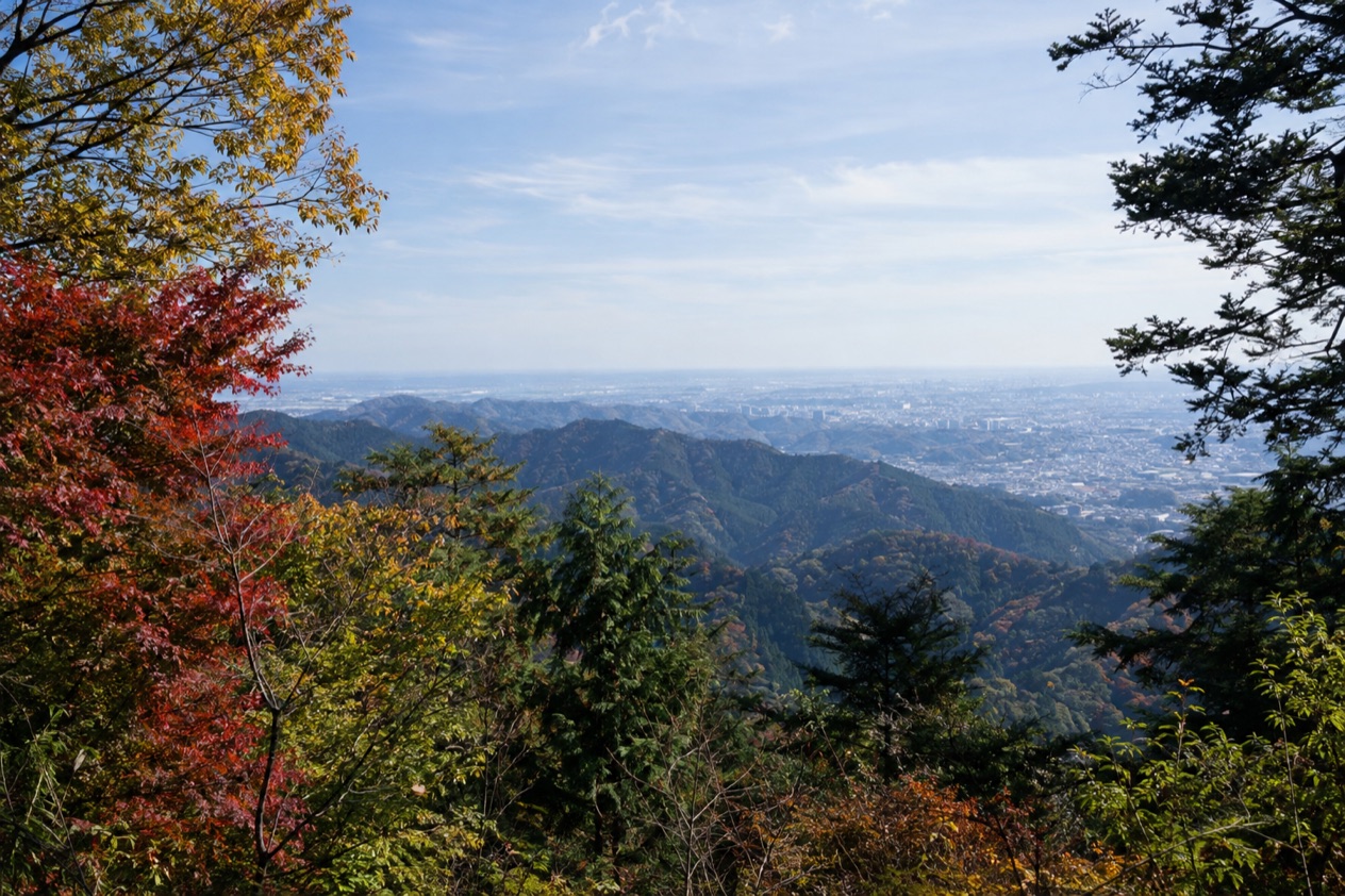
On a weekend the path up from the base of Mount Takao is a steady stream of hikers, families and friends in walking shoes, all heading into the trees just outside Tokyo. The trails climb through forest toward a summit that looks out over the city’s edge. This is a mountain day trip for anyone who wants green slopes and a long walk without leaving the Tokyo area.
Is visiting Mount Takao worth it?
Yes, if you want a day on a real mountain without leaving the Tokyo area, and it suits walkers, curious families and anyone who likes a choice of ways up.
What sets it apart from other outings near the capital is the number of ways to spend the day. Eight hiking trails cross the mountain, and each one gives a different feel.
Trail 1 is paved and passes the top stations of both the funicular and the ropeway. Trail 6 and the Inariyama Trail are unpaved and run from the base to the summit. You can ride halfway up and walk the rest, or climb the whole way on foot.
The mountain is also a place with a following. More than 2.5 million visitors come each year, and the trails reflect it: a monkey park, an old octopus cedar, observation decks and a waterfall give the walk stops that break it into chapters. Hiking to the top takes an average of 90 minutes, so the climb fits comfortably into a single day with time left for lunch and a look around.
For travelers who prefer a day of temples and city streets, the climb may feel like a lot of effort. For those who like to see where a long-distance route begins, there is one more reason to come: one end of the Tokai Nature Trail is here, and the other lies near Osaka.
What to see at Mount Takao
The mountain stands 599 meters (1,965 feet) tall, and most of what you see is arranged along the trails. Trail 1 holds the best-known stops, while Trail 6 has its own highlight in the waterfall.
Trail 1 and its observation decks
Trail 1 is the paved route, described as somewhat arduous, and it is the one that passes the top stations of both the ropeway and the funicular on its way to the summit. Three observation decks are scattered along it, which gives you three chances to stop, catch your breath and look out over the land below.
Because the path is paved, it feels more like a long, rising promenade through the forest than a trail over roots and rock. It also means you meet the people here, since the cable-car stations feed walkers onto the same path. If you want the full mountain experience with plenty of company and stops, this is the route.
The monkey park
A monkey park sits on Trail 1, just past the first observation deck. It is an easy detour to fold into the climb, since you meet it early on the path, before the legs begin to tire.
Think of it as a pause in the hike rather than a destination of its own. You walk in, watch the animals for a while, and then rejoin the trail toward the next deck and the stations higher up. Families with children often enjoy this stop most, and it gives the first part of the walk a clear landmark.
The Takosugi octopus cedar
On Trail 1 stands the Takosugi, the octopus cedar, a tree 37 meters tall with a trunk circumference of about 19 feet. It is estimated to be around 500 years old. The name comes from its roots, which twist and curl across the ground like the arms of an octopus.
Look at the roots rather than the crown. They bulge and loop over the path edge in a way that makes the tree easy to recognize, and it is a good place to stop for a photograph before the walk continues upward through the cedars.
Trail 6 and Biwa Falls
Trail 6 is unpaved and runs from the base all the way to the summit, bypassing the top stations of the ropeway and funicular. It is the choice for walkers who want a more traditional mountain trail, with soil and roots underfoot rather than pavement.
Biwa Falls lies along this trail, giving the route its own destination, a waterfall to hear before you see it. The Inariyama Trail is the other unpaved path to the top, so the mountain offers two ways to skip the cable-car stations entirely and arrive at the summit on foot.
How to get to Mount Takao
Mount Takao is in the city of Hachioji, within an hour of downtown Tokyo. That is the one travel-time figure available, and it describes the trip from the center of the capital to the mountain.
The route is tied to a station named Takaosan-guchi, which is where one end of the Tokai Nature Trail is located. That makes it the anchor point for arriving: you come to Takaosan-guchi Station, and from there the mountain begins.
Tokyo itself sits on Tokyo Bay in the Kanto region, and its two airports are Haneda (officially Tokyo International Airport) and Narita, Japan’s largest international airport. Visitors flying in reach the capital first, then make the trip out to the mountain.
Getting up the mountain once you arrive
There are two ways to get halfway up without hiking: a funicular and a ropeway, both operated by the Takaotozan Railway. Each carries you part of the way, and Trail 1 passes the top station of each on its way to the summit, so you can step off and continue on foot.
The alternative is to walk from the base. Hiking to the top takes an average of 90 minutes, and eight trails give you a choice. The unpaved Trail 6 and the Inariyama Trail go from the base to the summit without touching the cable-car stations. People combine the two, riding one way and walking the other, so the mountain can be shaped to the energy you have.
When to visit Mount Takao
Mount Takao can be visited in any month, but the weather shapes the day.
| Month | Avg. high (°F) | Avg. low (°F) | Precipitation (in) | Days with rain (1 mm+) |
|---|---|---|---|---|
| January | 49.6 | 34.2 | 2.35 | 4.5 |
| April | 66.9 | 49.6 | 5.26 | 9.5 |
| July | 85.8 | 72.3 | 6.15 | 10.5 |
| October | 71.6 | 58.6 | 9.24 | 10.5 |
January is cold and often bright, with about 193 hours of sunshine in the city, and a little snow or sleet is possible on some days. A climb in that season means dressing for chilly air at the start and warming up as you go.
April brings mild afternoons in the city, with more rain days than winter. July is hot and humid, and a long uphill walk on a paved path feels very different from the same walk in a cooler month.
October is mild in the city, with highs in the low 70s, though it is also a wet month with plenty of showery days and fewer hours of sun than spring. On a showery day the unpaved trails, Trail 6 and the Inariyama Trail, are the ones to think twice about.
The mountain draws more than 2.5 million visitors a year, so the paved Trail 1 and the cable-car stations are where the crowds gather. No opening hours or special festival dates are given for the mountain itself, so the choice of month comes down to the weather you prefer for walking.
Tips for your visit
Plan on most of a day. Hiking to the top takes an average of 90 minutes, and that is before you stop at the monkey park, the octopus cedar, the three observation decks and the summit itself. Add the way down and a meal, and the mountain fills the hours between morning and evening.
Choosing your route
Pick the trail to match the day you want. Trail 1 is paved and passes the cable-car stations, so it works for a mixed day, with a ride up and a walk down, or the other way around. It is described as somewhat arduous, so it is not a stroll, even on pavement.
Trail 6 and the Inariyama Trail are unpaved and go straight from base to summit. They suit walkers who want to leave the paved path behind. Trail 6 also has Biwa Falls, which gives it a reward partway up. Sturdy shoes make sense on any of them, since the climb is real and the unpaved routes are rougher underfoot.
What to combine it with
Because the mountain lies within an hour of downtown Tokyo, it pairs naturally with a city day on either side. Walkers who like long routes may be drawn by the Tokai Nature Trail, which starts at Takaosan-guchi Station and ends at Minoh near Osaka. You do not need to walk it, but knowing the mountain is its starting point adds something to the day.
For families, the monkey park on Trail 1 and the cable-car ride give younger travelers something to look forward to. For anyone with limited mobility, the funicular and ropeway take you halfway up, though the rest of the way is on foot. No information is given here about parking or guided walks, so the plan rests on the trails and the two rides.
Good to know before you go
October is a showery month in Tokyo, with plenty of wet days, so a light rain layer is worth carrying, and the paved Trail 1 is the one that stays friendlier underfoot. Carry water and a small snack for the climb, and wear shoes with a good grip. The funicular and the ropeway are both run by the Takaotozan Railway, which is the name to look for when you get to the base.
Sources
- Wikipedia, Mount Takao (https://en.wikipedia.org/wiki/Mount_Takao), checked October 11, 2026
- Japan National Tourism Organization, Tokyo (https://www.japan.travel/en/destinations/kanto/tokyo/), checked October 11, 2026
- Japan Meteorological Agency (JMA), Normal values 1991-2020, monthly (https://www.data.jma.go.jp/stats/etrn/view/nml_sfc_ym.php?prec_no=44&block_no=47662), station Tokyo, elevation 25 m, checked October 11, 2026
To plan your stay
- Best Time to Visit Japan: Cherry Blossoms, Autumn Colors, Weather and Festivals
- Where to Stay in Japan: Ryokan, Temple Stays, Capsule Hotels and the Best Cities to Base In
- Sending Luggage from the Airport in Japan: Hands-Free Travel, Hotel Delivery and Coin Lockers
- Know Before You Go to Japan: Entry, Money, Etiquette and Getting Around