
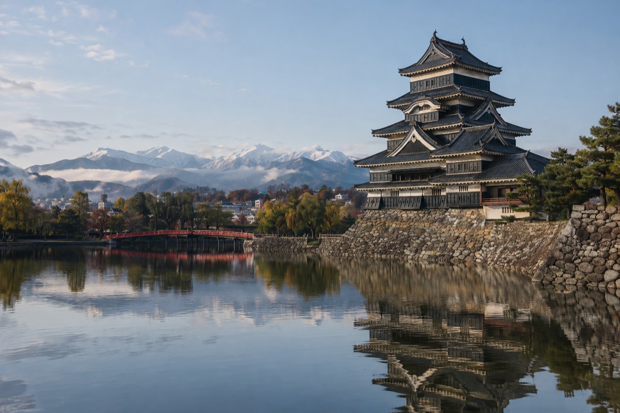
The morning starts under the big departure boards of Shinjuku, among commuters with coffee in paper cups, and ends with the Japan Alps standing at the edge of the city. Somewhere in between, the buildings thin out, the line climbs into valleys, and the train begins to feel like a small journey rather than a transfer. Matsumoto is a city in Nagano Prefecture, and this is the route from Tokyo for travelers who want to arrive with the mountains already in view.
How do you get to Matsumoto from Tokyo?
Matsumoto lies 104 miles from central Tokyo, and the direct way there is the Azusa, a limited express train that leaves from Shinjuku Station. It is operated by the East Japan Railway Company (JR East), and it runs mainly between Shinjuku and Matsumoto along the Chuo Main Line and the Shinonoi Line. The name comes from the Azusa River in Matsumoto itself, so the train is named after its destination.
Shinjuku is the place to start. It is the main connecting hub between central and eastern Tokyo and the western part of the city, and it is also where Narita Express trains to and from Narita International Airport begin and end.
If you land at Narita, the same station can be the point where an airport train turns into a mountain train. The Odakyu line toward Odawara and Hakone and the Keio line toward Hachioji also leave from here, so the platforms are shared by very different weekend plans.
What decides your choice is mostly where you are coming from and how you like to travel. From Tokyo, the Azusa is the line that links the two cities directly.
If you are arriving from Nagoya, Nagano or Takayama, other connections exist, and if you are flying within Japan, Matsumoto has its own small airport. Japanese trains have a reputation for running exactly on time, which lets you plan a connection or a dinner reservation in Matsumoto to the minute.
Tickets for the Azusa work in two parts: the basic fare ticket, plus a limited express ticket, which is required to board. On top of that you choose between a Reserved Seat Ticket, which gives you a specified seat, and an Unreserved Seat Ticket, which lets you sit in any unreserved seat.
Ways to get to Matsumoto from Tokyo
The Azusa limited express from Shinjuku
This is the through train between Tokyo and Matsumoto. It leaves from Shinjuku, follows the Chuo Main Line and then the Shinonoi Line, and is run by JR East. A few Azusa trains also use the Sobu Main Line and the Oito Line, but the core of the journey is the same.
The ride is part of the pleasure. Along the eastern section of the Chuo line, the peaks of the Akaishi and Kiso ranges and Mount Yatsugatake can be seen from the train, and the line reaches its highest point near Fujimi, about 3,000 feet above sea level. Sit by a window, and you watch the plain of Tokyo give way to the mountains.
The train suits anyone who wants to leave from Shinjuku and arrive in Matsumoto without changing. A tip for the seat choice: since a Reserved Seat Ticket assigns you a specific seat, it lets you pick a place by the window before you board, while an Unreserved Seat Ticket leaves the choice to the moment you step on.
Local and rapid trains on the same line
Japan also runs slower trains on its lines. Local trains stop at every station, which makes them a fit for short distances, while rapid trains skip the smaller stations and do not require a supplement. These are the trains you meet once you are already in the region, hopping between small stations in the valleys rather than crossing the whole distance from Tokyo.
The Chuo Main Line as a whole connects Tokyo and Nagoya, though it is the slowest direct railway connection between those two cities. It is operated by JR East in the east and JR Central in the west, and the dividing point is Shiojiri. For a traveler who prefers watching villages go by to arriving quickly, the slower trains are a way to see the line at its own pace.
By plane to Matsumoto Airport
Matsumoto Airport (MMJ) has commercial flights only from Osaka, Sapporo and Fukuoka. There is no flight from Tokyo, so this option matters if your trip includes one of those three cities before or after Matsumoto. Downtown is about 20 minutes from the airport.
A flight into Matsumoto fits a trip that starts elsewhere in Japan, for instance a visit to Osaka followed by a few days in the Alps. For a day out from Tokyo, the train is the connection that matches the departure point.
By bus from Takayama and by train from Nagoya or Nagano
A bus service connects Takayama, in Gifu Prefecture, with Matsumoto in 2 hours and 30 minutes. It is the link to remember if your route runs across the Alps rather than out of Tokyo, and it turns the two towns into a pair on one itinerary.
Matsumoto can also be reached from Nagoya Station in 2 hours by train, and from Nagano Station in 50 minutes. Nagano City lies about 47 miles to the north, so Matsumoto fits neatly into a trip through the prefecture. Whichever way you arrive, Japanese IC cards do not work on buses in Matsumoto, though contactless payment with major credit cards other than Mastercard is possible.
Options compared
| Option | Time each way | Best for | What to know |
|---|---|---|---|
| Azusa limited express from Shinjuku | 2 hours 40 minutes | Going straight from Tokyo to Matsumoto | Basic fare ticket plus limited express ticket, with a reserved or unreserved seat |
| Train from Nagoya | 2 hours | Arriving from the south | Reaches Matsumoto Station |
| Train from Nagano | 50 minutes | Combining Nagano City and Matsumoto | Nagano City is about 75 kilometers away |
| Bus from Takayama | 2 hours 30 minutes | Crossing the Alps from Gifu Prefecture | IC cards do not work on local buses once in Matsumoto |
| Flight to Matsumoto Airport | About 20 minutes from the airport to downtown | Arriving from Osaka, Sapporo or Fukuoka | No commercial flights from Tokyo |
From Tokyo, the Azusa is the single route that matters, and it gets you to the city in a single, direct ride. The other times belong to trips that begin in Nagoya, Nagano or Takayama, and the airport is for travelers coming from other parts of Japan.
If you are building a longer loop, the pieces fit together well. Tokyo to Matsumoto by Azusa, then north to Nagano by train, or across to Takayama by bus, gives you a route through the mountains without retracing your steps. A trip that ends in Matsumoto can finish with a flight to Osaka, Sapporo or Fukuoka.
Making a day of it
Matsumoto sits at the eastern end of the Japan Alps, and that position shapes the day. The train ride brings the mountains closer in stages, and once you step off, they frame the end of the streets. Treat the journey itself as the first part of the outing, and keep a window seat in mind.
On the way, the Chuo line gives you the views: the Akaishi and Kiso peaks and Mount Yatsugatake pass by outside the window, and the highest point of the line near Fujimi is where the landscape feels most like the mountains. If you are a rail enthusiast, the stretch beyond Shiojiri is where the Chuo West Line runs alongside the old Nakasendo highway, known for the preserved post towns of Tsumago-juku and Magome-juku and the steep Kiso Valley. That corridor is served by only one limited express and one local service per hour, so it suits a trip planned around the timetable rather than a spontaneous detour.
In Matsumoto, culture is close at hand. The Japan Ukiyo-e Museum holds over 10,000 pieces of ukiyo-e, the woodblock prints of Japan, in the largest private collection of its kind in the world. It is a quiet counterpoint to the mountain scenery, a way to spend the part of the day when you want to be indoors.
When to leave from Tokyo is a question of how much of the day you want in Matsumoto. Leaving Shinjuku early gives you more time at the end of the line, and a later departure turns the trip into an afternoon and evening.
Because trains in Japan have a reputation for being on time, you can plan your arrival and your first stop to the minute. For paying once you are there, bring a credit card that is not Mastercard, or cash, since IC cards are not accepted on the city buses.
How long to stay is up to you. The Azusa makes the city reachable in a single ride, so a visit can be as short as a day out or as long as a base for the Alps. For a longer stay, Nagano is 50 minutes away by train, and Takayama is a bus ride across the mountains.
Good to know before you go
Carry a credit card that is not Mastercard, because contactless payment on Matsumoto buses works with the other major cards and Japanese IC cards are not accepted there. Keep the Azusa ticket handy for the ride, with both the basic fare and the limited express portion.
Mountain weather can change the feel of the day, so a light layer is useful when you step out of the train, and the typhoon season, when it falls, can affect plans in any part of Japan. At Shinjuku, give yourself a moment to find the right platform, since it is among the busiest stations in the world.
Sources
- Wikipedia, Azusa (train) (https://en.wikipedia.org/wiki/Azusa_(train)), checked October 11, 2026
- Wikipedia, Chūō Main Line (https://en.wikipedia.org/wiki/Ch%C5%AB%C5%8D_Main_Line), checked October 11, 2026
- Wikipedia, Shinjuku Station (https://en.wikipedia.org/wiki/Shinjuku_Station), checked October 11, 2026
- Japan National Tourism Organization, Matsumoto (https://www.japan.travel/en/destinations/hokuriku-shinetsu/nagano/matsumoto-and-around/), checked October 11, 2026
- Wikipedia, Matsumoto, Nagano (https://en.wikipedia.org/wiki/Matsumoto,_Nagano), checked October 11, 2026
- Wikivoyage, Matsumoto (https://en.wikivoyage.org/wiki/Matsumoto), checked October 11, 2026
- Japan National Tourism Organization, trains and buses (https://www.japan.travel/en/guide/how-to-travel-by-train-and-bus-in-japan/), checked October 11, 2026
- Japan National Tourism Organization, traveling by rail (https://www.japan.travel/en/guide/traveling-by-rail/), checked October 11, 2026
- Japan National Tourism Organization, getting around Japan: trains, subways, buses, taxis (https://www.japan.travel/en/plan/getting-around/), checked October 11, 2026