
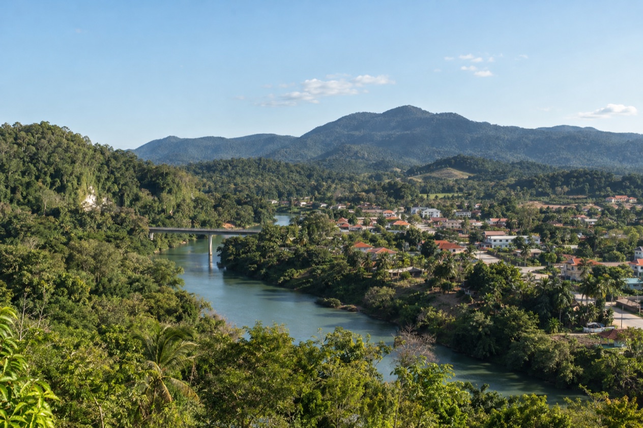
February in the Cayo District begins with the sound of the Macal and Mopan rivers running low and clear, and with the green of the hills still deep from the wet months. In San Ignacio the market streets fill early, the Cahal Pech ridge catches the first light above town, and the afternoons are long enough for a river, a cave or a ruin. It is a month for the Maya sites, the jungle lodges and the pine forests of the interior.
What is the weather like in San Ignacio and the Cayo District in February?
February is a drier, brighter month in the Cayo District, with days that are long enough for a full program of ruins, caves and river time. The light is the main thing that changes as the weeks go by, since the days keep stretching toward March.
| Month | Daylight on the 15th |
|---|---|
| January | 11 hours 15 minutes |
| February | 11 hours 38 minutes |
| March | 12 hours 05 minutes |
In Belize City, highs average about 85°F in February, and the rainy days are few compared with January. Showers can still pass through, and the hills of the interior keep their green, so a light rain layer is still useful.
With almost twelve hours of daylight, a day can start at a river or a ruin in the morning and still leave time for a second stop before dusk. The hills around San Ignacio and the Mountain Pine Ridge reserve hold a landscape of pine, granite and river that looks sharp in the clearer light of the dry months.
Evenings in town are pleasant for eating outside on a terrace or walking along the main streets. Bring light clothes for the day, and something with sleeves for the evening and for the cave and river outings, where you will be wet at times.
What to do in San Ignacio and the Cayo District in February
February is a month for the interior’s big outdoor program: Maya ruins above the river valleys, caves that hold ceremonial offerings, and forest reserves of pine and granite. Town life centers on San Ignacio, a compact base where the market, the river and the ridge-top ruin are all close. Between outings, the town gives you simple pleasures: a cold drink on a terrace, a plate of rice and beans with stewed chicken, fresh tortillas and fruit juices from the market stalls.
Cahal Pech above San Ignacio
Cahal Pech overlooks San Ignacio Town and sits a 10-minute walk from the town center, which makes it the simplest ruin to fit into any day. The name means The Place of Ticks, and the interconnected structures show how Maya architecture changed over the centuries. You walk among plazas and stone buildings on a ridge, with the town and the valley spread out below.
The clearer light of the dry months suits the view from the top, and the ridge is a good place to be at the start or the end of the day. Tickets come in two categories, Resident and Non-Resident.
Xunantunich and the hand-cranked ferry
Xunantunich stands near the village of San Jose Succotz, and the visit begins with a ride across the Mopan River on a hand-cranked ferry. The ferry crossing is part of the pleasure, a small slow moment before the ruins. At the site, the El Castillo pyramid rises 130 feet, and you walk the plazas around it beneath the trees.
February’s dry spell is a good moment for a site like this, where you spend your time outdoors on open plazas. Bring water and a hat for the open ground, and take your time among the carved structures.
Caves: Actun Tunichil Muknal and Barton Creek
Actun Tunichil Muknal, known as ATM, lies in the Tapir Mountain Nature Reserve near San Ignacio. It is a Maya archaeological site with skeletons, ceramics and stoneware, and it holds the Monkey Pot, one of just four of its type found in Central America. The cave is a journey into the Maya underworld as the ancient people understood it.
Barton Creek Cave, in the upper Barton Creek area, is both an archaeological site and a tourist destination. Its surveyed length reached 5 miles (5.0 mi) by 2005, and the remains of at least 28 humans have been found inside. Both caves leave you with a sense of how sacred the underground was to the Maya.
Mountain Pine Ridge
Mountain Pine Ridge is a forest reserve of roughly 400 square kilometers in Cayo, and the landscape changes from the river valleys to open pine country. The elevation averages between 400 and 700 meters, and the highest point, Baldy Beacon, reaches 1,017 meters. The Macal River forms its boundaries to the west and south.
The pine forest is a different world from the broadleaf jungle below, with rock, resin scent and wide skies. It is a place to spend time outdoors in the clearer weather of February.
| Site | Ticket categories |
|---|---|
| Cahal Pech | Resident and Non-Resident |
A two-day itinerary for San Ignacio and the Cayo District in February
Day 1 belongs to the town and the ridge. Start early in San Ignacio with coffee and a breakfast of fry jacks or eggs and beans, then walk up to Cahal Pech while the morning light is soft on the plazas. The ruin overlooks the town, so you can descend into the market streets afterward for lunch at a simple local spot.
In the afternoon, with almost twelve hours of daylight in the month, stay in town: wander the market, sit by the river, and have dinner on a terrace as the evening cools. If the weather turns, a long lunch and an afternoon in the cafés keep the day easy.
Day 2 heads out of town to Xunantunich. Cross the Mopan River on the hand-cranked ferry, walk the plazas and look up at El Castillo, then return to San Ignacio for a late lunch. In the evening, stay near the river and the market streets, and finish with a plate of stewed chicken or a cold drink on a terrace. If rain interrupts either day, trade the open-air stop for a slow meal in town and save the ruin for the next clear morning.
Is San Ignacio and the Cayo District busy in February?
February brings a steady flow of visitors to the Cayo District, drawn by the drier weather and the long days for outdoor outings. Town stays lively without feeling overwhelmed, and the ruins and the cave outings are the draw.
Restaurant tables in San Ignacio are usually easy to find on a weeknight, and the market streets are relaxed in the morning.
The places that draw the most attention are the ones with a single focus: the caves, the pyramid at Xunantunich and the ridge-top ruin at Cahal Pech. Others, such as the pine forests of Mountain Pine Ridge, spread visitors across a wide landscape.
What to pack for San Ignacio and the Cayo District in February
Pack for river, ruin and forest, with clothes that dry quickly and shoes that grip.
- Light, breathable shirts and shorts for days among the ruins
- A light long-sleeve layer for evenings on the terraces
- Water shoes or sandals with straps for river and cave outings
- Sturdy walking shoes for plazas, stairs and trails
- A hat and sunscreen for open plazas like Xunantunich
- A light rain jacket for passing showers
Good to know before you go
The U.S. State Department rates Belize Level 2, “Exercise increased caution”, because of crime, and says the south side of Belize City has historically had the highest concentration of violent crime.
February falls outside the Atlantic hurricane season, which runs from June 1 to November 30. The month is a good one for the interior, where the roads and trails to the sites are drier than in the wet months. Plan the cave outings and the ruin visits first, since they define a trip here, and leave the town days flexible.
San Ignacio and the Cayo District in February vs January and March
Moving earlier to January means shorter days and more rain, with the hills at their greenest. The landscape is lush, but the dry stretch has not fully settled, and trails and roads can be wetter.
Moving later to March brings longer days and the driest of the three months, with the warmest highs. The light is bright and the afternoons are hot, which suits river time and shaded forest walks more than long open-plaza visits at midday.
February sits comfortably between the two. Travelers who want the lush green of the wet months behind them but not the full heat of March will find the balance here, while those who prefer the longest days and the driest ground may lean toward March.
Is February a good time to visit San Ignacio and the Cayo District?
Yes, February is a good month for travelers who want ruins, caves and forest with drier conditions and growing daylight. It suits those who plan to spend most of their time outdoors in the interior.
Travelers who are mainly after beaches and sea time will want to look to the coast instead, since the Cayo District is an inland base of rivers, hills and ruins. Those who love archaeology, caving and long days in the forest will find the month well suited.
On arrival, walk up to Cahal Pech and look over San Ignacio from the ridge, then settle into the market streets. February here is a month of clear light on old stone, with the Mopan ferry, the cave descents and the pine ridge all within reach of one small town.
Sources
- sunrise-sunset.org, sunrise and sunset calculated for the 15th of the month, checked October 11, 2026
- NOAA NCEI, GHCN-Daily station BHM00078583 (Philip S. W. Goldson International Airport, Belize City), normals 1991-2020 computed from the daily record (https://www.ncei.noaa.gov/access/services/data/v1?dataset=daily-summaries&stations=BHM00078583), checked October 11, 2026
- Wikivoyage, Mountain Pine Ridge (https://en.wikivoyage.org/wiki/Mountain_Pine_Ridge), checked October 11, 2026
- Wikipedia, Actun Tunichil Muknal (https://en.wikipedia.org/wiki/Actun_Tunichil_Muknal), checked October 11, 2026
- Wikipedia, Barton Creek Cave (https://en.wikipedia.org/wiki/Barton_Creek_Cave), checked October 11, 2026
- NICH ticketing, Xunantunich (https://ticketing.nichbelize.org/product/xunantunich/), checked October 11, 2026
- NICH ticketing, Cahal Pech (https://ticketing.nichbelize.org/product/cahal-pech/), checked October 11, 2026
- Wikipedia, Climate of Belize (https://en.wikipedia.org/wiki/Climate_of_Belize), checked October 11, 2026
- U.S. Department of State, Belize Travel Information, Entry and exit requirements (https://travel.state.gov/), checked October 11, 2026
- U.S. Department of State, Belize Travel Advisory, Level 2, March 11, 2026 (https://travel.state.gov/), checked October 11, 2026
- NOAA National Hurricane Center, Climatology (https://www.nhc.noaa.gov/climo/), checked October 11, 2026
To plan your stay
- Things to Do in San Ignacio and the Cayo District: Maya Ruins, Caves, Rivers and Local Food
- Where to Stay in San Ignacio and the Cayo District: Riverside Lodges, Town Stays and the Mountain Pine Ridge
- San Ignacio and the Cayo District from Belize City: Distance, Bus, Rental Car and Day Trips
- Know Before You Go to San Ignacio and the Cayo District: Entry, Money, Getting Around and Health