
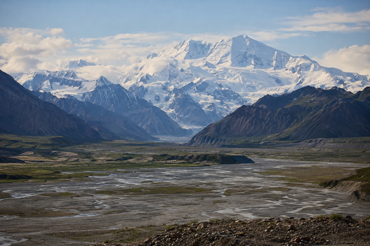
The pavement ends, the gravel begins, and the Wrangell Mountains slowly fill the windshield. Out here the scale of the land is the first thing you notice, and the second is how little of it has a trail. Wrangell-St. Elias is a park of long gravel roads, red mining buildings below glaciers, and a coast reached only by plane or boat, made for travelers who want Alaska on its own wild terms.
Is visiting Wrangell-St. Elias National Park worth it?
Yes, if you want space, silence and a sense of real distance more than a checklist of viewpoints with a parking lot beside each one. It suits travelers who like to read a landscape slowly, drive a gravel road to its end, and stay for the evening light on the peaks. It is a poor match for anyone hoping to see a national park in a single hurried afternoon.
The park covers over 13 million acres and is the largest national park in the country, bigger than Vermont and New Hampshire combined. It is also a UNESCO World Heritage site.
Its visitor services are spread across five separate areas, and travel between them takes hours, which is unusual for a national park. That separation is the real difference from other well-known Alaska parks: here you choose one area, settle into it, and let the rest wait for another trip.
Another difference is how little is built. There is no entry gate on either of the two roads that reach into the park, and no entrance fee. Most of the park is backcountry, and the park’s own words for visitor services are limited. What you get in exchange is a place where glaciers, old copper-mining history and mountain ranges meet with very few barriers between you and them.
What to see at Wrangell-St. Elias National Park
Copper Center and the Wrangell-St. Elias Visitor Center
Most visits begin at the main visitor center at Park Headquarters in Copper Center, a small community in the Copper River Valley just outside the park boundary. It sits along the Richardson and Edgerton Highways, and the Wrangell Mountains show on the horizon. This is the place to get your bearings before you head to a road, with exhibits, rangers and the park’s newspaper and visitor guide, K’elt’aeni, named for the Ahtna Athabaskan word for Mount Wrangell.
Near the visitor center, the Boreal Forest Trail and a bluff overlook above the Copper River give you a first look at the valley, where you may see a moose. The area carries history too, tied to the Valdez Trail and to the Ahtna people, whose homeland this is. It is a good first stop for orientation, and its trail and overlook make a gentle introduction to the landscape before the gravel starts.
McCarthy Road and the Kennecott mines
The McCarthy Road runs from the town of Chitina to the Kennicott River, a half mile from the town of McCarthy.
The Kennecott copper mines and mill buildings, a National Historic Landmark district, operated from 1903 to 1938 and were then abandoned. The big, weathered mill still stands on the slope below the mountains, a striking sight against the ice and rock.
Walking among the old buildings, you read the story of a remote industrial camp built in a hard place, then left behind when the ore ran out. The nearby town of McCarthy is a small, frontier-flavored place that makes a natural base for the area. Private overnight parking and camping, for a fee, are offered at the Kennicott River Bridge.
Nabesna Road
The Nabesna Road starts from the Tok Cutoff Highway and is a scenic road between the Mentasta and Wrangell Mountains. It is a 42-mile gravel road from Slana to Nabesna, usually suitable for passenger vehicles, and it is the park’s northern way in. It feels quieter than the McCarthy side, with big skies, braided rivers and mountain views opening along the way. Kendesnii Campground lies along it.
This road is for travelers who like to drive slowly and stop often. Like the McCarthy Road, it has no entry gate, and no fee is charged.
Yakutat and the coast
At the south end of the park, the Yakutat and Coastal Area holds 155 miles of little-known coastline, where huge mountains, enormous glaciers and temperate rainforest meet the ocean. Hubbard Glacier flows into the Gulf of Alaska, and Malaspina Glacier is a National Natural Landmark, the largest piedmont glacier in North America. Hubbard is the longest tidewater glacier in Alaska, and Nabesna Glacier, elsewhere in the park, is the world’s longest valley glacier.
This area is reached only by plane or boat, and visitor services are found only in the town of Yakutat, itself a plane or boat ride from the park. Activities include day hiking, sport fishing and sea kayaking. The Tlingit and Eyak peoples have cultural connections to this coast. It is the most remote part of an already remote park.
Hours, tickets and rules
There is nothing to buy at the door: the park is fee-free, and no gate stands on either road. The park is open year-round, though hours and seasons vary for each of its visitor centers.
| Site | Open | Admission |
|---|---|---|
| Headquarters Visitor Center, Copper Center | Mid-May through mid-September, 9 am to 5 pm, day use only. Closed October through April. Entrance gate closes at 5 pm year-round | Free |
| McCarthy Road | Year-round, weather dependent. No entry gate | Free |
| Nabesna Road | Year-round, weather dependent. No entry gate | Free |
| Wrangell-St. Elias National Park and Preserve | Open year-round | Free (no entrance fee) |
Because there is no entrance fee, visitor centers do not sell or issue federal land passes. Permits are needed for certain activities, including subsistence use, sport hunting and fishing, and off-road vehicles, and all commercial operations require permits. Backcountry camping is allowed without a permit. Sport hunting and trapping are allowed only within the preserve lands, while local residents may subsistence hunt in both park and preserve. The park does not accept cash.
How to get to Wrangell-St. Elias National Park
You arrive by road from the Copper River Valley, or by air or water if your destination is the coast. Only two roads enter the park, the McCarthy Road in the center and the Nabesna Road in the north, and both are unpaved. Facilities are separated by as much as 260 miles, and some are outside the park boundaries, so it helps to decide early which part of the park you are heading for.
The nearest city is Copper Center, home to the main visitor center. From there, the one-way trip to Chitina, where the McCarthy Road begins, takes 1 hour. Continuing from the visitor center to Kennecott takes 4 hours one way. From Chitina to Kennecott, the one-way travel time is 2 hours 45 minutes.
For the Nabesna Road, the one-way travel time from the visitor center to Slana, where the road begins, is 1 hour 30 minutes. Reaching Kendesnii Campground, farther along, takes 2 hours 15 minutes. Going from Kennecott to Slana takes 5 hours 30 minutes, and to Kendesnii Campground 6 hours 15 minutes, which shows how far apart the park’s areas are.
Yakutat is another matter. From the visitor center, or from Chitina or Kennecott, the one-way trip is a day by flying. The Yakutat and Coastal Area is accessible only by plane or boat, and if you are using an air taxi for the backcountry, weather can delay a scheduled pickup.
When to visit Wrangell-St. Elias National Park
The park is open year-round and both roads stay open through the year, weather dependent, but the most comfortable time for a first visit is when services are running. Most facilities are open from May to September, though some open in late May and close in mid-August. The main visitor center keeps its summer hours from mid-May through mid-September and is closed from October through April.
For the backcountry, the prime season is June 20 to August 20, set by snow depths at higher elevations. That is also when mosquitoes are typically a nuisance, a pest that lasts from May to September.
Plan for a wide range of temperatures, from as warm as 75 F to as cold as 20 F, possibly within the same day. Across the whole park, temperatures can differ by as much as 70 degrees at any one time.
Time of day matters too. If you cross a river, do it early, because water levels vary with season, time of day, temperature and upstream weather. On the road, mornings are a natural time to start, since the long distances between areas leave little margin. The visitor center gate closes at 5 pm, so plan to stop there before then.
Outside the short summer, the park is quieter, and most services are closed. Visit then only with that in mind: the roads may be open, but the visitor centers and many facilities will not be.
Tips for your visit
Pick one area and give it time. The Copper Center area, with its trail and overlook, pairs naturally with whichever road you choose.
There are no maintained trails in the backcountry, so you must be skilled at off-trail hiking. Routes involve numerous creek and river crossings, and bridges and log crossings are virtually non-existent. Alaskan waters are extremely cold, so know safe crossing techniques.
Cross at the widest, most braided area, usually where the water is shallowest. Never cross barefoot, and wear boots or bring extra shoes. Loosen your pack shoulder straps and unbuckle the hip belt before you cross.
Satellite phones and satellite messengers are the only way to communicate from the backcountry. Hazards include river crossings, glacier travel, thick brush, extreme weather, rock fall, mudslides, avalanches and bugs. Bear-proof canisters can be borrowed at no charge from ranger stations. If you fly in with an air taxi, bring 2 to 3 days of extra food in case weather delays your pickup.
For a lighter visit, stay near the road. Walk around the old buildings at Kennecott, stop at the overlook near the Copper Center visitor center, and let the mountain views do the work. Backcountry activities include backpacking, mountaineering and staying at a public use cabin, for those who want to go further.
Good to know before you go
The park does not accept cash, so plan your payments accordingly, and remember that services are limited and far apart. Weather varies widely and wildlife can be encountered. Visitor centers are closed from October through April, so plan your information stops for the warmer months.
Sources
- National Park Service, Wrangell – St. Elias National Park & Preserve, plan your visit: backcountry (https://www.nps.gov/wrst/planyourvisit/backcountry.htm), checked October 11, 2026
- National Park Service, Wrangell – St. Elias National Park & Preserve, plan your visit: basicinfo (https://www.nps.gov/wrst/planyourvisit/basicinfo.htm), checked October 11, 2026
- National Park Service, Wrangell – St. Elias National Park & Preserve, plan your visit: conditions (https://www.nps.gov/wrst/planyourvisit/conditions.htm), checked October 11, 2026
- National Park Service, Wrangell – St. Elias National Park & Preserve, plan your visit: copper center area (https://www.nps.gov/wrst/planyourvisit/copper-center-area.htm), checked October 11, 2026
- National Park Service, Wrangell – St. Elias National Park & Preserve, plan your visit: fees (https://www.nps.gov/wrst/planyourvisit/fees.htm), checked October 11, 2026
- National Park Service, Wrangell – St. Elias National Park & Preserve, plan your visit: travel times between visitor services areas (https://www.nps.gov/wrst/planyourvisit/travel-times-between-visitor-services-areas.htm), checked October 11, 2026
- National Park Service, Wrangell – St. Elias National Park & Preserve, plan your visit: yakutat and coast (https://www.nps.gov/wrst/planyourvisit/yakutat-and-coast.htm), checked October 11, 2026
- Wikipedia, Wrangell–St. Elias National Park and Preserve (https://en.wikipedia.org/wiki/Wrangell–St._Elias_National_Park_and_Preserve), checked October 11, 2026
- Wikivoyage, Wrangell-St. Elias National Park (https://en.wikivoyage.org/wiki/Wrangell-St._Elias_National_Park), checked October 11, 2026