
Somewhere past Tok, the forest thins, the road climbs onto a bare ridge, and the valleys drop away on both sides like folds in a rumpled blanket. That is the moment travelers start asking about the Top of the World Highway, the summer road that carries Alaska drivers over the hills to the Yukon and the old gold town of Dawson City.
What is the Top of the World Highway?
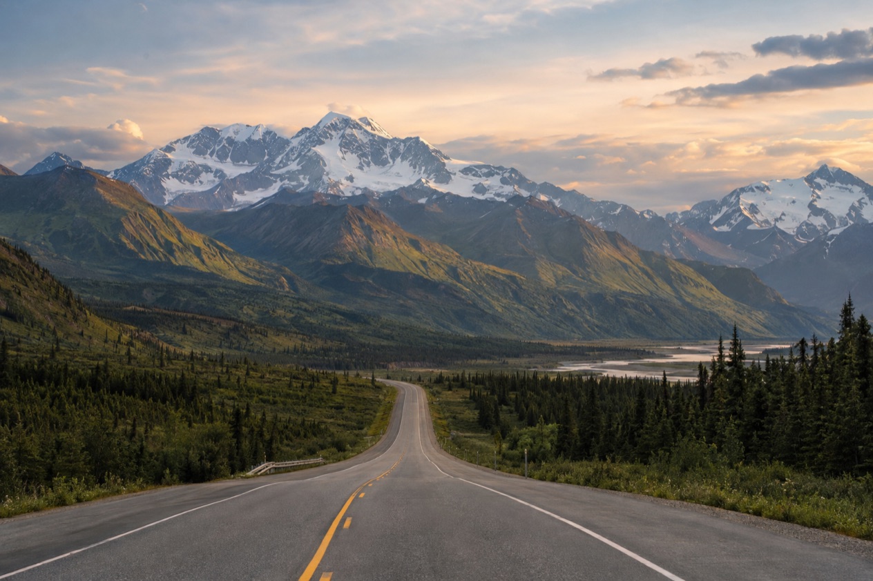
The Top of the World Highway is a 79-mile road that runs from a junction with the Taylor Highway near Jack Wade, Alaska, east to the ferry terminal in West Dawson, Yukon. It takes its name from the way it follows the crest of the hills, so you look down on the valleys instead of up from them. That single fact explains most of its character: wide open views, few trees, and a road that feels exposed in a way valley roads never do.
On the Yukon side the same road carries another name, Yukon Highway 9, and you will see that number on maps and signs once you cross the border. It is also one of the most northerly highways in the world at those latitudes, which is part of why the landscape looks the way it does, with open ridgelines and tundra-like stretches rather than thick forest.
A summer road
The highway is open only during the summer months. For planning, the Top of the World Highway and the Taylor Highway between Tok and Dawson City are listed as open seasonally from May to September. Outside those months the route is not something to count on, and a trip built around it belongs in the warm part of the calendar.
Winter is a different story altogether. The highway is not particularly safe in winter, even for snowmobile use, because there are so few trees to give shelter on the ridges. If your dates sit at the edge of the season, that exposure is the reason the road gets treated as a summer-only drive.
The surface on the Canadian side
Most of the Canadian portion is unpaved. Only a handful of stretches have pavement, and they are measured from kilometre 0 at Dawson.
| Paved stretch (Canadian side) | Kilometre markers |
|---|---|
| Leaving Dawson | 0 to 9 |
| First middle section | 74 to 76 |
| Second middle section | 79 to 82 |
| Third middle section | 83 to 94 |
| At the Canada–US border | 99 to 104 |
The branch road to Clinton Creek
A 31-mile branch road once left the highway to reach Clinton Creek, Yukon, the site of a former asbestos mine that has been shut down since 1979. The town it served is gone, and the name survives mostly as a footnote for people who like to read the history of a road. It is a reminder that this highway was built for work first and views second, and that the Yukon’s mining past runs through the whole region.
Dawson City itself was the center of the Klondike Gold Rush, which began in 1896, and the road ends at its doorstep, across the Yukon River from the town. Arriving at the far end of a ridge road and then crossing the river to a gold rush town is a good part of what gives the drive its sense of a journey with a destination.
Where does it go?
It goes from the Taylor Highway in Alaska to the Yukon River at West Dawson, where a ferry takes you across to Dawson City. Travelers think of it as the middle of a longer trip, with Tok at one end and Dawson City at the other, so each end deserves a look.
Tok, where the trip begins
Tok sits at the junction of the Alaska Highway (Alaska Route 2) and the Glenn Highway (Alaska Route 1), between the Tanana River and the Alaska Range. Two major highways meet here: one coming from Anchorage, the other from Fairbanks and from Whitehorse via Port Alcan. The town began in 1942 as an Alaska Road Commission camp built for the construction and upkeep of the Alaska Highway, and the camp earned the nickname Million Dollar Camp because of the money poured into it.
Tok is honest about what it is. It is not in one of the more scenic areas of Alaska, and the surrounding land is mostly flat, with young forests recovering from wildfires.
The climate is dry-winter continental subarctic, with generally warm summers and severely cold winters, and that is the reason the highway opens for only part of the year. For a meal, Fast Eddies serves pizza, burgers and sandwiches and has a salad bar, and Husky Lounge is on the Alaska Highway too.
Two state recreation sites sit close to town. Tok River State Recreation Site is a small park with a campground, trails and river access for small boats. Eagle Trail State Recreation Site, on the Tok Cutoff, has a campground, picnic areas, hiking trails and access to the historic Valdez-Eagle Trail and the Alaska Range high country. Either one makes a quieter stop than the highway junction itself.
Getting to Tok without your own car
Interior Alaska Bus Line runs year-round on Mondays, Wednesdays and Fridays between Tok and Anchorage, and between Tok and Fairbanks. The ride from Tok to Anchorage takes 7.25 hours, to Fairbanks 4 hours, and to Delta Junction 1.75 hours. Reservations should be made in advance, and it pays to stay flexible because buses may be rescheduled based on demand.
That bus brings you to Tok, not over the Top of the World Highway, so the stretch to Dawson City is a separate matter to sort out.
Dawson City and the river crossing
The highway ends at the ferry terminal in West Dawson. The George Black Ferry provides free vehicle and passenger service across the Yukon River at Dawson City from May to October, weather dependent. Because it depends on the weather, a windy or stormy day can change your crossing, and that is worth keeping in the back of your mind when you plan the last leg of the day.
Dawson City is a town in the Canadian territory of Yukon, and its Klondike Gold Rush story gives it a feel unlike anywhere on the Alaska side. July brings an average temperature around the low 60s Fahrenheit, which is why the season feels pleasant for walking its streets. January averages well below zero, about minus 14 degrees Fahrenheit, a good picture of why the summer road shuts down.
Dawson City Airport lies 9.2 miles east of town. The Klondike Highway (Yukon route 2) from Whitehorse to Dawson City is open year-round, so travelers who finish in Dawson have a route out that does not depend on the summer calendar.
What do you need to know before you drive it?
You need to know that it is a seasonal road that crosses an international border, that most of the Canadian side is unpaved, and that you must carry the right documents. Those three points shape every plan for the drive.
Season and timing
The highway, along with the Taylor Highway, is open seasonally from May to September. The ferry at Dawson City runs from May to October, weather dependent, so the ferry season is a little longer than the road season but does not make up for it. If your trip falls at either edge of the summer, build in room for the plan to change.
The route is described as skirting the crest of the hills, so you are on high, open ground for much of the way. That is what makes the views and also what makes winter dangerous. Treat the road as a summer drive and plan the rest of your Alaska and Yukon route around it.
Documents at the border
The highway crosses the Canada–US border, and the paved section at the border runs right up to it. Travelers can check land border wait times for crossing from the United States into Canada. Border officers may examine travelers’ digital devices at the Canadian border, so it is worth knowing before you arrive.
When returning to the United States by land, U.S. citizens can present a valid U.S. passport, a passport card, an Enhanced Driver’s License, a Trusted Traveler Program card (NEXUS, SENTRI or FAST), a U.S. military ID on official orders, a U.S. Merchant Mariner document, a Form I-872 American Indian Card, or an Enhanced Tribal Card. Lawful permanent residents must present their permanent resident card (Form I-551) or other valid evidence of status.
Children who are U.S. or Canadian citizens and under age 16, or under 19 if traveling with a school, religious or youth group, can present a birth certificate (original, photocopy or certified copy) or other proof of citizenship. Canadian citizens entering the United States by land can present a valid passport, an Enhanced Driver’s License or a Trusted Traveler card. Bermudian citizens must present a valid passport.
The road itself
On the Canadian side, only short pieces are paved, and the longest of them is the stretch between kilometre markers 83 and 94. Everything between those paved sections is unpaved. The Yukon portion is Yukon Highway 9, which helps when you read a map or a sign after the border.
The long views are the reward. You look down on valleys from the crest, and the ridgeline setting is what gave the road its name. There are few trees up there, which is lovely for scenery and a reason to take the exposure seriously whenever the weather turns.
Good to know before you go
Think of this as a summer drive with a hard edge on both ends of the season, and keep your border papers where you can reach them. The road is not meant for winter, when the lack of trees leaves nothing for shelter, and the Klondike Highway is the route that stays open all year for reaching Dawson City from Whitehorse.
In Tok, Tok River State Recreation Site is at 1309 Alaska Highway, and the Interior Alaska Bus Line is the way to reach town without a vehicle. Once you are across the river, Dawson City is the end of the road and the beginning of the Klondike story.
Sources
- Wikipedia, Top of the World Highway (https://en.wikipedia.org/wiki/Top_of_the_World_Highway), checked October 11, 2026
- Wikipedia, Tok, Alaska (https://en.wikipedia.org/wiki/Tok,_Alaska), checked October 11, 2026
- Wikivoyage, Tok (https://en.wikivoyage.org/wiki/Tok), checked October 11, 2026
- Wikipedia, Dawson City (https://en.wikipedia.org/wiki/Dawson_City), checked October 11, 2026
- Canada Border Services Agency, Cross the Canadian border (https://www.cbsa-asfc.gc.ca/travel-voyage/menu-eng.html), checked October 11, 2026
- U.S. Customs and Border Protection, Western Hemisphere Travel Initiative (https://www.cbp.gov/travel/us-citizens/western-hemisphere-travel-initiative), checked October 11, 2026