
Somewhere near Valdez, with the ferry terminal behind you and mountains already crowding the windshield, the question comes up: which road actually leads out of here? There is only one, and it is the Richardson Highway. It links the port town on the water to Fairbanks in the Interior, and it carries you past waterfalls, a glacier and a long list of mountain scenery on the way.
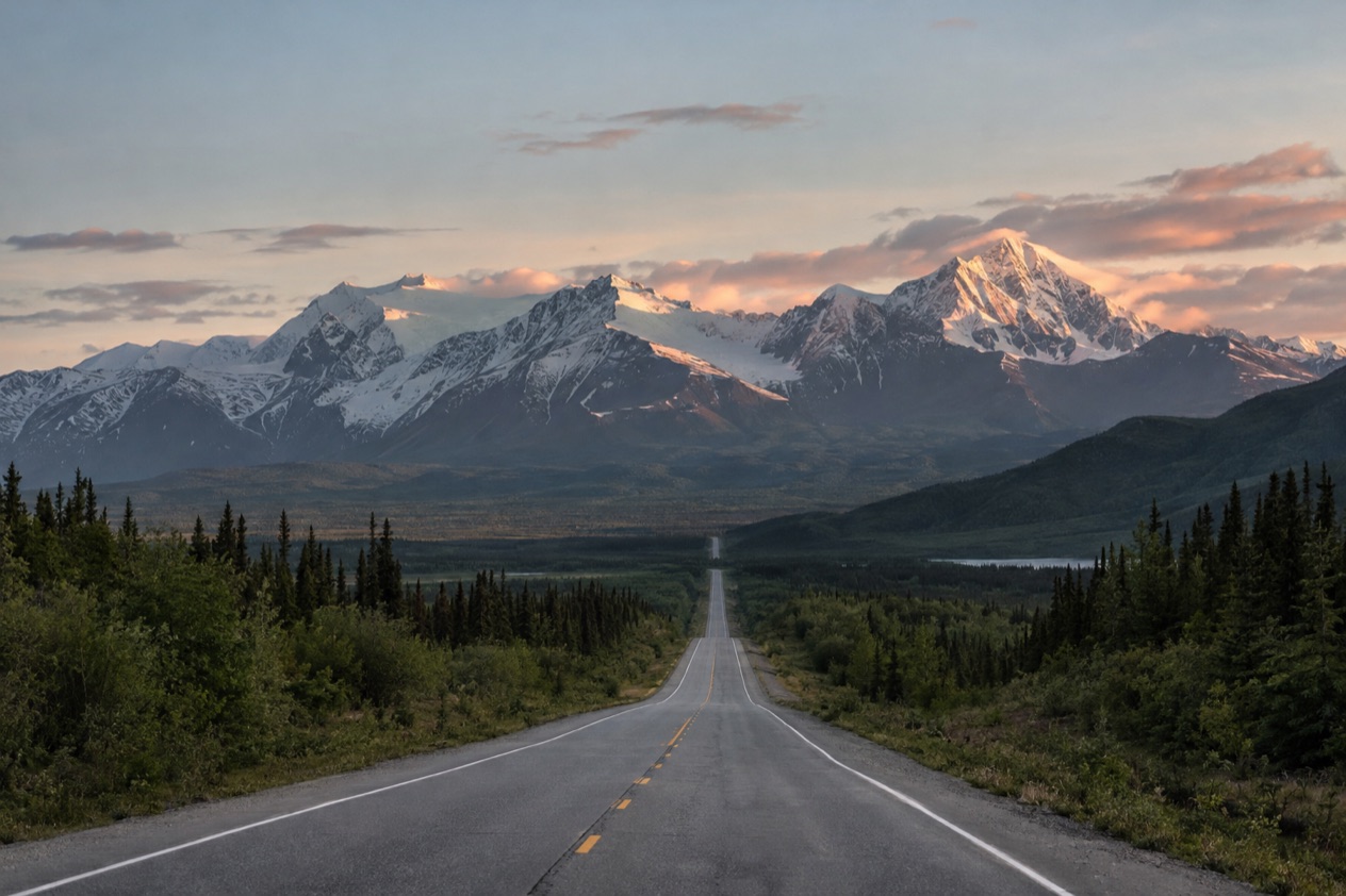
What is the Richardson Highway?
The Richardson Highway is a 368-mile road that connects Valdez to Fairbanks, and it holds a place in Alaska’s history as the first major road built in the state. It is not a loop or a side trip.
The road wears two numbers. From Valdez to Delta Junction it is marked as Alaska Route 4, and from Delta Junction on to Fairbanks it becomes Alaska Route 2. If you follow a map app or a roadside sign, expect that change of number at Delta Junction rather than any change in the road itself.
A road with scenic byway status
Several sections of the highway are designated Alaska State Scenic Byways. The stretch from Valdez to Glennallen received that designation on January 20, 1998, and it is the part of the road where the scenery is most concentrated: a canyon, a high pass and a glacier all within the first stretch out of town.
The designation says something about how the road is meant to be driven. This is a highway to take slowly, with room in the day for pull-offs, photographs and a look at the water coming off the cliffs. Because it is the only road to Valdez, the same scenery also greets anyone arriving or leaving by car.
Why Valdez sits at the end of it
Valdez is the northernmost port in North America that stays ice-free year-round, and it is a port of call in the Alaska Marine Highway ferry system.
Visitors come to Valdez for sightseeing trips to see marine life and glaciers, for deep-sea fishing and for heli skiing, and all of them arrive or depart along this one highway. It is also a town that gets a great deal of snow, with an average of over 300 inches a year according to the Weather Channel and NOAA, which makes it the snowiest city in the United States by that measure.
Where does it go?
The Richardson Highway runs from the Alaska Marine Highway terminal in Valdez to the Steese Expressway and Airport Way in Fairbanks, passing through Keystone Canyon, over Thompson Pass and on to Delta Junction. Each stretch has its own character, and the landmarks come in a clear order.
Keystone Canyon and Horsetail Falls
Just north of Valdez the road enters Keystone Canyon, a narrow cut where waterfalls spill down the rock walls beside the pavement. Horsetail Falls is the one named in the record, and it is the kind of sight that makes you slow down before you have even left town behind.
The canyon is the first test of the road’s mood. Walls close in, water is everywhere, and the highway threads between them on its way up toward the pass. It suits a first morning out of Valdez, when you want to stretch your legs and see what the coast gives before the road climbs.
Thompson Pass
Thompson Pass lies just north of Valdez on the Richardson Highway and brings spectacular waterfalls and glaciers right up against the road. It is the dramatic high point of the Valdez end, and the reason people photograph this road more than any other in the region.
The pass is also known for treacherous driving conditions in winter. That reputation matters for anyone traveling outside the summer months, and it is a good reason to look at live road information before you go. Valdez is reached only by crossing it, so the pass is part of every arrival and departure.
Worthington Glacier
Worthington Glacier sits at milepost 28.7 east of Valdez, and it is visible from the highway. The Worthington Glacier State Recreation Site gives you a view of the ice, and it is described as one of the remaining U.S. glaciers accessible by paved highway.
The glacier covers 5,774 acres and was listed as a National Natural Landmark in 1968. It has been steadily retreating for the last 150 years, though not as dramatically as many other Alaska glaciers. Seeing it from the roadside is a quiet reminder of how much the landscape here is still changing.
Delta Junction and the road to Fairbanks
At Delta Junction the Richardson Highway meets the Alaska Highway, and the town calls itself the Crossroads of Alaska. It is where the road changes from Alaska Route 4 to Alaska Route 2 and begins its final run to Fairbanks.
Delta Junction has a subarctic climate. Summer afternoons are mild and winters are severe, and the table gives the numbers for those who want them. The road ends in Fairbanks at the Steese Expressway and Airport Way.
| Delta Junction | Figure |
|---|---|
| Average high in July | 69.7°F |
| Average high in August | 64.5°F |
| Record high (June 15, 1969) | 92°F |
| Record low (January 30, 1947) | −63°F |
| Annual precipitation | 10.28 inches |
| Snowfall per season | 54.2 inches |
What do you need to know before you drive it?
Before you drive the Richardson Highway, the most useful thing to know is that Alaska 511 gives live road conditions, and that winter on Thompson Pass is known for treacherous driving. The rest is about timing and what the weather does along the way.
Reading road conditions on Alaska 511
Alaska 511 is the state’s road information service, run by the Alaska Department of Transportation. Its road conditions use a set of categories: Good, Fair, Difficult, Very Difficult, Hazardous, Road Closure and No Winter Maintenance. Reading those labels before you set out tells you quickly what kind of day the road is having.
The department has also partnered with Waze, so incidents and closures reported through Waze appear on the Alaska 511 website. The Waze for Cities program is a free data exchange between Waze and government entities, which means drivers’ reports feed into the same picture you see on the site.
Cameras, saved routes and notifications
On the Alaska 511 map page you can add a camera to My Cameras by clicking a camera icon, then the My Cameras button in the camera popup. On the camera page itself, the My Cameras option is reached through the three dots icon below the camera image. That lets you build a short list of views along the road.
To save routes for future viewing you must log in, and the site lets you create an account to save routes and receive notifications. Route notifications are sent by default on weekdays from 6 AM to 6 PM by SMS, so a saved route on the Richardson Highway can report to your phone during those hours.
Winter, snow and the weather along the road
Valdez gets over 300 inches of snow a year, and Thompson Pass is known for treacherous winter driving. Delta Junction has its own winter, with average lows below 0°F from December through February and snow typically falling from October to April.
Today’s date falls in that snow window at Delta Junction, so conditions along the northern half can change from one stretch to the next. Over half of Delta Junction’s yearly precipitation falls from June to August, which makes summer the wetter season there even though the air is mild.
Good to know before you go
The Richardson Highway is the only road into Valdez, so planning around it is part of any trip there. The road changes character from the waterfalls near the coast to the open Interior around Delta Junction, and the weather changes with it. Winter conditions on Thompson Pass deserve respect, and Alaska 511 is the place to look before you start. Cameras, saved routes and weekday text alerts make that easy to do from a phone.
Sources
- Wikipedia, Richardson Highway (https://en.wikipedia.org/wiki/Richardson_Highway), checked October 11, 2026
- Wikipedia, Valdez, Alaska (https://en.wikipedia.org/wiki/Valdez,_Alaska), checked October 11, 2026
- Wikipedia, Delta Junction, Alaska (https://en.wikipedia.org/wiki/Delta_Junction,_Alaska), checked October 11, 2026
- Wikipedia, Worthington Glacier (https://en.wikipedia.org/wiki/Worthington_Glacier), checked October 11, 2026
- Alaska 511 (https://511.alaska.gov/), checked October 11, 2026