
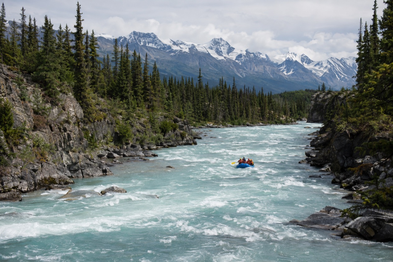
A raft slides out of an eddy and the river changes voice, from a hush to a rushing roar as the current picks up through a canyon wall. Paddles bite, spray comes over the bow, and the water has the milky look of rivers that begin in ice. Rafting in Alaska means rivers of the Kenai Peninsula, the roadless Susitna country and wilderness parks like Glacier Bay, and it belongs to the months when the ice has let go.
Where can you raft in Alaska?
The clearest answers are the Kenai River on the Kenai Peninsula, the Susitna River in Southcentral Alaska, and the wilderness of Glacier Bay National Park, which lists rafting among its adventures. Each is a different kind of river, and each asks for a different kind of day. The Kenai is a river you can reach by road, the Susitna is mostly a river of the roadless backcountry, and Glacier Bay is rafting folded into a larger wilderness trip.
What ties them together is the character of Alaska water. These are big, cold, glacier-influenced rivers running through spruce and cottonwood country, with mountains standing at the edge of the view.
Eagles may turn up along the banks, and on some rivers you may see salmon moving through the shallows. Nothing about a raft trip here feels like a theme park ride. It feels like being carried through the landscape instead of looking at it from a road.
The Kenai River
The Kenai runs westward from Kenai Lake to Cook Inlet, finishing near the towns of Kenai and Soldotna. It is a river of distinct personalities, and the stretch you choose decides the whole day.
Near its top, the river tumbles through Kenai Canyon, a whitewater passage that is the one place on the river where rafters hear rapids before they see them. Farther down it widens, slows and takes on the broad, steady look of a river heading to the sea.
Anglers know this river best. The Kenai is the most popular sport fishing destination in Alaska, particularly for king salmon, and that fishing culture shapes the river’s rhythm, with drift boats and guides working the same water that rafts use.
Pink salmon here run only in even-numbered years, so the feel of the river in the water changes from one year to the next. The king salmon fishery has been closed or heavily restricted in recent years because of low returns.
| River section | Length (miles) | What it is like |
|---|---|---|
| Upper River (Kenai Lake to Skilak Lake) | 17.3 | Includes a 2-mile whitewater stretch in Kenai Canyon |
| Middle River (Skilak Lake to the Sterling Highway bridge near Soldotna) | 19.5 | The stretch above the Soldotna bridge |
| Lower River (to Cook Inlet) | 12 | Greatly influenced by changing tides |
The Susitna River and its roadless country
The Susitna flows into Cook Inlet about 25 miles west of Anchorage, but the river feels much farther from the city than that. Its country is roadless, and access is usually by power boat or floatplane. That one fact sets the tone of any trip here. You arrive by air or by engine, you travel through country with very few buildings, and the settlements you pass are small places like Alexander and Susitna, where the mail comes by airplane twice a month.
The river is navigable upstream as far as Talkeetna, and the George Parks Highway bridges it south of that town. Beyond the bridge, no other bridge crosses it downstream, which says a lot about how little of this landscape is linked by road. Farther up, the Denali Highway crosses the upper river. Salmon runs, grayling, burbot and rainbow trout make the Susitna a fishing river too, with Chinook and Coho among its salmon.
Glacier Bay National Park
Glacier Bay National Park names rafting in its list of wilderness adventures, alongside camping, hiking, backpacking, kayaking and mountaineering. Here the raft is one tool among several for moving through big country, and the setting is as much the point as the paddling. Think of a trip where a day on moving water sits between nights camped under open sky and days of walking.
Around Fairbanks and Anchorage
Fairbanks sits on the Chena River, which visitors can explore, and businesses in town can provide equipment for Interior Alaska adventures. In summer the midnight sun shines nearly 24 hours a day there, so evenings on the water stretch late. Anchorage invites you to paddle turquoise waterways through a vast state park, a reminder that the city’s outdoors begin at its edges.
What kinds of trips are there?
Trips range from a whitewater run through a canyon to a slow float down a river with a mountain skyline, and on to wilderness journeys that depend on a plane. The river decides which one you are on, and so does the question of how far from a road you want to be.
Whitewater in a canyon
The Upper Kenai is the obvious picture of this kind of trip. After the calm of Kenai Lake the river narrows and enters Kenai Canyon, where a stretch of rapids turns paddling into teamwork. Expect to hear a guide call strokes, feel the raft lift over standing waves and find the cold arrive in a rush. Between the rapids the water settles and the canyon walls give you a moment to look up.
This is a trip for people who like the physical side of a river, who want to be wet by the end and would rather be in the action than watching it. Because the rapids sit about 12 miles from the lake, the quiet water above them is part of the day too, a calm first act before the noise begins.
Floats through broad river country
The Middle River, between Skilak Lake and the bridge near Soldotna, is the stretch where the Kenai spreads out and the current does most of the work. This is rafting as a way to see things. Banks of spruce and birch slide by, the mountains hold the horizon, and a bird may wheel overhead. It suits groups with different appetites, where one person wants photographs and another wants to watch for salmon.
Near the mouth, the Lower River is shaped by tides, which means the water you see in the morning is not the water you see in the afternoon. That tidal pull gives the last miles a different personality, closer to the sea than to the mountains.
Wilderness trips that start with a plane
In much of Alaska the road simply does not arrive. Most visitors reach Gates of the Arctic by air taxi, in small aircraft with floats or tundra tires, and access to Lake Clark is primarily by small aircraft. Most people reach Brooks Camp in Katmai by float-equipped aircraft. The Susitna works the same way, with power boats and floatplanes carrying people into roadless country.
That is the shape of a true wilderness river trip, where the flight is part of the story and the weather rules the schedule. In Katmai, strong storms can sweep through at any time of year, and pick-up from a chartered aircraft can be delayed for days. Waterproof rain gear and extra food are the Park Service’s advice there.
Rafting as part of a bigger trip
At Glacier Bay the raft joins camping, backpacking and kayaking in a single wilderness itinerary. Denali offers its own way to the backcountry, with six million acres of wilderness and backpacker campsites ranging from the sublime to the subtle, though the park’s own list of things to do centers on hiking, camping and ranger programs. If your idea of an Alaska trip is a river day between a hike and a night in a tent, this is the model.
What should you know before you go?
Know the season of the river, know how you will get there, and know that Alaska weather can rearrange a plan. A river that runs freely in summer is a sheet of ice in winter, and a road that reaches one river leaves another a flight away.
The ice decides the season
On the Susitna, the ice typically breaks up between April 12 and May 10, and the river typically freezes over between about October 19 and November 14. That window is a useful picture of how short the open-water season is, and why a river that feels endless in July belongs to snow and ice for much of the year. The Kenai, the Chena and other rivers each keep their own calendar.
Denali’s own rhythm is similar. The park is open year-round, but most visitors come in summer, when bus access into the park becomes possible as winter ice and snow melt. Winter visitors find solace, tranquility and the challenges of extreme weather. Anyone planning a river trip near the park should think in seasons, not in single dates.
Fishing rivers share the water
The Kenai and Susitna are fishing rivers first, with salmon runs that shape life on the water. On the Kenai, the state manages over 105 miles of river and lakes as the Kenai River Special Management Area, reaching from near the river mouth to far upstream.
On the Susitna, Chinook and Coho are among the salmon in the river. Rafters share these rivers with anglers, so expect boats, lines and a river that is also a working landscape.
Getting to the river
The Kenai sits on the Kenai Peninsula, near Kenai and Soldotna, and the Sterling Highway bridge near Soldotna marks the end of the Middle River. The Susitna is another matter, because its roadless country is reached by power boat or floatplane. In the parks, small aircraft are the norm in Gates of the Arctic, Lake Clark and Katmai. How you get there is half the trip.
Using park rangers and local help
A ranger at Denali National Park and Preserve can be reached by phone at 907 683-9532, and rangers there offer Discovery Hikes, trail walks and campground talks. In Fairbanks, visitor information is available by telephone at (907) 456-5774, and businesses in town can provide equipment for Interior Alaska adventures. Local museums and visitor centers share the history and local ways of life, which gives context to the rivers you travel.
Good to know before you go
Alaska’s rivers run cold and big, so a trip is about preparation as much as paddling. In Katmai the advice is waterproof rain gear and extra food, since storms can delay a pick-up for days. In Fairbanks, summer evenings stay light nearly around the clock under the midnight sun, which stretches the day on the water. Rivers like the Susitna freeze in the fall, so the season ends when the ice comes back.
Sources
- National Park Service, Denali National Park & Preserve, plan your visit: things2do (https://www.nps.gov/dena/planyourvisit/things2do.htm), checked October 11, 2026
- Explore Fairbanks, things to do (https://www.explorefairbanks.com/things-to-do/), checked October 11, 2026
- Visit Anchorage, things to do (https://www.anchorage.net/things-to-do/), checked October 11, 2026
- Wikipedia, Kenai River (https://en.wikipedia.org/wiki/Kenai_River), checked October 11, 2026
- Wikipedia, Susitna River (https://en.wikipedia.org/wiki/Susitna_River), checked October 11, 2026
- Wikipedia, Copper River Highway (https://en.wikipedia.org/wiki/Copper_River_Highway), checked October 11, 2026
- Government of Canada, Travel documents (https://travel.gc.ca/travelling/documents), checked October 11, 2026
- National Park Service, Gates of the Arctic National Park & Preserve, plan your visit: directions (https://www.nps.gov/gaar/planyourvisit/directions.htm), checked October 11, 2026
- National Park Service, Glacier Bay National Park & Preserve, plan your visit: things2do (https://www.nps.gov/glba/planyourvisit/things2do.htm), checked October 11, 2026
- National Park Service, Katmai National Park & Preserve, plan your visit: safety (https://www.nps.gov/katm/planyourvisit/safety.htm), checked October 11, 2026
- National Park Service, Katmai National Park & Preserve, plan your visit: brooks camp (https://www.nps.gov/katm/planyourvisit/brooks-camp.htm), checked October 11, 2026
- National Park Service, Lake Clark National Park & Preserve, plan your visit: basicinfo (https://www.nps.gov/lacl/planyourvisit/basicinfo.htm), checked October 11, 2026