
Spread a map of Alaska on a kitchen table and the roads look like a few threads dropped across an enormous page. One runs out of Anchorage toward Seward, another toward Denali and Fairbanks, and a long one slips off the edge into Canada.
Most of the state has no road at all, so the question is which thread to follow. The answer is the handful of highways that connect Anchorage, Fairbanks, Denali, Valdez and Seward, plus the Alaska Highway to Canada and two gravel or Arctic tracks for those who want more.
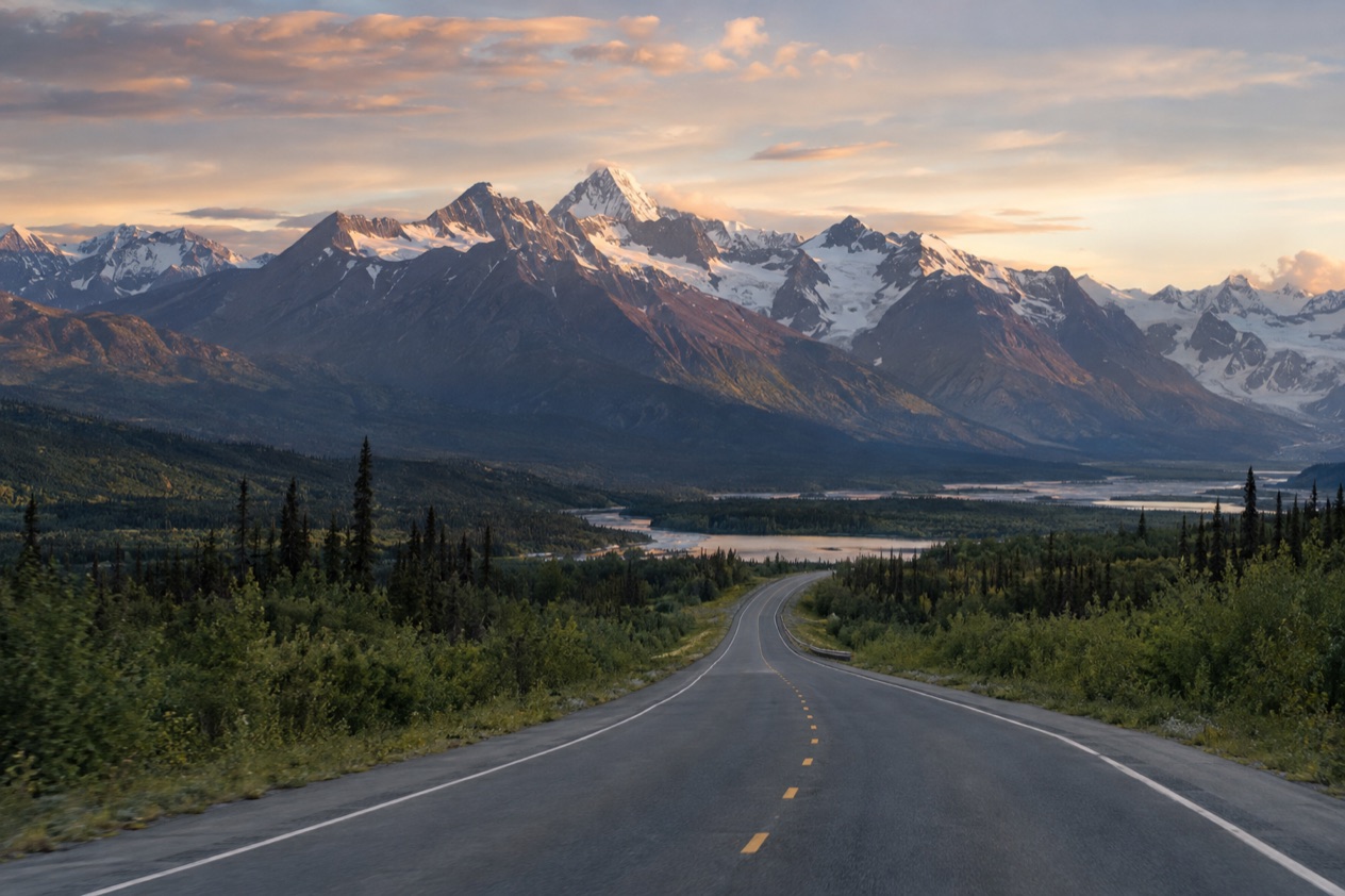
Where can you drive in Alaska?
You can drive a handful of main highways that fan out from Anchorage and Fairbanks and reach Seward, Denali, Glennallen, Valdez and the border with Canada. Between them lie huge stretches with no road at all, which is why the same names come up in every itinerary.
| Highway | Connects | Length (miles) |
|---|---|---|
| Seward Highway | Seward and Anchorage | 125 |
| George Parks Highway | The Glenn Highway junction and Fairbanks | 323 |
| Glenn Highway | Anchorage and Glennallen | 179 |
| Richardson Highway | Valdez and Fairbanks | 368 |
| Denali Highway | Paxson and Cantwell | 135 |
Out of Anchorage: Seward, Glenn and Parks
Three highways leave Anchorage and each leads somewhere different. The Seward Highway heads to the Kenai Peninsula and the port of Seward. The Glenn Highway began in the 1930s as the Palmer Road, built to reach the farming colony at Palmer, and was finished to Glennallen during World War II as part of the military road program that also produced the Alaska Highway.
The George Parks Highway is the main road to Denali National Park and Preserve and to Denali State Park, and it carries on to Fairbanks. It is signed as Alaska Route 3, and its mileposts start where the Glenn Highway numbering leaves off. Out of Anchorage the freeway runs for about 38 miles, ending at Wasilla, and for most of the state that stretch is the only road into the city, apart from the Seward Highway to the Kenai Peninsula.
Valdez, Fairbanks and the way to Canada
The Richardson Highway was the first major road built in Alaska. It starts at the Alaska Marine Highway terminal in Valdez and ends in Fairbanks at the Steese Expressway and Airport Way, marked as Alaska Route 4 as far as Delta Junction and as Alaska Route 2 beyond.
Delta Junction is also the end of the Alaska Highway, which begins at Dawson Creek, British Columbia, and passes through Whitehorse, Yukon. It is made up of British Columbia Highway 97, Yukon Highway 1 and Alaska Route 2, and it is now paved over its whole length. Once legendary as a rough, punishing drive, it now simply links the Lower 48 to the Interior by way of Canada.
Gravel and Arctic roads
The Denali Highway is a lightly traveled, mostly gravel road between Paxson on the Richardson Highway and Cantwell on the Parks Highway. Only the first 21.3 miles at the eastern end and the last 2.6 miles at the western end are paved. It is closed to all traffic from October to mid-May each year.
The Dalton Highway starts at the Elliott Highway and ends at Deadhorse, near the Arctic Ocean and the Prudhoe Bay Oil Fields. Its full length opened to the general public on December 2, 1994, and it is the road that reaches the top of the state.
Which routes make the best road trips?
The routes that stand out are the ones that combine a clear destination with landscape along the way: the Seward Highway to the coast, the Parks Highway to Denali, the Richardson Highway down to Valdez, the long Alaska Highway, and the gravel Denali and Dalton roads for travelers who want something wilder.
The Seward Highway and Turnagain Arm
This road carries three designations at once: National Forest Scenic Byway, State Scenic Byway and All-American Road. It threads between Turnagain Arm and the Kenai Mountains, then through Chugach National Forest, where it spends about 72 miles. It ends in Seward, where the road meets the water and the boats for Kenai Fjords.
It is also the busiest of these roads. On the stretch from Girdwood past the Portage curve toward Turnagain Pass, up to 15,000 vehicles a day pass in summer, so the trip suits a traveler who is happy to stop at pullouts and let the pace settle. U.S. Bicycle Route 97 follows the same corridor.
The Parks Highway to Denali
The Parks Highway was completed in 1971 and given its current name in 1975. It runs through Denali State Park, where signs mark the entrance and exit, and it is the main way to reach Denali National Park and Preserve. The road meets the Denali Highway at Cantwell, which opens a second way to turn the trip into a loop.
Fairbanks is the other end. Together the Parks and Richardson highways make a one-way line from Anchorage to Fairbanks and then down to Valdez, with the Glenn Highway cutting across between them.
The Richardson Highway to Valdez
Several sections of the Richardson Highway are State Scenic Byways, and the Valdez to Glennallen section received the designation on January 20, 1998. Worthington Glacier is visible from the road, and in Keystone Canyon, just north of Valdez, you pass waterfalls such as Horsetail Falls.
The Glenn Highway links to it at Glennallen. Along the way it climbs to Eureka Summit, 3,332 feet, on the divide between the Chugach and Talkeetna mountains, so a Glenn and Richardson loop gives a high pass and a harbor town in one trip.
The Alaska Highway from Delta Junction
The highway opened to the public in 1948, and Delta Junction sits at Historic Milepost 1422. From there the Richardson Highway covers the final 96 miles to Fairbanks, which people often treat unofficially as the northwestern end of the highway at Historic Milepost 1520.
In Yukon, a replica log bridge called the Canyon Creek bridge crosses the Aishihik River. It was rebuilt in 1987 and refurbished in 2005 by the Yukon government, and it gives the drive a stop with some history. The guidebook The Milepost has covered this road and the other highways of Alaska and Northwest Canada since 1949.
The Denali and Dalton highways
On the Denali Highway, Maclaren Summit at 4,086 feet is the second highest road in Alaska. There are developed campgrounds at Tangle Lakes (MP 22) and Brushkana Creek (MP 104), plus dozens of pullouts on public land where people camp. Year-round businesses include Denali Highway Cabins & Tours, Maclaren River Lodge, Alpine Creek Lodge, Backwoods Lodge and Cantwell Lodge.
The Dalton Highway crosses the Brooks Range at Atigun Pass, 4,739 feet. At the Arctic Circle Wayside Rest Area, at Mile 115, a short side road leads to a viewing deck with interpretive displays. At the end of the road, polar bears can be seen on the outskirts of Deadhorse.
What do you need to know before you set out?
You need to know the road conditions, the season, and where the fuel is, and the first of these is easiest to answer on the Alaska 511 website. It is run by the Alaska Department of Transportation, which also publishes Waze-reported incidents and closures there through a free data exchange.
Reading Alaska 511
The site rates roads in categories: Good, Fair, Difficult, Very Difficult, Hazardous, Road Closure and No Winter Maintenance. The last one is worth reading twice before you plan a late-season drive. On the map you can click a camera icon and then the My Cameras button in the popup to add a camera. On the camera page, the three dots under the image give the same option.
Creating an account lets you save routes and receive notifications. You must log in to save routes for later viewing, and the notifications go by SMS, by default on weekdays from 6 AM to 6 PM.
Season and daylight
Days are long and temperatures comfortable anytime from May to September, with lower hotel rates in the shoulder seasons, mid-May to mid-June and early September. The Denali Highway closure in October makes the point for the whole route: the roads and the places along them follow different calendars.
Fuel, trucks and speed
On the Dalton Highway, fuel is available at the E. L. Patton Yukon River Bridge at Mile 56, then at Coldfoot and Deadhorse. About 160 trucks use the road daily in summer and 250 daily in winter, so you share it with oil-field traffic. The Denali Highway has a recommended speed of 30 mph. On the Seward Highway, between Hope Junction and the top of Turnagain Pass, updated limits were posted in July 2016 that differ by lane.
| Seward Highway section | Right lane (mph) | Left lane (mph) |
|---|---|---|
| Hope Junction to top of Turnagain Pass | 55 | 65 |
Travelers who do not want to bring their own vehicle can fly into Anchorage and use the railroad, or rent a car or motorhome and drive the highways.
Good to know before you go
Budget for one to two excursions a day, at $100 to $200 each, on top of the road costs themselves. If you take a cruise as well, a cross-Gulf itinerary with a land tour added lets you see the interior that ships miss, including the highest mountains and the vast landscapes inland. Keep The Milepost on the seat beside you, the guidebook that has covered these highways every year since 1949.
Sources
- Wikipedia, Alaska Highway (https://en.wikipedia.org/wiki/Alaska_Highway), checked October 11, 2026
- Wikipedia, Seward Highway (https://en.wikipedia.org/wiki/Seward_Highway), checked October 11, 2026
- Wikipedia, George Parks Highway (https://en.wikipedia.org/wiki/George_Parks_Highway), checked October 11, 2026
- Wikipedia, Glenn Highway (https://en.wikipedia.org/wiki/Glenn_Highway), checked October 11, 2026
- Wikipedia, Richardson Highway (https://en.wikipedia.org/wiki/Richardson_Highway), checked October 11, 2026
- Wikipedia, Dalton Highway (https://en.wikipedia.org/wiki/Dalton_Highway), checked October 11, 2026
- Wikipedia, Denali Highway (https://en.wikipedia.org/wiki/Denali_Highway), checked October 11, 2026
- Alaska 511 (https://511.alaska.gov/), checked October 11, 2026
- Alaska.org, best way (https://www.alaska.org/advice/best-way-to-see-alaska), checked October 11, 2026