
Standing on the waterfront in Juneau, a traveler looks for the road out of town and finds there isn’t one. The capital sits on the mainland, yet only a boat or a plane connects it to the rest of the world. The Alaska Marine Highway is the state-run ferry system that answers that problem, linking Bellingham, Washington, with the coastal towns of Alaska on a string of separate routes.
What is the Alaska Marine Highway?
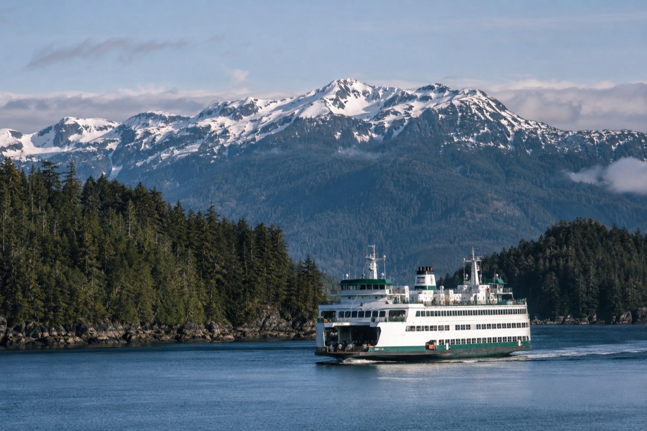
The Alaska Marine Highway is a ferry service operated by the state of Alaska, with its headquarters in Ketchikan. It works as a network of ferry lines along the southern coast of Alaska and down to Bellingham, and for many small communities it serves as the road that was never built. It is a working transportation system first, which explains a good deal about how it feels on board.
The routes cover 3,500 miles of coastline. Ferries run all the way from Bellingham to Unalaska and Dutch Harbor in the Aleutian Chain, and the system counts 32 terminals across Alaska, British Columbia and Washington.
Mainline ships, day boats and shuttles
The fleet comes in two broad families. Mainline vessels are the largest ships, and they typically take more than one day to get from their first port to their last, linking places that have road access. The mainline ferries are the MV Columbia, MV Kennicott, MV Matanuska and MV Tustumena.
Day boats play a different role. They tie smaller communities to each other or to the mainline routes, and the shuttle ferries are a sub-class of day boat. The MV Aurora, MV LeConte, MV Lituya, MV Hubbard and MV Tazlina belong to this group. The fleet as a whole is built to carry everything from motorcycles to large freight containers, so you may share a deck with a family car, a fishing skiff on a trailer or a truckload of supplies for a village.
What life on board is like
Do not picture a cruise ship. Cabins cost extra, and most food is served cafeteria-style. All mainline vessels have solariums, showers and lounges for sleeping, while the larger vessels also have staterooms. The solarium, a heated, glassed-in deck space, is where many passengers settle with a book and a coffee while the Inside Passage slides by.
Walk-on passengers may bring up to 100 pounds of hand-carried baggage. Kayaks and canoes may be carried aboard, and small inflatable boats are allowed if they weigh less than 300 pounds and do not exceed 18 feet in length and 3 feet in width. That makes the ferry a natural companion for paddlers heading to a coast with no road access.
Vehicles and pets
The ferry is one of the only ways to move a vehicle between Alaska and the contiguous United States without going through international customs and immigration. For anyone relocating a car or an RV, or simply wanting to drive in Alaska without the long way around, that is the point of the whole system.
Animals are restricted to the car deck. They must be properly contained in an approved carrier, or travel in a vehicle accompanied by an adult passenger.
Which ports does it serve?
The system serves coastal communities from Bellingham, Washington, to Dutch Harbor, with Southeast Alaska, Southcentral Alaska and the Aleutian Chain as the main stretches. You cannot sail the whole distance on a single boat, because the system is divided into three parts. Riders reach their final destination by combining one or more vessels, usually through a regional hub in Ketchikan, Juneau, Whittier or Homer.
| Route | Running time |
|---|---|
| Bellingham to Ketchikan (sample) | 38 hours |
| Bellingham to Skagway | Just under 3 days |
| Sitka to Juneau | 18 hours |
Southeast Alaska mainline routes
Two mainline routes anchor Southeast Alaska. One runs from Bellingham to Ketchikan, Wrangell, Petersburg, Juneau, Haines, Skagway and Sitka. The other starts in Ketchikan and calls at Wrangell, Petersburg, Sitka, Juneau, Haines and Skagway.
Most communities in Southeast Alaska receive ferry service all year. Mainline vessels serve the larger towns, and day boats supply regularly scheduled service to the smaller ones. The MV Kennicott follows a different pattern: it travels from Bellingham through Prince Rupert, Ketchikan and Juneau to Yakutat and on to Southcentral Alaska only in the summer.
Juneau and the smaller communities
Juneau is the ferry hub of Southeast Alaska, and every line calls there. From the capital, scheduled service routes fan out to Angoon, Kake, Pelican, Tenakee, Haines and Skagway, and a separate route links Gustavus with Hoonah. These are the day-boat runs that connect villages where the ferry is the way in and out, and where the arrival of the boat is an event for the whole waterfront.
Metlakatla can be reached through the Ketchikan terminal, at (907) 228-6886. Sand Point uses the central reservations number, (800) 642-0066.
Where the terminals sit
Terminal locations differ from town to town. In Skagway the terminal is in the middle of town at Mile 0 of the Klondike Highway, and in Yakutat it is centrally located as well. Whittier’s terminal is also in town, on West Camp Road. Prince Rupert’s terminal is centrally located at 2100 Park Avenue.
Others sit apart from the town they serve. The Sitka terminal is 7 miles from town on Halibut Point Road, and Petersburg’s is 2 miles out on South Nordic Drive. Knowing this before you arrive helps you plan the first hour on land.
Prince Rupert, British Columbia
Prince Rupert is the one port outside Alaska and Washington that the Kennicott calls at in summer. In the proposed winter 2026/27 schedule, however, the Alaska Marine Highway will not travel to Prince Rupert, so a plan that includes that stop for the coming winter needs another route.
What should you know before you book?
Before booking, know that the system prices dynamically, that reservations close at set times before each sailing, and that changing a booking costs more the closer you get to departure. Fares are published for each sailing, and the schedule tools on the system’s website show what is actually running.
How fares move
With dynamic pricing, published fares increase as availability decreases. A sailing that is filling up costs more than the same sailing when it opened. Some special events at a port also add a 10% increase to fares, applied for four days before and after the event in that port.
If you are planning around a festival in a coastal town, the event surcharge is a reason to compare nearby dates. The Sailing Search tool lets you enter a port and a travel date to see what is available.
Reservation deadlines and check-in
Online reservations close earlier at ports with terminals than at unmanned ports. For a booking within the final window from a terminal, passengers must contact the departing terminal directly.
| Situation | Deadline |
|---|---|
| Online reservations, departures from ports with terminals | 4 hours before sailing |
| Online reservations, departures from unmanned ports | 15 minutes before sailing |
| Passenger check-in without a vehicle, Bellingham and Juneau | 2 hours before departure |
| Passenger check-in without a vehicle, all other ports | 1 hour before departure |
Changing a booking
Change fees rise in three steps as the sailing approaches.
| When you change | Change fee |
|---|---|
| Up to two weeks before departure | $20 |
| From two weeks to three days before departure | $50 |
| Within three days of departure | $100 |
Reading the schedules
The Sailing Calendar shows ferry schedules in a monthly calendar, and you can sort entries by month, port or vessel. Clicking any entry opens the full schedule in a pop-up window. The Colored Schedule Grids show the schedule for a region or a vessel by month, laying out the entire sailing route, and each vessel has its own color.
In both tools, arrivals appear in plain text and departures in bold. Once you know that, a grid reads quickly: follow your vessel’s color along the route and see where it stops, and when.
Good to know before you go
Bring U.S. currency for anything you buy on board, since the Alaska Marine Highway accepts only U.S. money for goods and services. Credit cards drawn on foreign banks are accepted.
Crewmembers are State of Alaska employees, and state law prohibits them from accepting tips, so any tip money left behind goes to the State General Fund. For a trip that depends on a connection, such as a mainline sailing to a day boat, look at the full route in the schedule tools before you commit to a date.
Sources
- Alaska Department of Transportation, Alaska Marine Highway System, Passenger and vehicle fares (https://dot.alaska.gov/amhs/fares.shtml), checked October 11, 2026
- Alaska Department of Transportation, Alaska Marine Highway System, Fleet (https://dot.alaska.gov/amhs/fleet.shtml), checked October 11, 2026
- Alaska Department of Transportation, Alaska Marine Highway System, Alaska Marine Highway System (https://dot.alaska.gov/amhs/index.shtml), checked October 11, 2026
- Alaska Department of Transportation, Alaska Marine Highway System, System map (https://dot.alaska.gov/amhs/map.shtml), checked October 11, 2026
- Alaska Department of Transportation, Alaska Marine Highway System, Route guide (https://dot.alaska.gov/amhs/route.shtml), checked October 11, 2026
- Alaska Department of Transportation, Alaska Marine Highway System, Schedules (https://dot.alaska.gov/amhs/schedules.shtml), checked October 11, 2026
- Wikipedia, Alaska Marine Highway (https://en.wikipedia.org/wiki/Alaska_Marine_Highway), checked October 11, 2026
- Wikivoyage, Alaska Marine Highway (https://en.wikivoyage.org/wiki/Alaska_Marine_Highway), checked October 11, 2026