
Somewhere in the Yukon, a driver pulls into a gas station, sees the pumps shut for the night and realizes that the road north is a different kind of trip. The Alaska Highway is the long road that links Dawson Creek, British Columbia, with Delta Junction, Alaska, passing through Whitehorse on the way. It is the route people have in mind when they talk about driving to Alaska.
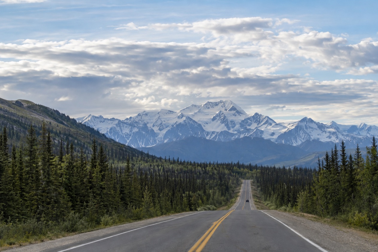
What is the Alaska Highway?
The Alaska Highway is the road that runs from Dawson Creek, British Columbia, to Delta Junction, Alaska, by way of Whitehorse, Yukon. It opened to the public in 1948, and for years it had a reputation as a rough, challenging drive. Today it is paved over its entire length, though the reputation lingers in the stories drivers tell.
The highway is not one road under one name. It stitches together three: British Columbia Highway 97, Yukon Highway 1 and Alaska Route 2. You will see those numbers on signs and maps as you cross from province to territory to state, and the road keeps its character even as the label changes.
A road with its own guidebook
The Milepost is an extensive guidebook to the Alaska Highway and the other highways of Alaska and Northwest Canada, and it has been published every year since 1949. It is available in print or as an eBook, and it is the book recommended for planning the trip.
The name of the guide hints at how the road is still described. Places along the way are often given by Historic Mile, a system older than the paving. Delta Junction sits at Historic Milepost 1422, and Whitehorse at Historic Mile 918, which is also kilometre 1426 on the modern markers.
A bridge worth a stop in the Yukon
One of the roadside attractions is the Canyon Creek bridge at the Aishihik River crossing. It is a replica log bridge, rebuilt in 1987 and refurbished in 2005 by the Yukon government, and it is a popular tourist attraction. It gives a sense of the timber-built crossings that once carried the road over the rivers of the north.
Beyond the bridge, the Yukon stretch brings you near Kluane National Park and Reserve, a UNESCO World Heritage Site that holds Mount Logan, the highest mountain in Canada. Whitehorse, the capital of Yukon, offers the MacBride Museum of Yukon History, the Yukon Beringia Interpretive Centre and the Yukon Transportation Museum, all useful for understanding why the road exists at all.
Where does it start and end?
The Alaska Highway begins in Dawson Creek, British Columbia, at the junction with Highway 2 and Highway 97, and ends at Delta Junction, Alaska. In between it passes through Whitehorse, the largest city in Northern Canada. Most of the route lies in Canada, and you cross into Alaska near the end of the journey.
Whitehorse, the big stop in the middle
Whitehorse is where many drivers rest. The city was named for the White Horse Rapids, which disappeared under Miles Canyon and Schwatka Lake when a hydroelectric dam was built in 1958. The name survives on the map even though the rapids are gone.
The city has a subarctic climate, milder than other comparable northern communities because of its position in the Whitehorse valley, and it is Canada’s driest city. Summer days stretch to about 19 hours of daylight, which makes for long evenings of museum visits or a walk by the water. In winter, Mount Sima, run by private interests, offers downhill skiing, and in summer the same slopes serve mountain bikers.
Whitehorse also has an airport served by Air Canada, Air North and Westjet, with nearly all flights to or from Vancouver. For a driver, that matters mostly as a fallback: it is the one place on the Canadian stretch where you can leave the road behind.
Delta Junction, where the road ends
Delta Junction is the terminus, known as the Crossroads of Alaska, and it is where the Alaska Highway meets the Richardson Highway. Travelers are advised to spend one night here. The town has the oldest roadhouse in the Interior region of Alaska, roadside adventure lodges, and The Lodge at Black Rapids as a lodging option.
Summer visitors can buy local goods at the farmers market called Highway’s End. Golden Eagle Outfitters offers flightseeing tours and air taxi services from Delta Junction to see mountains and glaciers. Summer afternoons run in the mid-60s to near 70°F, so you can wander without heavy layers.
Beyond the end: Fairbanks
From Delta Junction the Richardson Highway continues 96 miles to Fairbanks, which is often unofficially regarded as the northwestern portion of the Alaska Highway, at Historic Milepost 1520. Delta Junction is a 1.5-hour drive from Fairbanks and a 6-hour drive from Anchorage, so the end of the highway also works as a bridge to the rest of the state.
What do you need to know before you drive it?
Plan around fuel, phone coverage, daylight and the border, because the road asks more of you than a regular highway. Gas stations along the Alaska Highway in Canada are often not open 24 hours, especially in winter, and most lack pay-at-the-pump.
Phones and road information
Every Yukon community along the highway has cell service in its vicinity, but coverage is sparse elsewhere. Expect quiet stretches between towns where your phone will be little help, which is one more reason to carry The Milepost.
For the Alaska side, Alaska 511 gives road conditions in categories: Good, Fair, Difficult, Very Difficult, Hazardous, Road Closure and No Winter Maintenance. The Alaska Department of Transportation has partnered with Waze to publish Waze-reported incidents and closures there. You can create an account to save routes and receive notifications, and route alerts go out by default on weekdays from 6 AM to 6 PM by SMS.
On the map page you can add a camera to My Cameras by clicking a camera icon and then the My Cameras button in its popup. On the camera page, the three dots icon below the image opens the same option. You must log in to save routes for future viewing.
Light, cold and seasons
Along the highway there are more than 20 hours of sunlight in summer and less than 5 hours in mid-winter, which shapes how far you want to drive in a day. Delta Junction has a subarctic climate, with daily lows below 0°F from December through February, and snow typically falls from October to April. Over half of its yearly precipitation arrives from June to August.
Crossing the border and the side road
Because the road runs through Canada, entering by land means presenting documents. U.S. citizens can present a valid U.S. Passport, Passport Card, Enhanced Driver’s License or a Trusted Traveler Program card such as NEXUS, SENTRI or FAST, among other listed documents.
Children under age 16 can present a birth certificate or other proof of citizenship. Travelers can check land border wait times for crossing from the United States into Canada, and border officers may examine digital devices.
Highway 37, the Stewart-Cassiar Highway, is 447 miles long and intersects the Alaska Highway about 1.9 miles north of the British Columbia-Yukon border. It is a separate road, but it shows up on maps right where the Alaska Highway leaves British Columbia. If you would rather not drive the Alaska side, Interior Alaska Bus Line runs year-round on Mondays, Wednesdays and Fridays between Tok and Anchorage, and between Tok and Fairbanks.
Good to know before you go
The long summer light helps with this road, since you can keep driving into the evening, while winter brings short days and closed pumps. A Yukon visit also fits into a bigger picture: the territory shares a border with Alaska and has a second World Heritage Site, Tr’ondëk-Klondike, designated in 2023. Keep the guidebook handy, fuel up early, and treat each town as a chance to stretch your legs.
Sources
- Wikipedia, Alaska Highway (https://en.wikipedia.org/wiki/Alaska_Highway), checked October 11, 2026
- Wikivoyage, Alaska Highway (https://en.wikivoyage.org/wiki/Alaska_Highway), checked October 11, 2026
- Wikipedia, Delta Junction, Alaska (https://en.wikipedia.org/wiki/Delta_Junction,_Alaska), checked October 11, 2026
- Alaska.org, dest delta junction (https://www.alaska.org/destination/delta-junction), checked October 11, 2026
- Wikipedia, Whitehorse (https://en.wikipedia.org/wiki/Whitehorse), checked October 11, 2026
- Wikipedia, Yukon (https://en.wikipedia.org/wiki/Yukon), checked October 11, 2026
- Canada Border Services Agency, Cross the Canadian border (https://www.cbsa-asfc.gc.ca/travel-voyage/menu-eng.html), checked October 11, 2026
- U.S. Customs and Border Protection, Western Hemisphere Travel Initiative (https://www.cbp.gov/travel/us-citizens/western-hemisphere-travel-initiative), checked October 11, 2026
- Alaska 511 (https://511.alaska.gov/), checked October 11, 2026