
Totem poles stand in the wet green light of Ketchikan, and a floatplane lifts off the water toward the fjords. Down the coast the rain drips off spruce and hemlock, and the harbors smell of salt, diesel and fish. Southeast Alaska is the long, island-studded Panhandle, a region of rainforest towns, glaciers and Tlingit heritage, made for travelers who like to move by water and look at wild country.
Where is Southeast Alaska and what is it like?
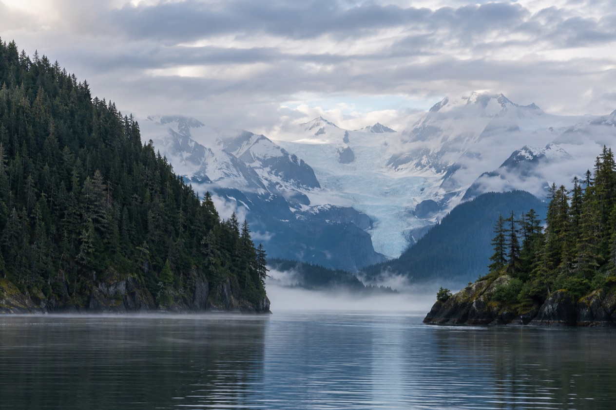
Southeast Alaska, also called the Alaska Panhandle, is a thin strip of land and islands between British Columbia and the northern Pacific Ocean, and it includes the Inside Passage. It is a region of water as much as land: channels, coves, fjords and a great scatter of islands, with mountains of the Coast Range rising behind them. The towns sit wherever the mountains leave room, and many of them are not linked to each other by road.
Most of the region lies inside the Tongass National Forest, the largest national forest in the country, a temperate rainforest of islands, fjords, glaciers and peaks. The three biggest towns are Juneau, the state capital, then Sitka and Ketchikan, which are close in size.
Juneau is a government town with a small downtown pressed against the mountain along Gastineau Channel. Ketchikan is an island community of rainforest and sea, known for its totem poles and its old fishing and cannery past.
This is also Tlingit country. The Tlingit, along with the Haida and Tsimshian, have lived along this coast for thousands of years, and their art, clan houses and ceremonies are part of everyday life in the towns. Hoonah, near Glacier Bay, is a traditional Tlingit village.
The pace follows the weather and the tides. Rain is part of the deal in a rainforest, and the people who love the Panhandle tend to love gray mornings, mist on the water and a walk under big trees.
It is also the one part of Alaska where winter daytime highs average above freezing. If you want a road trip with a different stop every night, the water-bound geography will frustrate you. If you like arriving by boat or small plane and staying put for a while, it fits.
What is there to do in Southeast Alaska?
The region offers glaciers, wildlife, Native culture and the sea routes of the Inside Passage, and the Panhandle sets itself apart from the rest of Alaska by putting all of it close to a rainforest shoreline.
Glaciers and Glacier Bay
Mendenhall Glacier sits 13 miles from downtown Juneau, close to the airport, and visitors can drive directly to it. The Forest Service runs the Mendenhall Glacier Visitor Center there, built in 1962 as the first Forest Service visitor center in the country. It is the easiest place in the region to see a glacier from the ground, with the ice at the end of a lake.
Glacier Bay National Park and Preserve lies west of Juneau and covers more than three million acres. No roads lead to it, so you arrive by air or sea. The Alaska Marine Highway ferry runs between Juneau and Gustavus by way of Hoonah twice weekly. The park is part of a UNESCO World Heritage Site, inscribed in 1979.
Wildlife on land and water
The region is home to brown and black bears, humpback whales, orcas, bald eagles and five species of salmon. Wildlife tours out of Juneau can bring you close to black bears, Dall’s porpoises, sea lions, harbor seals, sea otters, mountain goats and Sitka blacktail deer. You are likely to see bears, bald eagles or humpback whales in Juneau, especially from April through November, though sightings are never guaranteed.
Admiralty Island is bear country in a stronger sense. It holds an estimated 1,600 brown bears, outnumbering the island’s residents nearly three to one. Visitors who want to watch brown bears at the Pack Creek viewing area in the summer months need a permit from the Forest Service.
Totem poles, history and Native culture
Ketchikan has one of the largest collections of standing totem poles in the world, scattered through town, in totem parks and at the Totem Heritage Center. Totem Bight State Historical Park and the Tongass Historical Museum belong on the same list. Creek Street, a row of historic buildings along Ketchikan Creek, recalls the days when it was a red light district serving miners, fishermen and loggers.
Juneau’s historic district is small and walkable, with several sights. The Alaska State Capitol, completed in 1931, is open for self-guided tours Monday through Friday. In even-numbered years in June, Juneau hosts Celebration, a gathering that welcomes thousands of Native people for dances and regalia carrying generations of clan history.
Fjords, trails and the water
Misty Fjords National Monument is about 40 miles east of Ketchikan, and visitors can reach it by floatplane. Almost all of it is designated wilderness. Juneau offers more than 250 miles of hiking trails, and the Tongass is open to explore from Ketchikan too. Behind all of it runs the Inside Passage, a sheltered sea route more than 1,000 miles long from Seattle to Skagway.
How many days do you need in Southeast Alaska?
A week lets you see one or two towns properly, and the region rewards ten days or more, because every move between towns means a boat or a plane.
With a long weekend, pick one base. Juneau works well: the glacier, the historic district, the Capitol and a wildlife tour all sit within reach of each other, and the airport is close to downtown. Ketchikan also suits a short stay, with its totem collection, the museum, Creek Street and walkable downtown, plus the option of a floatplane to Misty Fjords.
With a week, pair two places. Juneau and Ketchikan are two of the three big towns and give you the capital’s mountain-and-ice side alongside the island, cannery and totem side. Alaska Airlines’ milk run connects several towns, including Sitka, Petersburg and Wrangell, so a route that touches a third or fourth community is possible, though they are not all on the same schedule.
Longer stays open the water-only places. Glacier Bay is reached by the ferry to Gustavus via Hoonah, or by air, and deserves more than a quick look. Admiralty Island and its bears, and the Tlingit community of Angoon, call for a separate trip. Sitka is the third of the big towns and adds the region’s older history, since Juneau took over as capital from there in 1906.
Build in slack. Rain falls on many days in Juneau, and a plan that allows an indoor afternoon at a museum or the visitor center will hold up better than a rigid one. The wilderness days are the ones to leave open, since they depend on the weather and on getting there.
Where to stay in Southeast Alaska
Stay in the towns, because that is where the region’s lodging, harbors and airports are. Downtown Juneau suits people who want to walk to the historic district, the Capitol and the waterfront. The Alaskan, a hotel and bar more than a century old and the state’s oldest operating hotel, stands there.
Mendenhall Valley is the part of Juneau near the glacier and the airport, a good fit for travelers who care more about the ice and the trails than about the downtown bars. Auke Bay, north of the valley, is the harbor area, handy for boat tours and wildlife outings. Douglas sits across Gastineau Channel and is linked to downtown by the Juneau-Douglas Bridge.
Ketchikan is the base for the totem parks, Creek Street and Misty Fjords flights. Downtown is easy to walk, with galleries, shops and locally made goods, so staying near the waterfront keeps most of the town within reach on foot.
For Glacier Bay, the gateway is Gustavus, and Hoonah is the Tlingit village on the ferry route. Angoon is the only settlement on Admiralty Island, a traditional Tlingit community. These small places suit travelers who came for the wild country and want to sleep near it.
How do you get to Southeast Alaska and get around?
Most visitors fly in. Alaska Airlines flies daily jets to Juneau from Seattle and Anchorage all year, and Seattle is Juneau’s only direct departure city in the Lower 48. The flight from Seattle takes about two and a half hours nonstop, and from Anchorage about an hour and a half. Delta serves Juneau, Sitka and Ketchikan from Seattle only seasonally, in summer.
Alaska Airlines also runs a milk run linking Anchorage and Seattle through Gustavus, Ketchikan, Petersburg, Juneau, Sitka, Wrangell and Yakutat, though only Juneau is on the same schedule as the rest. Juneau International Airport is about ten minutes from downtown. Juneau is not fully reachable by car, so transportation needs planning early.
Getting around the towns is simple in the old centers. Juneau’s historic district and downtown Ketchikan are walkable, and visitors can drive directly to Mendenhall Glacier. Between communities, the water takes over. The Alaska Marine Highway runs between Juneau and Gustavus via Hoonah twice weekly, and floatplanes reach places like Misty Fjords from Ketchikan.
One road route leaves the region. The Klondike Highway joins Skagway to Whitehorse in the Yukon over about 109 miles. Hyder is reached only by road from Stewart, British Columbia, with no border controls entering from Canada, but travelers need a passport to return to Canada or to fly to Ketchikan.
In Ketchikan, cruise ships dock either downtown or at Ward Cove, about 5.5 miles from the center. Tours can be booked on the day at the Visitors Center on Berth 2 or at kiosks on the docks.
When is the best time to visit Southeast Alaska?
Late spring through early fall is the time to come, with the wildlife window running from April through November in Juneau. That is when bears, bald eagles and humpback whales are most likely to turn up, and when boats, tours and the Delta flights are running. Summer highs in Juneau generally reach the low to mid 60s and can climb above 75, which makes for comfortable days outdoors in a light layer.
Daylight stretches long in summer. On June 21, the longest day, Juneau gets just over 18 hours of light, enough for evening walks and late glacier visits. June in even-numbered years is also when Celebration fills Juneau with Tlingit, Haida and Tsimshian dancers, canoe landings and song.
Rain is the constant in all seasons. Juneau counts 230 days with precipitation, so expect some during any stay. Winter is the quiet time, with temperatures averaging 29 degrees in Juneau. The legislature meets from January to April or May, which fills the capital with lawmakers while the sightseeing season sleeps.
Good to know before you go
Juneau runs on Alaska Time, one hour earlier than Pacific Time, and observes daylight saving time. Pack for rain, since wet weather is normal in a temperate rainforest.
Many towns are reached only by air or water, so the schedule of a ferry or small plane sets the shape of the trip. Bears live throughout the region, and the Forest Service sets the rules for places like Pack Creek, where a permit is required in summer.
Sources
- Wikivoyage, Alaska Panhandle (https://en.wikivoyage.org/wiki/Alaska_Panhandle), checked October 11, 2026
- Wikipedia, Alaska Panhandle (https://en.wikipedia.org/wiki/Alaska_Panhandle), checked October 11, 2026
- Wikipedia, Southeast Alaska (https://en.wikipedia.org/wiki/Southeast_Alaska), checked October 11, 2026
- Wikipedia, Inside Passage (https://en.wikipedia.org/wiki/Inside_Passage), checked October 11, 2026
- Wikipedia, Tongass National Forest (https://en.wikipedia.org/wiki/Tongass_National_Forest), checked October 11, 2026
- Wikipedia, Tlingit (https://en.wikipedia.org/wiki/Tlingit), checked October 11, 2026
- Travel Juneau (https://www.traveljuneau.com/), checked October 11, 2026
- Visit Ketchikan (https://www.visit-ketchikan.com/), checked October 11, 2026
- Wikipedia, Misty Fjords National Monument (https://en.wikipedia.org/wiki/Misty_Fjords_National_Monument), checked October 11, 2026
- Wikipedia, Glacier Bay National Park and Preserve (https://en.wikipedia.org/wiki/Glacier_Bay_National_Park_and_Preserve), checked October 11, 2026
- Wikipedia, Admiralty Island (https://en.wikipedia.org/wiki/Admiralty_Island), checked October 11, 2026
- Wikipedia, Climate of Alaska (https://en.wikipedia.org/wiki/Climate_of_Alaska), checked October 11, 2026