
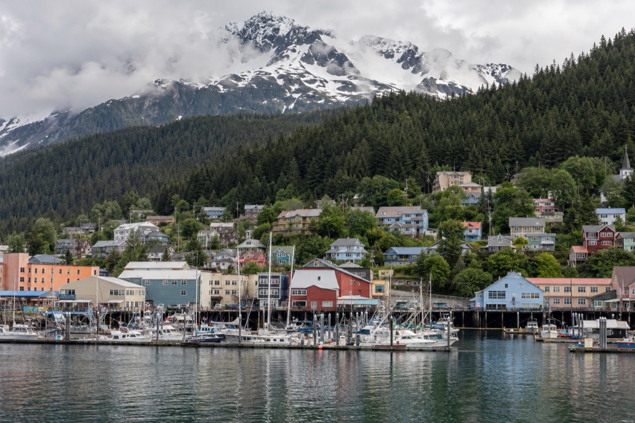
The plane drops toward Gastineau Channel between steep green mountains, and the first thing you notice is how close the forest comes to the town. Rain gear hangs by the doors, the Alaskan beer is on every bar menu, and the state capital feels more like a harbor village than a seat of government. A few things about the weather, the layout, the bears and the local habits will make the visit go more smoothly.
What should you know before visiting Juneau?
Four things matter most: the town sits in a rainforest, it is reached by air, the area around it is far larger than the town itself, and the weather asks for layers that shed water.
Juneau lies inside the Tongass National Forest, the world’s largest temperate rainforest, and that explains the damp green smell of the streets and the moss on everything. It also explains the clouds that settle on the mountains. The city sits on Gastineau Channel in the Inside Passage, and the water, the peaks and the weather decide how a day goes.
What surprises first-time visitors is the scale. The City and Borough of Juneau covers 3,255 square miles, yet only 14 square miles of it are urban.
A huge share is ice cap and water, so a place that looks like a small town on the map is really a town at the edge of wilderness. The Mendenhall Glacier is 13 miles from downtown and only a few minutes from the airport, which means a glacier can fit into the same afternoon as a coffee on the waterfront.
The other surprise is the capital itself. Juneau became the capital of Alaska in 1906, when the government moved from Sitka, and it is the only state capital that borders a foreign country.
Its name comes from gold prospector Joe Juneau, and the gold rush that began in 1880 still shapes the downtown streets, the old buildings and the stories locals tell. Long before that, the area was known as Dzantik’i Héeni, a Tlingit name meaning Base of the Flounder’s River, and for thousands of years it was a popular Native fishing ground.
Distance is the last thing to take in. Seattle is about 900 air miles away, a two-hour flight, and Anchorage is about 600 air miles away, a 90-minute flight. Juneau feels remote and close at once, depending on which direction you are thinking in.
Fees, passes and reservations
The decisions that shape a Juneau trip are about geography more than paperwork. The glacier, the forest trails and the town are close together, and the area has more than 250 miles of hiking trails, so the real planning question is how to divide your time between town and trail. Decide first how you will arrive, since flights from Seattle and from Anchorage are the links named for the capital.
The legislature adds one more thing to consider. Its session runs from January to April or May, and the town fills with lawmakers and staff during those months. If a visit to the capital building or a quiet downtown matters to you, the time of year shapes what you find. Settle your dates around the weather and the activity you want most, then build the rest of the days around that choice.
Money, phones and getting online
Juneau is a U.S. city, so you are in familiar territory with American dollars, American time and American roads. The one online tool the state names for travelers is Alaska 511, the Department of Transportation’s website, which publishes road conditions and closures. It sorts roads into Good, Fair, Difficult, Very Difficult, Hazardous, Road Closure and No Winter Maintenance, so a glance tells you what a road is like before you head out.
The department has also partnered with Waze, and incidents and closures reported there appear on the Alaska 511 site. On the map page you can pick a camera icon and add it to My Cameras, which is a handy way to watch a road you care about.
Time is straightforward too. Alaska keeps its own time zone, one hour behind the Pacific coast, and clocks change on the second Sunday in March and the first Sunday in November.
Getting around and staying connected
Most visitors reach Juneau by air, and the flights are short by Alaska standards. From Seattle it is about two hours in the air, and from Anchorage about an hour and a half. The airport sits near the Mendenhall Glacier, only a few minutes away, so the glacier is one of the first big sights you can reach after landing.
The glacier lies 13 miles from downtown, and that is the figure to keep in mind when you map out a day. Downtown, along the channel, holds the old gold rush streets, the waterfront and The Alaskan, a hotel and bar more than a century old that is the state’s oldest operating hotel.
Auke Bay is a different part of the city, north of the Mendenhall Valley, and it is also the name of the harbor and the water beside it. Knowing these three names helps when you read a map or listen to directions.
Before you drive anywhere, check Alaska 511. Its road condition categories run from Good to Hazardous, with Road Closure and No Winter Maintenance at the far end, and the cameras on its map let you look at a road before you commit to it. In the colder months that habit matters more, since the snowfall figures in the weather table are far from zero in winter.
Weather, daylight and wildlife
Juneau’s weather is damp in every season, with more than 50 inches of precipitation in a typical year. From spring to early fall, temperatures range between the 50s and the 70s Fahrenheit, with possible rain and wind. The answer is layers: something warm, something that breathes, and on top a fully waterproof and breathable shell with a hood. A small backpack lets you peel layers off and stow them as the weather changes.
| Month | Average high (°F) | Average low (°F) | Precipitation (in) | Days with precipitation | Snowfall (in) |
|---|---|---|---|---|---|
| January | 33.1 | 23.8 | 6.02 | 13.4 | 24.5 |
| April | 48.7 | 32.9 | 3.47 | 9.4 | 1.2 |
| July | 64.0 | 50.1 | 5.14 | 11.6 | 0.0 |
| October | 47.3 | 37.1 | 8.42 | 17.0 | 0.9 |
In words, January is cold and snowy, with a few clear days between storms. April stays cool and drier than the other months shown, with a light dusting of snow now and then. July is the mildest month, though it still brings rain on many days.
October is the wettest of the four, with rain falling on most days and the mountains often wrapped in cloud.
On wildlife, all three North American bear species, black, brown (including grizzly) and polar, flourish in Alaska. The state’s rule is simple: people in Alaska must keep all human sources of food secure from bears. A dangerous bear situation should be reported to the Alaska Department of Fish and Game using its wildlife encounter form. Bears, whales and other animals are chances rather than promises, so treat any sighting as a bonus.
Local customs and etiquette
Alaskans dress for the weather and not for the occasion. Rain jackets and sturdy boots show up at restaurants, at the theater and in the legislature, and nobody looks twice. If you arrive in a shell and walking shoes, you will fit right in. Locals tend to carry a spare layer wherever they go, and they take a shower in the street as a normal part of the day.
The pace is relaxed and friendly. People say hello on trails, chat in line at the coffee shop and ask where you are from. Conversation often turns to the weather, the fishing, the latest news from the capital building and the glacier. A pint of Alaskan beer, brewed in town, is a natural thing to order, and a seat at The Alaskan is a pleasant way to feel the town’s gold rush past.
Respect for the land runs deep. This is the homeland of the Tlingit people, and the Tlingit name for the place, Dzantik’i Héeni, is a reminder that the waters here were fishing grounds for thousands of years. Treat Native art, place names and gathering places with the care you would give anywhere that matters to a community. Ask before you photograph people, and listen when someone shares a story about the area.
Respect for wildlife is a daily habit. Locals keep food and trash closed up, give animals room and talk calmly when they are on a trail. The same instinct applies to the forest itself. People pack out what they bring in, stay on the trails and leave moss and flowers where they grow.
Good to know before you go
Winter and spring bring snow and the legislative session, while summer is milder and wetter than many visitors expect. Whatever the month, pack a waterproof shell with a hood and a layer you can add or remove.
Carry food in closed containers when you head to a trail, and check Alaska 511 before you drive. Last of all, keep a little room in your plans for a rainy hour, because in Juneau that hour often turns into a good conversation in a warm café.
Sources
- Travel Juneau (https://www.traveljuneau.com/), checked October 11, 2026
- Wikipedia, Climate of Alaska (https://en.wikipedia.org/wiki/Climate_of_Alaska), checked October 11, 2026
- Alaska 511 (https://511.alaska.gov/), checked October 11, 2026
- Alaska Department of Fish and Game, Living with bears (https://www.adfg.alaska.gov/index.cfm?adfg=livingwithbears.main), checked October 11, 2026
- Alaska.org, what to wear (https://www.alaska.org/advice/what-to-wear-in-alaska), checked October 11, 2026
- Wikipedia, Alaska Time Zone (https://en.wikipedia.org/wiki/Alaska_Time_Zone), checked October 11, 2026
- NOAA NCEI, U.S. Climate Normals 1991-2020, monthly (https://www.ncei.noaa.gov/access/services/data/v1?dataset=normals-monthly-1991-2020&stations=USW00025309), station Juneau Intl Ap, elevation 16 feet, checked October 11, 2026
To plan your stay
- Best Time to Visit Juneau: Weather by Month, Wildlife Season and Cruise Crowds
- Things to Do in Juneau: Mendenhall Glacier, Mount Roberts Tram, Whale Watching and Day Trips
- Where to Stay in Juneau: Downtown, Mendenhall Valley and Auke Bay
- Juneau from Seattle: Nonstop Flight, Ferry from Bellingham and What to Do on Arrival