
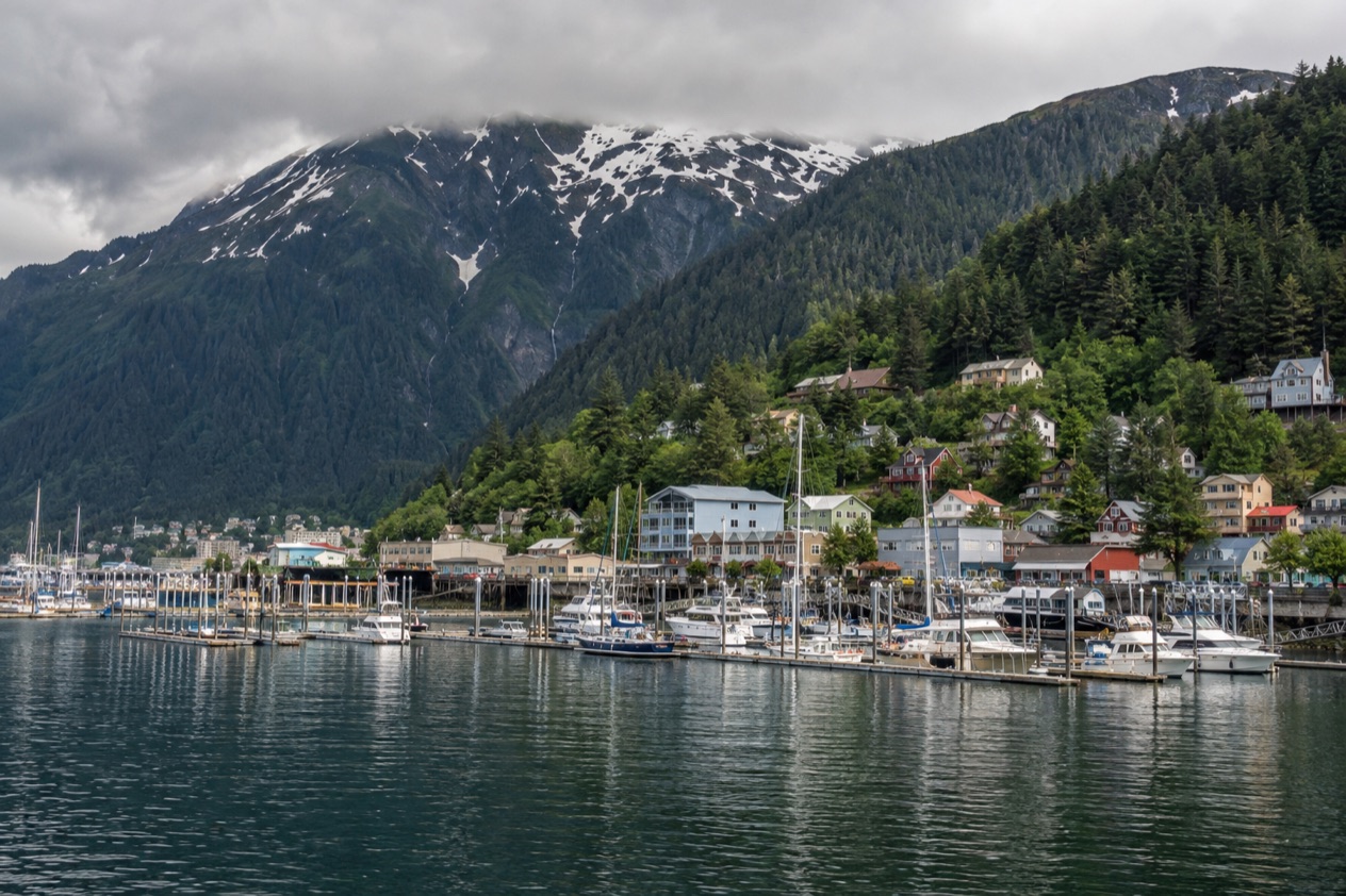
The morning begins at the harbor in Auke Bay, with gulls calling over the water and the smell of diesel and wet spruce drifting across the docks. Juneau has no road to anywhere else in Alaska, so every outing starts with a choice between a road that ends within the borough, a boat, a ferry or a small plane. A glacier, a fjord full of floating ice, an island of brown bears and a town of eagles all lie within reach of the capital.
What are the best day trips from Juneau?
The best day trips from Juneau all trade the city for ice, forest or water, and the one you choose depends on whether you want a road, a boat or a ferry deck under you.
- Mendenhall Glacier, a river of ice you can drive straight to from town.
- Tracy Arm, a narrow fjord with steep walls and, often, ice on the water.
- Admiralty Island and Angoon, a Tlingit village on an island known for its brown bears.
- Gustavus and Glacier Bay, the gateway to a national park with no road in from outside.
- Haines, a small port on Lynn Canal, famous in the cold months for its bald eagles.
- Skagway, a gold rush town of boardwalks, history and a narrow gauge railroad.
None of these is a pure sightseeing stop. Each has a character, from the quiet of a wilderness fjord to the creak of old wooden storefronts, and each rewards a different kind of morning. The section that follows takes them one at a time.
Rain is part of every one of them. Juneau sees precipitation on most days of the year, and that mist is a good part of why the forest looks the way it does. A waterproof layer belongs in the bag for every trip below, even on mornings that begin bright.
The best day trips from Juneau
Mendenhall Glacier
Mendenhall is the simplest outing from town, because you can drive directly to it and it sits only a few minutes from the airport. The glacier is a federally designated recreation area inside the Tongass National Forest, and it reaches back into the mountains for about 13.6 miles. From the lake in front of it you see a wall of blue-white ice, often with small bergs floating near the face and a roaring waterfall off to one side.
The recreation area covers 5,815 acres, so there is more here than the viewpoint. Trails thread through spruce and hemlock, moss hangs from the branches, and in the right season you may spot bald eagles over the water. Bears are a possibility in this part of Juneau, and the Forest Service posts its own guidance on site, which is worth reading before you set off along a trail.
It suits a half day and pairs naturally with something else, whether lunch in town or a stop at the botanical garden described in the last section. On a gray, drizzly day the ice often looks bluer, so a rainy forecast is no reason to cancel.
Tracy Arm
Tracy Arm is a fjord south of Juneau, off Holkham Bay and next to Stephens Passage, inside the Tongass National Forest. It is the heart of the Tracy Arm-Fords Terror Wilderness, which Congress designated in 1990. The wilderness takes in two deep, narrow fjords, Tracy Arm and Endicott Arm, and together they hold a huge area of rock, water and ice.
You reach it by water, since no road comes near. The picture people carry home is of granite walls rising straight from the water, thin waterfalls streaking down them, and icebergs drifting past the hull.
Harbor seals sometimes haul out on the ice, and mountain goats may appear on the cliffs, though neither is certain. Fjord days reward a warm jacket, because the air near the ice is cold even when the town is mild.
Expect to spend most of it on a boat, taking photographs and watching the shoreline change from forest to bare rock to ice.
Admiralty Island and Angoon
Admiralty Island lies across the water from Juneau, and nearly all of it is the Kootznoowoo Wilderness. The old-growth temperate rainforest shelters brown bears, bald eagles and Sitka black-tailed deer. The island is estimated to hold the highest density of brown bears in North America, about 1,600 of them, which outnumber the people living there nearly three to one.
The only settlement is Angoon, a traditional Tlingit community on the western coast. A visit here is about the place and its people as much as the wildlife, and it asks for respect and a quiet manner. The Tlingit have lived in these waters for generations, and the forest, the fishing grounds and the shoreline are woven into that history.
This is a trip for people who want a wild island rather than a town, and who are comfortable with a day that depends on weather and water. Bears are a chance rather than a promise, so go for the forest and the shoreline and treat any sighting as a bonus.
Gustavus and Glacier Bay
Gustavus sits northwest of Juneau at the mouth of the Salmon River on the north shore of Icy Strait. Glacier Bay National Park and Preserve surrounds it on three sides and water bounds the fourth, so the town feels like a small clearing in a huge protected landscape. No road leads into Gustavus from outside the park, which shapes how you reach it and how the whole outing feels.
Summer here is cool, with temperatures in the low 50s to low 60s, and winters stay near freezing. The attraction is the park itself, where tidewater glaciers, mountains and open water meet. A day is short for such a place, so people use it as a first look at the bay and its shoreline rather than an exhaustive visit.
It suits travelers who want a national park added to a Juneau stay without committing to a wilderness lodge. Dress for wind off the water and for the mist that tends to hang over the strait.
Haines
Haines is a small port on Lynn Canal, the state’s longest fjord. The Alaska Marine Highway ferry terminal in Auke Bay is where ferry service leaves Juneau, and from there ferries run regularly throughout Southeast Alaska. Haines is also joined to the road network by the Haines Highway, which runs to Canada, though that road does not connect back to Juneau.
Haines draws visitors in summer, but October is its eagle moment. From October to February, the Alaska Chilkat Bald Eagle Preserve gathers the largest concentration of bald eagles in the world, with more than 3,500 in the area. That makes the town a rewarding outing right now, as the days shorten and the trees along the river fill with white heads and dark wings.
Walk the waterfront, look at the mountain skyline across the canal and let the quiet set the pace. It suits birders, photographers and anyone who prefers a small town with a big landscape over a bustling one.
Skagway
Skagway is the northern end of the Alaska Marine Highway ferry network, a small town in Southeast Alaska with fewer than a thousand residents. Its population doubles in the summer tourist season, which gives the boardwalks a busy, theatrical air in those months. Klondike Gold Rush National Historical Park is here, and the old storefronts keep the feeling of the 1890s.
The White Pass and Yukon Route narrow gauge railroad starts at the Skagway port. It began as part of the area’s mining past and now runs for the tourist trade during the summer months. Outside those months, the railroad is not a plan to build a day around.
You can explore Skagway on your own without a guide, strolling the streets and reading the history on the buildings. It suits history lovers and anyone who enjoys a compact town that tells one story well.
Day trips from Juneau compared
| Trip | Distance from Juneau | Best for | How to go |
|---|---|---|---|
| Mendenhall Glacier | 13 miles from downtown | Glacier views and forest trails | Drive directly |
| Tracy Arm | 45 miles south | Fjord scenery and floating ice | By water |
| Admiralty Island and Angoon | Across the water | Brown bears and a Tlingit village | By water |
| Gustavus and Glacier Bay | 50 miles northwest | A national park gateway | No road from outside the park |
| Haines | Lynn Canal | Bald eagles, October to February | Alaska Marine Highway ferry from Auke Bay |
| Skagway | Northern end of the ferry network | Gold rush history | Alaska Marine Highway ferry |
To choose, start with how you like to travel. If you want ice and forest with the least planning, Mendenhall asks only for a drive. If you want a day of grand scenery from a deck, Tracy Arm is the obvious pick, and Admiralty Island suits those who care more about wildlife and a Tlingit community than about a view.
Timing matters too. Haines is best from October to February, while Skagway’s railroad runs only in the summer months. Wildlife is likely from April through November, and the cruise ships crowd downtown between May and September. In rain, which is frequent, the fjords and the glacier hold up well, since moody light suits ice.
Tour or on your own?
Mendenhall Glacier is the one trip where you can simply go on your own, because the road leads directly to it. You set your own pace along the trails, linger at the lake and leave when the weather turns. The same freedom applies in Skagway, where you can explore without a guide and read the town street by street.
Trips across the water are different. Tracy Arm, Admiralty Island and Glacier Bay lie beyond the end of any road, so reaching them means joining a boat, a plane or a ferry with its own schedule. Wildlife viewing tours in Juneau can get visitors close to black bears, Dall’s porpoises, sea lions, harbor seals, sea otters, mountain goats and Sitka blacktail deer, which is a good reason to go with an operator who knows the waters and the animals.
For a few tours, the booking is part of the experience. The Rainforest Adventure Tours at Glacier Gardens use 18-passenger golf carts on a two-mile path through the Tongass National Forest.
At the top you get views over Mendenhall Valley and the Chilkat Mountains, and the gardens themselves hold Flower Towers, upside-down trees turned into living sculptures with cascading blooms. It is a good wet-weather idea because much of it is under the forest canopy.
Before you commit to any trip, check that the service runs in your month. The White Pass railroad operates only in the summer months, wildlife is likely from April through November, and the eagles in Haines belong to the cold months from October to February. Check also how the trip begins, whether at the Auke Bay ferry terminal or on the downtown waterfront, so you start the day in the right place.
If a day turns out too wet or too short for a long trip, the Goldbelt Tram offers a way to see the area without leaving town. The cars rise from the downtown cruise docks through the rainforest in about six minutes, and at the top the Mountain House has a restaurant, theater, shop and nature center, with trails running both up and down Mount Roberts. The views take in Juneau and Gastineau Channel.
Good to know before you go
Rain should be expected at some point during any stay, so a waterproof jacket and layers are better company than an umbrella. Cruise ships bring thousands of visitors to the downtown docks between May and September, so downtown is busiest in those months. Because Juneau is connected to the rest of the world only by air and sea, build your day around the departure time of the plane, ferry or boat, and keep some slack in the evening.
Sources
- Travel Juneau (https://www.traveljuneau.com/), checked October 11, 2026
- Wikivoyage, Juneau (https://en.wikivoyage.org/wiki/Juneau), checked October 11, 2026
- Wikipedia, Juneau, Alaska (https://en.wikipedia.org/wiki/Juneau,_Alaska), checked October 11, 2026
- Wikipedia, Juneau International Airport (https://en.wikipedia.org/wiki/Juneau_International_Airport), checked October 11, 2026
- Goldbelt Tram, Juneau (https://mountrobertstramway.com/), checked October 11, 2026
- Glacier Gardens Rainforest Adventure, Juneau (https://www.glaciergardens.com/), checked October 11, 2026
- Wikipedia, Mendenhall Glacier (https://en.wikipedia.org/wiki/Mendenhall_Glacier), checked October 11, 2026
- Wikipedia, Mount Roberts Tramway (https://en.wikipedia.org/wiki/Mount_Roberts_Tramway), checked October 11, 2026
- Wikipedia, Tracy Arm (https://en.wikipedia.org/wiki/Tracy_Arm), checked October 11, 2026
- Wikipedia, Endicott Arm (https://en.wikipedia.org/wiki/Endicott_Arm), checked October 11, 2026
- Wikipedia, Admiralty Island (https://en.wikipedia.org/wiki/Admiralty_Island), checked October 11, 2026
- Wikipedia, Tlingit (https://en.wikipedia.org/wiki/Tlingit), checked October 11, 2026
- Sealaska Heritage Institute (https://www.sealaskaheritage.org/), checked October 11, 2026
- Wikipedia, Tongass National Forest (https://en.wikipedia.org/wiki/Tongass_National_Forest), checked October 11, 2026
- Wikipedia, Southeast Alaska (https://en.wikipedia.org/wiki/Southeast_Alaska), checked October 11, 2026
- Wikivoyage, Haines (https://en.wikivoyage.org/wiki/Haines), checked October 11, 2026
- Wikipedia, Haines, Alaska (https://en.wikipedia.org/wiki/Haines,_Alaska), checked October 11, 2026
- Wikipedia, Haines Highway (https://en.wikipedia.org/wiki/Haines_Highway), checked October 11, 2026
- Skagway Convention and Visitors Bureau (https://www.skagway.com/), checked October 11, 2026
- Skagway, things to do (https://www.skagway.com/things-to-do), checked October 11, 2026
- Wikivoyage, Skagway (https://en.wikivoyage.org/wiki/Skagway), checked October 11, 2026
- Wikipedia, Skagway, Alaska (https://en.wikipedia.org/wiki/Skagway,_Alaska), checked October 11, 2026
- Wikivoyage, Gustavus (https://en.wikivoyage.org/wiki/Gustavus), checked October 11, 2026
- Wikipedia, Gustavus, Alaska (https://en.wikipedia.org/wiki/Gustavus,_Alaska), checked October 11, 2026
To plan your stay
- Best Time to Visit Juneau: Weather by Month, Wildlife Season and Cruise Crowds
- Where to Stay in Juneau: Downtown, Mendenhall Valley and Auke Bay
- Juneau from Seattle: Nonstop Flight, Ferry from Bellingham and What to Do on Arrival
- Know Before You Go to Juneau: Weather, Getting Around, Bears and Local Customs