
Walk down Broadway in Skagway on a summer morning and the wooden false fronts, the boardwalks and a narrow gauge train pulling out of the depot make it easy to picture the day thousands of strangers stepped off a ship with a ton of supplies. Skagway and Dyea are where it begins, Nome is where a second strike happened, and a gold pan is the object that ties it all together.
What was the Klondike gold rush?
The Klondike gold rush was the stampede of prospectors toward the goldfields around Dawson in Yukon Territory, and for most of them the road ran through Alaska. Most took the route through the ports of Dyea and Skagway in southeast Alaska, then climbed on foot into Canada. The towns on the Alaska side filled with people who were only passing through, and what they left behind is what you can still see today.
Two trails out of Skagway and Dyea
Two routes led over the mountains. The Chilkoot Trail started at Dyea, and around 22,000 prospectors used it during the rush. Steps were cut into the ice at Chilkoot Pass, and climbers could use them for a daily fee, so even the final climb had a toll booth of sorts.
The other route, the White Pass trail, started at Skagway. It earned the informal name Dead Horse Trail because many horses died on it. When you ride the White Pass and Yukon Route today, you travel a railroad that grew out of that same corridor, and it now runs purely for the tourist trade during the summer months, leaving from the port of Skagway.
What a prospector had to carry
The Canadian authorities required each person entering Yukon Territory to bring a year’s supply of food. That meant a mountain of flour, beans and bacon that had to be hauled up the pass in relays, trip after trip, long before anyone saw a nugget. It explains why the trail photographs of the era show endless lines of people bent under packs.
At the other end of the journey the law was just as firm. The North-West Mounted Police forbade women and children to travel through the White Horse Rapids on the Yukon River, a reminder that the rush had rules and lawmen, not only wild camps and saloons.
The long way around
Not everyone chose the mountains. An all-water route ran from Seattle to St. Michael at the Yukon River delta, then continued by river boat to Dawson. It avoided the passes but it was long and expensive, which is why so people accepted the cold and the climb instead.
| Route or rule | Detail | Figure |
|---|---|---|
| Chilkoot Trail | Dyea to Bennett, British Columbia | 33 miles |
| All-water route | Seattle to St. Michael, then river boat to Dawson | 4,700 miles |
| Food required for Yukon entry | Per person, typical weight | 1,150 pounds |
| Chilkoot Trail in the rush | Prospectors who used it | 22,000 |
Where can you see its history in Alaska?
Dyea, the trail and Nome add the rest of the picture. Skagway is connected to the road system by the Klondike Highway, completed in 1978, which links it to Whitehorse in Yukon, northern British Columbia and the Alaska Highway.
Klondike Gold Rush National Historical Park
Start at the park’s visitor center, where you learn about programs, tours and the film. From there you can follow a self-guided walking tour of park buildings in the Skagway Historic District. Rangers also give short conversations on topics they care about, held in the theater or outdoors, and they are a good way to hear a story that a plaque only hints at.
Anyone planning a visit between October and May should read the park’s guidance on visiting during the winter. The town changes in character once the summer crowds are gone.
Skagway’s streets, saloon and stage
The Mascot Saloon opened during the gold rush and closed with local prohibition in 1916, and it stands as a good example of how the town lived off the traffic heading north. The Days of ’98 Show is performed in the Fraternal Order of Eagles Hall, a bit of costumed theater that leans into the era’s gamblers and dance hall songs.
Skagway is a popular stop for cruise ships, and the tourist trade is a big part of its business. The population doubles in the summer season, so the town you meet in July feels very different from the quiet one of winter.
The Chilkoot Trail and Dyea
The trail begins in Dyea, a ghost town and campground located 15 minutes from Skagway. It runs to Bennett, British Columbia, and part of it lies on the Canadian side of Klondike Gold Rush International Historical Park, where firearms are not permitted. Camping is allowed only in the designated, maintained campgrounds.
| Chilkoot Trail | Detail |
|---|---|
| Official hiking season | Late May to early September, when rangers and trail crew are on site |
| Peak demand | June through August |
| Backpackers starting each day | No more than 50, by permit |
| Designated campgrounds | Nine |
Skagway also has hiking trails ranging from 1 to 7 miles, with views of waterfalls, lakes and fjord vistas, for those who want the mountains without the full trail.
Nome and Fairbanks
Nome is a city on the southern Seward Peninsula coast, on Norton Sound of the Bering Sea. In 1898, three Nordic-Americans discovered gold on its ocean shores, which set off the Nome Gold Rush. No railroads go to or from Nome. Today it is also the finish line of the Iditarod Trail Sled Dog Race, which commemorates the 1925 serum run, and it claims the world’s largest gold pan, a claim disputed by Quesnel, British Columbia.
Fairbanks belongs to the same era of northern settlement. It was founded in August 1901 by E. T. Barnette, who set up a trading post on the south bank of the Chena River, and it became a city on November 10, 1903. It is the coldest city in the United States among cities of at least 10,000 people, which is worth remembering when you picture how the first residents lived.
Can you pan for gold?
What you can count on is that the story is visible all over the places above.
The gold pan as a symbol
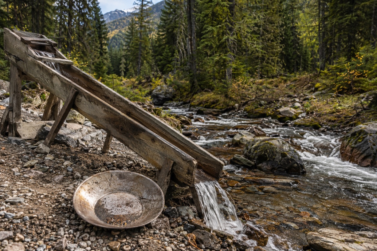
A shallow pan, a swirl of water and a few flecks of heavy metal left at the bottom is how the whole rush is remembered. Nome leans into that image with its claim to the world’s largest gold pan, and the gold that began its rush was found on the ocean shores, not in a mountain stream. It is a different picture from the creeks of the Klondike.
You will see pans in souvenir shops, in museum displays and in the Skagway storefronts, where the cruise-season crowds buy them as keepsakes. Treat them as part of the scenery of the town.
What to do around the idea
Spend your time where the history is explained. Join a ranger chat at the park, take the self-guided walking tour through the Historic District, and sit through the Days of ’98 Show for a bit of theater. These give you the story of the people who panned, dug and gambled, without relying on a rule you would have to confirm.
If you want to be on the ground the prospectors crossed, the trails are the answer. The Skagway hiking trails and, in season, the Chilkoot Trail put you in the same mountains, with waterfalls, lakes and fjord views as your reward instead of a nugget.
A ride on the old railroad corridor
The White Pass and Yukon Route narrow gauge railroad was originally part of the area’s mining past. Now it runs purely for the tourist trade during the summer months, starting at the port of Skagway. Sitting in a railcar and watching the White Pass country go by is the gentlest way to understand why the Dead Horse Trail got its name.
Good to know before you go
Skagway is busiest when cruise ships are in, and the summer crowds thin out once the season ends, so the mood of the town depends on when you arrive. The Chilkoot Trail is a summer undertaking with rangers on duty only in its official season, while the park suggests reading its winter guidance if you come between October and May. Firearms are not allowed on the Canadian side of the international park, and on the trail camping stays in the designated campgrounds.
Sources
- Wikipedia, Klondike Gold Rush (https://en.wikipedia.org/wiki/Klondike_Gold_Rush), checked October 11, 2026
- National Park Service, Klondike Gold Rush National Historical Park (Skagway), plan your visit (https://www.nps.gov/klgo/planyourvisit/index.htm), checked October 11, 2026
- Wikipedia, Chilkoot Trail (https://en.wikipedia.org/wiki/Chilkoot_Trail), checked October 11, 2026
- White Pass and Yukon Route Railway, Skagway (https://www.wpyr.com/), checked October 11, 2026
- Wikipedia, Skagway, Alaska (https://en.wikipedia.org/wiki/Skagway,_Alaska), checked October 11, 2026
- Wikipedia, Nome, Alaska (https://en.wikipedia.org/wiki/Nome,_Alaska), checked October 11, 2026
- Wikipedia, Fairbanks, Alaska (https://en.wikipedia.org/wiki/Fairbanks,_Alaska), checked October 11, 2026