
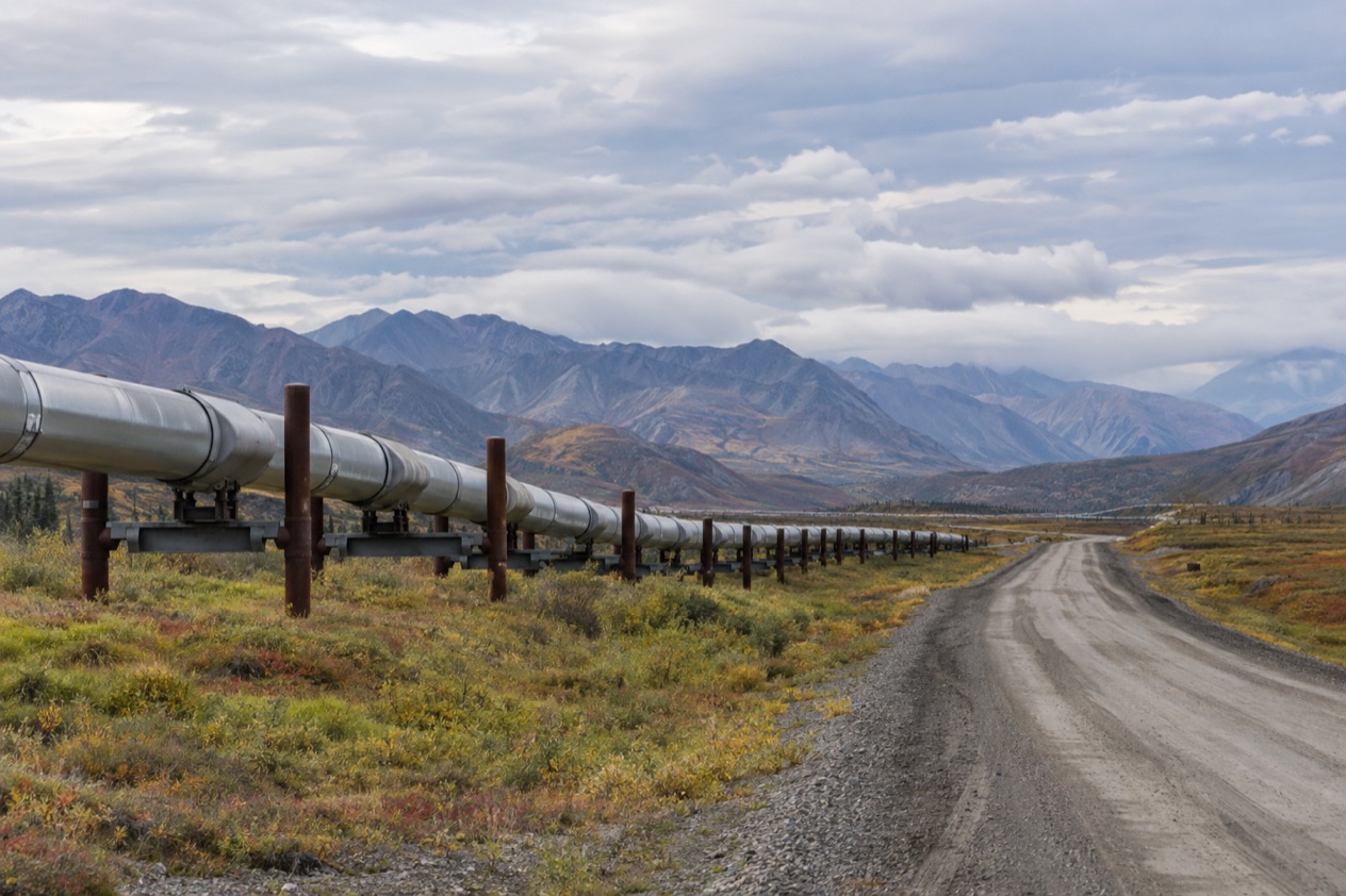
Somewhere past the last Fairbanks traffic lights, the pavement of the Elliott Highway gives way to a road that trucks own, and a pipeline starts to appear beside it like a silver thread. The Dalton Highway is Alaska’s road to the Arctic: a long, remote line across the Brooks Range to the oilfields at Deadhorse. It suits travelers who want tundra, caribou country and the feeling of having driven to the top of the continent.
What is the Dalton Highway?
The Dalton Highway, also signed as Alaska Route 11, is a 414-mile road across central and northern Alaska that begins at the Elliott Highway, north of Fairbanks, and ends at Deadhorse. Deadhorse sits near the Arctic Ocean in the middle of the Prudhoe Bay oilfield, and that is the reason the road exists. Its full length opened to the general public on December 2, 1994, and it has stayed a working industrial road ever since, shared between travelers and the trucks that serve the north.
The pipeline is the other half of the story. The Trans-Alaska Pipeline runs alongside the Dalton Highway for much of the way, and it draws tens of thousands of visitors every year on pipeline tourism trips. Welders who worked on it once cut scrap pipe into the shape of Alaska to make pipeline maps, which they sold to tourists or gave away as gifts, and you may still meet them as souvenirs.
The Arctic Circle stop
The most visited landmark on the highway is the Arctic Circle itself, at Mile 115. A sign marks the spot, and the Arctic Circle Wayside Rest Area gives you a pullout with a picnic area and information boards. A short side road leads to a viewing deck with interpretive displays, where you can read how the sun behaves above this line.
At the Arctic Circle the sun does not set at the June solstice and does not rise at the December solstice. That is the idea behind the midnight sun and the polar night. The stop is a place to stretch your legs, look at the boreal forest and the road ahead, and take the photograph beside the sign that nearly everyone wants to bring home.
The Brooks Range and Atigun Pass
The highway reaches its highest point as it crosses the Brooks Range at Atigun Pass, at 4,739 feet. Beyond the pass the landscape opens into tundra, and the trees that lined the southern stretches fall away. It is the great change of scenery on the drive, a moment when the road leaves the forest and heads for the treeless coastal plain.
The pipeline keeps running beside the road through these mountains, and trucks climb and descend the same grade you do. Treat the pass as a place to slow down and look, because the view is the point of the crossing.
Deadhorse and Prudhoe Bay
At the end of the road, Deadhorse is an oilfield town more than a tourist town. Lodgings are assembled from modular buildings, and alcohol is not sold, which gave the town its slogan, “All that far and still no bar.” Visitors come for the tundra, the Arctic Ocean and the midnight sun, which is possible here in summer because Deadhorse lies above the Arctic Circle. In winter the same latitude brings the polar night.
One surprise: the Arctic Ocean cannot be seen from the highway. The bay itself is 10 miles further north, through a security checkpoint, so open water is not in view from the road.
The country around Prudhoe Bay is a place for wildlife. Large herds of caribou move across it, and over 200 bird and waterfowl species live here, among them geese, swans, gulls and eagles.
Polar bears can sometimes be seen wandering the outskirts of Deadhorse, though a sighting is a chance and never a promise. Motorcyclists also know Deadhorse as a start or turn-around point for the Iron Butt Association’s Ultimate Coast to Coast challenge, which gives riders 30 days to ride between Deadhorse and Key West, Florida.
Can you drive it in a rental car?
A rental car meets the same road as every other vehicle on the Dalton Highway, so the real question is what that road asks of a driver. It asks a lot of planning: long distances between fuel stops, a service gap of 240 miles north of Coldfoot, a speed limit that applies from start to finish, and a steady flow of working trucks. Those conditions are the same whoever owns the car.
Tourists commonly travel the road in another way too, which is worth knowing when you weigh your options. They go by tour bus from Fairbanks, a two-day journey with an overnight stop in Coldfoot. The bus tour shows how most of the route fits into a trip: one long day up, a night in Coldfoot, and the return.
What any driver on the road faces
The highway is 414 miles long, and the speed limit is 50 mph along its entire length. Headlights must be kept on at all times, day and night, and that rule applies to every driver. Trucks serving the oilfields run both ways, so you share the road with them constantly.
About 160 trucks travel the Dalton Highway daily in the summer months, and about 250 daily in the winter. For a driver, that means the road is never empty, even when the surrounding country feels like wilderness, and it means your own pace is set by a working road rather than by a scenic route.
The bus alternative from Fairbanks
Bus tours along the Dalton Highway typically take two days, with passengers spending the night in Coldfoot. Tourists commonly travel from Fairbanks by tour bus via the James Dalton Highway to reach Prudhoe Bay and Deadhorse. The format hands the long hours behind the wheel to a driver and leaves you free to watch the Brooks Range roll past the window.
Coldfoot is the natural pause. It is a small settlement that has appeared on the reality TV series Ice Road Truckers, with the truck stop first seen in season three, and in summer the BLM, USFWS and NPS jointly staff a small visitor center there. Coldfoot Airport, a gravel strip on the west side of the highway, handles air taxi and general aviation flights.
Reaching Deadhorse by air
Deadhorse can also be reached through its airport. Overland access to Prudhoe Bay and Deadhorse is by the Dalton Highway from Fairbanks, 495 miles to the south, or through Deadhorse Airport. Those are the two ways in, and a traveler who drives up still has to think about how to return along the same road.
If a round trip by road is the plan, count the miles twice. The return trip passes the same fuel stops, the same Atigun Pass and the same trucks, only in the other direction.
What do you need to know before you drive it?
Before you go, you need to know where the fuel is, how the speed limit and lights rule works, and how to check conditions on Alaska 511. Fuel is the first concern because services are so far apart on this road. The pump stops are a short list, and they decide how a trip is planned.
Fuel and services
Gas stations stand at only three places on the whole highway. The one at the Yukon River crossing, by the E. L. Patton Yukon River Bridge, is closed in winter. After Coldfoot there is nothing for 240 miles, so the fill-up at Coldfoot is the one that carries you across the Brooks Range and the tundra.
| Place | Mile | Fuel |
|---|---|---|
| E. L. Patton Yukon River Bridge | 56 | Gas station, closed in winter |
| Coldfoot | 175 | Gas station |
| Deadhorse | 441 | Gas station |
| Arctic Circle Wayside Rest Area | 115 | Pullout with picnic area, information boards and viewing deck, no fuel |
Speed, lights and trucks
The speed limit is 50 mph for the whole length of the Dalton Highway, and headlights stay on at all times. Truck traffic is steady in every season, with more trucks in winter than in summer. Keep both figures in mind when you estimate how long a day on the road will take, because the limit caps your pace even where the view invites you to go faster.
Wildlife and weather add their own rhythm. Caribou herds and many bird species live around Prudhoe Bay, and polar bears can sometimes be seen near Deadhorse, so a drive north often ends with the eyes more than the odometer.
Checking conditions with Alaska 511
Alaska 511 is the state’s road information service, and it rates conditions in categories: Good, Fair, Difficult, Very Difficult, Hazardous, Road Closure and No Winter Maintenance. The Alaska Department of Transportation has partnered with Waze, so incidents and closures reported on Waze also appear on the Alaska 511 website. The Waze for Cities program is a free data exchange between Waze and government entities.
The site has cameras too. On the map page you can add a camera to My Cameras by clicking a camera icon and then the My Cameras button in its popup. On the camera page the option sits behind the three dots icon below the image.
If you create an account, you can save routes and receive notifications. You must log in to save a route for future viewing. Route notifications arrive by SMS and are sent by default on weekdays from 6 AM to 6 PM.
Good to know before you go
Alcohol is not sold in Deadhorse, so anything you want for the end of the road has to come from somewhere else. The Yukon River fuel stop closes in winter, which matters for any cold-weather plan, and daylight changes with the calendar: Deadhorse sees the midnight sun in summer and the polar night in winter. A pipeline map or a photograph at the Arctic Circle sign makes the simplest souvenir of the road.
Sources
- Wikipedia, Dalton Highway (https://en.wikipedia.org/wiki/Dalton_Highway), checked October 11, 2026
- Wikivoyage, Dalton Highway (https://en.wikivoyage.org/wiki/Dalton_Highway), checked October 11, 2026
- Wikipedia, Coldfoot, Alaska (https://en.wikipedia.org/wiki/Coldfoot,_Alaska), checked October 11, 2026
- Wikipedia, Prudhoe Bay, Alaska (https://en.wikipedia.org/wiki/Prudhoe_Bay,_Alaska), checked October 11, 2026
- Wikipedia, Arctic Circle (https://en.wikipedia.org/wiki/Arctic_Circle), checked October 11, 2026
- Wikipedia, Trans-Alaska Pipeline System (https://en.wikipedia.org/wiki/Trans-Alaska_Pipeline_System), checked October 11, 2026
- Alaska 511 (https://511.alaska.gov/), checked October 11, 2026