
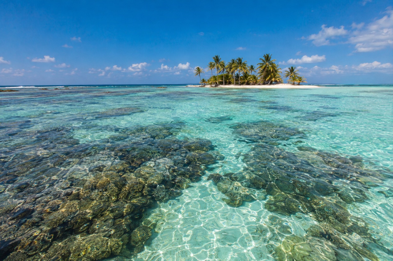
The island appears as a thin line of palms with a few roofs under them, and then you notice how little there is: no road, no sidewalk, only sand paths between wooden lodges and the water on every side. It is a visit for people who want a small island, a mask and a slow rhythm set by meal bells.
Is visiting snorkeling at Tobacco Caye worth it?
Yes, if you want your snorkeling tied to a tiny island where the reef is the main event and the rest of the day is quiet. Tobacco Caye suits travelers who like simple lodging, shared meals and the feeling of being on a speck of sand rather than at a resort town. It is less of a fit if you want shops, nightlife or a choice of restaurants.
What sets it apart from other cayes nearby is the scale and the setting. The island is only about three acres, home to a permanent population of about twenty and five small lodges, and it sits inside the South Water Caye Marine Reserve, part of Belize’s national system of protected waters. So the island and the snorkeling are one experience: you step off the sand into a protected area, and the rules of that reserve shape how you spend the day.
There is also a story in the place itself. The caye is believed to have been named for tobacco grown here in early times, and a British geographer charted it in 1771.
Hurricane Mitch levelled most of it in 1998, and nearly everything you see today was rebuilt afterward, which gives the lodges a patched-together, lived-in character. Sleeping on an island this small, with no vehicles at all, is part of what you are choosing when you choose to snorkel here.
What to see at snorkeling at Tobacco Caye
The island and its shoreline
Before you get in the water, the caye itself is worth a slow lap. It is longer north to south than it is wide, so you can see both edges of the island from nearly anywhere, with the horizon in every direction. Lodges stand close together under coconut palms, hammocks hang between trunks, and the sand paths are shared by guests, staff and the few residents.
Look at how the buildings sit. Everything is low and wooden, a reminder that the storm of 1998 left little standing. This is the starting point for every swim: you come back to the same shore, rinse off, and hear the next meal bell. It suits anyone who likes a place small enough to learn in a morning.
The reef waters of the South Water Caye Marine Reserve
The reserve was established by the Fisheries Department in 1996 and covers a wide stretch of mangrove and coastal ecosystems in the Stann Creek District. It lies on the inner side of the Barrier Reef and is one of the seven protected areas that make up the Belize Barrier Reef Reserve System World Heritage Site, a status UNESCO gave in the same year.
Look down at the coral heads and up at the mangrove roots, and watch the small schools that gather around both. The reserve is large, the second largest marine protected area in Belize, so what you see changes with where your boat or your fins take you.
Life in the reserve: turtles, corals and manatees
The reserve is home to at least twenty-four species that are vulnerable, endangered or critically endangered. They include five coral species, three turtle species, fifteen fish species and the West Indian manatee. You may spot a turtle gliding over the seagrass or a ray resting on sand, but these are chances, not promises, and a manatee is a rare gift rather than something to plan around.
Because the Conservation Zone allows only non-extractive recreational activities, with no fishing or collecting of anything living or not, the shells and coral you pass stay where they are. Bring your curiosity and leave your hands to yourself. The reserve’s rangers have a station on Twin Cayes with a visitor center, a sign that this water is watched over.
The mangroves and the Pelican Cayes
Within the reserve lie the Pelican Cayes, small mangrove islands that form part of the same protected system. Mangroves matter to snorkelers because their roots are nurseries for young fish, and a study found that a share of the forest there had been cleared, which is one reason the reserve exists. Seeing the green fringe from the water helps you understand why the reef nearby is healthy.
Significant Maya sites have also been found within the reserve, a reminder that people have used these waters and cayes for a very long time. They are part of the history of the area rather than something to visit on a snorkel outing.
Hours, tickets and rules
Tobacco Caye is an island with lodges, not a ticketed attraction with a gate and a closing bell, so snorkeling here is organized around your lodging and the reserve’s rules. The day itself has a rhythm set by the island: the meal bells usually ring around seven in the morning, at noon and at six in the evening, and checkout at the lodgings is at ten in the morning. Plan your swims between those bells.
The rules that matter most come from the South Water Caye Marine Reserve, and they protect what you came to see. They are short enough to remember, and they explain why the water looks the way it does.
- In the Conservation Zone, no fishing or collection of marine items, living or not, is allowed, and only non-extractive recreational activities are permitted.
- Boat captains must ensure no more than eight divers or snorkelers per licensed tour guide at all times.
- In the Preservation Zone, no fishing, sport fishing, diving or any other water activities are permitted.
- Water-skiing and jet skiing are not permitted anywhere in the reserve.
- Spear fishing is not permitted in the reserve.
Commercial fishing is allowed in the General Use Zone, but longlines and gillnets cannot be used. Illegal fishing remains a problem in the reserve, which is part of why the guide ratio and the zones are taken seriously.
How to get to snorkeling at Tobacco Caye
Tobacco Caye lies about 10 miles east of Dangriga, so Dangriga is the mainland town that the island is measured from. The caye is out on the inner side of the Barrier Reef, west of the southern end of Glover’s Reef atoll, and the reserve it belongs to lies well off the mainland coast. You are heading out to sea, to an island with its own small cluster of lodges.
Once you arrive, the island’s layout does the rest. There are no roads or vehicles of any sort on Tobacco Caye, and not even a single sidewalk, so everything is on foot over sand.
Think of Dangriga as the last piece of the mainland and the caye as a different world. Heading out to the reserve for a longer snorkeling trip means going by boat with a licensed guide, since the rules of the reserve speak of boat captains and tour guides.
Because the island is so small and so far from any road, travelers tend to think of the stay as a single stretch: arrive, settle in, and let the days follow the meal bells. The whole experience happens on and around a piece of sand you can see across in a moment.
When to visit snorkeling at Tobacco Caye
The day on Tobacco Caye follows the bells. With meals at seven, noon and six, the natural pattern is a swim before breakfast or between meals, a rest in a hammock when you are hungry or tired, and a last look at the water before the evening bell. Checkout at ten in the morning means your final day has its own early rhythm, so a last snorkel before breakfast fits well.
As for the time of year, the Atlantic hurricane season runs from June 1 to November 30, and Tobacco Caye knows what a storm can do. Hurricane Mitch levelled most of the island in the past, and the lodges you see today were built afterward. If your trip falls within those dates, it is a good reason to follow the forecast and keep your plans open.
Outside those dates, the island is the same small place with the same reef and the same bells. The reserve’s rules apply all year, and the marine life that makes the snorkeling worthwhile, from corals to turtles, lives here in every season. A visit between storms is simply a visit to a quiet island with the water close by.
Tips for your visit
Pack for an island where everything is within a few steps. A mask, snorkel and fins are the obvious items, along with a rash guard or a light shirt and a towel that dries easily. Bring a bag for wet gear, because the lodges are small and the sand paths lead straight from the water to your door.
Respect the reserve as you swim. Because the Conservation Zone allows only non-extractive activities, leave shells, coral and anything living where you find it. If you join a boat outing, the guide ratio means your group will be small, with no more than a handful of snorkelers per licensed guide, and the captain will stay within the zones the reserve allows.
Plan your days around the meal bells. The caye is small enough to circle on foot, and a walk along the sand shows you the island’s lodges, palms and shoreline from every side.
For families and for anyone who finds uneven ground hard, the layout is worth knowing. There are no roads, no vehicles and not even a sidewalk, so you move on sand paths between the lodges and the water. It is a place for people who enjoy a slow pace, and for combining snorkeling with reading, hammocks and watching the light change over the water.
If you want to see more of the area, the reserve itself offers plenty to explore beyond the caye, from the mangrove islands of the Pelican Cayes to the open reef. Ask your lodge about boat outings, since those are the way into the wider reserve.
Good to know before you go
The U.S. State Department rates Belize Level 2, “Exercise increased caution”, because of crime, and says the south side of Belize City has historically had the highest concentration of violent crime.
Tobacco Caye is a small island with five lodges and a permanent population of about twenty, so think of it as a quiet corner of Belize rather than a town. The reserve around it is protected for a reason, and following its rules, from the guide ratio to the ban on collecting, keeps the reef worth visiting. The hurricane season runs through the end of November, so keep an eye on forecasts if you travel in those months.
Sources
- Wikipedia, Tobacco Caye (https://en.wikipedia.org/wiki/Tobacco_Caye), checked October 11, 2026
- Wikivoyage, Tobacco Caye (https://en.wikivoyage.org/wiki/Tobacco_Caye), checked October 11, 2026
- Belize Fisheries Department, South Water Caye Marine Reserve (https://fisheries.gov.bz/swcmr/), checked October 11, 2026
- Wikipedia, South Water Caye Marine Reserve (https://en.wikipedia.org/wiki/South_Water_Caye_Marine_Reserve), checked October 11, 2026
- U.S. Department of State, Belize Travel Advisory, Level 2, March 11, 2026 (https://travel.state.gov/), checked October 11, 2026
- NOAA National Hurricane Center, Climatology (https://www.nhc.noaa.gov/climo/), checked October 11, 2026