
In San Pedro, boats pull away from the town docks in the morning with snorkel gear stacked on the benches, and the pelicans wait on the pilings for whatever comes back in the afternoon. In Placencia, people stroll The Sidewalk, a concrete path through the village that runs out to the sea, past restaurants and small shops with the water always at the end of the view.
Both towns face the same barrier reef, but they sit at opposite ends of the country and feel quite different. The choice comes down to the kind of vacation you want: an island town built around the northern reef, or a peninsula village in the south.
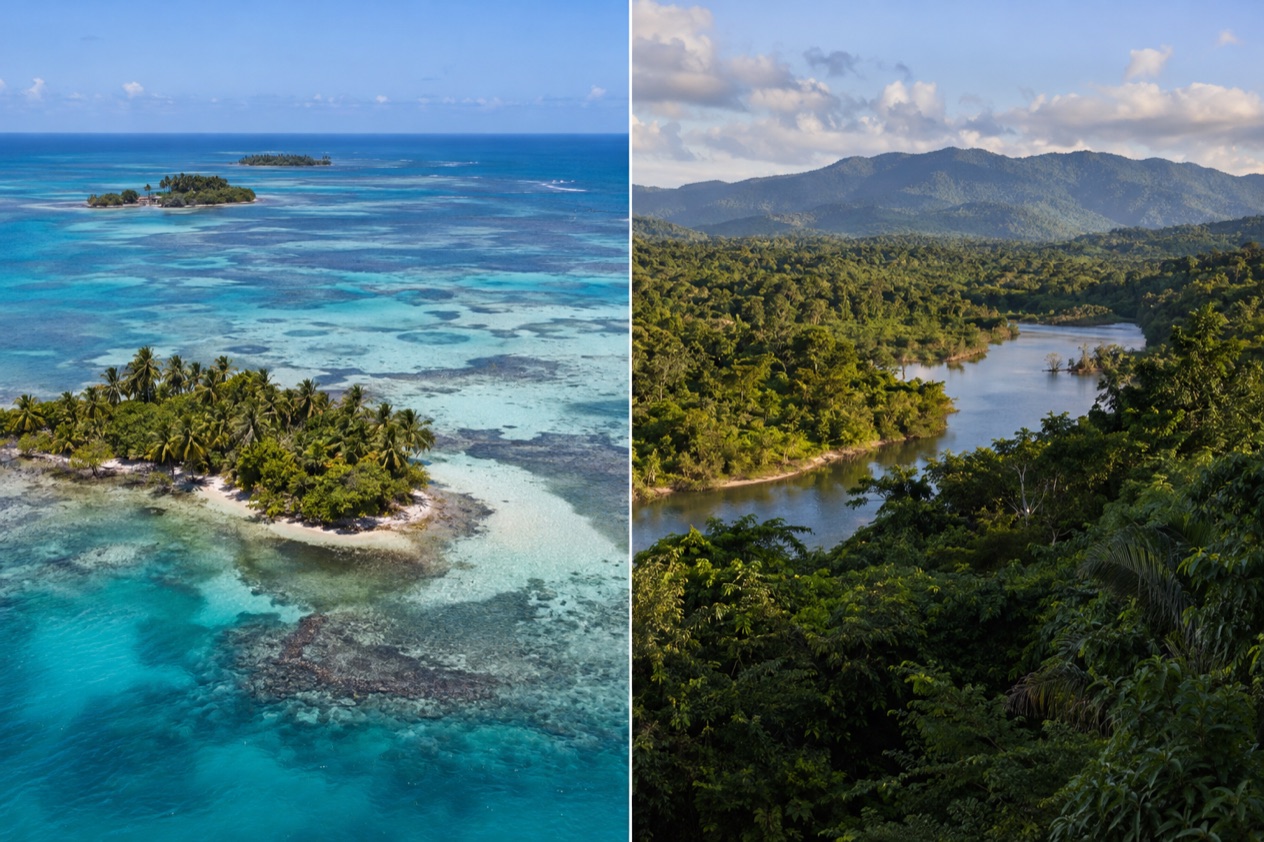
Which is better, San Pedro or Placencia?
Neither wins outright. San Pedro suits travelers who want a lively island town with a reef close by and plenty of places to eat and drink, while Placencia suits those who like a village you cover on foot, with whale sharks in spring and the southern cayes on the horizon. The table sets the two side by side.
| Category | San Pedro | Placencia |
|---|---|---|
| Where it is | A town on the southern part of Ambergris Caye, Belize District | A village at the southern tip of the Placencia Peninsula, Stann Creek District |
| Beaches | Island shoreline on the Caribbean side, with the barrier reef offshore | Peninsula shoreline, with The Sidewalk ending at the seashore |
| Vibe | A busy island town with a long tourism history | A small village where the main path is pedestrian only |
| Things to do | Hol Chan Marine Reserve, Shark Ray Alley, Bacalar Chico | Laughing Bird Caye, Gladden Spit and Silk Cayes, whale shark season |
| Nightlife | Beach bars and restaurants in town | Bars and restaurants along The Sidewalk |
| Weather | Island on the northern reef, on the Atlantic hurricane season calendar | Peninsula in the south, on the same calendar, with whale sharks in spring |
| Getting there | Small airstrip served by Tropic Air and Maya Island Air, plus helicopter service | By the Placencia Peninsula, with the sea as the way out to the reef |
| Best for | Reef trips straight from town and a full choice of restaurants | Walking the village, marine reserves farther offshore, Garifuna culture nearby |
What follows goes through each topic in turn, because the differences show up in small things: how far the reef sits from shore, what the main street feels like at dusk, and what time of year the sea has its own headline act.
Beaches and the sea
San Pedro sits on Ambergris Caye, a long, narrow island about a mile wide, so the water is never far from wherever you are standing. The shoreline is lined with piers, beach bars and small hotels, and the town is arranged along the sea rather than away from it. The island lies in the northernmost waters of Belize, where the barrier reef runs roughly 980 feet offshore, which is part of why boat trips to the reef start from the town docks.
The Caribbean side of the island is where the reef and the beaches come together. Ambergris Caye’s main attractions, as a well-known description puts it, are the Belize Barrier Reef and its beaches, and the reef here is described as the second largest in the world after Australia’s Great Barrier Reef. Sitting on a pier at the end of the day with the reef line marked by a thin white crest of water is a classic San Pedro scene.
Placencia has a different geography. The village sits at the southern tip of a long peninsula, with the Caribbean on one side and a lagoon on the other.
The beach runs along the peninsula’s seaward edge, and The Sidewalk, the pedestrian path lined with businesses, ends right at the seashore. Down here the barrier reef lies much farther out, roughly 25 miles offshore in the south, and the boat ride from Placencia to the reef takes about 45 minutes.
That distance gives the two places a different rhythm. In Placencia, the beach is where you spend the part of the day between boat trips, and the reef and cayes feel like a separate outing.
In San Pedro, the sea and the reef are woven into the town itself. Laughing Bird Caye, a national park and World Heritage Site, is closer than the main reef from Placencia, and it is a small island you reach by boat rather than a beach you walk to.
As for who wins, it depends on what a beach means to you. If you want a shoreline with a reef close at hand and a town buzzing behind you, San Pedro fits.
If you want a quieter strand at the end of a village path, with the cayes as a day out on the water, Placencia fits. Sargassum can affect both Caribbean-facing shorelines, so check current beach conditions before choosing where to stay.
Things to do
Both places revolve around the sea, but the outings are different in kind. San Pedro leans on marine reserves close to town and a wild national park at the island’s far end.
Placencia leans on faraway cayes, a spawning site that draws whale sharks, and a village life you can walk through. Both are part of the same barrier reef system, which also holds the atolls of Turneffe, Glover’s Reef and Lighthouse Reef, home to the Great Blue Hole that Jacques Cousteau made famous in 1970.
In and around San Pedro
Hol Chan Marine Reserve lies 4 miles south of San Pedro and was established in July 1987 as the first marine protected area in Belize. Its name means little channel in the Maya language, and it protects coral reef, seagrass beds and mangrove.
At the far north of Ambergris Caye, Bacalar Chico National Park and Marine Reserve stretches from Chetumal Bay in the west to the Caribbean in the east. It was designated in 1996 and is one of seven sites within the Belize Barrier Reef System World Heritage Site. San Pedro is described as one of the most popular destinations in Belize, with these protected areas at the heart of its appeal.
In and around Placencia
Gladden Spit and Silk Cayes Marine Reserve lies 22 miles off the coast of Placencia. It was declared in May 2000 and protects a spawning aggregation site where snapper gather. Between March and June around the full moon, whale sharks pass by Gladden Spit, and visitors can dive or snorkel with them. Spots on these trips should be arranged ahead of time.
Laughing Bird Caye National Park, declared in December 1991, covers just under two acres and lies 12 miles off Placencia village. Back on land, the Placencia Peninsula was home to the Maya before European colonization, who made salt and traded it along the coast. Seine Bight, a village on the peninsula, is where most residents are Garifuna, according to the 2010 census, and its kitchens are the place to find Garifuna dishes such as hudut, fish in coconut broth.
Food and nights out
Both coasts eat from the same sea. Expect ceviche, grilled fish, conch fritters and rice and beans with stewed chicken, plus fry jacks at breakfast. In San Pedro, restaurants and bars line the waterfront and run late with live music in places. In Placencia, the places to eat and drink sit along The Sidewalk and the main street, which Guinness World Records lists as the narrowest in the world, and an evening there means wandering from one open-air spot to the next.
Weather and the best time to go
Belize has a drier part of the year and a wetter, hotter part, and the figures for Belize City show the contrast between two representative months. January is the cooler and slightly drier of the pair, July the hotter and wetter, and rain days fall in both.
| Month | Belize City average high (°F) | Belize City average low (°F) | Belize City precipitation (inches) | Belize City rain days |
|---|---|---|---|---|
| January | 83.2 | 68.0 | 4.97 | 10.3 |
| July | 89.3 | 77.0 | 5.73 | 11.8 |
For a trip built around the reef, January is a comfortable month for time on a boat or a pier. The days are warm without the heavier heat of midsummer, and evenings in town are pleasant for walking from restaurant to bar. July runs hotter, and the warmth carries into the night, so the sea and shaded terraces take on more importance.
Placencia has a seasonal draw of its own. Whale sharks pass by Gladden Spit between March and June around the full moon, which makes spring the time when the village has its signature outing. San Pedro’s nearby reef sites do not depend on whale shark season, though hurricane season still matters to trip planning.
The Atlantic hurricane season runs from June 1 to November 30, and it applies to both coasts. On October 8, 2001, Hurricane Iris hit southern Belize with 145 mph winds and damaged nearly 95% of the buildings in Placencia, a reminder of what the season can bring to the south. Travelers who visit between June and November should keep the forecast in view as the trip approaches.
Getting there and getting around
Ambergris Caye has a small airstrip served by Tropic Air and Maya Island Air. Ambergris Caye has a small airstrip served by Tropic Air and Maya Island Air, and Astrum Helicopters serves the local airstrip and various resorts. Ambergris Caye is administered as part of the Belize District, though the closest point on the mainland belongs to the Corozal District.
Once on the island, the town sits on the southern part of Ambergris Caye, and the geography decides how you move. The island is long and narrow, with the town at one end and Bacalar Chico National Park at the other. Hol Chan Marine Reserve is south of town, so reef trips start at the docks and head out over the water.
Placencia sits at the southern tip of the Placencia Peninsula in the Stann Creek District, a village of about 1,600 people. The peninsula holds, from north to south, Riversdale Village, Maya Beach Village, Seine Bight and Placencia Village. Seine Bight is 2.5 miles south of Maya Beach Village and lies north of Placencia village, so the settlements are strung along one road.
The Sidewalk makes central Placencia easy to explore on foot. The Sidewalk is a concrete pedestrian-only path that runs most of the length of the village and ends at the seashore, with businesses along it. Trips to the reef go by boat from the shore, and the longest barrier reef in the northern hemisphere is a 45-minute boat ride off the coast. Laughing Bird Caye, a National Park and World Heritage Site, is closer still.
Who should choose which
San Pedro is for travelers who want a town with energy: a waterfront of restaurants and bars, a choice of reef outings that begin a short way from the docks, and a wild national park at the northern end of the island. Hol Chan, Shark Ray Alley and Bacalar Chico offer varied days on and around the water.
Placencia is for travelers who like a village scale. You walk The Sidewalk, eat along it, and take a boat out when the sea calls. It suits those who plan around the whale sharks of spring, the protected cayes at Laughing Bird and Gladden Spit, and a stretch of coast that includes Garifuna communities such as Seine Bight. The pace is that of a small village at the end of a peninsula.
The two can be combined in one trip, since they sit at the north and south ends of the same barrier reef system. A split stay lets you see a northern island town and a southern peninsula village, and it puts both Hol Chan and Gladden Spit within reach. Even then, each place deserves enough nights to take its boat trips without hurrying.
Good to know before you go
The U.S. State Department rates Belize Level 2, “Exercise increased caution”, because of crime, and says the south side of Belize City has historically had the highest concentration of violent crime.
The water in San Pedro on Ambergris Caye is safe to drink, but on the mainland and smaller islands of Belize, which includes Placencia, bottled water is the safer choice. For whale shark season at Gladden Spit, visitors should arrange their spot upfront, and the reserve is managed by the Southern Environmental Association, a community-based organization. The Atlantic hurricane season shapes the second half of the year on both coasts, so a late-year trip calls for a look at the forecast before you fly.
Sources
- Wikipedia, Ambergris Caye (https://en.wikipedia.org/wiki/Ambergris_Caye), checked October 11, 2026
- Wikipedia, San Pedro Town (https://en.wikipedia.org/wiki/San_Pedro_Town), checked October 11, 2026
- Wikivoyage, Ambergris Caye (https://en.wikivoyage.org/wiki/Ambergris_Caye), checked October 11, 2026
- Wikivoyage, San Pedro (Belize) (https://en.wikivoyage.org/wiki/San_Pedro_(Belize)), checked October 11, 2026
- Wikipedia, Hol Chan Marine Reserve (https://en.wikipedia.org/wiki/Hol_Chan_Marine_Reserve), checked October 11, 2026
- Belize Fisheries Department, Hol Chan Marine Reserve (https://fisheries.gov.bz/hcmr/), checked October 11, 2026
- Belize Fisheries Department, Bacalar Chico Marine Reserve (https://fisheries.gov.bz/bcmr/), checked October 11, 2026
- Wikipedia, Belize Barrier Reef (https://en.wikipedia.org/wiki/Belize_Barrier_Reef), checked October 11, 2026
- Wikipedia, Placencia (https://en.wikipedia.org/wiki/Placencia), checked October 11, 2026
- Wikivoyage, Placencia (https://en.wikivoyage.org/wiki/Placencia), checked October 11, 2026
- Wikipedia, Seine Bight (https://en.wikipedia.org/wiki/Seine_Bight), checked October 11, 2026
- Belize Fisheries Department, Gladden Spit and Silk Cayes Marine Reserve (https://fisheries.gov.bz/gsscmr/), checked October 11, 2026
- Wikipedia, Gladden Spit and Silk Cayes Marine Reserve (https://en.wikipedia.org/wiki/Gladden_Spit_and_Silk_Cayes_Marine_Reserve), checked October 11, 2026
- Wikipedia, Silk Cayes (https://en.wikipedia.org/wiki/Silk_Cayes), checked October 11, 2026
- Wikipedia, Laughing Bird Caye (https://en.wikipedia.org/wiki/Laughing_Bird_Caye), checked October 11, 2026
- Tropic Air, Placencia (https://www.tropicair.com/placencia-plj/), checked October 11, 2026
- NOAA NCEI, GHCN-Daily station BHM00078583 (Philip S. W. Goldson International Airport, Belize City), normals 1991-2020 computed from the daily record (https://www.ncei.noaa.gov/access/services/data/v1?dataset=daily-summaries&stations=BHM00078583), checked October 11, 2026
- U.S. Department of State, Belize Travel Advisory, Level 2, March 11, 2026 (https://travel.state.gov/), checked October 11, 2026
- NOAA National Hurricane Center, Climatology (https://www.nhc.noaa.gov/climo/), checked October 11, 2026