
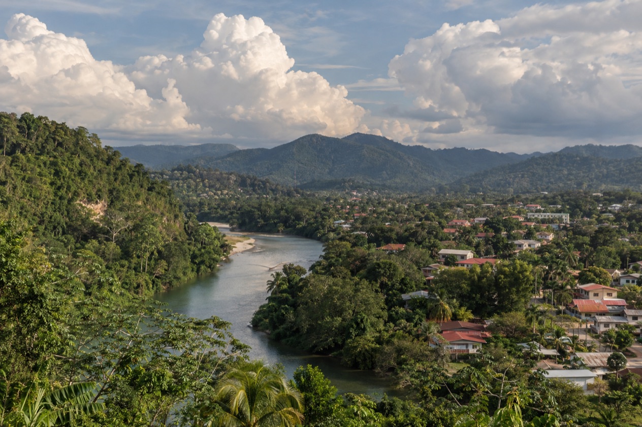
In June the hills around San Ignacio turn a deep, wet green, and the Macal and Mopan rivers run brown and full below the town. Cohune palms drip after a passing shower, orchids open on the trees, and the evening air carries woodsmoke and the smell of tortillas on the comal. It is a month when the Cayo District feels like a rainforest at work, with Maya ruins on the ridges and caves under the hills.
What is the weather like in San Ignacio and the Cayo District in June?
June is a warm, green and increasingly wet month in the Cayo District, with long days and the rains settling in after a drier May.
| Month | Daylight on the 15th |
|---|---|
| May | 12 h 59 min |
| June | 13 h 11 min |
| July | 13 h 05 min |
June has the longest days of the three months, giving you more daylight for an afternoon river walk before dinner. Days start early in the hills, so the first hours are the natural time for ruins, trails and anything that asks you to walk for a while.
In Belize City, highs average about 89°F in June, and rain falls on roughly ten days of the month. Inland, the Cayo District is a land of hills, rivers and rainforest, so expect the landscape to look lush and the rivers to be full. Plan for wet weather on some days, and keep your outdoor plans flexible rather than fixed to a single day.
Light, quick-drying clothes suit the month, along with a rain jacket and shoes that grip on damp stone and muddy paths. Evenings stay warm enough to sit outside, and the green of the hills is at its richest after the rain.
What to do in San Ignacio and the Cayo District in June
June is a month for the rainforest and the rivers rather than the beach. The Atlantic hurricane season begins on June 1, a background to the month rather than a reason to stay home.
Mennonite families from nearby farming communities are part of the local scene, and Belize’s Mennonite population is a visible thread in the country’s rural life.
Cahal Pech and the town’s own ruins
Cahal Pech sits near the town of San Ignacio on a hilltop above the Macal River, positioned to overlook the meeting of the Macal and the Mopan. It has evidence of habitation going back to 1200 BCE, which makes it one of the oldest recognizably Maya sites in western Belize.
In June the plazas are bright green and the trees around them are full of birdsong. The views over the valley are part of the visit, and the clouds moving over the hills give the stone courtyards a changing light. It suits an early start, when the forest is quiet.
Xunantunich above the Mopan River
Xunantunich stands on a ridge above the Mopan River, close to the Guatemala border. Its core holds six plazas ringed by more than 26 temples and palaces, so there is plenty to walk among and look at, and the ridge opens wide views over the forest.
Rain in June lends the site a freshly washed look, with the grass vivid against pale stone. Bring a rain jacket and shoes with grip, since stone steps and paths are slick after a shower. It pairs naturally with a lunch back in San Ignacio.
Caracol, deep in the forest
Caracol is a large Maya site in the Cayo District, south of San Ignacio. Its tallest building, Caana, is the tallest manmade structure in Belize, rising 141 feet above the forest canopy. The road to it is paved for its last stretch and joins the Western Highway.
A visit here gives you a sense of how large a Maya city could be, with plazas and temples spread through the trees. In the green season the forest is dense and loud, and the setting is as much a part of the day as the stonework. Expect it to be the focus of your day, with San Ignacio as the place to return to for dinner.
Beyond these ruins, the district also draws visitors to Actun Tunichil Muknal and other cave excursions, as well as its rivers and rainforest. Food in town runs from market stalls to riverside restaurants, with Belizean staples like stew chicken, rice and beans and fresh juices.
A two-day itinerary for San Ignacio and the Cayo District in June
Day 1 begins with Cahal Pech early in the morning, when the hilltop is quiet and the light over the Macal River is soft. The days are long in June, so there is no need to rush. Come back down into San Ignacio for a late breakfast at a café, then wander the market and the center of town.
In the afternoon, stay close to town: a walk along the river, a long lunch and a pause when a shower passes. As evening comes on, pick a terrace for dinner. If the weather turns, the cafés and the market offer plenty of cover, and the long daylight leaves room to wait out a downpour.
Day 2 is for Xunantunich, again starting early so the ridge is quiet and the views open over the Mopan River. Take your time among the plazas and temples, then come back to San Ignacio for lunch.
Keep the afternoon flexible for a locally arranged river or cave outing, or slow the pace with a riverside seat before dinner. If rain sets in, keep the evening for the covered spots in town and let the green hills do their work outside the window.
Is San Ignacio and the Cayo District busy in June?
June is a green-season month, and the Cayo District has a lived-in, unhurried feel, though the sites and the town still see visitors who come for the ruins and the rivers.
As a habit, book rooms early if you are traveling around a U.S. holiday week, and later for the ordinary weeks of the month. The Maya sites and the town spread visitors across the day, and an early start keeps your visit quiet in any season.
Restaurants in town are small and friendly, and the market gives you a place to eat and look around at any hour it is open. Plan your biggest outing for the days when the sky looks best and keep the others flexible, since the rain follows no fixed plan.
What to pack for San Ignacio and the Cayo District in June
The month calls for clothes that dry quickly and shoes that cope with wet stone and mud.
- A light rain jacket, for showers on the ridges and trails.
- Shoes with good grip, since temple steps and forest paths are slick after rain.
- Quick-drying shirts and shorts for warm, humid days.
- Insect repellent for the forest and the river evenings.
- A small dry bag to protect your phone and camera.
- A hat and sunscreen for the hours the sun is out over open plazas.
Good to know before you go
The U.S. State Department rates Belize Level 2, “Exercise increased caution”, because of crime, and says the south side of Belize City has historically had the highest concentration of violent crime.
The Atlantic hurricane season runs from June 1 to November 30, so June is its first month. San Ignacio and the Cayo District work well as a base for ruins, rivers and rainforest, and the main thing to settle first is your outings to Xunantunich and Caracol, since they shape the rest of your days.
San Ignacio and the Cayo District in June vs May and July
Going in May means a drier month, with fewer rainy days and a little less daylight, which suits travelers who want to be sure of dry ruins. The forest is a bit less lush, but trails and temple steps are easier underfoot.
July keeps the green season going, with slightly shorter days than June. The rivers stay full and the forest stays thick, so the mood is much the same as June, with a wetter edge.
If daylight matters most, June has the longest days of the three months. If you like the richest green and do not mind showers, June and July both deliver, and June gives you the longest days of the three.
Is June a good time to visit San Ignacio and the Cayo District?
Yes, for travelers who love green hills, rivers and ancient stone, and who are happy to adapt to a shower or two.
If you want a beach week or a guaranteed dry sky, another month will suit you better. But if you come for the forest, the Maya sites and the long evenings in a small riverside town, June is rewarding.
On arrival, start with Cahal Pech, close to town, and let the rest of the plan follow the weather. What is special about June here is the green itself, the hills at their richest, the rivers full and the ruins rising out of wet forest.
Sources
- sunrise-sunset.org, sunrise and sunset calculated for the 15th of the month, checked October 11, 2026
- NOAA NCEI, GHCN-Daily station BHM00078583 (Philip S. W. Goldson International Airport, Belize City), normals 1991-2020 computed from the daily record (https://www.ncei.noaa.gov/access/services/data/v1?dataset=daily-summaries&stations=BHM00078583), checked October 11, 2026
- NOAA National Hurricane Center, Climatology (https://www.nhc.noaa.gov/climo/), checked October 11, 2026
- Wikipedia, Hurricane Hattie (https://en.wikipedia.org/wiki/Hurricane_Hattie), checked October 11, 2026
- Wikipedia, Hurricane Keith (2000) (https://en.wikipedia.org/wiki/Hurricane_Keith_(2000)), checked October 11, 2026
- Wikipedia, Hurricane Dean (https://en.wikipedia.org/wiki/Hurricane_Dean), checked October 11, 2026
- Wikipedia, Hurricane Lisa (2022) (https://en.wikipedia.org/wiki/Hurricane_Lisa_(2022)), checked October 11, 2026
- Wikipedia, Hurricane Earl (2016) (https://en.wikipedia.org/wiki/Hurricane_Earl_(2016)), checked October 11, 2026
- Wikipedia, Hurricane Iota (https://en.wikipedia.org/wiki/Hurricane_Iota), checked October 11, 2026
- San Pedro Belize Express Water Taxi, Caye Caulker (https://belizewatertaxi.com/destinations/caye-caulker/), checked October 11, 2026
- Belize Fisheries Department, Bacalar Chico Marine Reserve (https://fisheries.gov.bz/bcmr/), checked October 11, 2026
- Belize Fisheries Department, Turneffe Atoll Marine Reserve (https://fisheries.gov.bz/tamr/), checked October 11, 2026
- Belize Fisheries Department, Regulations (https://fisheries.gov.bz/regulations/), checked October 11, 2026
- Belize Tourism Board, Sargassum resource (https://www.belizetourismboard.org/tourism-resources/sargassum-resource/), checked October 11, 2026
- Belize Fisheries Department, Gladden Spit and Silk Cayes Marine Reserve (https://fisheries.gov.bz/gsscmr/), checked October 11, 2026
- Wikipedia, Mennonites in Belize (https://en.wikipedia.org/wiki/Mennonites_in_Belize), checked October 11, 2026
- Wikipedia, Cayo District (https://en.wikipedia.org/wiki/Cayo_District), checked October 11, 2026
- Wikipedia, Xunantunich (https://en.wikipedia.org/wiki/Xunantunich), checked October 11, 2026
- Wikipedia, Cahal Pech (https://en.wikipedia.org/wiki/Cahal_Pech), checked October 11, 2026
- Wikipedia, Caracol (https://en.wikipedia.org/wiki/Caracol), checked October 11, 2026
- Wikipedia, Climate of Belize (https://en.wikipedia.org/wiki/Climate_of_Belize), checked October 11, 2026
- U.S. Department of State, Belize Travel Information, Entry and exit requirements (https://travel.state.gov/), checked October 11, 2026
- U.S. Department of State, Belize Travel Advisory, Level 2, March 11, 2026 (https://travel.state.gov/), checked October 11, 2026
To plan your stay
- Things to Do in San Ignacio and the Cayo District: Maya Ruins, Caves, Rivers and Local Food
- Where to Stay in San Ignacio and the Cayo District: Riverside Lodges, Town Stays and the Mountain Pine Ridge
- San Ignacio and the Cayo District from Belize City: Distance, Bus, Rental Car and Day Trips
- Know Before You Go to San Ignacio and the Cayo District: Entry, Money, Getting Around and Health