
The first sound at Mayflower Bocawina is usually not a waterfall but the forest itself: a bird call from the canopy, insects humming, and sometimes the low roar of howler monkeys carrying through the trees. The Southern Highway falls away behind you and the road turns into green. This is a rainforest park in the Stann Creek District, built around falls, old Maya temples and a long bird list, for travelers who want a day on foot among the trees.
Is visiting Mayflower Bocawina National Park worth it?
Yes, if you like your rainforest with moving water and a bit of history, and you are happy to spend your day outdoors rather than at a single viewpoint. The park gives you waterfalls, Maya temples and birdlife inside one protected forest, which is a lot to fit into a stop along the Southern Highway.
It suits hikers, birders and anyone curious about the Maya past of southern Belize. Families with older children who enjoy a trail will find plenty to look at, and so will couples who want a day away from the beach in Hopkins or Placencia.
What sets it apart from other nature stops in the district is the mix. Cockscomb Basin Wildlife Sanctuary, also in Stann Creek, is known for its jungle and for Victoria Peak, while the big Maya cities of Belize lie elsewhere in the country.
Mayflower Bocawina puts temples and falls in the same green space, and it is managed by a community group, the Friends of Mayflower Bocawina National Park, which gives it a local, hands-on feel. It was established in 2001 and covers an estimated 7,000 acres of dense tropical forest.
What to see at Mayflower Bocawina National Park
Everything in the park is reached on foot through forest, and the visit is organized around three themes: falling water, ancient stone and birds. The visitor center is the natural starting point, and from there the park opens out.
Bocawina Falls and Three Sisters Falls
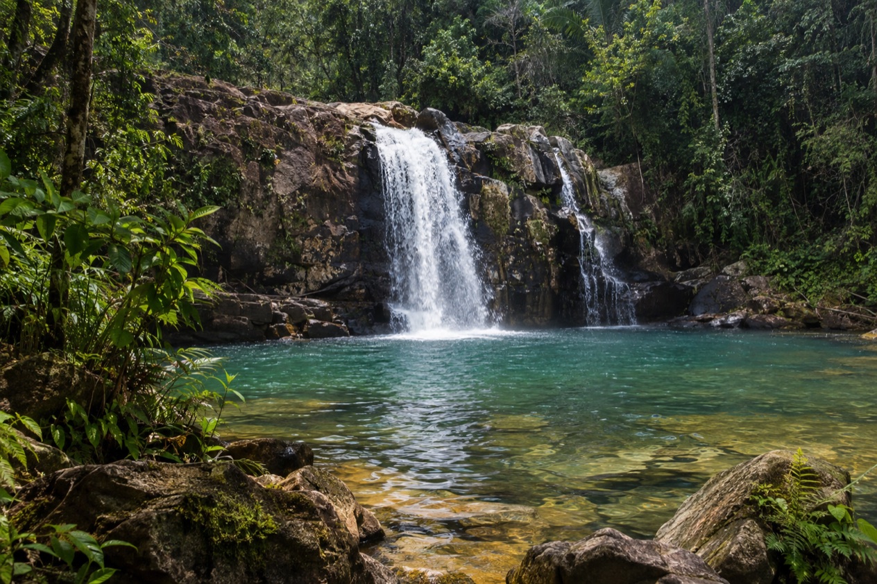
These two falls are close to each other and are reached by hiking around the mountain area of the park. Bocawina is the broad, tumbling one, a curtain of white water dropping through the trees into a pool surrounded by ferns, palms and moss-covered rock. The sound reaches you well before the view does.
Three Sisters earns its name from the way the water splits into separate streams. Together the pair makes the heart of a day in the park, and the trail between the trees is half the pleasure. Look at the forest floor as much as the water, since leaf-cutter ants often march across the path in long lines, and butterflies drift through the clearings.
Maintzunun and T’au Witz
Maintzunun and T’au Witz are a short distance from the visitor center, which makes them a gentle way into the park’s story. These are the park’s Maya names and places, and they belong to the same landscape as the temples hidden in the forest. T’au Witz is a Maya name that speaks to the lay of the land, hills and water rising together.
Treat them as a first look at how the Maya read this valley. The forest has grown back over a landscape people once shaped, and it is the setting that makes these places memorable more than any grand monument. Walk slowly and listen, since this is also where birds are easy to hear from the trail edges.
The Maya temples
Three Maya temples have been discovered in the park so far, and that phrasing matters: this is a place where the forest still holds unexcavated mounds and where discovery is ongoing. The Maya Center sits on the road opposite the visitor center and is the place to connect the stones with the people who built them.
Do not expect the towering plazas of Caracol or Xunantunich. The pleasure here is quieter, a green mound among the trees that reminds you the forest was once settled. Hamanasi, the resort in Hopkins, lists a Magical Mayan History Tour among its scheduled adventures, a sign that Maya heritage is a recognized theme of the region’s day outings.
Birds and forest life
An estimated 238 bird species have been identified in the park since it became a national park, which makes it a serious destination for birders as well as casual walkers. In tropical forest like this, you often hear birds long before you see them, so a pair of binoculars and patience repay you. Toucans, trogons and hummingbirds are the kinds of birds people hope for in Belizean forest, though no sighting is guaranteed.
Early in a walk the canopy is busiest with calls, and the edges of clearings and streams give the best sightlines. Even without a bird list, the forest rewards attention: buttress roots, strangler figs, bromeliads in the branches and the smell of wet earth near the falls.
Hours, tickets and rules
The park is a managed national park with a visitor center, and it is run by the Friends of Mayflower Bocawina National Park rather than a large commercial operator. It sits in the IUCN’s Category 2, the class used for large natural areas set aside to protect whole ecosystems and to allow visitors.
| Site | Location | Managed by |
|---|---|---|
| Mayflower Bocawina National Park | Mile six on the Southern Highway, Stann Creek District | Friends of Mayflower Bocawina National Park |
Hamanasi also lists Bocawina Jungle Ziplining as an additional adventure that can be added for an extra charge when it is not part of a guest’s package.
How to get to Mayflower Bocawina National Park
The park lies at mile six on the Southern Highway in the Stann Creek District, in the southeast of Belize. That one address is the key: you reach it by road, and the highway is the spine of this part of the country.
The district is served by the Hummingbird Highway and the Thomas Vincent Ramos Highway, which connect to Belize City by way of the George Price Highway at Belmopan. Dangriga, the district capital, was formerly known as Stann Creek Town and is a Garifuna center. Travelers who stay on the coast will recognize the district’s other names as well.
Hamanasi offers a Mayflower Jungle and Waterfall Hike as one of its scheduled rainforest adventures, which is one way guests staying there reach the park. Once you arrive, you find the visitor center and the trails begin from there.
When to visit Mayflower Bocawina National Park
Go when you can give the park your time and a clear head for walking in the forest. As a rainforest park, it is green in every month, and falls look different with each season: fuller after wet weather, thinner when rain has been scarce.
The Atlantic hurricane season runs from June 1 to November 30, so a trip in those months falls inside it, while the rest of the year falls outside the official season. Beyond that, the park does not hinge on a special date. Birders may prefer the early part of a day, when the canopy is full of calls, and photographers tend to like the soft light that filters through the trees.
Hamanasi lists Red Bank Birding as a seasonal activity, a reminder that birds in southern Belize follow the calendar. If birds are your goal, ask a resort or guide in the district what is moving through. On any visit, the trees do the work of shading you, and the sound of water gets louder as you approach the falls.
Tips for your visit
Dress for walking in a forest: shoes that grip, clothes you do not mind getting damp, and a small bag for a water bottle, a camera and binoculars if you have them. The trails lead around the mountain area to the falls, so plan the day around walking rather than sitting.
Combine the park with other southern Belize outings. Hamanasi’s scheduled adventures show what the region offers: a visit to Cockscomb Basin Wildlife Sanctuary and Jaguar Preserve, a Cave and Jungle Adventure, Jungle River Canoeing and a Jaguar Preserve Night Hike. Monkey River Adventure is another addition. Cockscomb also holds Victoria Peak, the second highest point in Belize, at 3,670 feet.
If you are staying at Hamanasi, the scheduled adventures are included in the Reef and Rainforest Package. Additional adventures are scheduled based on interest and subject to a minimum number of guests, and they can be added for an additional charge. Beyond the park, the nearby coast is a pleasant place to end the day, with Garifuna food and culture in Hopkins, where the village tells a story that began with people who escaped two shipwrecked Spanish slave ships near St. Vincent in 1635.
Good to know before you go
The U.S. State Department rates Belize Level 2, “Exercise increased caution”, because of crime, and says the south side of Belize City has historically had the highest concentration of violent crime.
Carry what you need for the day before you leave the coast, and treat the forest with the same habits you would anywhere outdoors: keep to the trails and take your trash with you. The hurricane season runs through November, so a visit late in the year deserves a glance at the forecast before you set out. Bigger plans in the district, such as the port of Big Creek, Belize’s main banana port, lie elsewhere on the same coast and are separate trips.
Sources
- Wikipedia, Mayflower Bocawina National Park (https://en.wikipedia.org/wiki/Mayflower_Bocawina_National_Park), checked October 11, 2026
- Hamanasi Adventure and Dive Resort, rainforest adventures (https://www.hamanasi.com/belize-rainforest-adventures/), checked October 11, 2026
- Wikipedia, Stann Creek District (https://en.wikipedia.org/wiki/Stann_Creek_District), checked October 11, 2026
- U.S. Department of State, Belize Travel Advisory, Level 2, March 11, 2026 (https://travel.state.gov/), checked October 11, 2026
- NOAA National Hurricane Center, Climatology (https://www.nhc.noaa.gov/climo/), checked October 11, 2026