
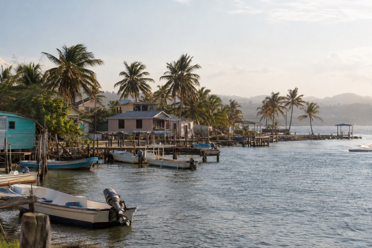
Drums carry across the water in Dangriga, where Garifuna songs and the rhythm of punta drift out from porches and open doorways along the shore. Fishing boats rest at the mouth of the North Stann Creek River, and the town goes about its business at an unhurried pace. This is the cultural heart of southern Belize, a place for travelers who care more about music, history and the road to the cayes than about a resort pool.
Where is Dangriga and what is it like?
Dangriga sits on the Caribbean coast of southern Belize, at the mouth of the North Stann Creek River, and it is the capital of the Stann Creek District. Its older name, Stann Creek Town, still turns up in conversation and on older maps. It is the largest settlement in southern Belize, with a population of roughly 9,500, so it feels like a real working town rather than a purpose-built holiday stop.
The setting is one of its quiet pleasures. To the west rise the Maya Mountains and fertile rainforest, and to the east lie islands and the Belize Barrier Reef. That means a town on a river mouth with jungle behind it and reef water in front of it, and you can feel all three in the same day.
What defines Dangriga above all is its people. It is a Garifuna town, widely called the culture capital of Belize because of its influence on punta music and other forms of Garifuna culture. The Garifuna language is spoken here, and traditional dancers can be seen in town. In 2001 UNESCO proclaimed the language, dance and music of the Garifuna a Masterpiece of the Oral and Intangible Heritage of Humanity in Belize.
Who will love it? Travelers curious about Garifuna music, food and history, and those who want a base for boat trips to the southern cayes or for days in the forest. Who may not?
Anyone hoping for a string of beachfront resorts will find that side of the district farther south, around Placencia, which is known for its resorts, guest houses, hotels and white sandy beaches. Dangriga is a town first and a vacation spot second, and that is exactly its appeal.
What is there to do in Dangriga?
Dangriga gives you three big reasons to come: Garifuna culture in town, the islands and reef offshore, and the forest and waterfalls inland. Few places in Belize put all three within reach of a single base, and that mix is what sets it apart from its neighbors.
Garifuna culture in town
Dangriga is the cultural center of the Garifuna people, and the music is the way in. Punta, the dance rhythm built on drums and call-and-response singing, is part of the town’s identity, and the modern revival of Garifuna music has been carried by artists such as Andy Palacio, Mohobub Flores and Aurelio Martinez. Andy Palacio’s album Watina and Umalali: The Garifuna Women’s Project both came out on the Belizean label Stonetree Records, a good place to start listening before you arrive.
The biggest day of the year is Garifuna Settlement Day on November 19, a public holiday in Belize. It marks the arrival of the Garinagu in Belize after their exile from the Grenadines by the British, and Dangriga celebrates it each year. The holiday was created by civil rights activist Thomas Vincent Ramos in 1941, recognized in the southern districts in 1943 and declared a national holiday in 1977.
Islands and the reef
From Dangriga you can take a short boat ride to South Water Caye, Tobacco Caye and Glover’s Reef Atoll. Tobacco Caye is a tiny island about 10 miles east of town, with a permanent population of about 20 and five small lodges. It lies within the South Water Caye Marine Reserve, which has a range of restrictions on fishing.
The reserve is part of the Belize Barrier Reef System, named a World Heritage Site in 1996, and it protects mangrove and coastal ecosystems off the mainland. For travelers, that means a small island stay where the reef is the main event and the day is organized around the water.
Waterfalls and the forest
Inland, Bocawina National Park offers ziplining, waterfall rappelling and a hike to Antelope Falls. Visitors to Dangriga can also hike to a waterfall of about three hundred feet. It is a good counterweight to the sea days, with the Maya Mountains as the backdrop.
Cockscomb Basin Jaguar Preserve is within easy driving distance of Dangriga. The Cockscomb Basin Wildlife Sanctuary in the Stann Creek District contains Victoria Peak, the second highest point in Belize, at 3,670 feet above sea level.
How many days do you need in Dangriga?
A long weekend covers Dangriga well, and a week lets you use it as the first stop of a trip south through the Stann Creek District. The town itself rewards a slow day of walking the waterfront, listening for drums and eating Garifuna food. Beyond that, each outing is its own day.
With two or three days, pair the town with one big excursion. You might take the boat to Tobacco Caye or South Water Caye for the reef, or head inland to Bocawina National Park for the zipline, the rappelling and the walk to Antelope Falls. If you arrive by road, the Hummingbird Highway itself is part of the pleasure, with stops such as Blue Hole National Park, Barquidier Waterfall, Kropf’s Bakery and Casita de Amour.
With four or five days, add Cockscomb Basin, where the forest and Victoria Peak make a different kind of day from the coast. Hopkins, an ethnic Garifuna village about a 40-minute drive from Dangriga, adds a smaller, more seaside take on the same culture.
With a week, follow the suggested route south from Dangriga to Hopkins and on to Placencia. Slot a night on a caye in the middle if the reef is your priority. If your visit happens to fall on November 19, plan around Garifuna Settlement Day, since the town is most celebratory then.
Where to stay in Dangriga
There are really three kinds of base around Dangriga: the town, the islands offshore and the villages along the coast. Staying in town puts you close to the music, the river mouth and the departure point for boats to the cayes. It suits travelers who want to be inside Garifuna daily life and who plan to spend their days out on excursions.
The islands are the choice for reef lovers. Tobacco Caye has five small lodges on an island of about three acres, so the whole place is small and the reef is on your doorstep. South Water Caye sits within the marine reserve, 11 miles off the mainland coast, and Glover’s Reef Atoll is the farthest of the three. Here the day is built around the water rather than the town.
Along the coast, Hopkins is a small Garifuna village about a 40-minute drive away and makes a quieter alternative to a town base, while Placencia, farther south, is where the district’s resorts, guest houses, hotels and white sandy beaches are concentrated. Travelers who want a resort-style stay often start there, then come north for a day or two of culture in Dangriga.
Think about the shape of your trip. If you want music and a town that lives for itself, sleep in Dangriga. If the reef is the goal, sleep on a caye. If you want beach time with a Garifuna village feel, Hopkins fits between the two.
How do you get to Dangriga and get around?
You reach Dangriga by air or by road. Dangriga Airport (DGA, the Pelican Beach Airstrip) is served by Maya Island Air and Tropic Air several times daily, with flights to Belize City, Placencia and Punta Gorda.
By road, the Hummingbird Highway is the main route from Belmopan. It cuts through the Belizean mountains, is known for its scenery and is completely paved along its 49 miles. Stann Creek District is also served by the Thomas Vincent Ramos Highway, and both connect to Belize City by way of the George Price Highway at Belmopan. Roadside stops include Blue Hole National Park, Barquidier Waterfall, Kropf’s Bakery and Casita de Amour.
Commerce Bight Port, about 1.5 miles south of town, is not currently operational. For the coast, Hopkins lies about a 40-minute drive away, and Cockscomb Basin is within easy driving distance.
When is the best time to visit Dangriga?
For the culture, November is the month to know, because Garifuna Settlement Day falls on November 19 and Dangriga is the town most closely tied to it. The celebrations mark the arrival of the Garinagu in Belize, and the music and dancing that the town carries all year are at the center of the day. November is also the last month of the Atlantic hurricane season, which runs from June 1 to November 30.
For the weather, the year runs between a cooler start and a hotter middle. In Belize City, January highs average in the low 80s with lows near 68°F and about ten rainy days, while July highs reach the upper 80s with lows near 77°F and about twelve rainy days. January therefore feels easier for hiking to waterfalls and walking the town, and July is hotter and a little wetter, with the hurricane season under way.
If you come for the islands and the reef, the same logic applies: choose the months that suit your tolerance for heat and rain, and keep in mind the season dates above. If you come for music and history, build the trip around November 19 and arrive a few days early to enjoy the town before the holiday.
Good to know before you go
The U.S. State Department rates Belize Level 2, “Exercise increased caution”, because of crime, and says the south side of Belize City has historically had the highest concentration of violent crime.
Belize has a high crime rate, and several credit card fraud rings are believed to be active in the country, particularly in San Pedro. Violent crime is historically concentrated in the Southside of Belize City, and Dangriga is a separate town on the coast.
The Atlantic hurricane season runs from June 1 to November 30, so travelers in those months should plan with it in mind. The Belize dollar is the national currency, and the airstrip, the highways and the boats described above are the practical ways in and out of town.
Sources
- Wikipedia, Dangriga (https://en.wikipedia.org/wiki/Dangriga), checked October 11, 2026
- Wikivoyage, Dangriga (https://en.wikivoyage.org/wiki/Dangriga), checked October 11, 2026
- Wikipedia, Garifuna (https://en.wikipedia.org/wiki/Garifuna), checked October 11, 2026
- Belize Port Authority, Commerce Bight port (https://portauthority.bz/belize-port-facilities/commerce-bight-port/), checked October 11, 2026
- Tropic Air, Dangriga and Hopkins (https://www.tropicair.com/dangriga-hopkins-dga/), checked October 11, 2026
- Maya Island Air, Dangriga and Hopkins flights (https://www.mayaislandair.com/belize-flights-dangriga-hopkins/), checked October 11, 2026
- Wikipedia, Stann Creek District (https://en.wikipedia.org/wiki/Stann_Creek_District), checked October 11, 2026
- Wikivoyage, Stann Creek (https://en.wikivoyage.org/wiki/Stann_Creek), checked October 11, 2026
- Wikipedia, Gales Point (https://en.wikipedia.org/wiki/Gales_Point), checked October 11, 2026
- Wikipedia, Tobacco Caye (https://en.wikipedia.org/wiki/Tobacco_Caye), checked October 11, 2026
- Wikipedia, South Water Caye Marine Reserve (https://en.wikipedia.org/wiki/South_Water_Caye_Marine_Reserve), checked October 11, 2026
- Wikipedia, Climate of Belize (https://en.wikipedia.org/wiki/Climate_of_Belize), checked October 11, 2026
- NOAA NCEI, GHCN-Daily station BHM00078583 (Philip S. W. Goldson International Airport, Belize City), normals 1991-2020 computed from the daily record (https://www.ncei.noaa.gov/access/services/data/v1?dataset=daily-summaries&stations=BHM00078583), checked October 11, 2026
- U.S. Department of State, Belize Travel Information, Safety and security (https://travel.state.gov/), checked October 11, 2026
- U.S. Department of State, Belize Travel Advisory, Level 2, March 11, 2026 (https://travel.state.gov/), checked October 11, 2026
- NOAA National Hurricane Center, Climatology (https://www.nhc.noaa.gov/climo/), checked October 11, 2026