
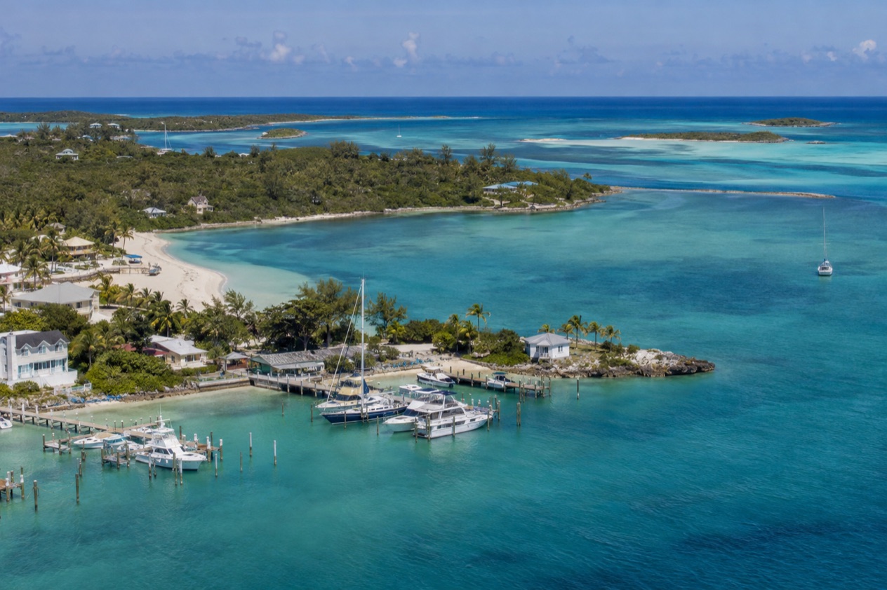
The first thing you notice at the top of the Abacos is how much sea there is. Walker’s Cay sits at the very end of the chain, a small island with a reef running around it and water that shifts from pale green to deep blue within a few boat lengths. It is a place for people who come for what lives under the surface and for the feeling of having reached the far edge of the Bahamas.
Is visiting Walker’s Cay worth it?
Yes, if you are drawn to reefs, big fish and remote places, and less so if you want a town with shops, cafés and a busy waterfront. Walker’s Cay is the northernmost island in the Bahamas, and that position shapes everything about a visit. You come here for the water and the sense of distance, not for a list of attractions to tick off in an afternoon.
Other places in the Abacos offer something different. Hope Town on Elbow Cay and Green Turtle Cay are settled communities with streets to wander, and Marsh Harbour is the largest settlement in the island group. Walker’s Cay is the opposite kind of stop.
Its draw is a barrier reef of its own and a protected national park, where the Bahamas National Trust works to show that marine resources can earn money for the economy without being used up. That idea, called non-consumptive use, is the whole spirit of the place: you look, you photograph, you leave the reef as you found it.
It also suits travelers who like to see how a protected area works. The park is small, under ten square miles, so it is easy to grasp as a whole. A visit here fits well into a longer Abaco trip, as the far-north chapter after the towns and beaches farther south, and it is best taken slowly, with attention on the water, the sky and the horizon.
What to see at Walker’s Cay
Nearly everything worth seeing here is connected to the sea, and the shape of the cay explains why. A small island at the far end of a long chain catches open Atlantic water on one side and sheltered shallows on the other, and the reef sits between the two. The park around it covers a modest area, which makes it a place to look closely rather than cover a lot of ground.
The barrier reef
Walker’s Cay is fringed by its own barrier reef, and this is the feature that gives the island its reputation. A barrier reef grows parallel to the shore, forming a living wall that breaks the swell and shelters the shallower water behind it. From a boat you can often see the line where the color changes, with lighter water inside the reef and a darker blue beyond it.
The reef is also a nursery and a feeding ground. Coral heads, ledges and gaps give small fish somewhere to hide and bigger fish something to hunt, so the whole food chain is packed into a narrow strip of sea.
Look for the way the light moves across the coral on a clear day, and for the schools that pass along the edge. The reef is the reason the national park exists, and it rewards anyone who simply stays still and watches.
Life in the water
The waters around Walker’s Cay host schools of pompano and amberjack, silvery fish that move together in flashing groups. Larger predators such as sharks and barracudas patrol the same waters, and multitudes of colorful tropical fish crowd the reef itself. Turtles and eagle rays are also part of the picture, the rays gliding with slow wingbeats that make them one of the most elegant sights in the sea.
These are animals that live here, and sightings are chances rather than promises. A turtle may surface beside a boat on one day and be nowhere to be seen the next. The best approach is patience and a good pair of eyes. Watch for the shadow of a ray crossing sand, the arrow shape of a barracuda hanging motionless, and the sudden turn of a school of pompano as one body.
Walker’s Cay National Park
Walker’s Cay National Park covers less than 10 square miles, roughly 3,800 acres, which includes the island and the water around it. It is managed as part of the national park system of the Bahamas, with a Chief Park Warden, and it makes important contributions to biodiversity and to the tourism industry of the island. In plain terms, the reef and its fish are the attraction, and the park is how they are looked after.
What you see here is, in large part, the result of that protection. The park shows that a place can bring in visitors and income by keeping its marine life intact. When you look at a healthy reef edge or a school of amberjack, you are looking at the argument for the park made in living form.
The northernmost point of the Bahamas
Being the northernmost island in the Bahamas gives Walker’s Cay a character apart from the rest of the Abacos. The island has long been known as a sport fishing outpost, a place where boats arrive after crossing open water and where the talk is of what is biting. That history still colors how people think of the cay, as a destination reached on purpose rather than passed through.
The experience is about horizon and open water. Stand on the shore and the sea runs out in front of you with very little in the way, and the sunsets and sunrises are wide and unhurried. It is the kind of place where a quiet hour with a view feels like a complete outing.
Hours, tickets and rules
Walker’s Cay is a protected national park rather than a museum or a ruin with a gate and a ticket window, and it is run by the Bahamas National Trust. The person in charge on the ground is the Chief Park Warden, Mr. David Knowles, and the park’s email contact is [email protected]. That is the direct line to the people who look after the reef and the shoreline.
The guiding principle of the park is non-consumptive use of marine resources. That means the park is meant to be enjoyed for what it shows, not for what can be taken from it. The fish, turtles, rays and coral are the park’s assets, and their value to the island’s economy comes from being seen alive and in place, which is why a visit here is built around looking and not collecting.
Across the Abacos, another national park shows how this model works on land. Abaco National Park in South Abaco was established in 1994 to protect the northern breeding grounds of the Bahama Parrot, and it has active patrol wardens. Walker’s Cay National Park follows the same idea in the water, with the same trust behind it and a warden in charge.
How to get to Walker’s Cay
Walker’s Cay lies in the Abacos, so the way in begins with the Abaco Islands as a whole. Those islands sit about 193 miles east of Miami, Florida, and they are served by two airports, Marsh Harbour Airport (MHH) and Treasure Cay Airport (TCB). Both have connections to Florida or Atlanta, which makes them the natural starting points for anyone heading to the north of the chain.
Marsh Harbour is the largest settlement in the Abacos, and it is the hub from which many trips begin. Ferry service to the southern cays of the Abaco Islands leaves from Marsh Harbour, and another ferry leaves from the Treasure Cay ferry dock, about a half-hour from Marsh Harbour by road. These are the connections that tie the island group together, and they show how much of life in the Abacos is organized around moving between islands by water.
Walker’s Cay is the most remote point of all that, at the far northern end. Reaching it is part of the experience, a small journey across open water that reminds you how far the island sits from everything else. The trip is the first lesson of the place: this is somewhere you go on purpose, and arriving is already part of what you came for.
When to visit Walker’s Cay
The best time depends on what you want from the sea, and the main calendar landmark is the Atlantic hurricane season, which runs from June 1 to November 30. Dates outside that window are outside the official hurricane season. Dates inside it carry the usual possibility of tropical systems, and the Abacos know that well, since Hurricane Dorian made landfall on Elbow Cay on September 1, 2019.
Because Walker’s Cay is an outdoor, water-focused place, the light matters more than the thermometer. Early in the day the sea tends to look its clearest and the horizon sharpest, and the low light of morning and late afternoon is kind to photographs of the reef edge and the shoreline. Midday brings the brightest overhead sun, which is when color in the shallows looks most vivid.
Marine life does not keep a fixed schedule for visitors. Pompano, amberjack, sharks, barracudas, turtles and eagle rays are all part of the waters here, and a day may bring many of them or only a few.
Rather than chasing a single month, think of the cay as a place to take your time. A longer stay gives the reef more chances to show itself, and a calm, clear day matters more than a date on the calendar.
Tourism across the Abacos reached 300,000 visitors in 2019, which made the islands the second most visited destination in the Bahamas. That overall picture says little about this far northern corner, which stays small and quiet by nature. Expect a place where the main crowd is the fish.
Tips for your visit
Bring what suits time on and near the water: a hat, sunglasses with good glare protection, and a camera that can cope with bright light and spray. Polarized lenses help cut the surface reflection so you can see into the shallows. A dry bag for your phone and a light layer for the breeze on a boat are the kind of small things that make a day on the sea more comfortable.
Plan the cay as one chapter of a larger Abaco trip. Hope Town on Elbow Cay and Green Turtle Cay are settled communities to combine with it, and Marsh Harbour is the island group’s largest settlement. On land, Abaco National Park in South Abaco offers a very different kind of outing, with the Bahama Parrot, which nests in underground cavities in the pine forest, and four endemic birds: the Bahama Yellowthroat, Bahama Warbler, Bahama Swallow and Bahama Woodstar.
Birders may also look for the West Indian Woodpecker, a specialty bird of Abaco, and the Atala Hairstreak butterfly, one of the few places to see it in its natural habitat. Pairing that forest with the reef at the northern tip gives a trip both a land side and a sea side, and the two parks share the same protective logic.
Treat the water with the respect the park asks for. The idea behind the cay is that you leave marine life where it lives, so keep your hands off coral and your distance from the animals, and let sharks, rays and turtles go about their business. Photographs, notes and memories are the souvenirs that fit this place best.
Good to know before you go
The U.S. State Department rates the Bahamas Level 2, “Exercise increased caution”, and says most crime occurs in Nassau on New Providence and in Freeport on Grand Bahama.
Walker’s Cay is far from the main centers of the Bahamas, so plan with that distance in mind and bring what you need for the day. The Bahamian dollar is the local currency.
The hurricane season runs from June 1 to November 30, and it is worth looking at the weather outlook before any trip in those months. For questions about the park itself, the Chief Park Warden can be reached at [email protected].
Sources
- Bahamas Ministry of Tourism, Investments & Aviation (bahamas.com), Walkers Cay (https://www.bahamas.com/natural-wonders/walkers-cay), checked October 10, 2026
- Wikipedia, Abaco Islands (https://en.wikipedia.org/wiki/Abaco_Islands), checked October 10, 2026
- Bahamas National Trust, Abaco National Park (https://bnt.bs/explore/abaco/abaco-national-park/), checked October 10, 2026
- U.S. Department of State, The Bahamas Travel Advisory, Level 2 (https://travel.state.gov/), checked October 10, 2026
- NOAA National Hurricane Center, Climatology (https://www.nhc.noaa.gov/climo/), checked October 10, 2026
To plan your stay
- Best Time to Visit the Bahamas: Weather, Hurricane Season, Sea Temperatures and Junkanoo
- Where to Stay in the Bahamas: Best Islands, Resorts, Boutique Stays and How to Choose
- Getting Around the Bahamas: Flights, Ferries, Mailboats and Taxis in Nassau
- Know Before You Go to the Bahamas: Entry Rules, Money, Getting Around and Local Customs