
FLORIDA · THE SAFETY BRIEFING · SINCE 1979
Florida arrives in the imagination with its cast of dangers already assembled: sharks, alligators, hurricanes. The National Weather Service office in Miami keeps a different list, and it has been keeping it since 1979. On that list, rip currents have claimed more lives in South Florida than any other weather-related hazard combined, hurricanes, tornadoes and lightning included.
The thing that kills is invisible from the sand, and the way out of it runs in a direction that feels wrong while you are in it. Everything else that matters here is equally learnable: four surface signs in the surf, five flag colors, four sentences from the state wildlife agency, and a toll network that photographs your rental car instead of taking your cash.
THE SAFETY BRIEFING · FLORIDA
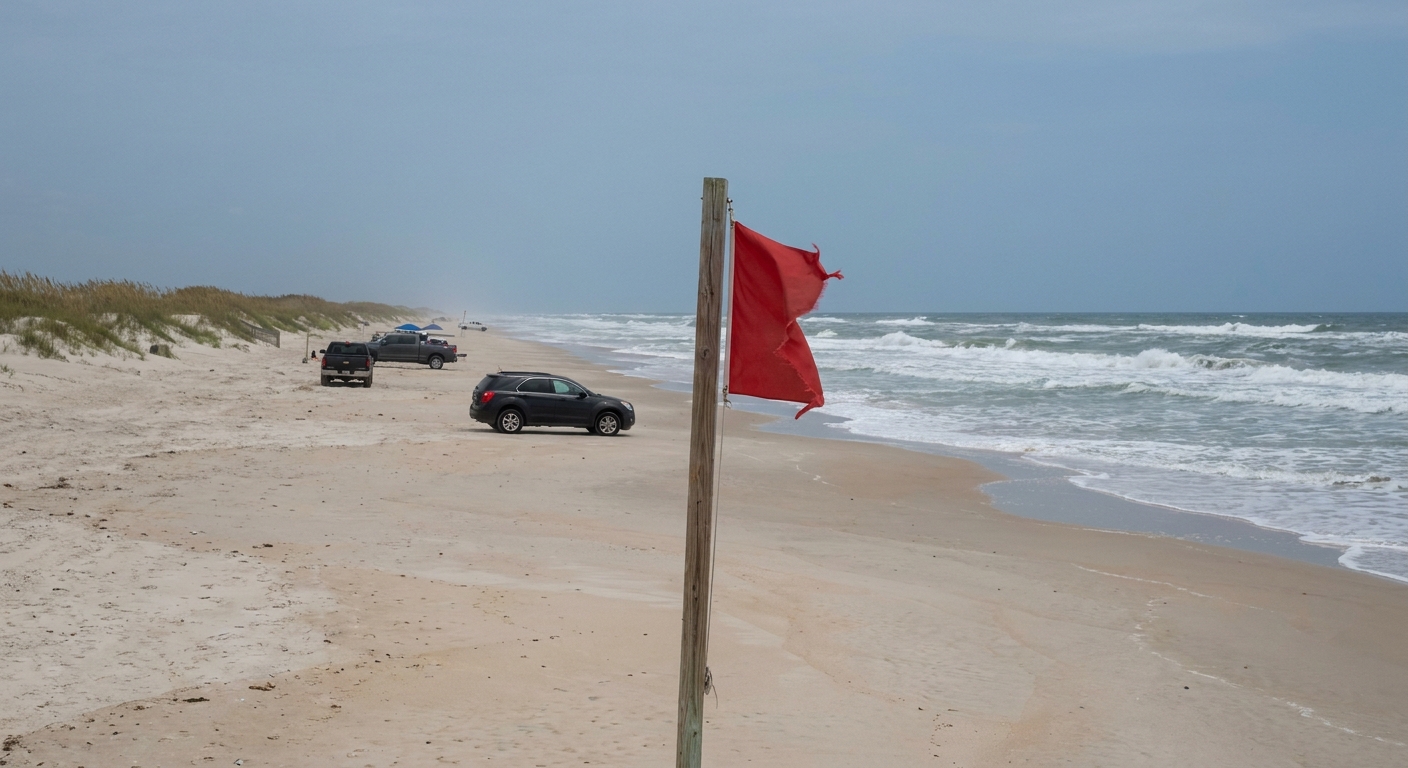
Learn the rip current escape and read the flag before you read anything else: the Weather Service ranks rip currents above every other weather hazard in South Florida since 1979, and no law requires a beach to fly a flag at all.
RIP CURRENTS RANK FIRST SINCE 1979 · FLAGS ARE VOLUNTARY · ALLIGATORS IN ALL 67 COUNTIES
Go for: lifeguarded sand, a flag visible from the parking lot, daylight swims in designated areas, and the parallel swim rehearsed in your head before you ever need it.
Think twice before: swimming at an unstaffed, unflagged stretch on a windy day. A rip current is faster than a swim straight back toward the beach, which is why strong swimmers are on the casualty lists.
Rip currents: NWS Miami · Flags: Florida DEP and statute 380.276 · Alligators: FWC · full sources at the end
On this page
- Rip currents in Florida: how to get out of oneSwim parallel, and the four visible signs
- What the Florida beach flag colors meanGreen, yellow, red, double red, purple
- Alligators in FloridaAll 67 counties, four FWC rules, one hotline
- Hurricane season dates and peakJune 1 to November 30, peak September 10
- Florida summer heat and afternoon stormsAbout 90°F, 85 to 90 percent humidity
- Driving in Florida: tolls, the Keys, the EvergladesAll-electronic gantries and one-hour gaps
- Spring break rules in Miami BeachGarage flat rates, the $548 tow, Thursday plan
- Florida beaches with lifeguardsLummus Park, Fort Zachary Taylor, and the check
A word on scope. That 1979 ranking is South Florida’s, kept by the Weather Service office in Miami, and it counts weather-related deaths only. Crime is a separate question, we hold no verified Florida figures for it, and so this guide advances none in either direction. Sharks sit outside the comparison for the same reason tornadoes sit inside it: the list is weather, and water movement is what tops it.
Rip currents in Florida: the deadliest hazard, and how to get out of one
| What you can see from the sand | What it is |
|---|---|
| A narrow gap of darker, seemingly calmer water between areas of breaking waves | The channel itself, water heading out instead of in |
| A channel of churning, choppy water | The outflow tearing through the incoming surf |
| A difference in water color | Sand and sediment being carried seaward |
| A line of foam, seaweed or debris moving seaward | The current made visible by what it is towing |
Rip currents rank at or near the top of the deadliest weather-related hazards in South Florida, and the Weather Service states the comparison bluntly: since 1979 they have claimed more lives there than any other weather-related hazard combined, hurricanes, tornadoes and lightning included. Not more than each of them. More than all of them together.
Physically it is a narrow channel of water flowing away from shore, usually 10 to 30 yards wide, strong enough to sweep even the strongest swimmer past the sand bar into deeper water. Four things betray it at the surface, and all four are readable before your feet get wet, from the top of the dune crossover or the lifeguard ramp. Two minutes of looking at the breakers is the cheapest safety equipment in Florida.
The official escape, in the agency’s own terms: cross the current in a direction following the shoreline, or towards breaking waves, until free from the current. Their rule of thumb is to swim parallel to the shore. The second method they list is to float with the current out a short distance beyond the breakers, then swim towards the shore once out of the current. Fighting it straight back toward your towel is the move that drowns people.
Casualties happen year-round in the usually warm South Florida surf, and they concentrate in the spring break period of March and April, through the summer months, and on major holiday weekends. Six rip current deaths were reported in South Florida in 2024. Over the past two decades the yearly average has fallen by more than half against the previous 20-year period, which is what forecasts, signage and staffed beaches buy.
Florida beach flags: what each color means, and the stretches that fly none
| Flag | What it means |
|---|---|
| Double red | Water is closed to the public |
| Red | High hazard, high surf and/or strong currents |
| Yellow | Medium hazard, moderate surf and/or currents |
| Green | Low hazard, calm conditions |
| Purple | Dangerous marine life spotted, flown alongside another flag |
Florida runs a uniform statewide beach warning flag program, specified down to the ink: green is PMS 348, yellow PMS 123, red PMS 186, purple PMS 266. Legislation in 2005 amending section 380.276 of the Florida Statutes required the standardization, which is why a red flag on the Panhandle means what a red flag means in Fort Lauderdale.
Now the trap. The statute organizes participation, it does not compel it. Participation is open to any government having jurisdiction over a public beach along the coast, whether or not that beach has lifeguards, and open is the operative word: a stretch of sand can legally fly nothing at all. An empty pole, or no pole, carries no information about the water. The program’s own wording says it plainly enough, that absence of flags does not assure safe waters.
Purple behaves differently from the other four. It reports dangerous marine life and it goes up beside another flag rather than replacing it, so purple next to green is calm water with something in it, and purple beside red is two problems at once. Read both poles before you decide the beach is green.
Alligators in Florida: all 67 counties, and the four FWC rules
The Florida Fish and Wildlife Conservation Commission puts alligators in all 67 counties. That includes counties with no swamp anywhere in the brochure, because the requirement is fresh water that holds still: golf course ponds, canals behind rental houses, drainage lakes at the edge of a parking lot. The Everglades is where you go to watch them on purpose. It is not where they are confined.
The agency’s advice runs to four instructions, and they are worth carrying verbatim. Never feed an alligator. Keep your distance if you see one. Keep pets on a leash and away from the water. Swim only in designated swimming areas, during daylight hours. For an animal that has turned up somewhere it should not be, FWC runs a toll-free Nuisance Alligator hotline: 866-FWC-GATOR, which dials as 866-392-4286.
One reservation, stated rather than buried. Feeding an alligator is commonly described as a criminal offense in Florida, penalty attached. We could not read the statute or the penalty at a primary source, so we quote neither the charge nor the fine you may see repeated elsewhere. What stands on verified authority is the FWC instruction itself, and it is the one that changes behaviour anyway: never feed an alligator.
Hurricane season in Florida: dates, the September 10 peak, and your booking
The Atlantic hurricane season runs June 1 to November 30 and peaks on September 10, with most activity between mid-August and mid-October. A season is a probability window, not a forecast for your week. Plenty of September trips pass with nothing more dramatic than the afternoon thunderstorm and a discount on the room.
What a traveller controls is the cancellation clause. Book the August-to-October nights refundable, keep the flight on a fare that changes without a penalty, and treat trip insurance as the line item that makes the peak-season price make sense. The track of a storm is the National Hurricane Center’s business. The terms of your booking are yours, and the month-by-month view sets out which weeks carry the risk.
Florida summer heat and afternoon storms: about 90°F, 85 to 90 percent humidity
Summer highs in South Florida reach about 90°F, with humidity between 85 and 90 percent, and the afternoon thunderstorm keeps something close to an appointment. The temperature alone undersells it. At that humidity sweat stops evaporating, which is the mechanism your body was relying on, and a shaded bench stops being a solution.
So a summer day outdoors gets front-loaded: the boardwalk, the trail or the beach walk before ten, water or air conditioning through the early afternoon, back outside once the storm has moved through and the light has softened. Open water and exposed boardwalks are the worst places to be under lightning, and the Everglades trails offer no shelter at all between the parking lot and the far end.
Driving in Florida: all-electronic tolls, the Keys and the Everglades
Florida’s toll roads run all-electronic across large stretches. The Homestead Extension of Florida’s Turnpike, the road you take between Miami and Florida City, has no cash booths whatsoever. A rental car under a gantry is photographed, the toll reaches the rental company, and the company adds its own service fee to it. Take the transponder option at the counter, and check what the daily charge for it actually is (our getting-around guide covers the rest of the driving admin).
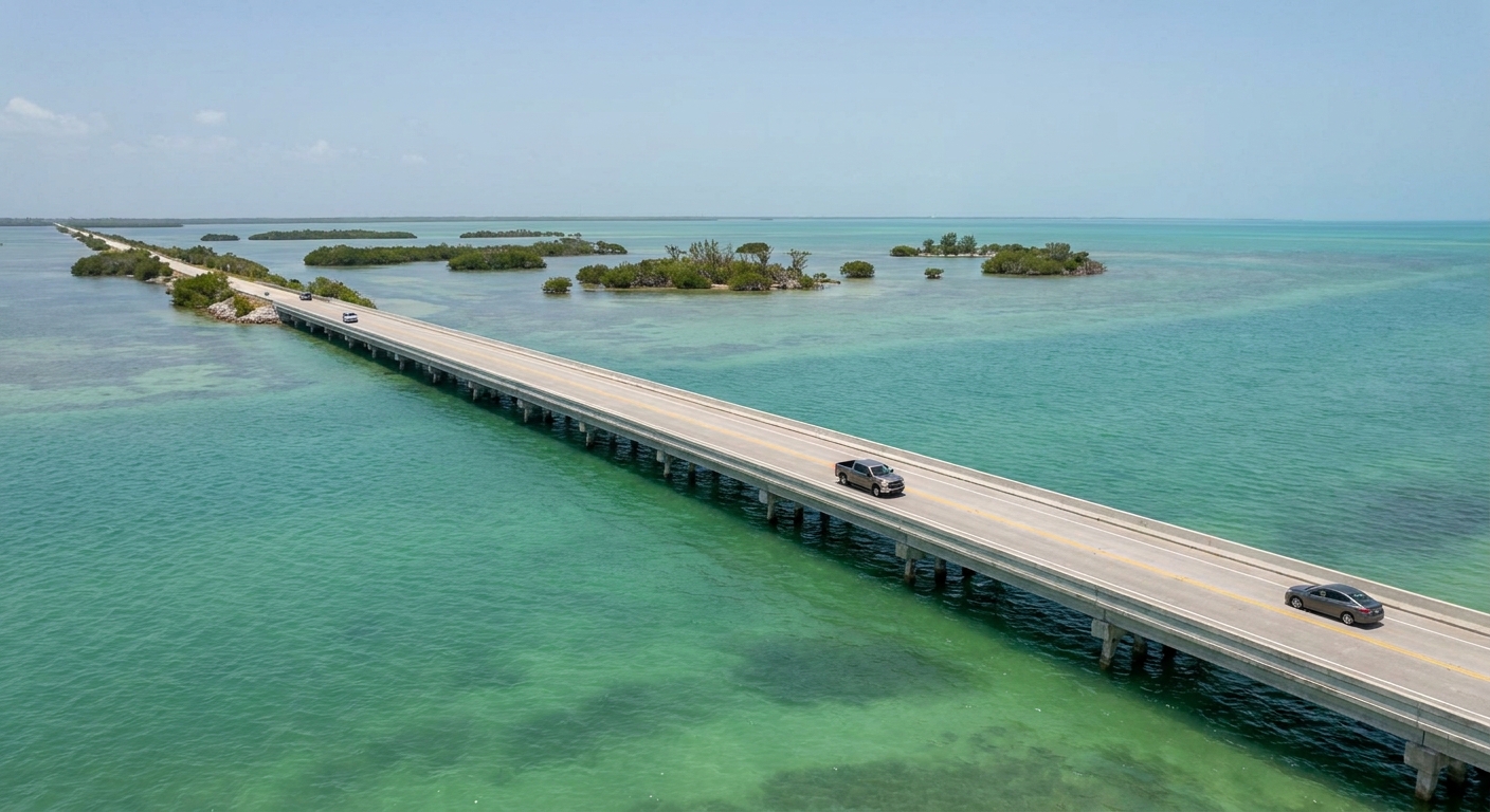
The Overseas Highway runs 113 miles from Florida City to Key West, mile markers counting down from about 126 to 0. One road in, one road out, which means a single crash ahead of you is not a detour, it is a wait. There is no safe place to stop on the Seven Mile Bridge itself, so the bridge photograph gets taken from either end.
The Everglades punishes improvisation in a quieter way. Each of the three park entrances and the interior Flamingo Visitor Center sits at least a one-hour drive from the others, with no shortcut between them. Choosing a second entrance at midday means two hours of driving before you see another trail, so pick the gate in the morning and stay with it.
Plan the whole state in hours rather than miles. Miami to Key West is a full day each way once traffic, bridges and stops are counted, and the drive west into the sawgrass eats an hour before the park boundary. Long flat road, bright light and steady speed make Florida driving tiring in a way the mileage never advertises, which is why the road-trip route is built around nights, not distances covered.
After dark the same roads change character. Neither the Overseas Highway nor the approach into the Everglades is lit end to end, both run with water directly alongside the asphalt, and wildlife uses the verges at exactly the hours you would be driving home from dinner. If the day has run long, the safer version is dinner where you are sleeping.
Spring break in Miami Beach: parking rates, towing and 2026 restrictions
For spring break 2026, Miami Beach put its four Art Deco District garages on flat rates of $40 to $100, raised the non-resident towing rate inside the district to $548, and ran a traffic plan from 6 p.m. each Thursday through Sunday. There is no blanket curfew unless the police chief determines one is required. The city renews and adjusts this package every year, so read the 2026 figures as the shape of the operation rather than a promise for next March.
Which Florida beaches have lifeguards
Lummus Park, fronting Ocean Drive between 5th and 15th Streets in South Beach, is free and open 24 hours, with lifeguards on duty, public restrooms and picnic tables. At the far end of the state, Fort Zachary Taylor Historic State Park in Key West opens 8 a.m. to sundown, 365 days a year, with the fort closing at 5 p.m., which sets your swimming window whether or not anyone is watching the water that day.
On an unfamiliar beach the check takes a minute. Is a flag flying, and which color. Is the stand staffed, or closed for the day. And what is the water doing in the gaps between the breaking waves. Absence of flags does not assure safe waters, so nothing on the pole means the assessment falls to you. From Siesta Key to South Walton, the three questions are identical.
The last word
Take one thing to Florida and let it be the parallel swim, because it is the only safety rule on this page that has to work while you are frightened. The rest is calmer arithmetic: read the pole, keep the daylight, save 866-392-4286 in your phone before you need it. And note what the state’s own wording does with its friendliest signal. The green flag is defined as low hazard, calm conditions, exercise caution. Even the calmest of the five flags ends in a warning.
Sources & data for this guide
- Rip currents ranked above all other weather-related hazards in South Florida since 1979, six deaths in 2024, the falling 20-year average, seasonality, escape advice and the four visible signs · National Weather Service, Miami office, Rip Current Awareness 2025 · checked Sep 7, 2026
- Statewide beach warning flag program, the four standardized colors and their PMS references, 2005 legislation amending section 380.276 · Florida Department of Environmental Protection and Florida Statutes · checked Sep 7, 2026
- Participation open to any government with jurisdiction over a public beach, with or without lifeguards, the law organizing participation without imposing it · Florida Statutes s. 380.276 · checked Sep 7, 2026
- Flag definitions including double red, purple flown alongside another flag, and “absence of flags does not assure safe waters” · Volusia County Beach Safety, a service applying the state program. The DEP pages we read give the colors but not the definitions · checked Sep 7, 2026
- Alligators in all 67 counties, the four instructions quoted verbatim, and the 866-FWC-GATOR hotline · Florida Fish and Wildlife Conservation Commission · checked Sep 7, 2026
- Feeding an alligator is commonly described as a criminal offense. We could not read the statute or the penalty at a primary source, so this guide states neither · verification incomplete at Sep 7, 2026
- Atlantic hurricane season dates, September 10 peak, mid-August to mid-October activity · NOAA · checked Sep 7, 2026
- All-electronic tolling and the Homestead Extension without cash booths, rental company service fees · Florida’s Turnpike · checked Sep 7, 2026
- Overseas Highway 113 miles, mile markers 126 to 0, no safe stop on the Seven Mile Bridge · Florida Keys · checked Sep 7, 2026
- Three Everglades entrances and Flamingo at least one hour apart · NPS Everglades · checked Sep 7, 2026
- Lummus Park hours, lifeguards and facilities · City of Miami Beach · checked Sep 7, 2026
- Fort Zachary Taylor hours, 8 a.m. to sundown, fort closing at 5 p.m. · Florida State Parks · checked Sep 7, 2026
- Spring break 2026: garage flat rates of $40 to $100, $548 non-resident towing rate, Thursday-to-Sunday traffic plan, no blanket curfew unless the police chief determines one is required · City of Miami Beach · checked Sep 7, 2026. The package is reissued and adjusted annually
- Summer highs near 90°F, humidity 85 to 90 percent, afternoon thunderstorms · concurring sources · checked Sep 7, 2026
- Night driving, fatigue and beach-arrival checks are editorial guidance, not agency advice · conditions change, read the pole and the water on the day