
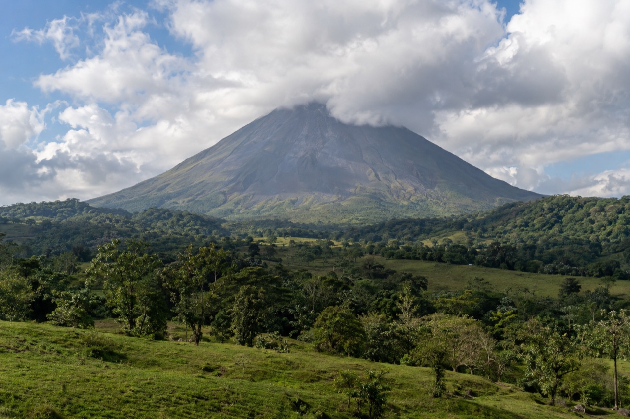
The vans start rolling out of La Fortuna before the mist has lifted off the pastures, and the cone of Arenal slowly appears and disappears behind the clouds as you leave town. From this base you can walk old lava flows, follow a river that turns turquoise, soak in volcano-heated water or cross the lake toward the cloud forest. Most of these outings fit into a single day and end back at your hotel for dinner, but Monteverde works better as a transfer.
What are the best day trips from La Fortuna?
The best day trips from La Fortuna are the ones that use the volcano country around you: a national park on your doorstep, a famous turquoise river, hot springs, a waterfall, hanging bridges and a long crossing toward Monteverde.
- Rio Celeste, in the Tenorio Volcano area, for a river that turns a milky turquoise and a trail that passes a waterfall.
- Arenal Volcano National Park, close to town, for short trails across old lava flows and views of the cone.
- The La Fortuna Waterfall, reached by a long staircase down to a green basin, for a half-day outing with a swim stop.
- The hot springs around Arenal, from simple local pools to big resorts, for a slow afternoon and evening.
- Monteverde, by the road around the lake or by a boat-and-van transfer, for a change of scenery to the cloud forest.
- Lake Arenal, for a day around the water below the volcano, with the cone as a backdrop on clear mornings.
Most visitors combine two nearby stops in one day, for example a morning walk in the park and an evening in the springs. The turquoise river and Monteverde ask for more time on the road, so they work better as the main event of the day.
Weather shapes the choice. In October, rain falls on most days, so mornings are the better bet for views and trails, and a soak in warm water suits a wet afternoon well. Nothing here is guaranteed, and the summit of the volcano often hides in cloud.
The best day trips from La Fortuna
Rio Celeste and Tenorio Volcano
Set within Guanacaste’s volcanic mountain range, the Tenorio Volcano area is home to Rio Celeste. Rio Celeste lies in the Tenorio Volcano area in Guanacaste’s volcanic mountain range.
The payoff is the river itself. A waterfall stands along the path, and beyond it the two streams come together, turning the water a milky turquoise. Sections can be muddy and slippery, so sturdy shoes matter, and in the rainy months the color can be paler after heavy rain, so treat the blue as a chance rather than a promise.
It suits walkers who like a real trail and a reward at the end. To hike in national parks, you should register with the park, have an entry permit and use a certified tour operator, so plan the visit around that rule.
Arenal Volcano National Park
This is the easiest outing, since the park lies near La Fortuna, about 9.3 miles from town, between the foothills of the Cordillera de Tilaran and the San Carlos plains.
On clear mornings, the short trails offer views of the cone and Lake Arenal as they pass through forest and old lava flows. Go early, because cloud tends to build later in the day, and give it a few hours rather than a whole day. It suits families, casual walkers and anyone who wants the volcano without a long drive.
Pair it with a soak in the springs afterward. Tired legs and warm mineral water make a natural ending, and the park’s trails leave plenty of the day free.
La Fortuna Waterfall
The waterfall drops into a green basin outside town. You reach it by a long staircase down, which is the real effort of the outing: the descent is easy, the climb back is slow and warm. At the bottom you hear the water before you see it, and the spray cools the air around the pool.
Taking a dip in the plunge basin below ranks as a favorite thing to do. Swimming in the pool at the bottom is a popular stop. After heavy rain the water runs stronger and browner.
Morning light is kinder for photos and the stairs are cooler before the day heats up.
Hot springs around Arenal
The volcano’s heat feeds the springs that made the Arenal area famous. Some are simple local pools with a few basins and a small restaurant, while large resort complexes offer many pools at different temperatures, swim-up bars and landscaped gardens among the trees.
The best moment is late afternoon into evening, when the air cools and the steam rises off the water. In the rainy months, sitting in hot water under a light rain is half the charm. It suits couples, families and anyone who spent the morning on a trail.
Choose by mood: a quiet local pool for a low-key hour, a resort for a full evening with dinner. Bring a towel and a change of clothes, and drink water, since hot soaking is tiring.
Monteverde by road or lake
Monteverde is the long one. The road around the lake takes roughly 3 to 4 hours each way, and a boat-and-van transfer across Lake Arenal takes about the same. That makes it more a move between two bases than a casual day trip, and a day out and back leaves limited time on the ground.
The boat-and-van option trades hours of driving for a crossing of the lake, with the volcano behind you if the cloud allows. The road option winds around the water and through farmland, and it is slow in places.
It suits travelers who want the cloud forest and are short on days. If you can, treat it as a transfer and stay a night, so the long travel buys you a proper walk under the canopy.
Day trips from La Fortuna compared
| Trip | Time each way | Best for | How to go |
|---|---|---|---|
| Rio Celeste (Tenorio) | Longest of the local outings, a long morning drive | Turquoise river and a rain forest trail | Tour with a certified operator, early start |
| Arenal Volcano National Park | Short drive, about 15 km from town | Lava flow trails and cone views | Tour, taxi or own car |
| La Fortuna Waterfall | Short drive outside town | Staircase walk and a swim stop | Tour, taxi or own car |
| Hot springs | Short drive from town | Evening soak, families, couples | Tour, taxi or own car |
| Monteverde | Roughly 3 to 4 hours | Cloud forest, a move between bases | Road around the lake, or boat and van across Lake Arenal |
To choose, start with how much time you want to spend in a vehicle. If you have one day and want the volcano, the park and the waterfall are the easy pair, and the springs finish the evening. If a single big memory matters more than variety, Rio Celeste is the one to build the day around.
Monteverde is the odd one out. It only makes sense as a bigger plan, with a night or more in the cloud forest. Weather can reshape the day too: in a wet month, put the outdoor walks in the morning and keep the springs for later.
A good rule of thumb is one main outing and one light stop per day. Trails in the rain forest take longer than they look, and rushing them removes the point of going.
Tour or on your own?
A tour makes the most sense where the drive is long, the site is guided or a boat is involved. Rio Celeste is the clearest case: to hike in national parks, you should register with the park, have an entry permit and use a certified tour operator, and a tour usually folds that into the day. The same goes for the boat-and-van crossing to Monteverde, where the vehicle waits on the far shore and you do not have to plan the connection yourself.
On your own works well for the places close to town. The park lies near La Fortuna, and the waterfall is outside town. That matters for the park, where early morning is the better time for views, and for the springs, where evening is the draw.
A rental car also suits anyone who wants to stop at a roadside fruit stand or a viewpoint. Roads in the mountains can be slow, steep or wet, so give yourself extra time and avoid driving tired after a day of walking.
Before you book anything, check what the outing includes, where the pickup happens and how long you will actually spend at the site rather than on the road. Ask the operator whether the guide is certified for the park you are visiting.
Rules and access at parks change, so confirm the details on the park’s official page before you go. Pack a light rain jacket, sturdy shoes, a change of clothes and a bag for wet things, since a day outdoors here almost always involves some moisture.
Good to know before you go
The U.S. State Department rates Costa Rica Level 2, ‘Exercise increased caution,’ due to crime; it says petty crime is common throughout Costa Rica and that violent crime also affects tourists, including armed robbery, homicide and sexual assault.
October is deep in the wet season here, with rain on nearly every day, so a rain jacket belongs in the day bag and the best views come early. Keep valuables out of sight in parked vehicles and carry only what you need on the trail.
Carry some cash for small stops and local pools, and bring water and snacks for the longer drives. Because the Atlantic hurricane season lasts into the fall, heavy rain can sometimes wash out a few days of your trip in this region, so it pays to keep your plans loose.
Sources
- Costa Rica Tourism Board (ICT), Arenal Volcano National Park (https://visitcostarica.com/where-to-go/protected-areas/arenal-volcano-national-park), checked October 8, 2026
- Costa Rica Tourism Board (ICT), Tenorio Volcano National Park (https://visitcostarica.com/where-to-go/protected-areas/tenorio-volcano-national-park), checked October 8, 2026
- Open-Meteo / ECMWF ERA5, normals 1991-2020 computed for the grid cell at 10.4679N 84.6427W, checked October 8, 2026
- U.S. Department of State, Costa Rica Travel Information, Safety and security (https://travel.state.gov/content/travel/en/international-travel/International-Travel-Country-Information-Pages/CostaRica.html), checked October 8, 2026
- U.S. Department of State, Costa Rica Travel Advisory, issued April 1, 2026 (https://travel.state.gov/content/travel/en/traveladvisories/traveladvisories/costa-rica-travel-advisory.html), read via the State Department open data API on October 8, 2026
To plan your stay
- Best Time to Visit La Fortuna: Dry Months, Rainy Season, Arenal Volcano and Festivals
- Where to Stay in La Fortuna: Town Center, Volcano Road, Hot Springs Strip and Lake Arenal
- La Fortuna vs Monteverde: Hot Springs, Cloud Forest, Weather and Which to Choose
- La Fortuna in January: Weather, Hot Springs and What to Do Near Arenal