
MEXICO · ENSENADA · APRIL
April in Ensenada is a light-jacket month. Afternoons are mild, nights are cool, March’s rain has largely gone, and the Pacific is still too cold for a long swim. The town sits on a bay on Baja California’s coast, close enough to a blowhole, a wine valley and a mountain range to use as a base for all three.
The places that anchor an April trip are La Bufadora, the marine geyser on the Punta Banda peninsula, Valle de Guadalupe, the wine valley inland, and the Sierra San Pedro Mártir range. Each one reacts to the calendar differently, and the weather and sea figures below say how.
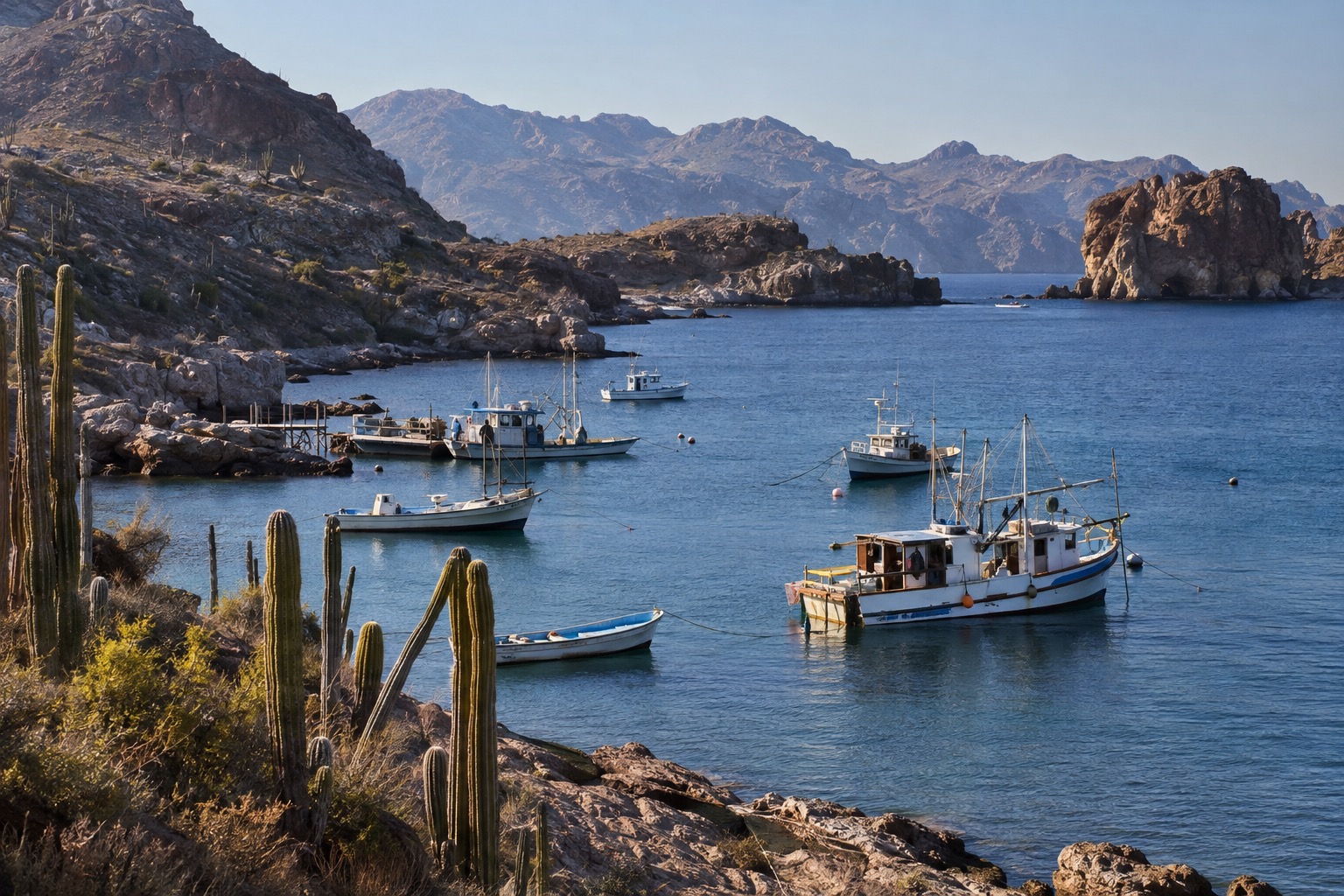
THE MONTH AT A GLANCE · ENSENADA
April in Ensenada means 67.5°F afternoons, 49.1°F nights, 1.7 days of measurable rain and 59.0°F water, a mild month for coast and valley days rather than long swims.
AVG HIGH 67.5°F · AVG LOW 49.1°F · SEA 59.0°F · 1.7 RAIN DAYS
Go for: afternoons at 67.5°F, a month with only 1.7 days of measurable rain on average, and day trips to La Bufadora and Valle de Guadalupe.
Think twice before: planning long ocean swims, since the sea averages 59.0°F, or leaving the jacket at home, since average lows fall to 49.1°F.
April sits between a wetter March (2.06 inches of rain) and a nearly dry May (0.11 inches).
Climate: SMN (CONAGUA) · Sea: Open-Meteo Marine API · Daylight: sunrise-sunset.org · full sources at the end
On this page
- Ensenada weather in AprilHighs of 67.5°F, lows of 49.1°F and 0.65 inches of rain
- Can you swim in Ensenada in April?Sea surface at 59.0°F and what that means in the water
- How busy is Ensenada in April?Cruise-port arrivals, the 5% lodging tax and what we could not verify
- Things to do in Ensenada in AprilLa Bufadora, Valle de Guadalupe and Sierra San Pedro Mártir
- Ensenada itinerary for AprilA coast day, a wine-valley day and a rain swap
- Ensenada in April vs March and MayHighs of 66.0°F, 67.5°F and 69.8°F across the three months
- Is April a good time to visit Ensenada?Who should book April and who should look at May
Ensenada has no commercial airport of its own, so an April trip starts at Tijuana International (TIJ), the nearest international airport. Baja California carries Level 3 (Reconsider travel) in the State Department’s Mexico advisory, which cites terrorism, crime and kidnapping and singles out high homicide numbers in the non-tourist areas of Tijuana. The only travel restrictions in the state apply to the Mexicali Valley.
Ensenada weather in April
| Measure | April average | Source |
|---|---|---|
| Average high | 67.5°F | SMN (CONAGUA) normals, 1991-2020 |
| Average low | 49.1°F | SMN (CONAGUA) normals, 1991-2020 |
| Precipitation | 0.65 inches | SMN (CONAGUA) normals, 1991-2020 |
| Days with measurable rain | 1.7 days | SMN’s own count |
| Sea surface (mean of daily maxima) | 59.0°F | Open-Meteo Marine API, 2015-2024 |
| Daylight on April 15 | 13 hours 02 minutes | sunrise-sunset.org |
The April normals come from Mexico’s national weather service (SMN, part of CONAGUA), averaged over 1991-2020 at station 02108. That is a real thermometer rather than a grid-cell reanalysis. It stands at Punta Banda, about 11 miles south of downtown on the same bay, because Ensenada’s own town-center station has no published normals. Every figure here comes from that station: an average high of 67.5°F, an average low of 49.1°F and 0.65 inches of precipitation.
SMN records 1.7 days of measurable rain in an average April, using a threshold it does not publish on the station sheet. Set against 0.65 inches for the month, that means one or two wet days and no measurable rain on the others. Pack a light rain shell and keep one indoor plan in reserve, such as a tasting room in Valle de Guadalupe.
From afternoon to night the average drops 18.4 degrees, from 67.5°F to 49.1°F. A T-shirt handles the afternoon. After sunset the bag needs a fleece or a light jacket, and long sleeves earn their space by the water in the evening.
April 15 brings about 13 hours 02 minutes of daylight. Sunset falls at 02:17 UTC, just after 7 p.m. on Ensenada’s clock, so dinner happens after dark and the outdoor stops belong in the daytime.
Can you swim in Ensenada in April? Sea temperature
The sea surface off Ensenada averages 59.0°F in April, according to the Open-Meteo Marine API over 2015-2024. That figure is a mean of daily maxima, so it runs a shade warmer than a 24-hour average would.
At 59.0°F the Pacific suits wading, a paddle at the edge and a short dip for the brave, with a wetsuit for anyone who wants more than a few minutes. March reads 58.7°F on the same API, so April water sits only a notch above it, and May reaches 60.7°F.
Our sources carry no wind or swell data for April, so we cannot say how choppy the bay runs. Check a marine forecast the morning you plan to get on the water.
How busy is Ensenada in April? Crowds and prices
Ensenada is a working cruise port. It received 360 cruise ship calls in 2025, 24% more than in 2024, and more than 1.3 million cruise passengers reached the municipality that year. Those are annual totals. We hold no April ship calendar and found no occupancy or room-rate series, so we crown no month busy or expensive.
We could not verify how many weeks ahead April rooms fill, so we give no lead time. No April event date appears in our sources either, so nothing on the calendar forces an early commitment. A rate with free cancellation lets you hold a room while you weigh April against May.
Baja California charges a lodging tax (Impuesto sobre Servicios de Hospedaje) of 5% on hotels and 7% on moteles in 2026, with a 5% rate on digital booking platforms. Ask whether a quoted nightly rate already includes it before you compare two hotels.
If one line of the budget deserves the bigger spend, make it a room within walking distance of dinner. With lows of 49.1°F and a sunset just after 7 p.m., the evening is the cold part of an April day.
Things to do in Ensenada in April
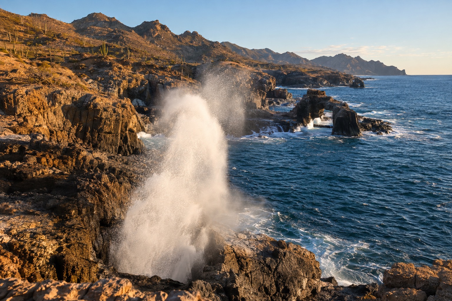
April’s 1.7 rain days leave most of the month open for outings that start with a drive: a marine geyser on the coast, a wine valley inland, a mountain range farther out. The sea at 59.0°F takes long beach days off the list, so the plans lean toward land.
La Bufadora sits on the Punta Banda peninsula, about 20 miles southwest of Ensenada. Visit Mexico and the research center CICESE describe a marine geyser that shoots seawater through a coastal blowhole in a plume that can reach 30 meters (about 100 feet). Valle de Guadalupe, the wine valley inland, is promoted by the state as the Ruta del Vino. Ensenada is also the usual overland gateway to Sierra San Pedro Mártir National Park, a CONANP-protected mountain range.
The blowhole runs on seawater, and the sea barely moves across spring: 58.7°F in March, 59.0°F in April, 60.7°F in May, all from the marine API. The air changes more, with the average high climbing 3.8 degrees between March and May. The Punta Banda normals describe the coast, so we hold no figures for the valley or the sierra.
We could not verify which of these places charge admission or what they charge, and we found no opening hours, so we quote none. Check each operator the week you go.
Ensenada itinerary for April
Day one goes to the coast. Leave in the morning for La Bufadora, about 20 miles southwest, while the air climbs toward its 67.5°F high, and watch the plume. Come back to town for a late lunch and spend the afternoon on the bay. Sunset falls just after 7 p.m. and nights drop to 49.1°F, so carry a jacket to dinner.
Day two heads inland to Valle de Guadalupe for a tasting or two along the Ruta del Vino, with the question of who drives settled before the first glass. If rain arrives (1.7 days is the April average), the wine valley is the day to hold for it, and La Bufadora is the one to move to a clear morning.
Ensenada in April vs March and May
| Measure | March | April | May |
|---|---|---|---|
| Average high | 66.0°F | 67.5°F | 69.8°F |
| Average low | 46.6°F | 49.1°F | 53.1°F |
| Precipitation | 2.06 inches | 0.65 inches | 0.11 inches |
| Days with measurable rain | 3.6 days | 1.7 days | 0.7 days |
| Sea surface (Open-Meteo Marine API) | 58.7°F | 59.0°F | 60.7°F |
April’s average high sits 1.5 degrees above March’s and 2.3 degrees below May’s. The night gap is wider: April lows run 2.5 degrees above March and 4.0 degrees below May. Rain falls fast, with April’s 0.65 inches at roughly a third of March’s 2.06 and May’s 0.11 at about one-sixth of April’s. Air figures are SMN normals, and the sea figures come from the Open-Meteo Marine API.
Moving four weeks later brings 0.7 days of measurable rain and 60.7°F water, but our sources say nothing about rates or crowds, so we cannot say what the move costs. Moving four weeks earlier brings 3.6 wet days and 2.06 inches of rain for a sea only 0.3 degrees cooler. Ensenada in May has its own set of numbers.
Is April a good time to visit Ensenada?
Yes, for anyone who wants mild afternoons, cool nights and dry days for driving out to La Bufadora or the wine valley. Less so for a trip built around swimming, since 59.0°F water stays cold. Read the State Department’s Baja California advisory before you book.
Anyone who wants warmer water should look at May, with a 60.7°F sea, 69.8°F highs and 0.11 inches of rain. For other destinations and months, our guide to where to go by month covers the calendar.
April’s particular offer is a 67.5°F afternoon inside 13 hours 02 minutes of daylight on the 15th, after March’s rain and ahead of May’s warmer water.
The last word
Book April for cool, dry afternoons at 67.5°F, fly into Tijuana and keep a jacket for the 49.1°F nights. If a third day opens up, point the car at Sierra San Pedro Mártir, the range that hosts Mexico’s National Astronomical Observatory, and ask locally about the road first.
Sources & data for this guide
- Climate normals for April, station 02108 (Punta Banda) · Servicio Meteorologico Nacional (CONAGUA), 1991-2020 · checked Sep 30, 2026
- Sea surface temperature, mean of daily maxima 2015-2024 · Open-Meteo Marine API · checked Sep 30, 2026
- Daylight and sunset for April 15 · sunrise-sunset.org · checked Sep 30, 2026
- March and May comparison columns · same SMN station and Open-Meteo Marine API · checked Sep 30, 2026
- Cruise calls and passengers, 2025 · XXV Ayuntamiento de Ensenada, press release of April 4, 2026 · ensenada.gob.mx · checked Sep 30, 2026
- La Bufadora · Visit Mexico and CICESE · checked Sep 30, 2026
- Lodging tax, 2026 rates · Ley de Hacienda del Estado de Baja California, chapter V, with El Contribuyente and J.A. Del Rio tables · checked Sep 30, 2026
- Travel advisory · U.S. Department of State, Mexico Travel Advisory reissued May 29, 2026 · checked Sep 30, 2026
- Tijuana as the nearest airport, Valle de Guadalupe and Sierra San Pedro Mártir are common knowledge and carry no registry source. We found no occupancy, room-rate, wind, swell, admission or opening-hours data, so none is quoted. Fees, hours and ship calendars change · check operators when you book.