
The road narrows and turns to stone, and the sound of the highway falls away behind a screen of cedars. A wooden sign points the way, a stream runs somewhere out of sight, and the old post towns of the Nakasendo wait at the end of each stretch of forest. This is a visit on foot along a historic road that once tied Tokyo to Kyoto, built for travelers who like to walk from one village to the next.
Is visiting the Nakasendo Trail worth it?
Yes, if you like to walk and want to see Japan at the pace of its old travelers, with stone paving under your shoes and a village at the end of the day.
What sets it apart from the temples and castles that fill most itineraries is that the main attraction is the road itself. The Nakasendo ran through five prefectures, Saitama, Gunma, Nagano, Gifu and Shiga, and the whole route stretched about 332 miles. Along it stood 69 staging posts where travelers slept, ate and changed porters.
Unlike a city district, you move through it step by step, so the experience is the walk, the forest, the water and the village that appears around a bend. Kyoto and Tokyo offer grand sights. The Nakasendo offers the long, slow way between them, and it is a good counterweight to a trip made mostly by shinkansen.
Not everyone will want this. If you prefer a single landmark with a clear start and finish, or you would rather ride than walk, a stretch of road in the forest may feel like a lot of effort for modest sights. For walkers, though, it is a rare chance to follow a route that shaped how people, goods and news crossed the country.
What to see at the Nakasendo Trail
The walk from Tsumago-juku to Magome-juku
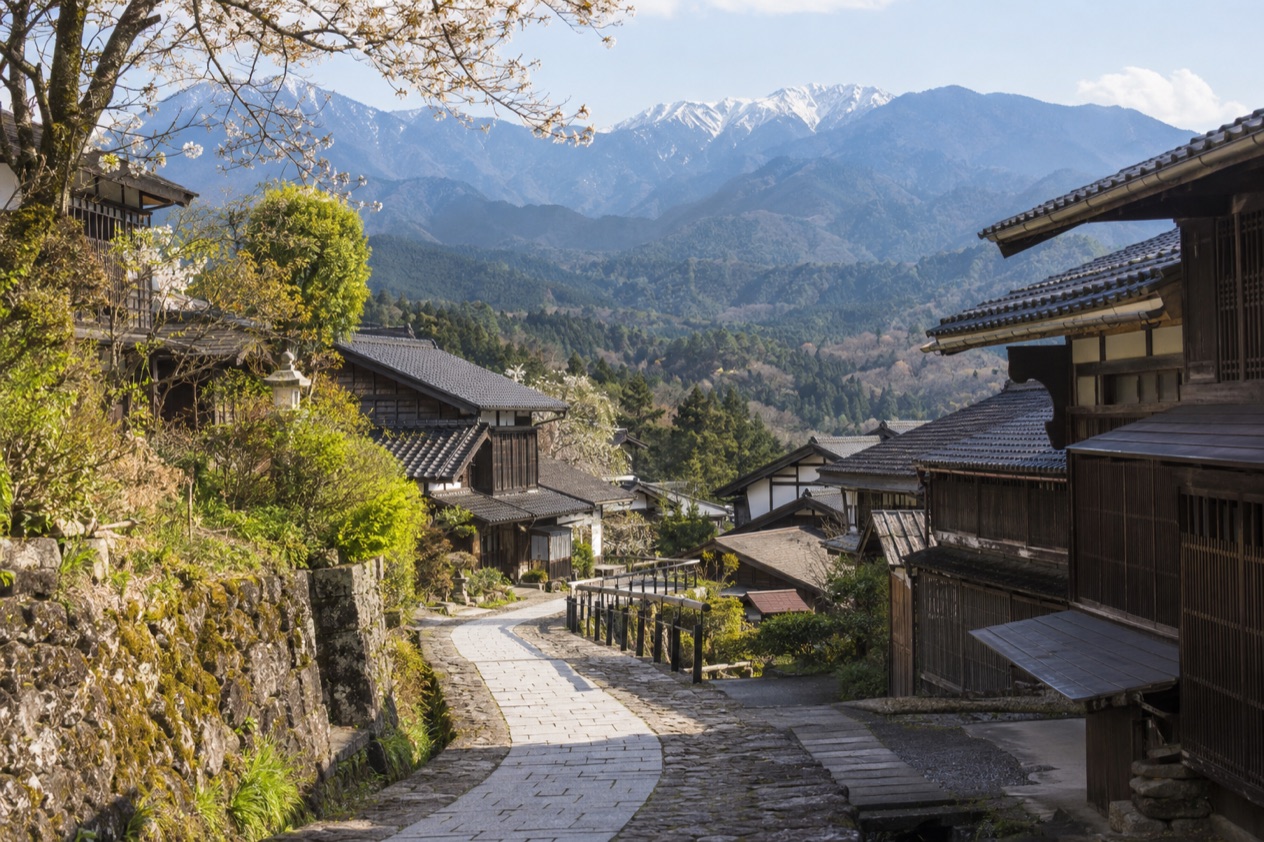
This is the stretch travelers have in mind, and the walking takes two to three hours between the two post towns. The path moves through forest, over restored paving and past views of waterfalls, with the sound of running water often close by. Little wooden huts and rest spots mark the way, and small hamlets of farmhouses sit between the two towns.
Look for the stone surface underfoot, the cedar trunks lining the lane, and the bells that hikers ring at some points along the road. You can walk it in either direction, so the choice depends on where you sleep and how you plan the day. Shoes with a good grip and water in your bag fit the terrain.
Tsumago-juku and Magome-juku, the post towns
A juku was a post town, a place where travelers on the road found lodging, meals, horses and porters. In these two towns the old lodging houses, with their latticed windows, deep eaves and dark wood, line the main street. Many were built to receive officials and merchants, and they now hold small inns, shops, tea rooms and restaurants.
Walk the main street slowly and look at the details: the carved signs, the stone lanterns, the water troughs and the small shops selling local sweets and crafts. Regional food in the valley often involves buckwheat noodles, rice cakes grilled on skewers and mountain vegetables, so a bowl of noodles or a skewer by the street makes a natural pause. Magome and Tsumago each have their own character, and seeing both gives a fuller picture of how the road worked.
The designated historic sections
In 1987, three sections of the road in Nagano Prefecture and Gifu Prefecture were designated National Historic Sites of Japan. They run between Wada-shuku and Wada Pass, between Shiojiri-juku and Midono-juku, and between Tsumago-juku and Magome-juku. The recognition covers the old road itself, with its paving, its slopes and its line through the landscape, not just individual buildings.
If the Tsumago to Magome walk whets your appetite, these other sections show different faces of the road. Wada Pass and the Shiojiri to Midono stretch each have their own setting and their own post towns, so the Nakasendo can be explored as a series of separate walks rather than as one long journey.
Railways that shadow the old road
Parts of the Takasaki Line, the Shin’etsu Main Line, the Chuo Main Line, the Taita Line and the Tokaido Main Line approximately follow the path of the former Nakasendo. That means the old road and the modern tracks share a corridor in places, and a journey on these lines gives a sense of how the same geography has guided travelers for centuries.
It is a detail worth keeping in mind as you travel: the road you walk in the forest was once the main artery between two great cities, and the rail lines that came later followed many of the same valleys and passes.
Hours, tickets and rules
The designated historic sections are stretches of old road in Nagano and Gifu, and the post towns of Tsumago and Magome are living villages where people still make their homes.
What the walk asks of you is time. , and that is the planning figure to keep in mind when you shape your day. The route passes through forest, along restored paving and near waterfalls, so you walk through changing surroundings rather than along a single street.
Because the road runs through villages where people live and work, it helps to move through them the way a respectful guest would. Keep to the path, leave nothing behind, and treat the lodging houses and shops as the working places they are. The route is a protected historic landscape, which is part of why it has kept its character, and that character is what you are there to see.
How to get to the Nakasendo Trail
The Nakasendo connects Tokyo and Kyoto, so the road is reached from many points rather than from a single gate. The Chubu region sits directly between the Kanto region, which includes Tokyo, and the Kansai region, which includes Kyoto, and the Nakasendo crosses the heart of it. Nagoya, the major city of Chubu, lies in the same part of Honshu, which makes it a useful reference point when you place the route on a map.
Rail is part of the story here. Portions of the Takasaki Line, the Shin’etsu Main Line, the Chuo Main Line, the Taita Line and the Tokaido Main Line approximately follow the path of the former road, so the corridors travelers used long ago are still served by trains. For the wider region, the shinkansen links Tokyo to much of Hokuriku Shinetsu in 2 hours 30 minutes or less, and Nagano Prefecture belongs to that region.
For the specific walk between Tsumago-juku and Magome-juku, the thing to plan around is the walking itself, which takes two to three hours. Think of the day as a walk from one post town to the other, with time at each end to see the lodging houses and the streets before or after you set out. Choose your base according to the direction you want to walk, and plan the rest of your route in Japan around that.
When to visit the Nakasendo Trail
Because the route passes through woods, along stone paving and near waterfalls, the weather shapes the experience more than any opening time does.
In spring, new growth brightens the cedar and broadleaf forest and the small gardens of the villages. Summer brings deep green and the sound of water, though warm days and the rainy season can make a long walk more demanding.
Autumn paints the broadleaf trees in color along the old road, and the stone paving and timber houses make a fine backdrop. Winter leaves the broadleaf trees bare while the cedars stay green. No single season is promised to be clear or dry, so allow for changes in the weather whatever month you choose.
Since the Tsumago to Magome walk takes two to three hours, give yourself a day that does not feel rushed, with time to stop in each village. , and the road itself, wet stone under tall trees, has a character of its own.
Tips for your visit
Bring shoes with a good grip, since the road includes restored stone paving and forest paths. Water, a light layer and a rain jacket are sensible companions for a walk that takes two to three hours between Tsumago-juku and Magome-juku, and a small bag keeps your hands free for photographs.
Think of the walk as part of a larger route. The Nakasendo ran for about 332 miles through five prefectures, and the Kiso Valley is only one part of it.
If the walk appeals, the other designated sections, between Wada-shuku and Wada Pass and between Shiojiri-juku and Midono-juku, give you reasons to return or to extend your trip. Pairing the Nakasendo with a stay in Nagoya, Kyoto or Tokyo fits the logic of the road, which linked those regions in the first place.
Families and travelers who prefer less walking can still enjoy the post towns themselves, where the main streets are the attraction and a stroll among the old lodging houses, shops and tea rooms fills a pleasant stretch of time. Beyond that, it is best to plan your own pace and treat the walk as something to enjoy rather than something to finish.
Good to know before you go
The villages along the Nakasendo are living communities, so a little courtesy goes a long way: speak softly in the lanes, keep to the path and carry out what you carry in. In the rainy season and during typhoon season, conditions can shift, so keep your plans flexible.
Sources
- Wikipedia, Nakasendō (https://en.wikipedia.org/wiki/Nakasend%C5%8D), checked October 11, 2026
- Japan National Tourism Organization, the Chubu region (https://www.japan.travel/en/destinations/hokuriku-shinetsu/), checked October 11, 2026
- Wikipedia, Chūbu region (https://en.wikipedia.org/wiki/Ch%C5%ABbu_region), checked October 11, 2026
- Wikipedia, Regions of Japan (https://en.wikipedia.org/wiki/Regions_of_Japan), checked October 11, 2026
To plan your stay
- Best Time to Visit Japan: Cherry Blossoms, Autumn Colors, Weather and Festivals
- Where to Stay in Japan: Ryokan, Temple Stays, Capsule Hotels and the Best Cities to Base In
- Sending Luggage from the Airport in Japan: Hands-Free Travel, Hotel Delivery and Coin Lockers
- Know Before You Go to Japan: Entry, Money, Etiquette and Getting Around