
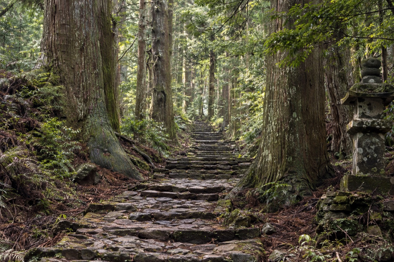
Stone steps worn smooth and green with moss climb through cedar forest, and every so often a small marker or a roadside shrine tells you that people have been walking this way for a very long time. The Kumano Kodo is not one path but a web of pilgrimage routes across the Kii Peninsula, and all of them lead toward the same three shrines.
Is visiting the Kumano Kodo worth it?
It is worth it for travelers who want to spend their days walking through mountains toward a destination of faith, and less so for anyone who wants to tick off a single monument and move on. The reward here is the walking itself: forest, ridges, small villages where pilgrims stop for the night, and the arrival at a shrine after hours on the trail.
What sets the Kumano Kodo apart from other sacred places in Kansai is that it is a network rather than a site. Some of its roads and the shrines of Kumano were registered as UNESCO World Heritage in July 2004, as part of the Sacred Sites and Pilgrimage Routes in the Kii Mountain Range.
Other routes connect Kumano with Koyasan, with Ise Grand Shrine and with Mount Omine, so the region reads as a map of devotion in which Kumano sits at the center. You choose your own length, from a single pass to a long crossing of the peninsula.
There is a pleasing symmetry for those who have already walked in Spain. Pilgrims who have completed both the Camino de Santiago and the Kumano Kodo can receive a certificate of dual pilgrimage, a detail that walkers on both trails tend to enjoy. For everyone else, the draw is simpler: a pilgrimage route where the destination matters, and where the days between one shrine and the next are the heart of the trip.
What to see at the Kumano Kodo
The routes differ widely in length and character, from a single pass beside a hot spring village to a crossing of the whole peninsula. These are the main ones, as measured on the trail.
| Route | Length | Connects |
|---|---|---|
| Nakahechi | About 37 km | Takijiri-oji to Kumano Hongu Taisha |
| Dainichi-goe | 2 km | Kumano Hongu Taisha to Yunomine Onsen |
| Akagi-goe | 6.5 km | Mikoshi-toge pass to Yunomine Onsen |
| Kumano River route | 40 km | Kumano Hongu Taisha to Kumano Hayatama Taisha |
| Kohechi | 65 km | Koyasan to the Kumano Sanzan |
| Iseji | About 160 km | Ise Grand Shrine to the Kumano Sanzan |
The Three Grand Shrines of Kumano
Every route ends at the Kumano Sanzan: Kumano Hongu Taisha, Kumano Nachi Taisha and Kumano Hayatama Taisha. Each has its own setting and its own character, and together they are the reason the trails exist. Pilgrims have traditionally visited all three, moving between them along the paths that link them.
Look for the vermilion and weathered wood of the shrine buildings against the forest, the stone lanterns and steps on the approach, and the way each shrine feels like the end of a chapter after the miles that lead to it. Arriving on foot changes how the place reads. A shrine reached after a mountain day is a different experience from one reached by a parking lot.
The Nakahechi route
The Nakahechi is the route most associated with the Kumano Kodo. It runs from Takijiri-oji to Kumano Hongu Taisha over mountainous trail, climbing and dropping through forest, passing small roadside shrines called oji and crossing stretches where the path is little more than a stone-laid line through the trees.
Most pilgrims split it into a two-day walk, overnighting in the village of Chikatsuyu, about halfway. That rhythm of a day on the trail, an evening in a village and a second day toward the shrine is the classic pilgrim shape of the walk. It suits travelers who like a clear goal at the end and are happy with mountain terrain along the way.
Around Hongu and Yunomine Onsen
Two shorter routes link Kumano Hongu Taisha with Yunomine Onsen, a hot spring village (onsen means hot spring). The Dainichi-goe crosses a small but relatively steep pass, so it is brief on the map but not flat. The Akagi-goe follows steep mountain ridges from the Mikoshi-toge pass to the village and is described as a relatively leisurely walk.
Together they make a way to taste the Kumano Kodo without committing to the long crossing. You can walk one, soak in a hot spring village at the end, and still be close to the shrine. The two differ in feel, one a pass and one a ridge, which makes them pleasant to pair if you have time for both.
The Kumano River and the boat tour
The river route between Kumano Hongu Taisha and Kumano Hayatama Taisha follows the Kumano River for 25 miles. For part of the year this pilgrimage is served by a traditional boat tour, running from March to November. Instead of another day of climbing, you travel with the current between two of the Three Grand Shrines.
It adds a very different view of the same landscape: the forested banks seen from the water rather than from above. It is a good counterweight to the hiking days, and the season it covers is worth knowing when you plan which month to come.
Dogiri-zaka and the road to Nachi
Between Koguchi and Kumano Nachi Taisha, the Ogumotori-goe section holds what is called the hardest part of the whole pilgrimage, the Dogiri-zaka slope, which climbs 800 metres in elevation. The name is often read as a slope that makes you gasp, and walkers who take it on go in knowing it is demanding.
The payoff is the destination: Kumano Nachi Taisha at the end of the section, one of the Three Grand Shrines. This stretch suits strong walkers who want the pilgrimage at its most testing, and those who prefer a gentler day can choose the shorter routes around Hongu instead.
The long routes: Kohechi, Iseji and Omine
The Kohechi links Koyasan with the Kumano Sanzan and is a tough walk across three passes with elevation gains of over 1,000 meters. The Iseji joins Ise Grand Shrine with Kumano, a far longer line of travel that links two of Japan’s great sacred sites.
The Omine Okugakemichi, which connects Mount Omine with the Kumano Sanzan, belongs to the yamabushi, mountain ascetics who practice in these ranges. It is so dangerous in winter that even they do not generally travel it. Women on this route must bypass Mount Omine itself, as the mountain is forbidden to them.
How to get to the Kumano Kodo
The Kumano Kodo lies on the Kii Peninsula, the largest peninsula on the island of Honshu, in the Kansai region of Japan. Wakayama Prefecture covers much of it, including the entire southern part, while Osaka, Nara and Mie Prefectures also hold land on the peninsula. That spread of prefectures is part of why the routes reach so far in different directions.
Rather than one entrance, the pilgrimage has several starting points, each tied to a route. The Nakahechi begins at Takijiri-oji and ends at Kumano Hongu Taisha. The Kohechi begins at Koyasan, the Iseji at Ise Grand Shrine, and the Omine Okugakemichi at Mount Omine. Choosing where to begin is therefore the first decision of the trip, because it decides which route you walk and which shrine you reach.
Travelers think of the area as a place reached from the larger cities of Kansai, since the peninsula belongs to that region. The detail of how to reach each trailhead depends on which route you choose, and the starting points above are the ones that define the pilgrimage. Within the network, the shorter links join places already on your way: Kumano Hongu Taisha to Yunomine Onsen, or the shrines along the Kumano River.
Once you are on the trails, the shape of the network helps with planning. The Nakahechi ends at Hongu, from where the Dainichi-goe and Akagi-goe lead to Yunomine Onsen. The river route continues from Hongu to Hayatama Taisha, and the Ogumotori-goe leads to Nachi Taisha. Thinking in terms of these links, rather than a single route, is the way to build an itinerary around the three shrines.
When to visit the Kumano Kodo
The boat tour on the Kumano River operates seasonally from March to November, so a trip that includes the river belongs in those months. A walker who wants the full set of routes, including the boat, should plan around that window.
Winter changes the picture on the high routes. The Omine Okugakemichi is so dangerous in winter that even the yamabushi do not generally travel it, which tells you how seriously the mountains of this region can turn. The tougher routes, such as the Kohechi with its three passes and the steep Dogiri-zaka, ask the most of a walker in any month, and the colder season adds to that.
For a first visit, the shorter walks leave the most room to adapt. The Nakahechi, split over two days with a night at Chikatsuyu, gives you a place to stop halfway and reassess. The little routes by Yunomine Onsen can be fitted into a day without a long commitment. Choose the length of your pilgrimage first, then pick the month that suits it.
There is also a cultural calendar in the choice. The 2004 UNESCO registration drew attention to these roads, but the pilgrimage itself has no single festival day that the walk depends on. You come when your legs and the season agree, and the walking is the occasion.
Tips for your visit
Plan the trip around a route rather than around a list of sights. The Nakahechi, from Takijiri-oji to Kumano Hongu Taisha, is built for two days with a stop at Chikatsuyu, and that division is the way most pilgrims do it. If two days feels like too much, the Dainichi-goe and Akagi-goe give a taste of the mountain walking around Yunomine Onsen.
Combine the walking with the other forms of travel the network offers. A day on the Kumano River aboard the traditional boat, available from March to November, gives your legs a rest between two of the Three Grand Shrines. A hot spring village like Yunomine Onsen is a natural place to end a day of walking, since the Dainichi-goe and Akagi-goe both lead into it.
Think honestly about difficulty. The Dogiri-zaka is described as the hardest part of the pilgrimage, and the Kohechi is a tough walk over three passes. Families and travelers who prefer gentler terrain will find more comfortable options in the shorter links around Hongu. Women planning the Omine Okugakemichi should know that Mount Omine itself is forbidden to them, and the route bypasses it.
For walkers who have already done the Camino de Santiago, finishing the Kumano Kodo earns the dual-pilgrimage certificate. Beyond that, the best preparation is to decide what you want from the trails: a single pass and a soak, a two-day crossing to Hongu, or a longer line from Koyasan or Ise. Each choice gives a different trip to the same three shrines.
Good to know before you go
The Kumano Kodo is mountain country, and the harder routes, from the Dogiri-zaka slope to the passes of the Kohechi, deserve respect as walks rather than strolls. Winter on the high routes is serious enough that the yamabushi themselves avoid the Omine Okugakemichi.
The boat tour on the Kumano River runs only from March to November, so build the river into your plans with that in mind. The shrines and trails are living places of worship, so walk them as pilgrims have, with attention and restraint.
Sources
- Wikipedia, Kumano Kodō (https://en.wikipedia.org/wiki/Kumano_Kod%C5%8D), checked October 11, 2026
- Wikipedia, Kii Peninsula (https://en.wikipedia.org/wiki/Kii_Peninsula), checked October 11, 2026
To plan your stay
- Best Time to Visit Japan: Cherry Blossoms, Autumn Colors, Weather and Festivals
- Where to Stay in Japan: Ryokan, Temple Stays, Capsule Hotels and the Best Cities to Base In
- Sending Luggage from the Airport in Japan: Hands-Free Travel, Hotel Delivery and Coin Lockers
- Know Before You Go to Japan: Entry, Money, Etiquette and Getting Around