
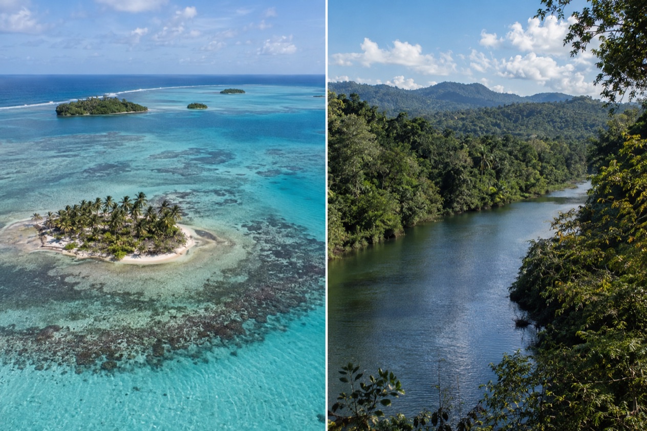
On Caye Caulker the sand streets fill with the smell of grilled fish and the sound of flip-flops, and the Barrier Reef sits just offshore. A few hours west, in the Cayo District, the Macal River slides beneath a one-lane suspension bridge and Maya temples rise out of the forest. Belize offers both, and choosing between them comes down to whether you want salt water or green hills.
Which is better, the cayes or the Cayo District?
The cayes suit travelers who want to spend their days on and in the water, while the Cayo District suits those who want ruins, rivers and rainforest. Neither is better in general. They offer two different kinds of vacation, and the table sets them side by side.
| Category | The cayes | The Cayo District |
|---|---|---|
| Beaches | Island shores along the Belize Barrier Reef | Riverbanks of the Macal and Mopan rivers, no ocean coast |
| Vibe | Small island towns such as San Pedro and Caye Caulker Village | Twin towns of San Ignacio and Santa Elena, with forest reserves around them |
| Things to do | Reef, Hol Chan Marine Reserve, Shark Ray Alley | Caracol, Xunantunich, Cahal Pech, El Pilar, Mountain Pine Ridge |
| Nightlife | Island towns | San Ignacio town |
| Weather | Sea-influenced, with the Atlantic hurricane season June 1 to November 30 | Mountain Pine Ridge has a rainy season from July to February |
| Getting there | Flight from Belize City about 20 minutes to Ambergris Caye, or water taxi or small plane to Caye Caulker | About 63 miles (101 km) west of Belize City to San Ignacio |
| Best for | Reef lovers and water people | Ruin explorers and river and forest lovers |
Beaches and the sea
The cayes are the place for the sea. Ambergris Caye, the largest of several hundred cayes in the northernmost waters of Belize, runs about 25 miles from north to south and only about a mile across, so water is never far from wherever you are standing. Its main attractions are the Belize Barrier Reef and its beaches, and the reef is the second largest in the world.
Caye Caulker is smaller, with a village of its own and a reef lying a mile to the east. Its marine reserve covers over 9,000 acres of the Mesoamerican Barrier Reef System. The name may come from boats once being caulked in the protected bay on the island’s western side, which tells you how long people have lived by this water.
Near San Pedro, Hol Chan Marine Reserve covers coral reefs, seagrass beds and mangrove forest, and its Maya name means little channel. Shark Ray Alley and Bacalar Chico are protected areas nearby too. Sargassum is a seaweed that reaches Caribbean shores in some seasons, and it is a reason to ask your lodging about the beach in front of it.
The Cayo District has no ocean beach at all. What it offers instead are riverbanks, with the Macal River and the Mopan River as the major waterways. They make a lovely setting, but they are not a substitute for a day on the reef.
The winner here is clear: the cayes, by a wide margin. If sand, sea views and time on a boat sit at the top of your wish list, the islands are the answer, and the Cayo District works best as a second stop.
Things to do
The cayes revolve around the reef. Boat trips head out to Hol Chan Marine Reserve, which sits 4 miles south of San Pedro, and to Shark Ray Alley. Bacalar Chico, another protected area of the San Pedro region, adds a quieter, wilder side. On Caye Caulker, the day is built around the village and the reserve beside it.
In the evening, the island towns turn to seafood, rum drinks and music. Food is part of the pleasure: grilled fish, lobster when it is in season and rice and beans are staples of the Belizean table. You walk from dinner to the dock and watch the lights on the water.
Maya ruins around San Ignacio
The Cayo District holds several pre-Columbian Maya sites, including Caracol, Xunantunich, Cahal Pech, Baking Pot, Lower Dover and El Pilar. Xunantunich sits on a ridge above the Mopan River, a short way from the Guatemala border. Its core holds six plazas surrounded by more than 26 temples and palaces, and El Castillo rises 130 feet, the second tallest structure in Belize.
Cahal Pech overlooks the point where the Macal and Mopan rivers meet, and it shows evidence of habitation going back to 1200 BCE. It has 34 structures and is one of the oldest recognizably Maya sites in western Belize. Caracol is the giant. Its largest building, Caana, stands 141 feet tall and is the tallest manmade structure in Belize, and the area has been a national park since 1991.
| Site | Place |
|---|---|
| Caracol | About 40 kilometers south of Xunantunich and San Ignacio |
| Xunantunich | About 70 miles (110 km) west of Belize City |
| Cahal Pech | Near San Ignacio |
Mountain Pine Ridge and the rivers
Mountain Pine Ridge Forest Reserve was set up in 1944 to protect native pine forest and covers roughly 430 square kilometers. Elevation averages between 400 and 700 meters, and the highest point, Baldy Beacon, reaches 1,017 meters. The Macal River forms its western and southern boundaries. The pines and hills give the landscape a very different feel from the lowland coast.
San Ignacio and Santa Elena are joined by the Hawkesworth Bridge, the only suspension bridge in Belize, one lane wide and built in 1949. Together the two towns form the third largest urban area in the country, so evenings here mean restaurants, markets and a lively street scene.
Weather and the best time to go
Both areas are warm all year, and the seasons differ more in how they are felt than in temperature. In Belize City, January highs average in the low 80s and July highs in the upper 80s, with nights in the upper 60s in January and the upper 70s in July. Those readings give a fair sense of the coast’s range: pleasant in winter and properly hot in summer.
| Belize City | January | July |
|---|---|---|
| Average high (°F) | 83.2 | 89.3 |
| Average low (°F) | 68.0 | 77.0 |
| Precipitation (inches) | 4.97 | 5.73 |
| Days with rain | 10.3 | 11.8 |
For the cayes, the Atlantic hurricane season runs from June 1 to November 30, so a trip in those months falls inside it. The reef and the water are the main draw, which makes weather matter more here than inland, since days on a boat depend on it.
In the Cayo District, Mountain Pine Ridge has a rainy season from July to February and a dry season from February to May. That gives the late winter and spring months a clear identity for ruins and forest walks, while the rainy months turn the hills and rivers lush and green.
If you want to do both on one trip, the months from February to May fit the dry season of the hills, and they sit outside the hurricane season on the coast. Either way, the sea stays warm, and the hills never get cold in a way that changes what you pack for the lowlands.
Getting there and getting around
Most routes begin in Belize City. From there, a flight to Ambergris Caye takes about 20 minutes. Caye Caulker lies about 20 miles north-northeast of Belize City and can be reached by high-speed water taxi or by small plane to Caye Caulker Airport.
Once on the islands, you are on a small piece of land. Ambergris Caye is long and narrow, with San Pedro on its southern part. Caye Caulker is about 5 miles long, and on its village council the registration of vehicles is handled by monthly discussions held on the last Thursday of each month, a sign of how closely the island manages traffic.
San Ignacio sits on the banks of the Macal River in western Belize, about 63 miles west of Belize City and 22 miles west of Belmopan, the capital. A bus from San Ignacio to Belmopan takes about an hour, and Hopkins is 87 miles away, reached by bus via Belmopan in about three hours.
From San Ignacio the ruins fan out. Xunantunich lies about 70 miles from Belize City, and Caracol is reached by a road that is paved for its last 9.9 miles and links to the Western Highway between San Ignacio and Belmopan and to Santa Elena. La Loma Luz Hospital in Santa Elena serves the twin towns.
Who should choose which
Choose the cayes if the reef is the point of the trip. Caye Caulker fits those who prefer a smaller village by the sea, with a protected marine reserve at its doorstep.
Choose the Cayo District if you are drawn to history and green country: Caracol, Xunantunich and Cahal Pech, the rivers, and the pine forest of the ridge. It suits people who like to move between towns, ruins and trails, and who would rather end the day by a river than on a dock.
Combining them is natural, since the cayes and the Cayo District sit in the same small country and both start from the Belize City area. A few days in the hills and a few on an island give you the two faces of Belize, forest and reef, without repeating yourself.
Good to know before you go
The U.S. State Department rates Belize Level 2, “Exercise increased caution”, because of crime, and says the south side of Belize City has historically had the highest concentration of violent crime.
The currency question is simple to plan for: bring a mix of payment options and expect to use the Belize dollar locally. On the coast, remember that the Atlantic hurricane season runs from June 1 to November 30. In the hills, Mountain Pine Ridge sits at a higher elevation than the lowlands, which changes the feel of the air in the evenings.
Sources
- Wikipedia, Ambergris Caye (https://en.wikipedia.org/wiki/Ambergris_Caye), checked October 11, 2026
- Wikipedia, San Pedro Town (https://en.wikipedia.org/wiki/San_Pedro_Town), checked October 11, 2026
- Wikivoyage, Ambergris Caye (https://en.wikivoyage.org/wiki/Ambergris_Caye), checked October 11, 2026
- Wikivoyage, San Pedro (Belize) (https://en.wikivoyage.org/wiki/San_Pedro_(Belize)), checked October 11, 2026
- Wikipedia, Hol Chan Marine Reserve (https://en.wikipedia.org/wiki/Hol_Chan_Marine_Reserve), checked October 11, 2026
- Wikipedia, Caye Caulker (https://en.wikipedia.org/wiki/Caye_Caulker), checked October 11, 2026
- Wikivoyage, Caye Caulker (https://en.wikivoyage.org/wiki/Caye_Caulker), checked October 11, 2026
- Belize Fisheries Department, Caye Caulker Marine Reserve (https://fisheries.gov.bz/ccmr/), checked October 11, 2026
- Caye Caulker Village Council, Traffic (https://www.cayecaulkervillagecouncil.org/traffic), checked October 11, 2026
- Caye Caulker Village Council, About (https://www.cayecaulkervillagecouncil.org/about), checked October 11, 2026
- Wikipedia, San Ignacio, Belize (https://en.wikipedia.org/wiki/San_Ignacio,_Belize), checked October 11, 2026
- Wikivoyage, San Ignacio (Belize) (https://en.wikivoyage.org/wiki/San_Ignacio_(Belize)), checked October 11, 2026
- Wikipedia, Cayo District (https://en.wikipedia.org/wiki/Cayo_District), checked October 11, 2026
- Wikipedia, Xunantunich (https://en.wikipedia.org/wiki/Xunantunich), checked October 11, 2026
- Wikipedia, Cahal Pech (https://en.wikipedia.org/wiki/Cahal_Pech), checked October 11, 2026
- Wikipedia, Caracol (https://en.wikipedia.org/wiki/Caracol), checked October 11, 2026
- Wikipedia, Mountain Pine Ridge Forest Reserve (https://en.wikipedia.org/wiki/Mountain_Pine_Ridge_Forest_Reserve), checked October 11, 2026
- Wikivoyage, Mountain Pine Ridge (https://en.wikivoyage.org/wiki/Mountain_Pine_Ridge), checked October 11, 2026
- NOAA NCEI, GHCN-Daily station BHM00078583 (Philip S. W. Goldson International Airport, Belize City), normals 1991-2020 computed from the daily record (https://www.ncei.noaa.gov/access/services/data/v1?dataset=daily-summaries&stations=BHM00078583), checked October 11, 2026
- U.S. Department of State, Belize Travel Advisory, Level 2, March 11, 2026 (https://travel.state.gov/), checked October 11, 2026
- NOAA National Hurricane Center, Climatology (https://www.nhc.noaa.gov/climo/), checked October 11, 2026