
At dawn on a caye in Belize, the water turns from gray to turquoise while someone down the lane fries fry jacks and the talk around you is in English, Creole and Spanish. Across the border in Guatemala, mist lifts off the jungle around Tikal and the howler monkeys start up long before the first temple catches the sun. One country is built around a barrier reef, the other around a Maya heartland, volcanoes and colonial streets, and choosing between them comes down to what you want your days to be made of.
Which is better, Belize or Guatemala?
Belize is better for travelers who want a reef, a small island and an English-speaking country, while Guatemala is better for those who want big Maya cities, colonial architecture and highland scenery. Neither is better in general. They answer different questions, and the table lays out where each one leads.
| Category | Belize | Guatemala |
|---|---|---|
| Beaches | Cayes on the barrier reef, with atolls farther out | A Pacific coast to the south and a short Caribbean stretch near Puerto Barrios |
| Vibe | Small, relaxed, English-speaking, with Creole, Garifuna, Maya and Mennonite communities | Spanish-speaking, with a strong Maya presence, colonial towns and volcano country |
| Things to do | Snorkeling and diving, the Great Blue Hole, rainforest lodges, Maya sites in the Cayo District | Tikal, Antigua, Lake Atitlán, markets, volcano landscapes |
| Nightlife | Evenings on the cayes and in San Ignacio | Antigua and Guatemala City after dark |
| Weather | Dry season from February to May, rainy season through November | Highland cities, a wet Caribbean coast, a Pacific coast to the south |
| Getting there | Belize City is the largest city, with the cayes offshore | La Aurora International Airport in Guatemala City, with flights on to Flores |
| Best for | Reef trips and a first taste of Central America in English | Maya history, culture and scenery |
Where the two countries overlap is the Maya world. Guatemala holds the core of that civilization and Belize holds a string of its sites, so a trip to either can include temples rising out of the forest. The difference is scale and setting. In Guatemala the ruins are the headline, and in Belize they sit alongside the sea.
Language shapes the feel of a trip more than people expect. In Belize you order, ask directions and chat with a guide in English, which is the official language. In Guatemala, Spanish is the official language, and a few phrases will take you a long way in markets and small towns.
Beaches and the sea
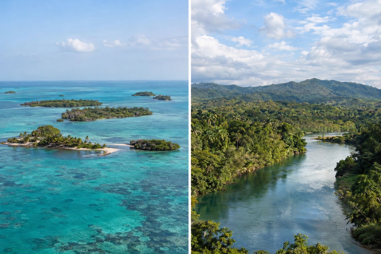
Belize is the country to choose for the sea. The Belize Barrier Reef is the second-largest coral reef system in the world and a UNESCO World Heritage Site, and it runs along the entire coast. Close to the north it lies about 980 feet offshore, while in the south it sits about 25 miles out. That is why the beach days here are really reef days, built around boats, snorkel masks and small islands.
Out beyond the reef are the three atolls, Turneffe Atoll, Glover’s Reef and Lighthouse Reef. Lighthouse Reef is the most easterly diving area in Belize and holds the Great Blue Hole, made famous by Jacques Cousteau in 1970. Closer in, San Pedro on Ambergris Caye lies about 45 miles off the coast, and Caye Caulker has the Split, a channel cut by Hurricane Hattie in 1961 that has become a favorite spot to sit with a drink and watch the water.
Guatemala has two quite different coasts. The Pacific side, to the south, is a long stretch of dark volcanic sand backed by fishing villages and the green slopes of the volcano chain. The sea there is a place to walk, watch surfers and eat grilled fish, and it is not the soft turquoise postcard that Belize sells.
On the other side, the country touches the Gulf of Honduras to the northeast, and the Caribbean town of Puerto Barrios is the main port there. This coast is green, humid and hot, and it is far more about river mouths and the sea road to Garifuna villages than about resort beaches. Sargassum can reach Caribbean shores, and the Belize Tourism Board has addressed it, so the sea along either Caribbean coast may look different from one week to the next.
For the water itself, Belize wins and it is not close. If your picture of the trip includes a mask and fins, a boat to a patch of reef or an evening on a dock, you want Belize. Guatemala’s coasts are for travelers who already plan to be there for the mountains and the ruins and want a day by the ocean added on.
Things to do
Belize packs its activities into a small country. On the water you have snorkeling and diving along the reef, with Hol Chan and Shark Ray Alley as names that come up around Ambergris Caye and Caye Caulker, and the Great Blue Hole as the dive that divers dream about. On land, the Cayo District around San Ignacio is the base for rainforest lodges, rivers and caves, including the cave known as Actun Tunichil Muknal.
Maya sites are scattered across the country. Xunantunich and Cahal Pech are in the Cayo District, Caracol lies deep in the forest, Lamanai sits beside a lagoon in the north, and Altun Ha is a short name that appears on many itineraries. Wildlife adds another layer. The keel-billed toucan is the national bird, and the Cockscomb Basin Wildlife Sanctuary and the Belize Zoo are places to see the animals of the forest.
Food in Belize is a mix of its communities. Rice and beans with stew chicken is the everyday plate, fry jacks turn up at breakfast, and Garifuna kitchens serve hudut, fish in coconut broth with mashed plantain. Evenings are about rum punch on a caye, a drink in a San Ignacio bar or a plate of grilled lobster when the season allows.
Guatemala is bigger in every way, and its first draw is Tikal. Long considered the largest of the Maya ruins, it was declared a UNESCO World Heritage Site in 1979, and the national park around it protects 570 square miles of forest, savanna and wetland. Flores, an island town in Petén, serves as a good starting point for reaching it, and the park is also where you hear toucans and monkeys before you see the temples.
Petén holds the largest concentration of Classic period Maya sites in the country. El Mirador was by far the most populated city in pre-Columbian America, and its El Tigre and Monos pyramids are enormous. These are far fewer travelers’ stops than Tikal, but they show how deep the Maya story runs in northern Guatemala.
Away from the jungle, Antigua Guatemala is a UNESCO World Heritage Site and the former colonial Spanish capital of Central America. Its cobbled streets, ruined churches and views of volcanoes make it a place to wander slowly. Lake Atitlán, ringed by volcanoes and lakeside villages, and highland markets like Chichicastenango add color, with woven textiles in every stall.
The Guatemalan table is built on corn and the highlands. You find pepián, a rich spiced stew, kak’ik, a turkey soup from the Maya Q’eqchi’ tradition, tamales wrapped in banana leaf and coffee grown on the surrounding slopes. Nightlife is livelier in Antigua and Guatemala City than in most of the countryside, and in Antigua the evening is built around rooftop bars and mezcal.
Weather and the best time to go
Belize has a dry season that typically runs from February to May and a rainy season that typically lasts through November. Hurricanes that bring coastal flooding, especially in the south of Belize, are prevalent from June to November, and the Atlantic season officially runs from June 1 to November 30. The months at either end of the year therefore feel very different on the coast and in the forest.
In Belize City, January highs average 83.2°F, with lows near 68.0°F, so evenings are comfortable and the sun is gentle. July is hotter and wetter, with highs near 89.3°F and lows close to 77.0°F, and rain falls on about twelve days. The sea follows the air, so a summer reef trip means warm water and a bright sky when the rain holds off.
Guatemala does not behave like one climate, because altitude changes everything. Guatemala City sits in the highlands, with spring-like days and cool nights. The average maximum is 80.6°F in April and May, and the average low drops to 55.8°F in January, so a sweater belongs in your bag.
The Caribbean side is a different world. Puerto Barrios, on the coast, ranges from 68.3°F in January to nearly 85°F in March, and it takes 121.1 inches of rain over the year. That is a wet, green lowland, with humidity you can feel from the dock.
If you want to combine the two, the shoulder of the dry season is a sensible window. February through May gives Belize its drier months for boats and jungle trails, and Guatemala’s highland cities are most comfortable then as well. The rainy months work too, with fewer crowds at the ruins and greener forest, as long as you accept wet days and the possibility of a tropical system on the Belize coast.
The practical rule is simple. For the reef, pick the dry months and keep the hurricane season in mind when you book flights and boat days. For Tikal, Antigua and Atitlán, plan for layers, because mornings and evenings in the highlands are cool whenever you go.
Getting there and getting around
Belize City is the largest city in Belize and the usual starting point, and Belmopan is the capital. From there the cayes lie offshore.
San Pedro Town on Ambergris Caye is about 45 miles east off the coast, and Turneffe Atoll lies directly east of Belize City as the nearest of the atolls. Inland, San Ignacio sits on the banks of the Macal River, about 63 miles west of Belize City and 22 miles west of Belmopan.
San Ignacio and its sister town Santa Elena are joined by the one-lane Hawkesworth Bridge, Belize’s only suspension bridge, built in 1949. Together they form the country’s third largest urban area, and they work as a base for the Cayo District. The westernmost town in the country, Benque Viejo del Carmen, lies 81 miles by road from Belize City, right on the border.
Guatemala’s gateway is Guatemala City, the capital and the largest city, home to La Aurora International Airport. From there, regular domestic flights run only between Guatemala City and Flores, operated by Transportes Aéreos Guatemaltecos and Avianca. Flores is the island capital of Petén, and Tikal lies about 40 miles from it by road to the southwest.
Antigua Guatemala and Lake Atitlán are in the highlands, in a different direction from the northern jungle, so Guatemala rewards a plan that picks regions rather than trying to touch everything. Belize is the opposite, a small country where reef, river and ruins are all within one trip.
The two countries meet at one point. Melchor de Mencos, on the eastern edge of Petén, is the only major border crossing from Guatemala to Belize, and across from it stands Benque Viejo del Carmen. That makes a land route between Tikal and the Cayo District possible, and it is the natural hinge of any trip that combines the two.
Who should choose which
Choose Belize if the sea is the point. It suits divers and snorkelers, couples who want a caye and a dock, travelers who like speaking English with the person who runs the boat, and anyone who wants a rainforest lodge and a beach in the same trip. It also suits people for whom this is a first trip to Central America, because the country is small and the language is familiar.
Choose Guatemala if culture and landscape matter more. It suits travelers who want to stand in front of the great Maya temples at Tikal, walk Antigua’s cobbled streets, watch the volcanoes over Lake Atitlán and shop in a highland market. It also suits those who want a meal cooked from corn, chile and coffee that tastes like the place it came from, and who are comfortable using some Spanish.
Combining them works well because the border at Melchor de Mencos links the Cayo District to Petén. A common shape is the reef and cayes on one side, then the jungle and ruins on the other, with San Ignacio and Flores as the two anchors. Each country then gets the part of the trip it does best.
If you have only a single trip and must pick, let the first image in your head decide. If it is water, take Belize. If it is a temple above the treetops or a volcano at sunset, take Guatemala. Either way you meet the Maya world, just from a different side.
Good to know before you go
The U.S. State Department rates Belize Level 2, “Exercise increased caution”, because of crime, and says the south side of Belize City has historically had the highest concentration of violent crime.
Belize’s money is the Belize dollar, and Guatemala’s is the quetzal, so plan a little cash for small purchases in markets and villages on both sides. Crime exists in both countries, and in Belize the south side of Belize City has historically had the highest concentration of violent crime.
In Guatemala, the Tourist Assistance Program (ASISTUR) and its tourist police are present in places like Antigua, Lake Atitlán, Tikal and Puerto Barrios, and its call center operates in Spanish and English. U.S. government employees can travel to Tikal, Antigua, Lake Atitlán and the Pacific coast areas of Santa Rosa and Escuintla.
Sources
- Wikipedia, Belize (https://en.wikipedia.org/wiki/Belize), checked October 11, 2026
- Wikivoyage, Belize (https://en.wikivoyage.org/wiki/Belize), checked October 11, 2026
- Wikipedia, Tourism in Belize (https://en.wikipedia.org/wiki/Tourism_in_Belize), checked October 11, 2026
- Wikipedia, Wildlife of Belize (https://en.wikipedia.org/wiki/Wildlife_of_Belize), checked October 11, 2026
- U.S. Department of State, Belize Travel Information, Travel Advisory (Level 2) (https://travel.state.gov/), checked October 11, 2026
- U.S. Department of State, Belize Travel Information, Entry and exit requirements (https://travel.state.gov/), checked October 11, 2026
- Wikipedia, Guatemala (https://en.wikipedia.org/wiki/Guatemala), checked October 11, 2026
- Wikivoyage, Guatemala (https://en.wikivoyage.org/wiki/Guatemala), checked October 11, 2026
- U.S. Department of State, Guatemala Travel Advisory (https://travel.state.gov/), checked October 11, 2026
- U.S. Department of State, Guatemala Travel Information, Entry and exit requirements (https://travel.state.gov/), checked October 11, 2026
- Wikipedia, Tikal (https://en.wikipedia.org/wiki/Tikal), checked October 11, 2026
- Wikipedia, Melchor de Mencos (https://en.wikipedia.org/wiki/Melchor_de_Mencos), checked October 11, 2026
- Wikipedia, Benque Viejo del Carmen (https://en.wikipedia.org/wiki/Benque_Viejo_del_Carmen), checked October 11, 2026
- Wikipedia, San Ignacio, Belize (https://en.wikipedia.org/wiki/San_Ignacio,_Belize), checked October 11, 2026
- NOAA NCEI, GHCN-Daily station BHM00078583 (Philip S. W. Goldson International Airport, Belize City), normals 1991-2020 computed from the daily record (https://www.ncei.noaa.gov/access/services/data/v1?dataset=daily-summaries&stations=BHM00078583), checked October 11, 2026
- U.S. Department of State, Belize Travel Advisory, Level 2, March 11, 2026 (https://travel.state.gov/), checked October 11, 2026
- NOAA National Hurricane Center, Climatology (https://www.nhc.noaa.gov/climo/), checked October 11, 2026