
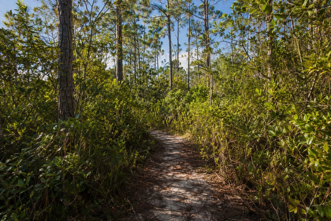
You leave the road near Freeport and step into a quiet of pine needles, mangrove roots and the dry rustle of palmetto, with a boardwalk running off into the trees. Somewhere ahead the ground opens into a cave, its water as clear as glass. Lucayan National Park is a half-day of walking on Grand Bahama, with limestone holes, tidal creeks and a long, empty beach at the far end.
Is visiting Lucayan National Park worth it?
Yes, if you like to walk, look closely and spend a morning outdoors, and especially if you are curious about what lies under the Bahamian limestone. The park suits travelers who want a break from the resort strip and from the beach-and-bar rhythm of the island. It rewards patience more than adrenaline.
What sets it apart from other outings on Grand Bahama is how many landscapes it holds in a small footprint. Pine forest, mangrove, tidal creek, dune and beach follow one another along the trails, and the caves beneath them belong to one of the largest underwater cave systems in the world.
Grand Bahama has three parks, and this is the star of them. The water inside the caves is for looking at, since swimming there is prohibited, which keeps the visit calm and unhurried.
It also works well with a mixed group. Birders have a real reason to come, divers have a rare place to aim for, and anyone who just wants shade, a boardwalk and a picnic by the sea will find all three in the same visit.
What to see at Lucayan National Park
The park is built around a walk from the forest to the shore, with the caves as the centerpiece in the middle. Two caves are open to the public, and the rest of the visit is trails, boardwalks and a beach.
Ben’s Cave and the blue holes
Ben’s Cave is one of the inland blue holes inside the park, a deep round opening in the limestone that you look down into from above. It is named for Ben Rose, a UNEXSO legend, and divers still speak of it with respect. The clear upper layer of water is fresh and floats on top of the salt water below, so the surface looks still and almost colorless.
From the stairs and platforms you can pick out the shapes of the rock and the way the light fades with depth. Beneath you the passages stretch horizontally for thousands of yards, and the cavern system is deemed one of the longest surveyed in the world.
Divers who go in with an authorized instructor describe stalactites, stalagmites, a halocline where fresh water meets salt, and fossilized conch shells and bivalves. Visitors on foot see none of that, but the stillness of the water makes the scale easy to imagine.
Nature trails and boardwalks
Trails and boardwalks lead through a variety of ecosystems, which is the quiet pleasure of the park. You pass under Caribbean pine, move onto planked walkways over mangrove and tidal creek, and come out among low dune vegetation where the air smells of salt. The boardwalks keep your feet off the fragile ground and let you look straight down into the roots and shallows.
Go slowly and listen. The park is an Important Bird Area, with habitat for the thick-billed vireo, the Bahama swallow and the olive-capped warbler, so a pair of binoculars earns its place in your bag. Early in the day the forest is most talkative, and lizards, butterflies and small birds move along the edges of the path.
Gold Rock Beach
The walk ends at Gold Rock Beach, part of the park and protected by the Bahamas National Trust. It is described as secluded and spectacular, and the picture fits: a wide pale shore with the sea running out along it and little else in sight. At low tide the shoreline stretches yards into the sea, and it has earned the nickname of Grand Bahama’s welcome mat.
The facilities are simple. There are BBQ pits, picnic tables and benches, and nothing else, so the beach feels more like a picnic ground than a beach club. Sit on a bench, watch the tide pull back across the flats and let the visit finish without a schedule.
The world under the park
The caves you look into are only a window onto a much larger system. The park’s underwater passages include about 6.4 miles of charted tunnels, and the Lucayan Caverns lie just across the road from Gold Rock Beach. Science came here before tourism did: the Remipedia class of crustaceans was discovered in the area in 1979, before the park was created.
None of this is visible from the boardwalk, which is part of the charm. You stand above a hidden landscape, and the fresh water, the salt water and the dark limestone work on the imagination more than a sign could.
Hours, tickets and rules
The rules at Lucayan National Park protect the caves and the water, and they are few and clear. You look into the caves from above, you walk the marked trails, and anything that involves going into the water belongs to trained divers.
| Site | Access |
|---|---|
| The park’s public caves | Open to the public, swimming prohibited |
| Ben’s Cave (diving) | Authorized dive instructor required, special permit required for diving |
| Gold Rock Beach | Part of the park, protected by the Bahamas National Trust, with BBQ pits, picnic tables and benches |
Swimming in the caves is prohibited, and diving requires a special permit. At Ben’s Cave you must be accompanied by an authorized dive instructor, and the arrangements are made before the dive date. Picnic tables stand on the beach, and the park’s amenities beyond those are limited to what is described here.
How to get to Lucayan National Park
The park is on Grand Bahama island, near the city of Freeport, and that is the base most visitors start from. Ben’s Cave is likewise near Freeport, so the same starting point serves both the caves and the beach.
Gold Rock Beach lies about 25 miles from Freeport, and the Lucayan Caverns are north of it, across the street. That layout shapes the visit: the caves and the sea face each other on either side of the road, so you can see the one and walk to the other without starting over somewhere else.
Think of the trip as an outing from Freeport rather than a stop in a town. You are heading to a protected area with forest on one side and shore on the other, and the sense of leaving the resort districts behind is part of why people make the trip. Plan to make it a deliberate morning or afternoon, with enough room to walk the trails and still reach the beach at the end.
If you want a dive arranged, the arrangement happens before the day itself, through the park contact given in the tips. The cave dive is not something you decide on at the entrance.
When to visit Lucayan National Park
Go early in the day if you can. The forest is cooler under the pines, the birds are most active, and the light on the water inside the caves is soft before the sun climbs high. A morning start also leaves the beach for later, when a picnic and a bench in the open feel earned.
The park is a good fit for the cooler, drier part of the year, when walking on boardwalks and under pines is most comfortable. Summer visits are possible too, but the heat sits heavier on the trails and the afternoon showers can arrive suddenly, so shade and water matter more. The tide matters at the shore: at low tide Gold Rock Beach shows its wide, uncovered flats, which is the moment to see it.
The Atlantic hurricane season runs from June 1 to November 30, and a trip planned in those months should keep a little flexibility in the days. Outside those dates the calendar is simpler. There is no special festival tied to the park, so the best moment is mostly a matter of light, tide and your own energy.
Birders will want the early hours above all. The thick-billed vireo, the Bahama swallow and the olive-capped warbler are the names to listen for, and a quiet pace along the boardwalks gives you the best chance of noticing them.
Tips for your visit
Bring what a day outdoors asks for: comfortable shoes for boardwalks and sandy paths, water, a hat, and binoculars if you have them. A camera suits the park well, since the blue holes, the creeks and the long beach all photograph easily. Since the beach has tables and BBQ pits but no other amenities, bring your own food and drink if you want to picnic.
Plan the visit as a loop with a payoff: forest first, caves in the middle, beach last. That order lets the day build, and it saves the open shoreline for when you have had your fill of shade. Take your time at the water’s edge, because at low tide the sea pulls well out and the flats are the best part of the shore.
Families will find the boardwalks and the picnic tables a natural rhythm for a morning, with the caves as a look-but-don’t-swim stop. Remember the rule that swimming in the caves is prohibited, and keep children at the viewing points. For questions about the park, the contact is Mrs. Cecilia Bodie at (242) 352-5438, the same number given for Ben’s Cave.
The park pairs well with a quiet afternoon rather than another busy stop. A swim-free, walking-and-picnic day on Grand Bahama is a different pace from Freeport itself, and the best way to keep it that way is to leave the rest of the schedule open.
Good to know before you go
The U.S. State Department rates the Bahamas Level 2, “Exercise increased caution”, and says most crime occurs in Nassau on New Providence and in Freeport on Grand Bahama.
The Bahamas uses its own dollar, but the park’s practical side is simple: plan to bring what you need for a picnic and for a few hours outdoors, because the beach offers tables and pits and nothing more. Stay on the boardwalks and marked paths, which protect both the ground and the visitor. The Atlantic hurricane season runs from June 1 to November 30, so a trip in those months deserves a flexible plan, and the park is a place to see on a clear day.
Sources
- Bahamas Ministry of Tourism, Investments & Aviation (bahamas.com), Lucayan National Park (https://www.bahamas.com/natural-wonders/lucayan-national-park), checked October 10, 2026
- Wikipedia, Lucayan National Park (https://en.wikipedia.org/wiki/Lucayan_National_Park), checked October 10, 2026
- Bahamas Ministry of Tourism, Investments & Aviation (bahamas.com), Gold Rock Beach (https://www.bahamas.com/natural-wonders/gold-rock-beach), checked October 10, 2026
- Bahamas Ministry of Tourism, Investments & Aviation (bahamas.com), Bens Cave (https://www.bahamas.com/natural-wonders/bens-cave), checked October 10, 2026
- U.S. Department of State, The Bahamas Travel Advisory, Level 2 (https://travel.state.gov/), checked October 10, 2026
- NOAA National Hurricane Center, Climatology (https://www.nhc.noaa.gov/climo/), checked October 10, 2026
To plan your stay
- Best Time to Visit the Bahamas: Weather, Hurricane Season, Sea Temperatures and Junkanoo
- Where to Stay in the Bahamas: Best Islands, Resorts, Boutique Stays and How to Choose
- Getting Around the Bahamas: Flights, Ferries, Mailboats and Taxis in Nassau
- Know Before You Go to the Bahamas: Entry Rules, Money, Getting Around and Local Customs