
Somewhere around Dawson Creek, with a full tank and a well-worn guidebook on the passenger seat, the question stops being abstract: how do you actually get a car to Alaska? The answer runs through Canada. From the Lower 48 you drive north into British Columbia, follow the Alaska Highway through the Yukon, and cross back into Alaska on the final stretch.
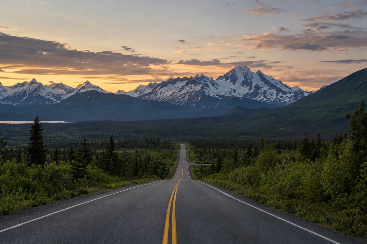
How do you drive to Alaska from the Lower 48?
You drive north out of the Lower 48, cross into Canada, and follow the Alaska Highway, which begins in Dawson Creek, British Columbia, and ends at Delta Junction, Alaska. There is no road that stays on U.S. soil the whole way, so the trip is really a drive through two provinces and territories before you arrive. People from the Pacific Northwest start by heading north from a city such as Seattle, which sits on an isthmus between Puget Sound and Lake Washington, about 100 miles south of the Canadian border.
The Alaska Highway opened to the public in 1948, and the old reputation of a rough, punishing track has faded. The road is now paved over its entire length. It is still a long, remote drive, and it rewards the kind of planning that people did with paper maps in the old days.
Planning the drive
The Milepost, a thick guidebook to the Alaska Highway and the other highways of Alaska and Northwest Canada, has been published every year since 1949. It is recommended for planning the trip and comes in print or as an eBook. Many drivers keep it open on the seat and read it town by town, since it tells you what each stretch holds.
Daylight shapes the day. Along the highway there are more than 20 hours of sunlight in summer and fewer than 5 hours in midwinter, so a summer driver can keep going late into the evening, while a winter driver has a very short window of light.
Gas, phones and the stretches in between
Gas stations along the Alaska Highway in Canada are often not open 24 hours, especially in winter, and most lack pay-at-the-pump. That means going inside, waiting for the attendant and paying at the counter.
Every Yukon community along the highway has cell service in its vicinity, but coverage is sparse elsewhere. Expect quiet stretches where the phone shows nothing, and download your maps and music before you leave town.
If you would rather not drive the whole way
Whitehorse airport is served by Air Canada, Air North and Westjet, with nearly all flights to or from Vancouver. Once you are in Alaska, Interior Alaska Bus Line runs year-round on Mondays, Wednesdays and Fridays between Tok and Anchorage, and between Tok and Fairbanks. Both are handy if part of the trip has to be done without your own car.
Which roads do you take through Canada?
The main road is the Alaska Highway itself, which is made up of British Columbia Highway 97, Yukon Highway 1 and Alaska Route 2. It starts at the junction with Highway 2 and Highway 97 in Dawson Creek, British Columbia, passes through Whitehorse in the Yukon, and ends at Delta Junction, Alaska. The numbers change at each border, but the road is the same ribbon of pavement, and the signs make it easy to follow.
Dawson Creek to Whitehorse
Dawson Creek is the starting point, the town where the highway meets Highway 2 and Highway 97. From there the road follows British Columbia Highway 97 and then crosses into the Yukon, where it becomes Yukon Highway 1. Along the way, a replica log bridge called the Canyon Creek bridge crosses the Aishihik River and is a popular tourist stop. It was rebuilt in 1987 and refurbished in 2005 by the Yukon government.
Whitehorse is the natural pause. It is the capital of Yukon and the largest city in Northern Canada, found at kilometre 1426 (Historic Mile 918) on the highway.
The city takes its name from the White Horse Rapids, which disappeared under Miles Canyon and Schwatka Lake after a hydroelectric dam was built in 1958. It has a subarctic climate that is milder than comparable northern communities because of its sheltered valley, and it is Canada’s driest city.
If you want a break from the wheel, Whitehorse has four museums: the MacBride Copperbelt Mining Museum, the MacBride Museum of Yukon History, the Yukon Beringia Interpretive Centre and the Yukon Transportation Museum. Summer days here have up to about 19 hours of daylight, so there is time to see one and still get back on the road.
The Stewart-Cassiar alternative
Highway 37, the Stewart-Cassiar Highway, is 447 miles long and intersects the Alaska Highway about 1.9 miles north of the British Columbia-Yukon border. It is the other route drivers weigh when planning a north-bound trip. It joins the main road rather than replacing it, so you still finish the journey on the Alaska Highway.
Into Alaska: Delta Junction and Fairbanks
The Alaska Highway ends at Delta Junction, at Historic Milepost 1422. From there the Richardson Highway continues 96 miles to Fairbanks, which is often unofficially regarded as the northwestern portion of the Alaska Highway at Historic Milepost 1520. Many drivers treat Fairbanks as the real finish line.
Once you are in Alaska, the Alaska 511 site is useful for road conditions. It uses categories such as Good, Fair, Difficult, Very Difficult, Hazardous, Road Closure and No Winter Maintenance, and it publishes Waze-reported incidents and closures through a partnership between the Alaska Department of Transportation and Waze. You can create an account to save routes, and route notifications are sent by default on weekdays from 6 AM to 6 PM via SMS.
What do you need at the border?
You need proof of identity and citizenship, and for most U.S. citizens driving in, that means a passport or one of the other documents accepted for land crossings. The same documents matter again on the way back into the United States, since the route crosses the border twice. Land border wait times for crossing from the United States into Canada can be checked ahead of time.
Documents for U.S. citizens by land
U.S. citizens entering by land or sea can present a valid U.S. Passport, Passport Card, Enhanced Driver’s License, Trusted Traveler Program card (NEXUS, SENTRI or FAST), U.S. Military ID on official orders, U.S. Merchant Mariner document, Form I-872 American Indian Card, or Enhanced Tribal Card. A passport remains the only reliable and universally accepted travel identification document, and it proves your right to return home.
If you cross often, a NEXUS card will save you time at the border. U.S. Lawful Permanent Residents are still required to present their permanent resident card (Form I-551) or other valid evidence of permanent residence status.
Children and families
U.S. and Canadian citizen children under age 16, or under 19 if traveling with a school, religious or youth group, can present a birth certificate (original, photocopy or certified copy) or other proof of citizenship for land or sea entry. That makes a family road trip simpler on paper, though a passport is still the cleanest option to carry.
If anyone in the group flies instead, the rule changes. Children traveling by air are required to present their own passport, and an Indian or tribal card cannot be used for air travel.
At the Canadian booth and with your vehicle
Border officers may examine travelers’ digital devices at the Canadian border, so think about what your phone and laptop hold before you reach the booth. Some wildlife items need paperwork too, since CITES permits are needed to transport, import or export a listed wildlife species or items made from one.
Canadian residents have their own rules. Permanent residents of Canada need a permanent resident card to re-enter Canada, and a Canadian traveler needs a valid Canadian passport to board a flight to Canada. If you fly into Canada at the start or end of a trip, Advance Declaration in ArriveCAN lets you submit your customs and immigration declaration before arriving.
Good to know before you go
Plan around daylight, fuel and phone coverage more than anything else. Gas stations in Canada are often closed overnight, cell service thins out between towns, and the hours of light change sharply with the season. Keep your documents within reach rather than buried in the trunk, and treat Whitehorse and Delta Junction as natural places to stop, stretch and refuel before the next long run.
Sources
- Wikipedia, Alaska Highway (https://en.wikipedia.org/wiki/Alaska_Highway), checked October 11, 2026
- Wikivoyage, Alaska Highway (https://en.wikivoyage.org/wiki/Alaska_Highway), checked October 11, 2026
- Canada Border Services Agency, Cross the Canadian border (https://www.cbsa-asfc.gc.ca/travel-voyage/menu-eng.html), checked October 11, 2026
- U.S. Customs and Border Protection, Western Hemisphere Travel Initiative (https://www.cbp.gov/travel/us-citizens/western-hemisphere-travel-initiative), checked October 11, 2026
- Government of Canada, Travel documents (https://travel.gc.ca/travelling/documents), checked October 11, 2026
- Wikipedia, Whitehorse (https://en.wikipedia.org/wiki/Whitehorse), checked October 11, 2026
- Alaska 511 (https://511.alaska.gov/), checked October 11, 2026
- Wikipedia, Seattle (https://en.wikipedia.org/wiki/Seattle), checked October 11, 2026