
Somewhere over the Gulf of Alaska, with the Chugach Mountains showing through the window, travelers start looking at a map and wondering how far a rental car will take them. The honest answer is that a car or motorhome rented in Anchorage opens up a lot of the state, but the roads vary a great deal, and a few of them ask more of you than the rest.
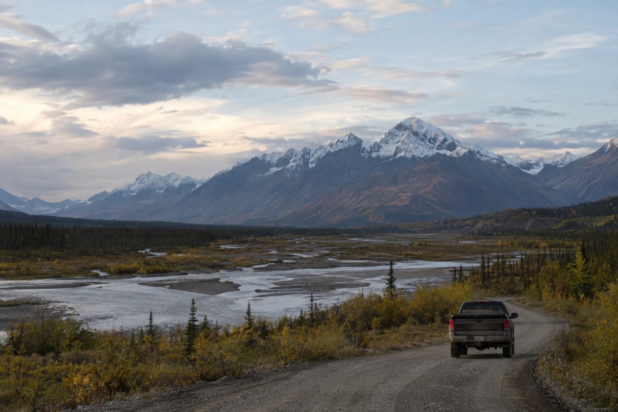
Can you rent a car in Alaska?
Yes, renting a car or a motorhome is one of the two classic ways to travel Alaska on your own, the other being the railroad. The route most independent travelers sketch is simple: fly into Anchorage, pick up a vehicle, and drive the highways from there.
Anchorage is the natural starting point because the airport sees more than 240 arriving flights every day. From there the state’s road network fans out toward the Kenai Peninsula, the interior and the Parks Highway corridor. The Anchorage visitor bureau notes that people plan at least three days in the city, which gives you time to settle in before you head out on the road.
Car, motorhome or something else
A rental car or motorhome gives you the freedom to stop where you like, and Alaska’s highways are made for that. A pullout beside a river, a lake with the mountains reflected in it, a roadside lodge where you stop for a meal: these are the pleasures of driving yourself. The Denali Highway even has dozens of pullouts where camping on public lands is possible, which suits a motorhome or a tent-carrying traveler.
Driving is only one way to organize a trip, though. You can take the Alaska Railroad, join a motorcoach tour, take a flightseeing flight or a day cruise, or sleep in a remote lodge. Many Alaska vacation packages combine motorcoach and train segments with overnight stays and activities. Some travelers mix the options, driving one stretch and letting someone else handle the next.
When the roads are at their friendliest
Days are long and temperatures comfortable anytime from mid-May to September, and hotel rates are lower in the shoulder seasons, from mid-May to mid-June and in early September. The Denali Highway, for one, is closed to all traffic from October to mid-May each year, so a trip planned outside that window leaves it off the map.
Long days also mean you can stretch a drive across a leisurely afternoon without watching the clock, then stop for dinner at a lodge or a town cafe when you feel like it. Plan your route around where you will sleep each night and let the daylight do the rest.
A first drive from Anchorage: the Seward Highway
The Seward Highway is the drive many first-timers have in mind. It runs 125 miles between Anchorage and Seward, and it carries three scenic titles at once: National Forest Scenic Byway, State Scenic Byway and All-American Road. Along the way it passes Turnagain Arm, the Chugach National Forest and the Kenai Mountains before it reaches the Kenai Peninsula.
About 72 miles of the route lie inside the national forest, so most of the drive is framed by spruce, mountains and water. Seward is the end of the line, a harbor town where day cruises head out among the fjords. The highway is also part of the unsigned Interstate system as Interstate A-3, a small curiosity for anyone who likes road trivia.
Which roads are off limits to rental cars?
Three roads call for a closer look before you sign a rental agreement: the Dalton Highway, the Denali Highway and, for a different reason, the busy Seward Highway. The two long interior roads are remote, and what makes them special is also what makes them demanding.
The Dalton Highway
The Dalton Highway begins at the Elliott Highway, north of Fairbanks, and ends at Deadhorse near the Arctic Ocean and the Prudhoe Bay Oil Fields. It is the road of the Arctic, crossing the Brooks Range at Atigun Pass, where it reaches its highest point at 4,739 feet. Its full length was opened to the general public on December 2, 1994.
This is a working road. Around 160 trucks use it each day in the summer months, and the count rises to about 250 daily in winter, so you share it with heavy freight traffic. Fuel is available at the E. L. Patton Yukon River Bridge at Mile 56, then at Coldfoot and Deadhorse, which gives you a sense of how spread out the services are.
There are rewards along the way. The Arctic Circle Wayside Rest Area at Mile 115 has a short side road leading to a viewing deck with interpretive displays. At the far end, polar bears can be seen wandering the outskirts of Deadhorse, a chance rather than a promise. Because the rental company’s own terms decide whether a contract covers this road, read that part of your agreement before you plan a northern drive.
The Denali Highway
The Denali Highway, Alaska Route 8, is a lightly traveled, mostly gravel road between Paxson on the Richardson Highway and Cantwell on the Parks Highway. It stretches 135 miles, and only the easternmost 21.3 miles and the westernmost 2.6 miles are paved. The recommended speed limit is 30 mph, which tells you what kind of drive it is: slow, with time to look around.
At Maclaren Summit the road climbs to 4,086 feet, the second highest road in Alaska. The highway is closed to all traffic from October to mid-May, so it is a summer road only. As with the Dalton, check your rental agreement for what it says about gravel roads before you head out.
| Stop on the Denali Highway | Mile marker |
|---|---|
| Denali Highway Cabins & Tours | 0.2 |
| Tangle Lakes campground | 22 |
| Maclaren River Lodge | 42 |
| Alpine Creek Lodge | 68 |
| Brushkana Creek campground | 104 |
| Backwoods Lodge | 134 |
| Cantwell Lodge | 138 |
The lodges on that list operate year-round, while the two developed campgrounds at Tangle Lakes and Brushkana Creek give you a place to pitch a tent or park a motorhome if you prefer to sleep outdoors.
The Seward Highway in summer
The Seward Highway is not a restricted road, but it deserves a mention because of its traffic. During the summer months, up to 15,000 vehicles a day use the stretch from Girdwood past the Portage curve toward Turnagain Pass, ending at Ingram Creek. That is a lot of cars for a scenic byway, so patience and a flexible schedule help.
In July 2016, Alaska DOT&PF posted updated speed limits on a five-mile section south of Anchorage, between Hope Junction and the top of Turnagain Pass: 55 mph in the right lane and 65 mph in the left lane. If you are driving there, watch the signs and keep in the lane that suits your speed.
What do you need to know before you rent?
The most useful thing to know is how to read the road before you drive it, and Alaska 511, run by the state Department of Transportation, is built for that. It publishes road conditions, closures and cameras, and it works well as a daily habit while you travel.
Reading Alaska 511
Road conditions on Alaska 511 fall into named categories: Good, Fair, Difficult, Very Difficult, Hazardous, Road Closure and No Winter Maintenance. A glance at the map tells you what the department reports on the route you plan to take. The department has also partnered with Waze to publish Waze-reported incidents and closures on the site, a free data exchange between Waze and government agencies.
The map includes cameras, so you can see for yourself what a stretch of highway looks like before you set out. On the map page you can add a camera to My Cameras by clicking a camera icon and then the My Cameras button in the popup. On the camera page, the same option sits behind the three dots below the image.
Saving routes and getting alerts
If you plan to drive several days in a row, create an account. Alaska 511 lets users save routes and receive notifications, and you must log in to save routes for future viewing. By default, route notifications arrive by text message on weekdays from 6 AM to 6 PM, which fits a normal travel day.
Setting this up at your hotel in Anchorage, before you pick up the vehicle, saves fiddling with a phone at a roadside pullout. Save the routes you actually mean to drive, for example the Seward Highway or the Parks Highway, and add a few cameras along them.
Planning the trip around the vehicle
Think about where you will sleep and eat before you choose the vehicle, because Alaska’s distances shape the trip. The Seward Highway stretches 125 miles, the Denali Highway 135 miles, and the Dalton Highway runs from the Elliott Highway to the Arctic Ocean.
Fuel is worth thinking about on the longer roads. On the Dalton, the stops are the Yukon River Bridge, Coldfoot and Deadhorse. On the Denali Highway, the lodges along the route are the points where people stop. Plan stops as part of the drive rather than an afterthought.
If the idea of driving every mile does not appeal, the alternatives are real. You can fly into Anchorage and travel by railroad, take the marine highway or fly into an Inside Passage town, or add a land tour to a cruise. A cross-Gulf cruise with a land tour is one way to see more of the interior, since cruises alone miss the highest mountains and the vast interior landscapes.
Good to know before you go
Money goes further if you plan the extras ahead: expect to budget $100 to $200 for each excursion, with one to two excursions a day. Lower hotel rates in the shoulder seasons also leave room in the budget.
The free Official Anchorage Visitor Guide includes a business directory for Anchorage and Southcentral Alaska, and the Anchorage e-newsletter offers planning tools and travel deals. Keep Alaska 511 open on your phone, and let it tell you what the road ahead looks like.
Sources
- Alaska 511 (https://511.alaska.gov/), checked October 11, 2026
- Wikipedia, Dalton Highway (https://en.wikipedia.org/wiki/Dalton_Highway), checked October 11, 2026
- Wikipedia, Denali Highway (https://en.wikipedia.org/wiki/Denali_Highway), checked October 11, 2026
- Wikipedia, Seward Highway (https://en.wikipedia.org/wiki/Seward_Highway), checked October 11, 2026
- Alaska.org, best way (https://www.alaska.org/advice/best-way-to-see-alaska), checked October 11, 2026
- Visit Anchorage, plan your trip (https://www.anchorage.net/plan-your-trip/), checked October 11, 2026