
BIG CYPRESS NATIONAL PRESERVE · APRIL · TAMIAMI TRAIL
April closes Florida’s dry season, which runs from November through April on our statewide calendar. For a trip to Big Cypress, that means you catch the last of the drier air before the wet months arrive. Mornings along the Tamiami Trail start near 70°F, and afternoons climb into the low 80s.
Four weeks later the picture changes. May brings nearly twice April’s rainfall, 6.32 inches against 3.36, so the date you book decides how much of the swamp you see from a boardwalk and how much through a windshield. If you are torn between spring months, our March guide covers the cooler option.
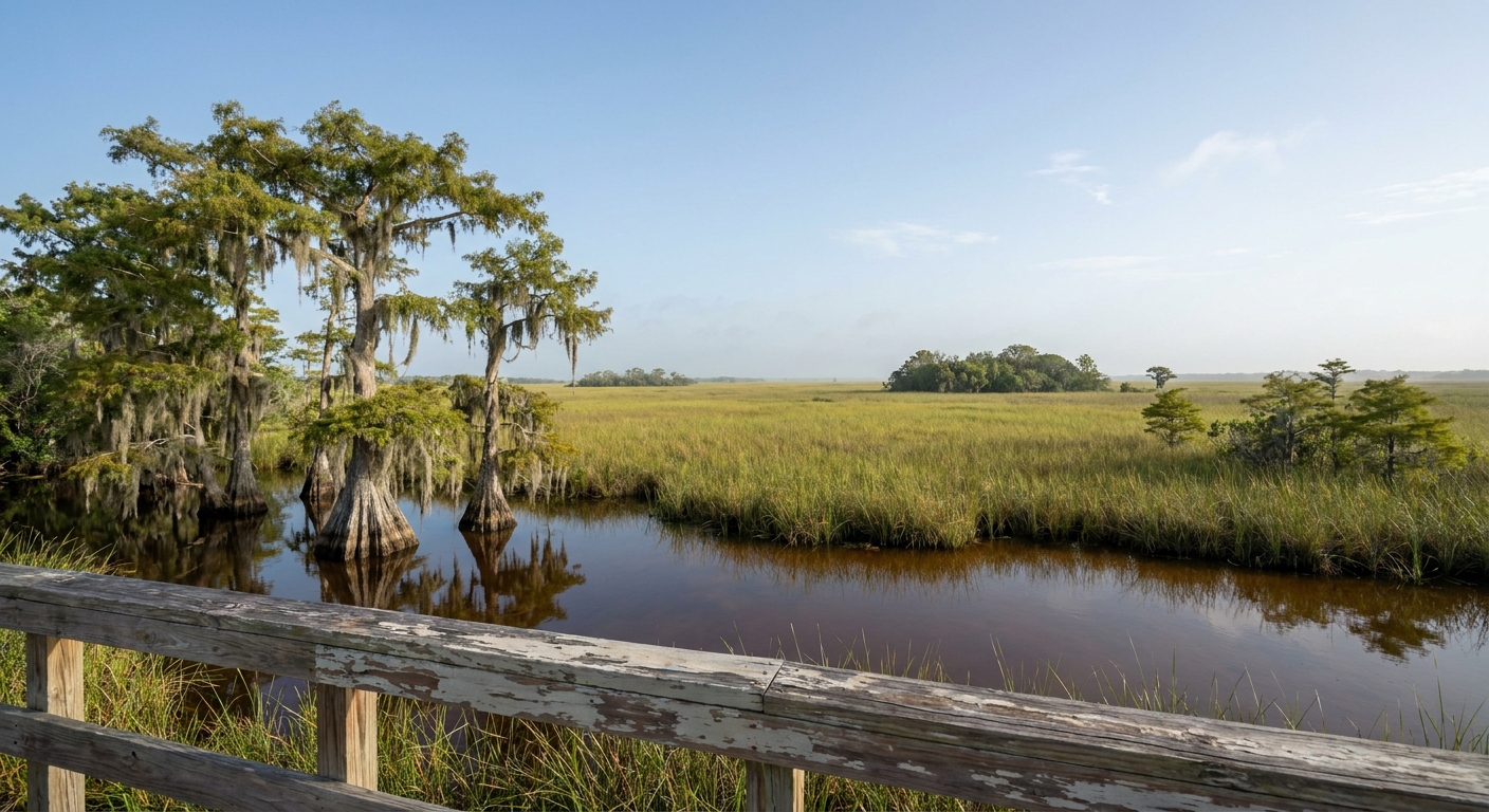
APRIL AT A GLANCE · BIG CYPRESS NATIONAL PRESERVE
April gives Big Cypress warm, mostly dry days with long light, and it is the last month before May’s rain nearly doubles the monthly total.
END OF THE DRY SEASON · NOAA NORMALS FROM MIAMI · SUNSET 7:45 P.M. ON APRIL 15
Go for: early boardwalk walks in air near 70°F, scenic drives on Loop Road and Turner River Road, and evenings of light that last until 7:45 p.m.
Think twice before: planning long midday hikes, since the preserve sits inland where afternoons run hotter than the Miami figures suggest.
Climate: NOAA NCEI 1991–2020, Miami station · Light: sunrise-sunset.org · full sources at the end
On this page
- Big Cypress weather in April83.6°F highs, 69.8°F lows and 4.3 rain days
- How warm is Big Cypress in April?A 13.8°F swing between dawn and afternoon
- Crowds and prices in AprilWhere April falls at the close of the dry season
- Things to do in Big Cypress in AprilOasis, Kirby Storter, Loop Road and Turner River Road
- A two-day April itineraryTwo days set around a 6:55 a.m. sunrise and a 7:45 p.m. sunset
- Big Cypress in April vs March and MayMarch at 2.46 inches of rain, May at 6.32
- Is April a good time to visit Big Cypress?Yes for boardwalks and scenic drives, less so for heat-shy hikers
Every figure here comes from a real thermometer, but that thermometer stands at Miami International Airport, on the coast. The preserve lies inland along the Tamiami Trail, where summer afternoons run hotter and winter nights colder than in the city. Read the normals below as the regional baseline, and expect the swamp to feel a little warmer at 3 p.m. than Miami does.
Big Cypress National Preserve weather in April: average highs, lows and rain days
| April normal | Value |
|---|---|
| Average high | 83.6°F (28.7°C) |
| Average low | 69.8°F (21.0°C) |
| Precipitation | 3.36 in |
| Days with 0.10 in or more | 4.3 |
| Daylight on April 15 | About 12 h 50 min |
| Sunrise and sunset, April 15 | 6:55 a.m. and 7:45 p.m. EDT |
NOAA’s National Centers for Environmental Information publish official 1991–2020 normals for station USW00012839 at Miami International Airport. For April they give an average high of 83.6°F, an average low of 69.8°F and 3.36 inches of precipitation. These are station normals, measured by an instrument on the ground, not a reanalysis estimated over a grid cell. The one caveat is distance: the station sits on the coast, and the Tamiami Trail runs well inland of it.
An average April records 4.3 days with at least 0.10 inch of rain. In practice that means measurable rain about one day in seven, so a two-day visit will most likely stay dry. When rain does come, plan to wait it out in the car or at a visitor center and pick the walk back up once it clears.
The gap between the average low and the average high is 13.8°F. At dawn a light long-sleeved shirt feels right and also keeps insects off your arms. By early afternoon you will want a hat, sunscreen and at least one full water bottle per person in the car, because roadside stops along the Trail are far apart.
On April 15 the preserve gets about 12 hours 50 minutes of daylight. Sunrise is at 6:55 a.m. Eastern Daylight Time and sunset at 7:45 p.m. That leaves time for a first walk before 8 a.m. and a late drive in soft light after 6 p.m., with the hottest hours in between.
How warm is Big Cypress National Preserve in April?
The monthly normal peaks at 83.6°F and drops to 69.8°F overnight, a spread of 13.8°F. Both numbers come from the Miami station, so inland afternoons will run a touch hotter than the high suggests. We have no sea-temperature reading for the preserve, which is a freshwater swamp with no beach, so we quote no water figure.
Dress in two stages. Start the morning in breathable long sleeves and long pants for boardwalks and trail edges. After lunch, switch to the lightest layer you brought, and keep closed-toe shoes on anywhere near mud or tall grass.
We found no count of freezing nights for April. With an average low of 69.8°F, nobody needs to pack for frost on an April trip. A packable layer is only useful for an air-conditioned restaurant after dark.
How busy is Big Cypress National Preserve in April? Crowds and prices
April is the final month of Florida’s dry season, and that is a calendar fact. We found no occupancy series and no monthly room-rate data for the towns around the preserve, so we rank no month as the cheapest or the busiest. For a sense of what a Florida trip costs overall, our trip-cost guide sets out the budget tiers.
We have no booking-window data for Big Cypress lodging, so we give no number of weeks. Most visitors fly into Miami or Fort Lauderdale for this corner of the state, or into Fort Myers for the Naples side, as our flights guide explains. If your April dates are firm, a refundable rate keeps your plans flexible without locking in a guess about demand.
We could not verify the lodging-tax rate for the counties the preserve crosses, so we give no percentage. Check the final price with taxes included before you confirm a room.
Paying more makes a real difference on one line: where you sleep. A room close to the Tamiami Trail puts you on a boardwalk soon after the 6:55 a.m. sunrise, while a cheaper base farther out spends those cool hours on the road. Our where-to-stay guide covers the southwest Florida bases.
Things to do in Big Cypress National Preserve in April
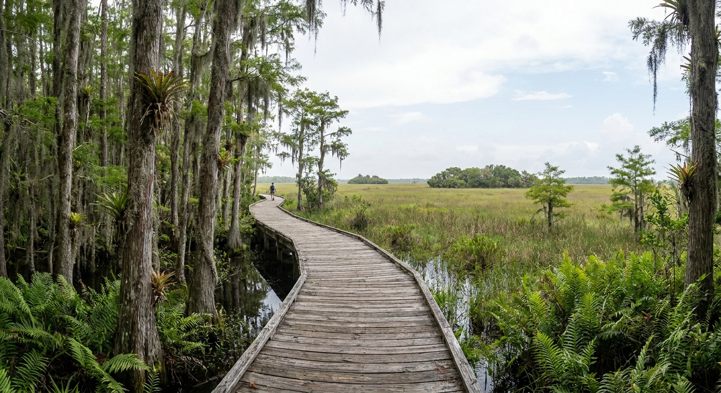
April gives you two things at once: dawn air near 70°F and rain on only 4.3 days of the month. In May, rain days climb to 6.9 and the average low rises to 73.4°F. That makes April the last month when a long morning on foot and an afternoon on a gravel scenic drive both fit into the same day.
On the Tamiami Trail, the Oasis Visitor Center is the southern trailhead of the Florida National Scenic Trail and the natural first stop. Farther along, the Kirby Storter Roadside Park boardwalk leads into a cypress strand. The Loop Road Scenic Drive and Turner River Road are the preserve’s two classic slow drives. Check the National Park Service for current hours, fees, and road conditions before you set out.
What April changes at these places is the air. The average low sits at 69.8°F, up from 65.6°F in March, so you can walk at sunrise without a jacket. The average high of 83.6°F still leaves the afternoon comfortable in a car with the windows down, before May lifts it to 86.7°F.
We could not confirm which sites charge no fee this April, so we list none as free. The roadside boardwalks and scenic drives need no booking, and the national parks guide explains how the preserve relates to Florida’s other federal lands.
Big Cypress National Preserve in April: a two-day itinerary
Day one. Reach the Kirby Storter boardwalk soon after the 6:55 a.m. sunrise, while the air sits near its 69.8°F low. Move on to the Oasis Visitor Center once it opens, and walk a short stretch of the Florida National Scenic Trail before 11 a.m. Spend the midday peak, when highs approach 83.6°F, at lunch and a rest indoors. Around 5 p.m., head out onto Loop Road, and plan to leave the gravel before the 7:45 p.m. sunset.
Day two. Drive Turner River Road in the early morning, then continue east toward the Everglades for the afternoon. If a storm arrives, which happens about one April day in seven, swap the gravel road for paved sections of the Tamiami Trail and a visitor-center stop. Pick up the walk again once the rain has passed. Our 7-day Florida itinerary shows how the two days fit into a longer trip.
Big Cypress National Preserve in April vs March and May
| Normal (NOAA, Miami station) | March | April | May |
|---|---|---|---|
| Average high | 80.6°F | 83.6°F | 86.7°F |
| Average low | 65.6°F | 69.8°F | 73.4°F |
| Precipitation | 2.46 in | 3.36 in | 6.32 in |
| Days with 0.10 in or more | 3.5 | 4.3 | 6.9 |
From March to April, the average high rises by 3.0°F and the low by 4.2°F. From April to May, the high rises another 3.1°F and the low 3.6°F. Rain grows slowly, then sharply: 2.46 inches in March, 3.36 in April, 6.32 in May, with rain days going from 3.5 to 4.3 to 6.9. We have no water-temperature series for any of the three months, and the preserve has no sea to measure.
Moving four weeks earlier gets you nights 4.2°F cooler and nearly an inch less rain, at the cost of about a day’s worth of daylight and warmth. Moving four weeks later adds 2.96 inches of rain and 2.6 more wet days per month, in exchange for the year’s longer evenings. For a walking trip, March is the safer swap. May suits only travelers who don’t mind rain showers.
Is April a good time to visit Big Cypress National Preserve?
Yes, for anyone planning boardwalks, a short section of trail and the scenic drives, with the walking done before late morning. Less so for travelers who want long midday hikes, since the 83.6°F Miami high understates the inland heat.
If heat is the deciding factor, choose March. Its 80.6°F high and 65.6°F low make for cooler mornings, and its 3.5 rain days keep more outings dry. Our March guide has the full picture.
April is the last month in our three-month comparison with near-70°F dawns and fewer than five rain days, followed by an evening that lasts until 7:45 p.m.
The last word
The decision that matters is the hour, more than the day. Be on a boardwalk soon after 6:55 a.m. and you will have the swamp at its coolest. Keep a dry plan in your pocket for the afternoon as well: an average April brings 1.3 days with an inch of rain or more, enough to close a gravel road for an afternoon. Pack long sleeves, fill the water bottles, and let Loop Road’s evening light end the day.
Sources & data for this guide
- April, March and May normals (highs, lows, precipitation, days at 0.10 in or more, days at 1 in or more) · NOAA NCEI monthly normals 1991–2020, station USW00012839, Miami International Airport · checked Sep 24, 2026
- Station location caveat: coastal Miami readings, while the preserve lies inland on the Tamiami Trail · NOAA NCEI · checked Sep 24, 2026
- Daylight, sunrise and sunset on April 15 (10:55 and 23:45 UTC, shown here in EDT) · sunrise-sunset.org · checked Sep 24, 2026
- Celsius conversions are our own arithmetic from the NOAA Fahrenheit normals.
- We could not verify site hours, fees, road conditions, lodging-tax rates, occupancy or booking lead times, and we found no water-temperature series. Place names are editorial orientation · check the National Park Service before you drive.
To plan your stay
- Best Time to Visit Big Cypress National Preserve: Dry Season Months, Summer Heat and Rainfall
- Big Cypress National Preserve in March: Weather, Rain Days, Crowds and a Two-Day Plan
- Big Cypress National Preserve in May: Weather, Rain Days, Crowds and a Two-Day Itinerary
- Big Cypress National Preserve in February: Weather, Daylight and January vs March