
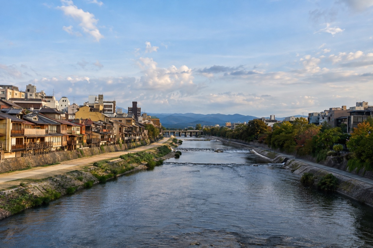
The water of the Kamo River runs shallow and bright over the stones, and people sit along the banks as if the river were the city’s front porch. Herons stand in the shallows, and in summer restaurants open their balconies to the current. This is a visit made on foot, following the river through Kyoto and stopping wherever something pulls you toward the water.
Is visiting the Kamo River worth it?
Yes, for anyone who wants to feel Kyoto between its big sights: the river suits travelers who like to wander, sit, eat with a view and watch city life go by, and it asks for no particular plan. Temples and palaces ask you to look at them. The Kamo River simply lets you spend time beside it.
What makes it different from the other places nearby is that it ties the city together. The riverbanks are walking spots for residents and visitors alike, so you share the path with people jogging, couples talking on the grass and students with their bikes.
A temple gives you one place. The river gives you a thread to follow from the northern wards down to the point where it meets other rivers.
Kyoto has a cultural heritage built up over the past 1,200 years, and the river is where much of that everyday life spills outdoors. If your trip is mostly interiors, gates and gardens, an hour beside the water makes a pleasant change of pace.
What to see at the Kamo River
The river rises in the mountains around Mount Sajikigatake, near the boundary of Kumogahata and Keihoku villages in the northern ward of Kyoto, and it gathers strength and neighbors as it flows through the city.
The Tadasu River Banks at Demachi
Around Demachi, in Kamigyo ward, the Kamo River joins the Takano River and turns to run due south through Nakagyo ward. The riverbanks where the two meet are known as the Tadasu River Banks, or Tadasu-gawara. This is a good place to watch the two currents merge and to understand how the river takes on its familiar shape for the rest of its trip through the city.
Stand near the meeting point and look at how the water changes: two streams become one broader river with a clear course ahead. It is a spot to linger rather than rush, with open space on the banks for a picnic or a rest. It also makes a natural link in a walk that continues toward the shrines.
Kamigamo and Shimogamo shrines
The Kamo River is known for Kamigamo Shrine and Shimogamo Shrine on its course, and together they give the river its spiritual side. Shinto shrines are places of gravel paths, wooden gates, rope-wrapped trees and quiet offerings, and these two belong to the same river landscape as the walking paths outside their grounds.
Seeing both gives you a sense of the river as more than scenery. The Japan National Tourism Organization recommends visiting Kyoto’s shrines at less crowded times, such as early morning or late evening when they are illuminated, so plan your shrine stop around that thought and keep the riverside walk for the rest of the day.
Shijo Bridge and the downtown stretch
Near Shijo Bridge, at Shijo Street in downtown Kyoto, the Shirakawa River joins the Kamo River. This is the busiest part of the story, where the river meets shopping streets, cafés and the lanes of a city that has kept its traditions alive, among them machiya townhouses, the Gion Matsuri festival and the hanamachi districts where geishas live and work.
In summer, restaurants along the river open balconies that look out over the water. Even without a table, the banks nearby offer a place to sit and watch the lights come on.
Stepping stones and the riverbed
Stepping stones cross the Kamo River, and the water is usually relatively low, less than a meter in most places. That shallowness is what gives the river its open, airy feeling: you see the bed, the stones and the light moving on the surface rather than a deep channel walled off by embankments.
Watching other people hop across the stones is a small show in itself. The walkways along the banks can flood in their lower stretches during the rainy season, so the same river that invites you down to the water can change its mood quickly after heavy rain.
Where Kabuki began
The Kamo River is the birthplace of Kabuki. In 1603 Izumo no Okuni began performing on a makeshift stage on the dry bed of the river, and the art that grew from those performances is still a cornerstone of Japanese theater. Knowing this changes how you look at the wide, open bed: it was once a stage.
Nothing on the riverbed asks you to act it out, but it is worth standing there for a moment and imagining the crowd and the improvised platform. The story pairs well with a later evening at the theater if Kabuki interests you.
Hours, tickets and rules
The Kamo River is a long stretch of water and bank running through the city, so what shapes your visit is the setting and the season rather than a gate and a schedule. You go down to the banks, you walk, you sit and you cross where the stepping stones lie.
The one rule that follows from the river’s nature concerns the rainy season. During that time the walkways along the Kamo River sometimes flood in their lower stretches, so the paths nearest the water are the ones affected. The upper banks stay available for walking when the lower ones are covered.
The shrines on the river keep their own character. Kamigamo Shrine and Shimogamo Shrine are places where the Japan National Tourism Organization recommends visiting at less crowded times, such as early morning or late evening when they are illuminated. Otherwise the river itself comes with no stated rules for climbing, swimming, tripods or drones, so the sensible habit is to enjoy the banks as the residents do: walking, sitting and watching the water.
When to visit the Kamo River
The river changes with each season, and the best moment depends on what you want from it. Summer brings the riverside balconies and a lively evening mood. Spring and autumn bring a milder feel for walking. Winter is quiet and cold, with more snow and sleet than you might expect in a city of temples.
| Month | Average high (°F) | Average low (°F) | Precipitation (inches) | Days with rain of 0.04 inch or more |
|---|---|---|---|---|
| January | 48.4 | 34.7 | 2.10 | 6.4 |
| April | 68.2 | 48.6 | 4.61 | 9.4 |
| July | 89.6 | 74.5 | 8.80 | 11.6 |
| October | 74.1 | 57.9 | 5.64 | 8.2 |
In April the days are warm enough for a long riverside stroll, with sunshine for much of the month and a few showers. The evenings still call for a layer. July is hot and humid, and rain comes often, so the balconies over the water are most tempting at the end of the day. It is also the month of the Gion Matsuri, one of the traditions Kyoto is known for.
October is mild, with highs in the low 70s and cooler evenings, and the sunshine is generous enough for a long afternoon outdoors. January is the cold month: highs stay in the upper 40s, and the month brings more days of snow or sleet than days of plain rain, so dress for a stroll that feels brisk.
As for time of day, the shrines are the part of the river that reward an early or late visit, because Japan’s tourism authority recommends those times for Kyoto’s shrines.
Tips for your visit
Bring shoes you are happy to walk in for a long time, since the pleasure of the river is following it. A layer is useful in the cooler months, and in summer something light and a bottle of water suit the humid days. If you plan to cross at the stepping stones, shoes with good grip are a sensible choice, and a rain jacket makes sense in the wetter months when showers come often.
The river fits easily into a day that includes other parts of Kyoto. Kyoto Station is served by the Tokaido Shinkansen line, which makes the city a starting point for exploring and for connecting to other major cities, and the station building itself holds a full floor of ramen restaurants, an Isetan department store, a theater and a Granvia hotel. Kyoto Tower, a few steps from the main entrance and over 130 meters tall, is visible across the city and helps with your bearings.
For a combined outing, pair the northern stretch with the shrines and keep the downtown stretch for the evening, when the restaurants along the banks open their balconies in summer. In central Kyoto, Nijo Castle makes another stop, known for its nightingale floors that sound like birds when walked on, an old security system meant to alert guards to intruders.
Families and anyone who prefers a gentler pace can choose a single stretch and stay there rather than trying to cover the whole river. The water is usually relatively low, but the lower walkways may flood in the rainy season, so choose your path with the weather in mind.
Good to know before you go
The rainy season is the time to be flexible: the lower walkways along the river sometimes flood, and a wet day may suit the shrines or an indoor stop better than the water’s edge. Summer evenings can stay warm and humid, so a small towel and a drink are welcome. Keep to the usual habits of the banks, where residents walk, sit and chat, and leave the place as tidy as you found it.
Sources
- Wikipedia, Kamo River (Kyoto) (https://en.wikipedia.org/wiki/Kamo_River_(Kyoto)), checked October 11, 2026
- Japan National Tourism Organization, Kyoto (https://www.japan.travel/en/destinations/kansai/kyoto/), checked October 11, 2026
- Japan Meteorological Agency (JMA), Normal values 1991-2020, monthly (https://www.data.jma.go.jp/stats/etrn/view/nml_sfc_ym.php?prec_no=61&block_no=47759), station Kyoto, elevation 41 m, checked October 11, 2026
To plan your stay
- Best Time to Visit Japan: Cherry Blossoms, Autumn Colors, Weather and Festivals
- Where to Stay in Japan: Ryokan, Temple Stays, Capsule Hotels and the Best Cities to Base In
- Sending Luggage from the Airport in Japan: Hands-Free Travel, Hotel Delivery and Coin Lockers
- Know Before You Go to Japan: Entry, Money, Etiquette and Getting Around