
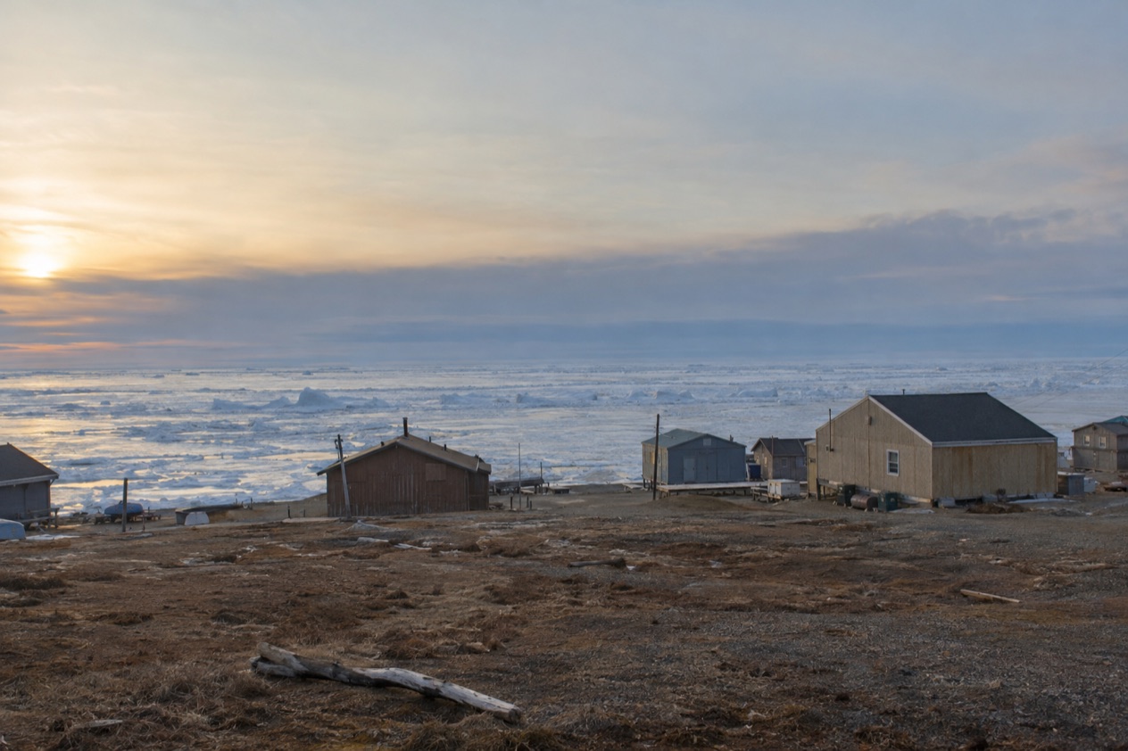
Leaving Fairbanks for Utqiagvik means leaving behind the last of the roads that the rest of Alaska takes for granted. Spruce, rivers and pickup trucks give way to a flat horizon, a low sky and the Arctic Ocean at the edge of town.
At the end of the trip you reach the northernmost settlement in the United States, a community of Iñupiat families, whale-bone arches on the shore and tundra in every direction.
How do you get to Utqiagvik from Fairbanks?
You fly. There are no roads or rails into Utqiagvik, and the only way to travel there is by plane, so the question is less about choosing a route than about understanding why the map offers only one.
Utqiagvik sits on the Arctic Ocean, 300 miles north of the Arctic Circle, on the North Slope. That region is cut off from the rest of the state by the Brooks Range, and it depends mostly on waterways and small airports for transportation. Fairbanks is the last big town with a highway system behind it, and Utqiagvik is on the other side of that mountain barrier with nothing connecting the two on the ground.
What decides your trip is therefore the season and the sky, not the road. The long daylight of summer and the polar night of winter shape what you see once you land, and they are worth thinking about before you pick your dates.
The sun sets on November 18 and stays below the horizon until January 23, so a midwinter visit comes without sunrise. In summer, polar day brings the midnight sun, and the town lives by a clock that has little to do with sunrise.
The one overland route in the region is the Dalton Highway, which runs from Fairbanks to Prudhoe Bay and Deadhorse. Except for that highway, the North Slope is disconnected from the rest of the Alaskan road system. The highway is an adventure of its own, but it ends well short of Utqiagvik, and it should not be mistaken for a way of reaching it.
With a plane as the answer, the rest of your planning is about what you do at the other end: what the light is doing, what a town of Iñupiat families offers a visitor, and how much of the Arctic you want to take in on one trip.
Ways to get to Utqiagvik from Fairbanks
By air, the only way in
Every traveler who reaches Utqiagvik arrives by plane. From Fairbanks you leave a city of birch and spruce and land in a place where the tundra runs flat to the shore.
What you see from the window changes as you go: the boreal forest thins, the land opens up and the ocean appears as a pale edge at the end of the world.
One thing to carry in mind is the daylight at your destination. In summer the sun stays up through the night, and in winter it does not rise for weeks, so your arrival may feel entirely different from the Fairbanks you left that same morning.
The Dalton Highway, Fairbanks to Prudhoe Bay
The Dalton Highway is the road people think of when they imagine driving north from Fairbanks, and it deserves a clear description. It covers 495 miles from Fairbanks to Prudhoe Bay and Deadhorse, the oil-field community on the North Slope. A sign along the highway marks the Arctic Circle, which is a favorite stop for photographs.
It does not go to Utqiagvik. Even at the top, the bay itself lies further north through a security checkpoint, so the open water of the Arctic Ocean is not visible from the highway. Tourists who go to Prudhoe Bay come for the tundra, the Arctic Ocean and the midnight sun, and they stay in lodgings assembled from modular buildings.
Alaska 511 posts road conditions in categories running from Good through Difficult and Very Difficult to Hazardous and Road Closure, and it also lists segments with no winter maintenance. It is the place to read about the highway before you consider any drive north. For Utqiagvik, the highway is a neighboring adventure, not a route.
Train and ferry: why they stop short
There are no rails into Utqiagvik, and the Alaska Railroad’s routes, such as the winter Hurricane Turn from Anchorage or the Coastal Classic between Anchorage and Seward, belong to a different part of the state. They are good trips in their own right but they point away from the Arctic coast.
The Alaska Marine Highway likewise covers a long stretch of coastline, 3,500 miles in all, with service to over 30 communities from Bellingham to Dutch Harbor in the Aleutian Chain. That is a route of the southern and southwestern coasts, and the only way to travel to Utqiagvik remains by plane. If you love trains and boats, plan them as separate trips elsewhere in Alaska.
Options compared
| Option | Best for | What to know |
|---|---|---|
| Plane | Reaching Utqiagvik | The only way to travel there, since no road or rail goes in |
| Dalton Highway | Reaching Prudhoe Bay and Deadhorse | 495 miles from Fairbanks, and it does not continue to Utqiagvik |
| Alaska Railroad | Other parts of Alaska | No rails go into Utqiagvik |
| Alaska Marine Highway | Coastal communities of the south and the Aleutians | Serves ports from Bellingham to Dutch Harbor, and the only way to Utqiagvik is by plane |
If your goal is Utqiagvik itself, the plane is the answer and everything else is a different trip. If your goal is the Arctic more broadly, the Dalton Highway to Prudhoe Bay is the overland alternative, with its own landscape of tundra and oil-field lodgings.
It helps to think of the two Arctic destinations as distinct experiences. Prudhoe Bay is an industrial outpost where visitors come for tundra, the ocean beyond the checkpoint and the midnight sun. Utqiagvik is a town of several thousand people, mostly Iñupiat, with a long history on this coast and a community life that goes on whatever the season.
Travelers who want both can treat them as two separate trips rather than links in one chain. Nothing on the ground joins them in a way a visitor can use, and the North Slope’s reliance on waterways and small airports means even neighbors in the region travel by air.
Making a day of it
A trip to Utqiagvik is best planned around what you want from the Arctic, because the town rewards attention more than speed. Walk the shoreline, look at the ocean that you have flown a long way to see, and notice how a place with only a few thousand residents holds a full civic life, from schools to a community that has kept its traditions through great change.
Before you leave Fairbanks, there is a good local stop for anyone interested in northern light. The city hosts the Midnight Sun Game, a baseball competition contested since 1906 in the twilight around midnight on June 21. If your dates fall near the solstice, it is a fitting way to start a trip about long days. Fairbanks itself is a pleasant place to spend a night before the flight.
Timing matters in Utqiagvik. In summer, polar day lasts for weeks, and the sun does not set at the June solstice at the Arctic Circle, so the town’s light is constant. In the other direction, the polar night from November 18 to January 23 brings a long stretch without sunrise. Think about which kind of Arctic appeals to you, the endless daylight or the quiet dark.
Bring your curiosity about the people who live there. The Iñupiat are the largest part of the community, and their villages stretch across the North Slope and beyond. Listen more than you talk, and let the place set the pace.
Dress and pack for the Arctic, not for Fairbanks, and carry what you need for the hours you will spend outdoors. How long to stay depends on what draws you, whether the light, the shoreline or the chance to see a town at the top of the continent. Even a short stay gives you the sense of being at the edge of the map.
Good to know before you go
Utqiagvik is the largest U.S. settlement north of the Arctic Circle, with about 5,000 inhabitants, and it is roughly 1,300 miles south of the North Pole. The daylight you meet depends on the time of year, from the midnight sun of summer to the polar night that begins on November 18. Plan your clothing, your schedule and your expectations around that light, and treat the town as a community where people live, not only a destination.
Sources
- Wikivoyage, Utqiagvik (https://en.wikivoyage.org/wiki/Utqiagvik), checked October 11, 2026
- Wikipedia, Utqiagvik, Alaska (https://en.wikipedia.org/wiki/Utqiagvik,_Alaska), checked October 11, 2026
- Wikipedia, Polar night (https://en.wikipedia.org/wiki/Polar_night), checked October 11, 2026
- Wikipedia, Midnight sun (https://en.wikipedia.org/wiki/Midnight_sun), checked October 11, 2026
- Wikipedia, Alaska North Slope (https://en.wikipedia.org/wiki/Alaska_North_Slope), checked October 11, 2026
- Wikipedia, Inupiat (https://en.wikipedia.org/wiki/Inupiat), checked October 11, 2026
- Wikipedia, Prudhoe Bay, Alaska (https://en.wikipedia.org/wiki/Prudhoe_Bay,_Alaska), checked October 11, 2026
- Wikipedia, Arctic Circle (https://en.wikipedia.org/wiki/Arctic_Circle), checked October 11, 2026
- Alaska Railroad, Our trains (https://www.alaskarailroad.com/ride-a-train/our-trains), checked October 11, 2026
- Alaska Department of Transportation, Alaska Marine Highway System, Alaska Marine Highway System (https://dot.alaska.gov/amhs/index.shtml), checked October 11, 2026
- Alaska 511 (https://511.alaska.gov/), checked October 11, 2026