
Past the last streets of San Pedro, the pavement gives way to a sandy road where golf carts pass pickup trucks and the Caribbean flashes through the palms on the right. Pelicans sit on weathered docks, and the quiet grows the farther north you go. North Ambergris Caye is the long, thin top of the island, a stretch of beach houses, resorts and mangrove that ends in a national park.
What is North Ambergris Caye like?
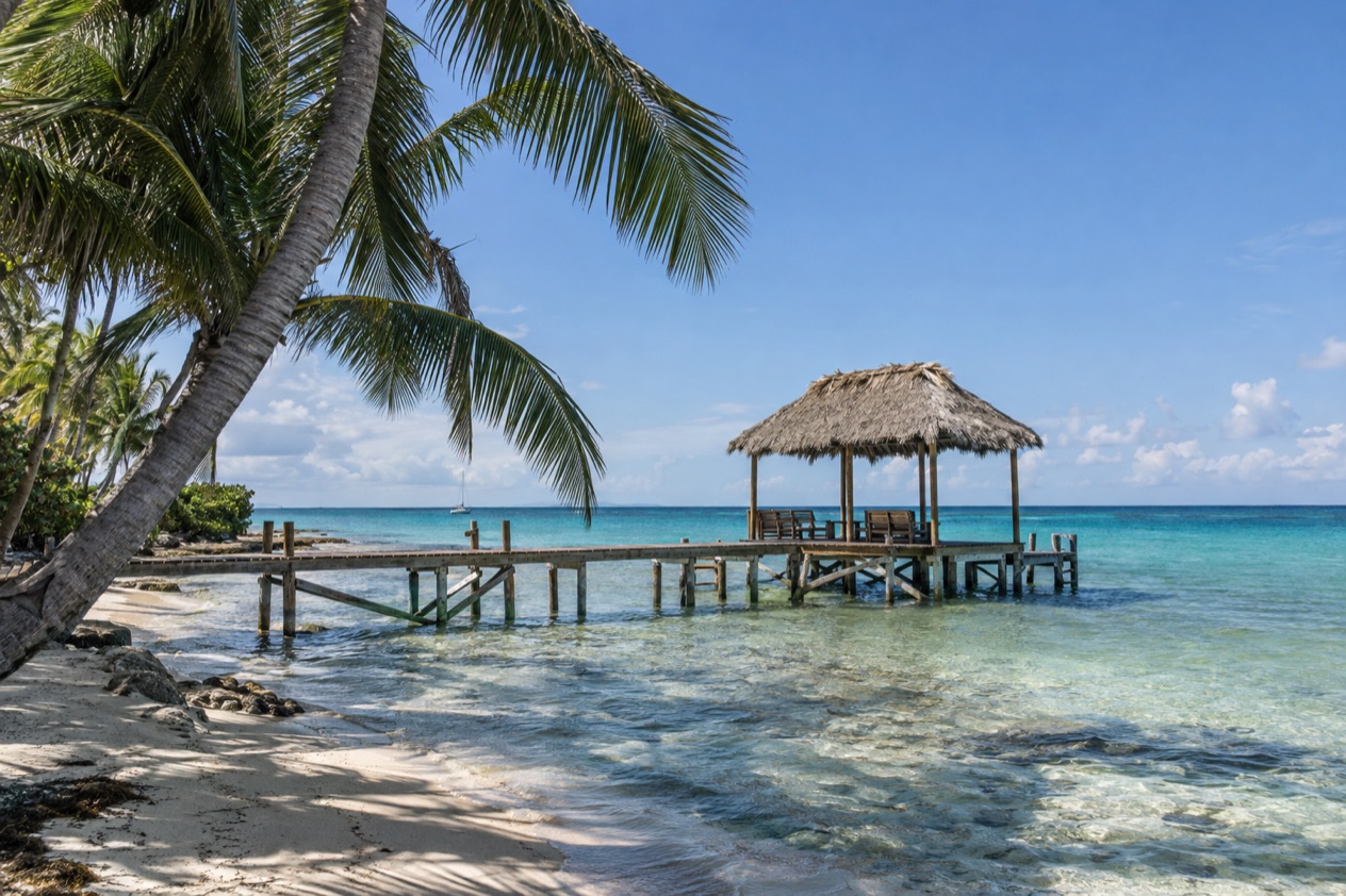
North Ambergris Caye is a quiet, spread-out part of the island, where resorts and beach houses line a single road and the town of San Pedro falls behind you. The island is about 25 miles long and only about a mile wide, so the north is a narrow ribbon of land with the Caribbean on one side and the lagoon on the other.
For a long time the north could be reached only by boat. Today the north road of San Pedro Town runs for more than 10 miles, and it has brought a steady growth in resort and beach house development with better access than watercraft alone. The change is visible in the mix of the place: small family-run places sit near larger properties, and building sites appear between stretches of untouched palm and scrub.
At the far end the road meets Bacalar Chico National Park and Marine Reserve, which occupies the northern tip of Ambergris Caye. It reaches from Chetumal Bay in the west to the Caribbean Sea in the east, and it is one of seven sites within the Belize Barrier Reef System UNESCO World Heritage Site. That protected edge gives the north its character: the island’s wilder side, where the reef is the main attraction and the pace is set by boats and tides.
The north suits travelers who want to step away from the bustle of town, people who like to watch the water from a porch, and anyone drawn to the reef and the park. It is less a place of sights to tick off than a place to settle into.
Things to do in North Ambergris Caye
Bacalar Chico National Park and Marine Reserve
The park is the great set piece of the north. It was designated in 1996 and covers 28,169 acres, made up of a 12,640 acre land portion and an adjacent 15,529 acre marine reserve. It stretches across the island from Chetumal Bay to the Caribbean Sea, so a single protected area holds lagoon, mangrove, forest and reef.
What you see depends on how you move through it: water in every direction, mangrove edges, and the line of the barrier reef offshore. In the marine reserve’s General Use Zones, fishing is restricted, with only Bacalar Chico residents allowed to fish for subsistence, and gear such as spear guns and nets is prohibited. The result is a coast treated as a protected place rather than a fishing ground.
A visit here fits travelers who care more about landscape and wildlife than about services. It is the natural end point of any trip up the island.
The north road and its beaches
The north road is an outing in itself. It runs more than 10 miles beyond San Pedro, past beach houses, small resorts and docks, and the island’s main form of powered transportation, the golf cart, suits its pace. Because the island is so narrow, the sea is never far, and the road offers glimpses of the water between the buildings.
The beaches on this side face the Caribbean and the reef beyond. The barrier reef, the second largest in the world after Australia’s Great Barrier Reef, is the main attraction of Ambergris Caye, and from the north shore its presence defines the view. Evenings tend to be quiet, with the lights of the resorts the main glow on the shore.
Reef outings from the north
Hol Chan Marine Reserve is 4 miles south of San Pedro, and Shark Ray Alley belongs to the same family of protected areas around the town. Bacalarchico, at the other end, completes the trio of protected places that the island is known for.
These reserves are what draw people to the reef in the first place, and they sit at opposite ends of the same long island, which is why the north makes a good starting point for the northern one. Within reach of the north lies San Pedro Town, home of the Ambergris Museum and of the festivals that mark the year, among them San Pedro Day on June 27 and El Gran Carnaval de San Pedro.
Eating and drinking in North Ambergris Caye
Eating in the north tends to happen where you sleep or at the water’s edge, in the kind of places that grow along a road of resorts and beach houses. Seafood is the natural order of the day on an island whose main attraction is the reef, and the sea shapes what comes to the table.
Expect the north’s dining to look like the north itself: open-air restaurants attached to resorts, small beachfront spots where you can watch the water, and bars with their feet practically in the sand. The mood is relaxed and unhurried, and a meal often stretches into the evening as the light changes over the Caribbean.
For a wider choice, San Pedro Town lies to the south, where the island’s restaurants, cafés and bars are concentrated. Many visitors staying in the north make the trip into town for a change of scene, then return to the quiet of the shore afterward.
One thing the reserve does shape is local fishing. Within Bacalar Chico Marine Reserve’s General Use Zones, fishing is restricted, which keeps the northern waters protected and reminds you that what arrives on a plate comes from elsewhere around the island.
Staying in North Ambergris Caye
The north suits travelers who want space, sea views and quiet nights over a lively street scene. Lodging here is made up of resorts and beach houses, the very kind of development the north road has brought to this stretch of the island.
Compared with San Pedro Town, to the south, the north is farther from the center of things. You trade easy access to restaurants and bars for a calmer setting, and the sound at night is more likely to be waves and wind than music from the street. A beach house can suit families or groups who want a base of their own, while a resort offers a more complete stay on a single property.
Because the island is only about a mile wide, the water is never far from wherever you stay. The golf cart, the island’s main form of powered transportation, becomes a part of daily life for guests in the north, linking lodging, beaches and the road toward town.
The far north, near Bacalar Chico, is the most secluded part of the island. It appeals to travelers whose priority is the reef and the park, and who are happy to treat the rest of the island as a short outing rather than a daily routine.
Getting to North Ambergris Caye
Most arrivals start with the island itself. Ambergris Caye can be reached by plane or helicopter from Belize City and by numerous fast sea ferries, and it can also be reached by ferry from Chetumal in Mexico. A flight from Belize City takes about 20 minutes.
The island’s small airstrip is serviced by Tropic Air and Maya Island Air, and Astrum Helicopters services the local airstrip and various resorts. From San Pedro, the north is reached by the north road, which runs for more than 10 miles and has given the northern shore better access than only watercraft.
On the island, the main form of powered transportation is the golf cart, a result of Ambergris Caye’s small size. The caye is about 25 miles long, so the north and the town are parts of the same long, narrow strip.
Ambergris Caye is administered as part of the Belize District, though the closest point on the mainland belongs to the Corozal District. It is the largest of several hundred cayes in the northernmost waters of Belize.
Good to know before you go
The U.S. State Department rates Belize Level 2, “Exercise increased caution”, because of crime, and says the south side of Belize City has historically had the highest concentration of violent crime.
The Atlantic hurricane season runs from June 1 to November 30, which is worth remembering when you plan a stay on a low island like this one. San Pedro Day on June 27 and the Carnaval celebrations are among the moments of the year in town, and during El Gran Carnaval the first day is restricted to children until 7 pm along the beachfront stretch near the cemetery area and Barrier Reef Drive.
In Bacalar Chico Marine Reserve, the rules on fishing and gear protect the water you come to see, so treat the park as a place to look and learn rather than to harvest.
Sources
- Wikipedia, Ambergris Caye (https://en.wikipedia.org/wiki/Ambergris_Caye), checked October 11, 2026
- Wikivoyage, Ambergris Caye (https://en.wikivoyage.org/wiki/Ambergris_Caye), checked October 11, 2026
- Belize Fisheries Department, Bacalar Chico Marine Reserve (https://fisheries.gov.bz/bcmr/), checked October 11, 2026
- Wikipedia, San Pedro Town (https://en.wikipedia.org/wiki/San_Pedro_Town), checked October 11, 2026
- U.S. Department of State, Belize Travel Advisory, Level 2, March 11, 2026 (https://travel.state.gov/), checked October 11, 2026
- NOAA National Hurricane Center, Climatology (https://www.nhc.noaa.gov/climo/), checked October 11, 2026