
Before the first boat of the day has left, Caye Caulker smells of coffee and fry jacks, and the sand streets are quiet except for bicycles and a radio playing reggae somewhere behind a palm. Out past the village the reef breaks the swell into a long white line, and beyond it lie the atolls and the tiny islands with a handful of cabins. Belize’s cayes run from lively island towns to lodges you reach by boat, and this is how they fit together for a traveler.
Which islands and cayes can you visit in Belize?
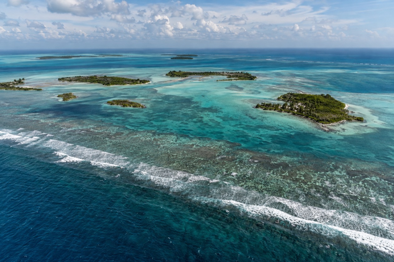
You can visit a long list of them, from Ambergris Caye and Caye Caulker, which have hotels, restaurants and a town, to St. George’s Caye, Caye Chapel and Tobacco Caye, which are far smaller, and on to three atolls farther out. All of them sit along or beyond the Belize Barrier Reef, a chain of coral reefs that holds about 500 species of fish alongside soft and hard corals and hundreds of invertebrates. The reef system was named a World Heritage Site in 1996, and that status explains why so many of the waters around these islands are protected reserves.
Each island has its own tempo. Some are places to eat well and walk to a bar in flip-flops, others are places to watch frigatebirds, and a few are places where the only schedule is the tide. Pick by what you want your days to look like, not by the name on the map.
Ambergris Caye and San Pedro
Ambergris Caye is the largest of the cayes most visitors hear about, a narrow strip about 25 miles from end to end. San Pedro Town sits on it, with beach bars, seafood grills, dive shops and sandy lanes where golf carts do most of the work, since they are the main form of powered transportation on the island. The reef and the beaches are the main attractions, and the Belize Barrier Reef here is the second largest in the world after Australia’s Great Barrier Reef.
The island is administered as part of the Belize District, though its closest point on the mainland belongs to the Corozal District. On San Pedro Day, celebrated every year on June 27, the town honors its patron saint, and the fishing heritage that built San Pedro shows in the boats lined up along the shore. At mealtimes look for grilled fish, conch ceviche and the rum punches that arrive with the sunset.
Caye Caulker
Caye Caulker Village is the island’s one town, home to about 4,000 people, and it has become a popular destination for backpackers and other tourists. There are over 50 hotels, along with a scatter of restaurants and shops. Streets are sand, painted wooden houses lean toward the water, and menus lean on lobster, snapper and rice and beans, often cooked at roadside grills in the evening.
Right in front of the village, a shallow lagoon, in places only six inches deep, meets the barrier reef to the east, and the reef there is a dry reef exposed at the surface. Windsurfers like the area too, so you may see colored sails skimming the lagoon.
St. George’s Caye and Caye Chapel
St. George’s Caye carries more history than any other caye on this coast. It was settled as a town in 1650, was once the largest settlement in what was then British Honduras and served as Belize’s first capital in the 1700s.
The Spaniards called it Cayo Cocina, or Kitchen Cay. Each September 10 Belize marks the Battle of St. George’s Caye, when British settlers defeated a small Spanish fleet here in 1798, and the day is a national holiday.
Caye Chapel is a small private island with an airstrip and the White Shark Golf Course, co-designed by former PGA Tour player Greg Norman and former LPGA Tour player Lorena Ochoa. A clubhouse of 25,000 square feet anchors the grounds. It is a different kind of caye from the barefoot towns, one where the draw is the course and the resort setting.
Tobacco Caye and the South Water Caye reserve
Tobacco Caye is a speck of sand of about three acres, believed to be named for the tobacco once grown there. Only about 20 people live on it permanently, and it has five small lodges. Palms, a few cabins, and the sea on every side make up the whole scene, so evenings here mean the sound of water and not much else.
The caye lies inside the South Water Caye Marine Reserve, part of the national system of protected waters, where fishing is restricted in several ways. The reserve covers mangroves and coastal habitats across the Stann Creek District and shelters the West Indian manatee and several sea turtle species. If you like wildlife more than nightlife, this is the corner of the cayes to choose.
How are they grouped?
They fall into three groups: the cayes closest to Belize City, the southern cayes off the Stann Creek coast, and the three atolls on the far side of the barrier reef. Thinking of them this way helps more than a map does, because each group has a different mood and a different kind of trip.
| Place | Distance | From |
|---|---|---|
| St. George’s Caye | 8 miles east | Belize City |
| Caye Chapel | 16 miles north-northeast | Belize City |
| Caye Caulker | 20 miles north-northeast | Belize City |
| Turneffe Atoll | 20 miles | Belize City |
| Lighthouse Reef | 50 miles southeast | Belize City |
| Tobacco Caye | 10 miles east | Dangriga |
| Glover’s Reef | 28 miles off the coast | Southern coast of Belize |
The cayes near Belize City and the northern chain
St. George’s Caye, Caye Chapel and Caye Caulker form a line of islands near Belize City, with Ambergris Caye part of the same barrier-reef coast. Caye Chapel lies just south of Caye Caulker, so the two are neighbors even though one is a lively village and the other a private resort island. This is the part of the coast with towns, restaurants, airstrips and the most hotels.
It suits travelers who like a base with choices: a bar one evening, a quiet dinner the next, a reef outing in between.
The southern cayes
South of the northern chain, Tobacco Caye and the South Water Caye reserve make up a quieter group, reached from the Dangriga side of the coast. The reserve stretches along the coast for more than 25 miles, and is classed as a habitat and species management area. It protects at least two dozen species that are vulnerable, endangered or critically endangered, from corals to manatees.
There are no towns here, only small lodges and open water. These cayes are for people who would rather watch a pelican dive than scroll a menu, and who are happy with simple meals taken a few steps from the sand.
The three atolls
Turneffe Atoll, Lighthouse Reef and Glover’s Reef are the three atolls of the barrier reef system. Turneffe is the largest coral atoll in Belize, about 30 miles long, and it is a maze of flats, creeks and lagoons with more than 150 mangrove islands. Dolphins, manatees, sea turtles and seabirds live there, and at least three known fish spawning sites lie within the atoll. It was declared a marine reserve in 2012.
Lighthouse Reef is the most easterly diving area in Belize and is home to the Great Blue Hole, made famous by Jacques Cousteau. Dive sites include Half Moon Caye Wall, Long Caye Aquarium, Silver Caves, Tres Cocos and West Point. On Half Moon Caye you may spot a rookery of magnificent frigatebirds and a nesting colony of about 4000 red-footed boobies, with a rare atoll forest of siricote trees on the western half.
Glover’s Reef is an oval atoll whose interior lagoon holds around 850 reef patches and pinnacles. Its major cays include Northeast Cay, Long Cay, Middle Cay and Southwest Cay, and it has one of the greatest varieties of reef types in the western Caribbean. A large spawning site for the endangered Nassau grouper lies at its northeastern end, and the area has been a marine reserve since 1993.
How do you reach them?
Belize City is the main gateway, and from there you can go by air or by sea to most of the cayes. The details differ from island to island, so it helps to think of each caye as its own small journey.
Ambergris Caye
Ambergris Caye can be reached by plane or helicopter from Belize City, and by numerous fast sea ferries. The island has a small airstrip served by Tropic Air and Maya Island Air, and Astrum Helicopters serves the local airstrip and various resorts. Landing on a short strip beside the water is part of the experience, with the reef visible below as you come in.
There is a second route from the north, by ferry from Chetumal in Mexico. Once on the island, you will see golf carts everywhere, and that is the way the island moves.
Caye Caulker and the nearby cayes
Caye Caulker is accessible by high-speed water taxi or by small plane to Caye Caulker Airport. Arriving by water means stepping off at the village dock and straight onto the sand streets, with the hotels and restaurants close at hand.
Caye Chapel has its own airstrip, which is how the island receives guests. St. George’s Caye sits close to Belize City, being the nearest of the cayes in the table, and carries the history of the city’s early days. Both are small private-feeling places rather than towns with ferries on every hour.
Tobacco Caye and the atolls
How do you reach them? Turneffe is the nearest atoll to Belize City and lies southeast of Ambergris Caye and Caye Caulker. Lighthouse Reef is farther again, and Glover’s Reef lies off the southern coast.
Because these places sit so far from towns, most stays there are built around a lodge or a dive trip, and the sea itself is the way in. Lodge and tour operators are the ones who shape those trips, so the experience tends to be set by where you choose to sleep.
Good to know before you go
The U.S. State Department rates Belize Level 2, “Exercise increased caution”, because of crime, and says the south side of Belize City has historically had the highest concentration of violent crime.
The Atlantic hurricane season runs from June 1 to November 30, and low islands feel it most. Caye Caulker is only 8 feet above the sea at its highest point, and a strong storm surge can cover the whole island, as happened during Hurricane Hattie and Hurricane Keith.
On the smaller cayes, fishing restrictions apply inside the marine reserves, so follow what the lodges tell you. On the larger islands you will see golf carts instead of cars, and on the farthest cayes you will find only a few lodges and plenty of sea.
Sources
- Wikipedia, Belize Barrier Reef (https://en.wikipedia.org/wiki/Belize_Barrier_Reef), checked October 11, 2026
- Wikipedia, Ambergris Caye (https://en.wikipedia.org/wiki/Ambergris_Caye), checked October 11, 2026
- Wikipedia, Caye Caulker (https://en.wikipedia.org/wiki/Caye_Caulker), checked October 11, 2026
- Wikipedia, Tobacco Caye (https://en.wikipedia.org/wiki/Tobacco_Caye), checked October 11, 2026
- Wikipedia, Turneffe Atoll (https://en.wikipedia.org/wiki/Turneffe_Atoll), checked October 11, 2026
- Wikipedia, Lighthouse Reef (https://en.wikipedia.org/wiki/Lighthouse_Reef), checked October 11, 2026
- Wikipedia, Glover's Reef (https://en.wikipedia.org/wiki/Glover's_Reef), checked October 11, 2026
- Wikipedia, St. George's Caye (https://en.wikipedia.org/wiki/St._George's_Caye), checked October 11, 2026
- Wikipedia, Caye Chapel (https://en.wikipedia.org/wiki/Caye_Chapel), checked October 11, 2026
- Wikipedia, South Water Caye Marine Reserve (https://en.wikipedia.org/wiki/South_Water_Caye_Marine_Reserve), checked October 11, 2026
- U.S. Department of State, Belize Travel Advisory, Level 2, March 11, 2026 (https://travel.state.gov/), checked October 11, 2026
- NOAA National Hurricane Center, Climatology (https://www.nhc.noaa.gov/climo/), checked October 11, 2026