
On a September evening in Belize City, the sky over the Caribbean turns heavy and gray, and the talk on the seawall drifts to the forecast. People here have long memories of storms, and the question travelers ask is a fair one. Hurricane season in Belize is the stretch from early summer to the end of November, and it overlaps with the rainy season. Knowing how the months differ helps you decide when to go.
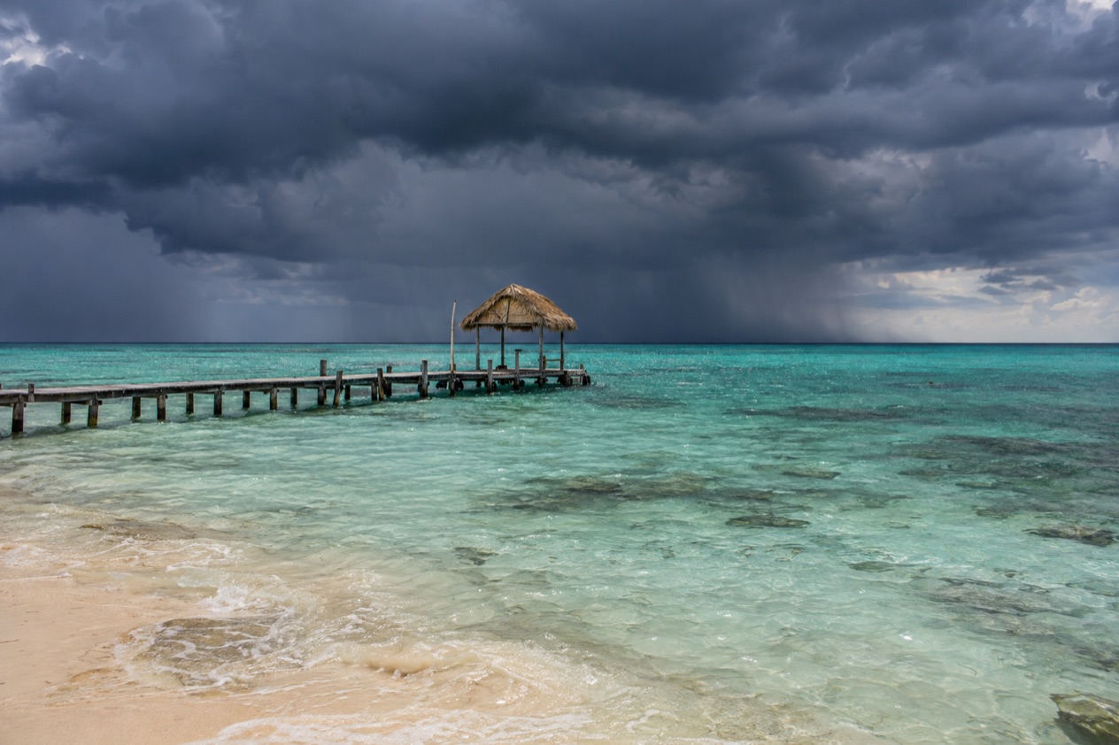
When is hurricane season in Belize?
Hurricane season in Belize follows the Atlantic calendar, which runs from June 1 to November 30. Belize sits on the Caribbean coast of the Yucatán Peninsula, so it is the Atlantic season that matters here, not the eastern Pacific one, which starts in mid-May. Belize is also the only country in Central America without a Pacific coastline.
The season is long, but the weight is not spread evenly. Activity builds slowly through the early summer, reaches its crest around September 10, and most of the action falls between mid-August and mid-October. After that the Atlantic quiets down, though a late-season hurricane is possible: Hurricane Iota, a powerful Category 4 storm, formed in 2020 near the very end of the calendar.
The same months make up the rainy season, which the climate of Belize places from June to November. The dry season then runs from January to May. So a trip in the second half of the year means rain as well as a small chance of a tropical system, and the weather figures for Belize City show how that plays out.
| Month | Avg. high (°F), Belize City | Avg. low (°F), Belize City | Rain (inches), Belize City | Rain days, Belize City |
|---|---|---|---|---|
| June | 89.4 | 77.7 | 8.1 | 10.0 |
| September | 90.0 | 76.3 | 6.93 | 12.5 |
| October | 88.1 | 74.3 | 10.15 | 13.7 |
| November | 85.5 | 71.0 | 8.17 | 11.4 |
June: the season opens
June is the first month of the season and the first of the rains. In Belize City the days are hot and the nights stay warm. Rainfall is steady rather than extreme, with about ten rainy days across the month.
It is a month when the season exists on the calendar more than in the sky. The peak is still a couple of months away, so June is the entry point for travelers who want to see the green, wet side of Belize while the Atlantic is still warming up.
September and October: the core months
September holds the peak date of the Atlantic season, and October is the wettest of the months in the table, with more than ten inches of rain in Belize City and rain on most days of the month. These are the two months when the odds of a storm in the region are highest, and also the months when heavy rain is the most likely thing you will meet.
Keith made landfall in early October 2000, so the old pattern of autumn storms is part of Belizean memory. The sea is warm and the land is lush, but plans need room to shift.
November: the season winds down
By November the highs ease into the mid-80s and the nights cool to about 71°F in Belize City. The season ends on the 30th, and the rains begin to loosen their hold as the dry months approach.
It is still officially hurricane season, and Iota is a reminder that a strong storm can form this late. Yet the month has a different mood from September, with fewer rainy days and softer heat.
How often do hurricanes hit Belize?
Direct hits on Belize are not an annual event, but the country has a record of serious storms, and several are remembered by name. An average Atlantic season brings 14 named storms, 7 hurricanes and 3 major hurricanes across the whole basin, and only a few of them ever turn toward the Belizean coast. A hurricane is a storm with sustained winds of 74 mph or higher.
Hattie, the storm that moved a capital
Hurricane Hattie was the strongest and deadliest tropical cyclone of the 1961 Atlantic season, peaking as a Category 5 with winds of 165 mph. In Belize City, then the capital of British Honduras, wind and storm surge damaged over 70% of the buildings and left more than 10,000 people homeless. Most of the city was wooden, and most of those buildings were destroyed.
In Stann Creek, now Dangriga, over 75% of the population fled to safer ground before the storm struck. The destruction in Belize City led the government to move the capital inland to Belmopan, completed in 1970. The Belize Barrier Reef offshore from Belize City was heavily damaged, about 80% of it, though it recovered. In 2005 a monument to the victims was unveiled in Belize City.
Keith, Dean, Earl and Lisa
Hurricane Keith, a Category 4 cyclone that formed in September 2000, came ashore at Ambergris Caye and Caye Caulker as a minimal hurricane late on October 2, and near Belize City early the next day. On Caye Caulker it pushed a storm surge of 4 feet from the west, and about 50% of the houses were destroyed.
Four airplanes were destroyed on Ambergris Caye. At Philip S. W. Goldson International Airport gusts reached 61 mph, and the airport recorded 32.67 inches of rain, the highest total in Belize from the storm.
Hurricane Dean, a Category 5 storm with winds of 175 mph, approached in August 2007 and came ashore in Mexico near Majahual on August 21. Belize had issued a hurricane warning for coastal areas north of Belize City, set a dusk-to-dawn curfew from Belize City to the Mexican border, and evacuated Caye Caulker and Ambergris Caye by boat and plane. Belize City’s three hospitals moved high-risk patients inland to Belmopan.
Hurricane Earl hit about 6 miles south of Belize City on August 4, 2016, as a Category 1 with 85 mph winds. Damage was estimated at BZ$220 million (US$110 million), and about 80% of houses in Belize District flooded. In Belize City all power and some communications went down, and 29 shelters housed 2,500 people.
Hurricane Lisa came ashore about 11.5 miles southwest of Belize City as a strong Category 1 with 90 mph winds. A storm surge of 3 to 5 feet flooded much of the coast, particularly in Belize District, and strong winds, fallen trees and roof damage reached as far inland as the Cayo District. The highest rainfall was 8.43 inches at Altun Ha.
Is it worth traveling during hurricane season?
It can be, if you accept that the weather is less predictable and the rain is part of the trip. Hurricane season is also the rainy season, and for much of it Belize is green, warm and in motion. The long record above shows that a serious storm is possible, but the probability of meeting one on a particular week is low compared with the certainty of some rain.
What the weather is like
Highs hover near 90°F in June and September in Belize City, so the heat is constant. Nights stay warm, and in October there is rain on most days. By November the air is a little kinder, with highs in the mid-80s.
If you want the driest conditions, the dry season from January to May is the other half of the year. The wet months suit travelers who can live with gray skies and a changed plan.
Choosing your month
June gives you the rainy season without the height of the storm calendar. The Atlantic peak is September 10, with most activity from mid-August to mid-October, so those weeks carry the most uncertainty. November sits at the tail, with the season ending on the 30th.
The past storms show how Belize responds when one approaches: warnings, curfews, evacuations of the cayes by boat and plane, and shelters in the districts. A trip in these months means following the forecast and being willing to follow local instructions if a system heads for the coast.
Good to know before you go
The U.S. State Department rates Belize Level 2, “Exercise increased caution”, because of crime, and says the south side of Belize City has historically had the highest concentration of violent crime.
The calendar and the history above are the practical frame: the Atlantic season runs through November 30, and the rainy months share it. Keep an eye on the forecast for the coast and cayes in the weeks before you leave, and expect the mood to change fast if a storm is named. Rain is the near certainty, so pack for wet days in the same bag as the sunscreen.
Sources
- NOAA National Hurricane Center, Climatology (https://www.nhc.noaa.gov/climo/), checked October 11, 2026
- Wikipedia, Hurricane Hattie (https://en.wikipedia.org/wiki/Hurricane_Hattie), checked October 11, 2026
- Wikipedia, Hurricane Keith (2000) (https://en.wikipedia.org/wiki/Hurricane_Keith_(2000)), checked October 11, 2026
- Wikipedia, Hurricane Dean (https://en.wikipedia.org/wiki/Hurricane_Dean), checked October 11, 2026
- Wikipedia, Hurricane Earl (2016) (https://en.wikipedia.org/wiki/Hurricane_Earl_(2016)), checked October 11, 2026
- Wikipedia, Hurricane Lisa (2022) (https://en.wikipedia.org/wiki/Hurricane_Lisa_(2022)), checked October 11, 2026
- Wikipedia, Hurricane Iota (https://en.wikipedia.org/wiki/Hurricane_Iota), checked October 11, 2026
- Wikipedia, Climate of Belize (https://en.wikipedia.org/wiki/Climate_of_Belize), checked October 11, 2026
- U.S. Department of State, Belize Travel Information, Travel Advisory (Level 2) (https://travel.state.gov/), checked October 11, 2026
- NOAA NCEI, GHCN-Daily station BHM00078583 (Philip S. W. Goldson International Airport, Belize City), normals 1991-2020 computed from the daily record (https://www.ncei.noaa.gov/access/services/data/v1?dataset=daily-summaries&stations=BHM00078583), checked October 11, 2026
- U.S. Department of State, Belize Travel Advisory, Level 2, March 11, 2026 (https://travel.state.gov/), checked October 11, 2026