
Every September, Belize City rings with drums and brass bands, and children in the national colors line the streets to mark a sea battle fought among the cayes. The celebration says a lot about the country: a Maya past under the forest, a colonial name that stuck for generations, and a people made from many origins. A trip here lets you read that story in ruins, museum cells and island villages.
What is the history of Belize?
Belize’s history is told in layers: Maya cities that flourished long before European ships appeared, a settlement of British woodcutters and pirates on the coast, the arrival of the Garifuna, and a path to independence from the United Kingdom on September 21, 1981. Each layer left something you can still see, from jungle plazas to wooden towns by the sea. English remains the official language, the only Central American country with that status.
The Maya world
Long before 1000 AD, the Maya lived in Belize in far denser numbers than the quiet countryside suggests today. Cahal Pech, Caracol, Lamanai, Lubaantun, Altun Ha and Xunantunich all reflect an advanced civilization, and the inscriptions at Caracol are written in Classic Ch’olti’an, the aristocratic language of the Lowland Maya.
The story goes back further still. Cuello, just west of Orange Walk, has jars and bowls among the oldest pottery found in present-day Mexico and Central America. Cerros, on Chetumal Bay, was a flourishing trade and ceremonial center from about 300 BC. The Maya centers are spread across the country: Xunantunich and Baking Pot in the Cayo District, Lubaantun and Nim Li Punit in the Toledo District, and Lamanai beside Hill Bank Lagoon in the Orange Walk District.
Pirates, logwood cutters and a famous battle
The coast and its cayes drew buccaneers, and the pirate Blackbeard captured the sloop Adventure at Turneffe Atoll in April 1718, forcing its captain, David Herriot, to join him. British settlers lived among these waters too. St. George’s Caye was settled as a town in 1650 and became the largest settlement in what was then British Honduras, and the country’s first capital in the 1700s.
The settlers’ defining moment came in September 1798. From the third to the tenth of the month, they fought and defeated a small Spanish fleet at St. George’s Caye. It was the last Spanish attack on the British settlement, and Belizeans still remember it with a national holiday every September 10, the Battle of St. George’s Caye.
The Garifuna and the nineteenth century
By 1802, about 150 Garifuna had settled around Stann Creek, today’s Dangriga, where they fished and farmed. A later American visitor, John Stephens, described the Garifuna village of Punta Gorda as home to 500 people growing a wide variety of fruits and vegetables. Garifuna communities remain a living part of the south, and their music is easy to hear on the coast.
Conflict with the Maya continued into the colonial period. An unsuccessful Maya attack on Orange Walk in 1872 was the last serious attack on the British colony. After that, the story turns toward governance, trade and the long road to self-rule, which ended with full independence.
What was British Honduras?
British Honduras was the name of the British settlement and later colony that became Belize. The name lingers in museum labels, old maps and the stories older Belizeans tell, and it frames everything that happened between the logwood camps of the early days and independence.
St. George’s Caye, the first capital
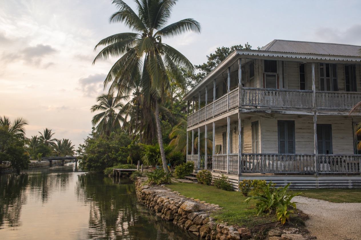
The settlement began on the water. St. George’s Caye lies eight miles east of Belize City, and the Spaniards once called it Cayo Cocina, or Kitchen Cay. As the capital of the early colony, it was the center of British life in the region for much of the 1700s.
Today the island is a small village in the Belize District, with a population of 657 at the last census that counted it. St. George’s Caye Resort there focuses on diving, sailing and snorkeling. A British Army adventure training center for soldiers and their families once offered similar activities, but it closed in the late twentieth century.
Hurricane Hattie and the move to Belmopan
Two hurricanes shaped the colony’s capital. The worst in recent history demolished Belize Town in September 1931 and killed more than 1,000 people. Hurricane Hattie then struck in 1961, the strongest and deadliest storm of that Atlantic season, reaching Category 5 with winds of 165 mph.
In Belize City, then the capital of British Honduras, wind and storm surge damaged over 70% of the buildings and left more than 10,000 people homeless. Most of the city was wooden, and most wooden buildings were destroyed. Offshore, the storm heavily damaged 80% of the barrier reef, though the reef recovered. In Stann Creek, over 75% of residents fled to safer places before it hit.
The destruction led the government to move the capital inland to Belmopan, completed in 1970. Belize City remains the largest city, and a monument there honors the victims of Hattie. It was unveiled on the 44th anniversary of the storm.
A mix of cultures that shaped the nation
The colony’s people left a culture with many threads: Kriol, Maya, East Indian, Garinagu (Garifuna), Mestizo and Mennonite influences, among others. You can hear that in the music.
Brukdown, a modern style related to calypso, grew out of the music and dance of loggers. Everyday life offers surprises too: ice hockey is played among the Mennonite population in the Western Cayo District, and an international cross-country cycling race is held every Easter weekend. The cayes are favorite recreation spots for city people, especially during school vacations and at Easter.
Which historic sites can you visit?
The main historic stops are the Museum of Belize in Belize City, the Maya sites of the interior and north, and the old settlement island of St. George’s Caye. Together they cover three thousand years of history, from early Maya villages to the colonial port.
The Museum of Belize
The museum is an art and history museum in Belize City, housed in a building with a story of its own. It served as the Belize City Prison until 1993, when prisoners were transferred to Hattieville Prison, and it was restored and renovated into the national museum in 2002.
Inside, exhibits on slavery include a timeline, accounts of slave revolts and the communities of escaped slaves known as maroons. Maya artifacts trace some 3,000 years of Maya history. Other rooms cover the prison’s own past, colonial life, natural history, visual arts and the cultural traditions of the nation’s many ethnic groups. It makes a good first stop before heading out to the ruins.
Altun Ha and Lamanai
Altun Ha lies northwest of Belize City and preserves remnants of Maya culture. A tomb there held one of the finest carved jade objects of Maya civilization, a head of the sun god Kinich Ahau. It is a natural place to start learning how the Maya connected ritual, trade and craftsmanship.
Lamanai stands on Hill Bank Lagoon in the Orange Walk District. Its lagoon setting, in a region that also holds the early pottery site of Cuello near Orange Walk, makes the north a rewarding area for anyone interested in how long people have lived here.
Caracol, Xunantunich and the west
In the west, Caracol, Cahal Pech and Xunantunich belong to the Maya cities that reflect a population much denser than today’s. Caracol’s monuments carry inscriptions in Classic Ch’olti’an, and Baking Pot and Xunantunich both lie in the Cayo District.
These sites are best approached as a set of places that together explain the region’s role in the Maya world. If you want to understand why the interior was once so crowded, they answer it more clearly than any museum label.
Southern Maya sites and Garifuna towns
In the Toledo District, Lubaantun and Nim Li Punit offer a quieter side of the Maya story, and Punta Gorda, where Garifuna families have long lived, is the region’s main town. Pairing the ruins with a town like Punta Gorda or Dangriga links the ancient and recent past: both settlements go back to early Garifuna communities, and both are tied to the music of punta and paranda.
On the coast, Cerros on Chetumal Bay recalls the Maya trade routes that once tied the interior to the sea. Seen together, these places make a loop through the country’s whole story rather than a list of isolated stops.
Good to know before you go
The U.S. State Department rates Belize Level 2, “Exercise increased caution”, because of crime, and says the south side of Belize City has historically had the highest concentration of violent crime.
The currency is the Belize dollar, and the country keeps Central Standard Time all year. English is spoken everywhere, which makes museum visits and conversations with guides straightforward.
The Atlantic hurricane season runs from June 1 to November 30, a stretch that includes the September anniversaries of the Battle of St. George’s Caye and of the great storms in this history. Belize City is the largest city and the usual gateway, while Belmopan, built after Hattie, is the capital.
Sources
- Wikipedia, History of Belize (https://en.wikipedia.org/wiki/History_of_Belize), checked October 11, 2026
- Wikipedia, Hurricane Hattie (https://en.wikipedia.org/wiki/Hurricane_Hattie), checked October 11, 2026
- Wikipedia, Culture of Belize (https://en.wikipedia.org/wiki/Culture_of_Belize), checked October 11, 2026
- Wikipedia, Museum of Belize (https://en.wikipedia.org/wiki/Museum_of_Belize), checked October 11, 2026
- Wikipedia, Belize (https://en.wikipedia.org/wiki/Belize), checked October 11, 2026
- Wikipedia, St. George's Caye (https://en.wikipedia.org/wiki/St._George's_Caye), checked October 11, 2026
- U.S. Department of State, Belize Travel Advisory, Level 2, March 11, 2026 (https://travel.state.gov/), checked October 11, 2026
- NOAA National Hurricane Center, Climatology (https://www.nhc.noaa.gov/climo/), checked October 11, 2026