
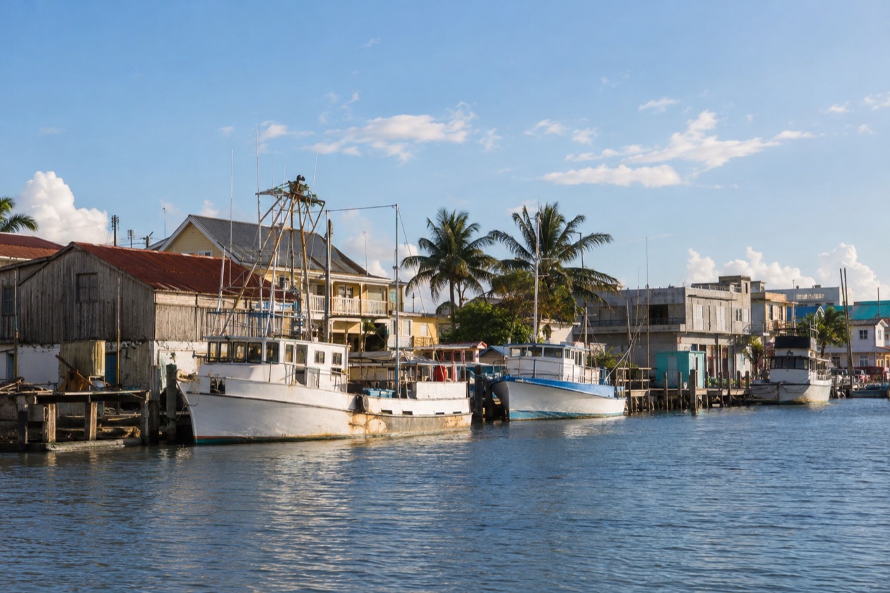
Where Haulover Creek runs out into the Caribbean, the sea breeze moves through the palms of the Fort George waterfront and rattles the shutters of old wooden houses with deep galleries. Fishing boats and pelicans share the harbor edge with the gate of the cruise terminal. This is the tidy seaside corner of Belize City, a place for strolling at the water’s edge, looking at colonial architecture and eating Belizean food before heading to the cayes or the rainforest.
What is the Fort George area of Belize City like?
The Fort George area is the harbor-front district of Belize City, a compact peninsula neighborhood of waterfront parks, a lighthouse, hotels, consulates and the cruise terminal. It sits at the mouth of Haulover Creek, on the Caribbean coast, in the largest city in the country. The name goes back to the old British fort that once guarded the entrance to the creek, and the district still feels like the front porch of the city, turned toward the water.
Belize City was the capital of British Honduras for generations, and the Fort George district was where much of that colonial life played out: the governor’s circle, the merchants, the ships coming in from Europe. The government left for Belmopan in 1970 after a hurricane in 1961 flooded and shattered the city.
Hurricane Hattie reached Category 5 with winds of 165 mph, and in Belize City it damaged more than 70% of the buildings, most of them wooden. A monument in the city now recognizes the victims. That history explains why so many houses here are newer than their wooden gingerbread style suggests, and why the waterfront has a sober, remembered feel.
Today the district suits travelers who like to see a city on foot rather than from a bus window. It rewards people with a few free hours between a flight and a boat, cruise passengers with a morning ashore, and anyone curious about how Belize built itself on the port trade. Creole, Garifuna, Maya, Mestizo and Mennonite Belizeans all pass through this city, and you hear Kriol, English and Spanish at the same corner.
The mood is quiet, breezy and a little formal, more consulate lawn than party strip. Evenings bring locals to the seawall, joggers to the promenade and the smell of grilled fish from somewhere close by. It is a place to sit down, watch boats and let the city come to you.
Things to do in the Fort George area of Belize City
Fort Street Tourism Village
The Fort Street Tourism Village sits at the mouth of Haulover Creek, on the northern bank, on about two acres of land. It is the cruise terminal of Belize City, a compound of shops, craft stalls and cafés built to greet passengers stepping off the ships. The village is only open when a cruise ship is in town, so on a day with no ship the gates stay closed.
Inside you find Belizean crafts: woodcarvings, Garifuna drums, baskets, hot sauces, jams and rum. It is a handy place to pick up gifts and to taste a cold Belikin beer or a fruit punch under an awning while the harbor shimmers behind you. The village also works as a starting point for the tours that fan out to the caves, ruins and cayes.
The waterfront and Baron Bliss Park
A walk along the seawall is the signature thing to do here. Palms, benches and small pavilions line the water, and the Fort George Lighthouse and the memorial to Baron Bliss stand at the point. Baron Bliss was an English benefactor who left his fortune to the people of Belize, and each March the country marks Baron Bliss Day with regattas and horse races.
Go when the light is soft and the breeze is moving, and bring a hat for the sun. The park is a good spot to watch pelicans and frigatebirds working the harbor, and to see small boats headed out toward the reef. Children play on the lawns, and older residents sit in the shade of the almond trees to talk.
The Swing Bridge
On the edge of the district, the Swing Bridge crosses Haulover Creek and links the harbor side of the city with the south. It is the only functioning, manually operated swing bridge in the world, and the sight of it opening to let a boat through is the kind of small spectacle the city is proud of. Look for the iron frame, the crank and the crowd of cyclists waiting for the way to reopen.
The creek here is lined with fishing boats, small cargo vessels and old warehouses, and the bridge makes a good place to take photographs of the working city. Stand on the north side to look back toward the water and the Fort George skyline.
Colonial streets and consulate row
Behind the waterfront, the streets of Fort George hold some of the best-kept wooden houses in the city. You see high-pitched roofs, louvered windows, white railings and galleries that catch the breeze. Some are guesthouses and offices, a few are private homes, and they give you an idea of what the whole city looked like before Hattie.
Walk the quiet blocks for the details: carved brackets, painted shutters and gardens thick with hibiscus and croton. It is an unhurried way to understand how Belize City was laid out, with the sea at one end and the creek at the other.
Within reach of the district is the Museum of Belize, an art and history museum in Belize City that was established in 2002. The building served as the city prison until 1993 and was restored into a national museum. Its exhibits cover about 3,000 years of Maya history, slavery in Belize and the maroon communities of escaped slaves, colonial life, natural history and the cultures of the many ethnic groups of the nation.
Eating and drinking in the Fort George area of Belize City
Eating here means Belizean Creole cooking: plates of rice and beans with stew chicken, fried plantain and a scoop of potato salad, served at small restaurants where the menu is whatever the cook made that morning. Seafood is the other pillar, with whole fried snapper, conch fritters, ceviche and lobster when it is in season.
Breakfast is its own tradition. Look for fry jacks, puffy fried dough served with beans, eggs and cheese, or johnnycakes, a dense, buttery bread often split and filled. Coffee and fresh juice go alongside. A lunch of tamales or panades, small fried masa pockets filled with fish or beans, fits neatly into a walk along the waterfront.
Garifuna cooking shows up too, in hudut, a fish stew with coconut and mashed plantain, and in coconut-based soups that reflect the Garifuna communities farther down the coast. Ask for the hot sauce on the table, usually made from habanero and often homemade.
For drinks, Belikin is the national beer and it appears everywhere, cold and cheap in spirit. Rum is the other local favorite, in rum punch and in simple rum and Coke, and you also find fresh limeade, sorrel and fruit juices in the cafés around the Tourism Village. Hotel restaurants along the waterfront offer sit-down meals with sea views, and small bakeries sell coconut bread and sweet buns early in the day.
A good rhythm for a day here: fry jacks for breakfast, a walk, a plate of stew chicken for lunch, and fresh grilled fish and a cold beer near the water as the light goes orange. It is simple, filling food that tells you more about Belize than any menu description could.
Staying in the Fort George area of Belize City
The Fort George area suits travelers who want to sleep by the water in Belize City for a night or two, before or after a trip to the cayes, the reef or the jungle. Lodging here runs from harbor-front hotels to small guesthouses and bed and breakfasts in converted wooden houses, so you can choose between a polished lobby and a creaking gallery with a rocking chair.
The location puts you near the Tourism Village, the seawall and the Swing Bridge, which keeps your evenings simple. A harbor-side room often comes with a sea breeze, and you may hear boats, gulls and the occasional ship’s horn. City sounds carry at night, so a room set back from the street can feel different from one on the front.
As a base, the district works for a short stay rather than a long one. Belize City is the largest city in the country and the principal port, financial and industrial hub, so you are close to the municipal airport and to the departure points for the water taxis to the cayes. From the Fort George side you can start an excursion in the morning without crossing the whole city.
Choose your room with the season in mind. Hurricane season runs from June 1 to November 30, and a harbor-front location is the part of the city closest to the water. Many guests who plan to travel on to Ambergris Caye, Caye Caulker, the Cayo District or the south treat Fort George as a comfortable first or last night.
Getting to the Fort George area of Belize City
Most arrivals begin at Philip S. W. Goldson International Airport (BZE), in the village of Ladyville, northwest of Belize City. It is about a 30-minute drive to the city centre, so you can be settled into a Fort George room in time for a late lunch. Belize City Municipal Airport lies within the city itself, which makes it the closer airfield for domestic hops.
The Fort Street Tourism Village is where cruise passengers step ashore, at the mouth of Haulover Creek. From the terminal gate you walk straight into the district, and the waterfront, the lighthouse and the Swing Bridge are all around you, so many cruise passengers simply explore on foot.
For travel onward by land, buses leave Belize City for the Northern Zone, serving Orange Walk and Corozal, about every half hour from 5:30AM to 7:30PM. Westbound buses to the Western Zone, covering Belmopan, San Ignacio and Benque Viejo del Carmen, depart between 5AM and 9PM. These services let you reach the Cayo District, the Maya sites and the northern towns without leaving the country’s main roads.
Once you are in the district, the plan is simple: the waterfront, the creek and the colonial streets are close together, so you can walk between them. Because Belize City sits on a small peninsula pushing into the Caribbean, the sea is never far away, and you can orient yourself by following the water.
Good to know before you go
The U.S. State Department rates Belize Level 2, “Exercise increased caution”, because of crime, and says the south side of Belize City has historically had the highest concentration of violent crime.
Belize uses its own Belize dollar, and the daily rhythm of the Fort George area follows the ships: the Tourism Village opens only when a cruise ship is in town, so plan shopping there around a ship day. The Atlantic hurricane season runs from June 1 to November 30, and the harbor front is the part of the city nearest the water, so a flexible plan helps if a storm is forecast.
If you need help, the emergency number in Belize is 966. Belize City rewards a relaxed pace and an eye on the weather, and pairs well with a longer stay on the cayes or inland.
Sources
- Wikipedia, Belize City (https://en.wikipedia.org/wiki/Belize_City), checked October 11, 2026
- Wikivoyage, Belize City (https://en.wikivoyage.org/wiki/Belize_City), checked October 11, 2026
- Belize Port Authority, Fort Street Tourism Village port (https://portauthority.bz/belize-port-facilities/fort-street-tourism-village-port/), checked October 11, 2026
- Wikipedia, Museum of Belize (https://en.wikipedia.org/wiki/Museum_of_Belize), checked October 11, 2026
- Wikipedia, Hurricane Hattie (https://en.wikipedia.org/wiki/Hurricane_Hattie), checked October 11, 2026
- U.S. Department of State, Belize Travel Advisory, Level 2, March 11, 2026 (https://travel.state.gov/), checked October 11, 2026
- NOAA National Hurricane Center, Climatology (https://www.nhc.noaa.gov/climo/), checked October 11, 2026