
On a morning in Belize, a pickup rattles past with a load of oranges, a cyclist wobbles along the shoulder, and a bridge ahead narrows to a single lane while a driver decides who goes first. Moments like these are when travelers start wondering what the rules actually are. A U.S. driver’s license is accepted for a limited time, traffic keeps to the right as at home, and the road itself deserves more attention than the rulebook.
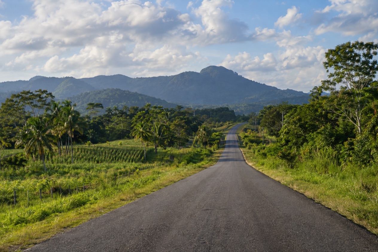
Can you drive in Belize with a U.S. license?
Yes, for a limited time: a valid U.S. driver’s license or an international driver’s permit is accepted in Belize for three months after your initial entry. That window covers a typical vacation, a long winter stay and then some. Anyone planning to stay on beyond it is dealing with a different set of paperwork, and that is a question for the local licensing authorities rather than something to improvise at a roadblock.
Your home license is the document that counts, so it should be valid, in your own name and in your wallet whenever you sit behind the wheel. An international driver’s permit is accepted on the same terms, which makes it a handy second piece of ID for anyone who already carries one. It does not extend the three months.
Rental desks at the airport
Two car rental companies are listed at the Philip Goldson International Airport near Belize City: Hertz/Safari Belize and Crystal Auto Rental. Both can be reached by phone ahead of a trip, and Crystal also takes reservations by email. The contacts are gathered here so they are in one place.
| Company | Phone |
|---|---|
| Hertz/Safari Belize | +(501) 225-3300 |
| Crystal Auto Rental | +(501) 223-1600 |
A travel agency at the same airport, All in One Travel Service, can be reached at +(501) 225-2016 or +(501) 620-2267, and by email at [email protected] or [email protected]. Whether you drive yourself or not, the airport is where many trips begin, and it helps to know who answers the phone there.
If your stay runs longer: licensing on Caye Caulker
Caye Caulker has its own traffic office, and its rules show how the system works for people who settle in rather than pass through. An applicant must hold a learner’s permit for at least one month before attempting the practical test. Driver’s license printing day on the island is every Wednesday after 3:00 p.m.
The same office handles changes of vehicle ownership, and the transfer in that process is valid for seven days. These details are specific to Caye Caulker and should not be read as the rule everywhere else in the country. For a visitor on a normal vacation they matter little, but they explain the paperwork you may see people queuing for at the island’s offices on a given day.
Taxis, buses and other ways to get around
Not everyone who skips driving is stuck. Taxis are prevalent in Belize’s cities and not as common in rural areas, and they are identified by green license plates, so a green plate is the quickest way to tell a taxi from a private car. Uber and Lyft are not available in Belize, so the apps you rely on at home will not call a car here.
Buses link the cities and are used for travel between them rather than for short commutes. Secondhand and salvage vehicles and buses are often used for public transportation and may not have security features such as seatbelts and airbags. That is a fact worth knowing when you weigh a bus against a taxi or your own wheels.
Which side of the road do you drive on?
You drive on the right side of the road in Belize, exactly as in the United States. For American drivers that removes the most disorienting part of driving abroad: no mirrored roundabouts to rehearse, no shifting from the wrong side of the car, and the same instincts for passing and turning that you use every day at home.
English is the official language, the only one in mainland Central America, so road signs and the words of anyone who stops to help you are readable without a phrasebook. That familiarity can lull you, though, because the surface under the tires is often nothing like an American highway.
What the roads are actually like
Road conditions range from two-lane paved roads to dirt or gravel tracks. The paved roads link the towns and are the ones you will see most on a map, while the tracks lead off toward farms, villages, jungle lodges and trailheads. A route that looks like a clean line on a screen can change character several times between one town and the next.
Rain changes the picture too. The dry season typically lasts from February to May and the rainy season typically lasts through November, so a dirt track in autumn is a different proposition from the same track in spring. Plan for slower going whenever the surface is anything other than pavement.
Single-lane bridges and other surprises
Bridges on some major highways can be reduced to a single lane, sometimes without warning. The road may be a normal two-lane stretch and then funnel into a crossing where one direction must wait for the other. Easing off the accelerator as you approach any bridge keeps that moment calm.
Cyclists add another layer. They commonly fail to obey red lights or stop signs and often ride against traffic, which means a bicycle can appear from the wrong direction at a junction or along a village main street. In towns, where bikes are part of daily life, scan both sides of the road, not just the lane you expect traffic to come from.
The airport access road
Roadwork and dredging are underway on the access road to the Philip Goldson International Airport, which means slower traffic and uneven road surfaces. Drivers heading there should leave extra time for the trip. That matters most on the way out at the end of a vacation, when a flight is waiting and the last miles of the drive are the slowest.
Inside the work zone, reduce speed and follow the flaggers, and watch for dredging equipment and workers near the roadway. Treat the stretch the way you would a construction zone at home, with patience and with your eyes on the people in it.
What are the road rules?
The rules that matter most to a visitor come down to caution rather than a list of regulations: keep to the right, avoid driving after dark, and expect surprises from bridges, bicycles and work zones. Beyond the three-month limit on a U.S. license, what the road asks of you is mostly attention.
Driving after dark
Driving at night is strongly discouraged in Belize. Many roads outside the towns have no lighting, and the hazards described elsewhere, from single-lane bridges to cyclists riding the wrong way, are far harder to spot once the sun is down. The sensible habit is to plan your day so that the last stretch of any drive ends while there is still light.
In the rainy months that habit is worth even more, because wet pavement and a gravel shoulder look alike in the dark. If a late arrival is unavoidable, a taxi, identifiable by its green plates, takes the driving off your hands, at least in the cities where taxis are prevalent.
When something goes wrong
Roadside assistance is frequently unavailable in Belize. A flat tire or a stalled engine on a quiet rural stretch is therefore something you should expect to handle yourself, or with the help of a passing driver, rather than with a quick call to a tow service. Setting out with a full tank and a charged phone is the kind of habit that pays off here.
Staying on the paved roads between towns, where other traffic is more likely to pass, is the natural way to lower the odds of being stranded.
Sharing the road
On the road you will share space with taxis, buses, pickups hauling farm goods, and cyclists. Buses connect the cities rather than serving short commutes, so you tend to meet them on the highways between towns. In rural areas, where taxis are less common, private vehicles and bikes make up more of what you see.
Mariners and passengers planning travel by water should check for U.S. Maritime Advisories and Alerts. Anyone thinking of a flight on a small plane should know that the U.S. Federal Aviation Administration has not assessed Belize’s Civil Aviation Authority for compliance with international standards for aviation safety oversight.
Good to know before you go
The U.S. State Department rates Belize Level 2, “Exercise increased caution”, because of crime, and says the south side of Belize City has historically had the highest concentration of violent crime.
Cash machines are not everywhere, but ATMs of three banks accept Mastercard: Belize Bank, Scotiabank and Atlantic Bank, so it is worth topping up before leaving a town for the countryside. The Atlantic hurricane season runs from June 1 to November 30, and heavy weather can change a road’s condition quickly. In the Cayo district, entering caves without a licensed guide is both dangerous and illegal, so a drive to a trailhead ends with a guide, not a solo walk.
Sources
- U.S. Department of State, Belize Travel Information, Traveling and transportation (https://travel.state.gov/), checked October 11, 2026
- Philip S. W. Goldson International Airport (Belize), Travel and ground transportation (https://www.pgiabelize.com/passenger-info/travel-ground-transporation/), checked October 11, 2026
- Caye Caulker Village Council, Traffic (https://www.cayecaulkervillagecouncil.org/traffic), checked October 11, 2026
- Wikivoyage, Belize (https://en.wikivoyage.org/wiki/Belize), checked October 11, 2026
- U.S. Department of State, Belize Travel Advisory, Level 2, March 11, 2026 (https://travel.state.gov/), checked October 11, 2026
- NOAA National Hurricane Center, Climatology (https://www.nhc.noaa.gov/climo/), checked October 11, 2026