
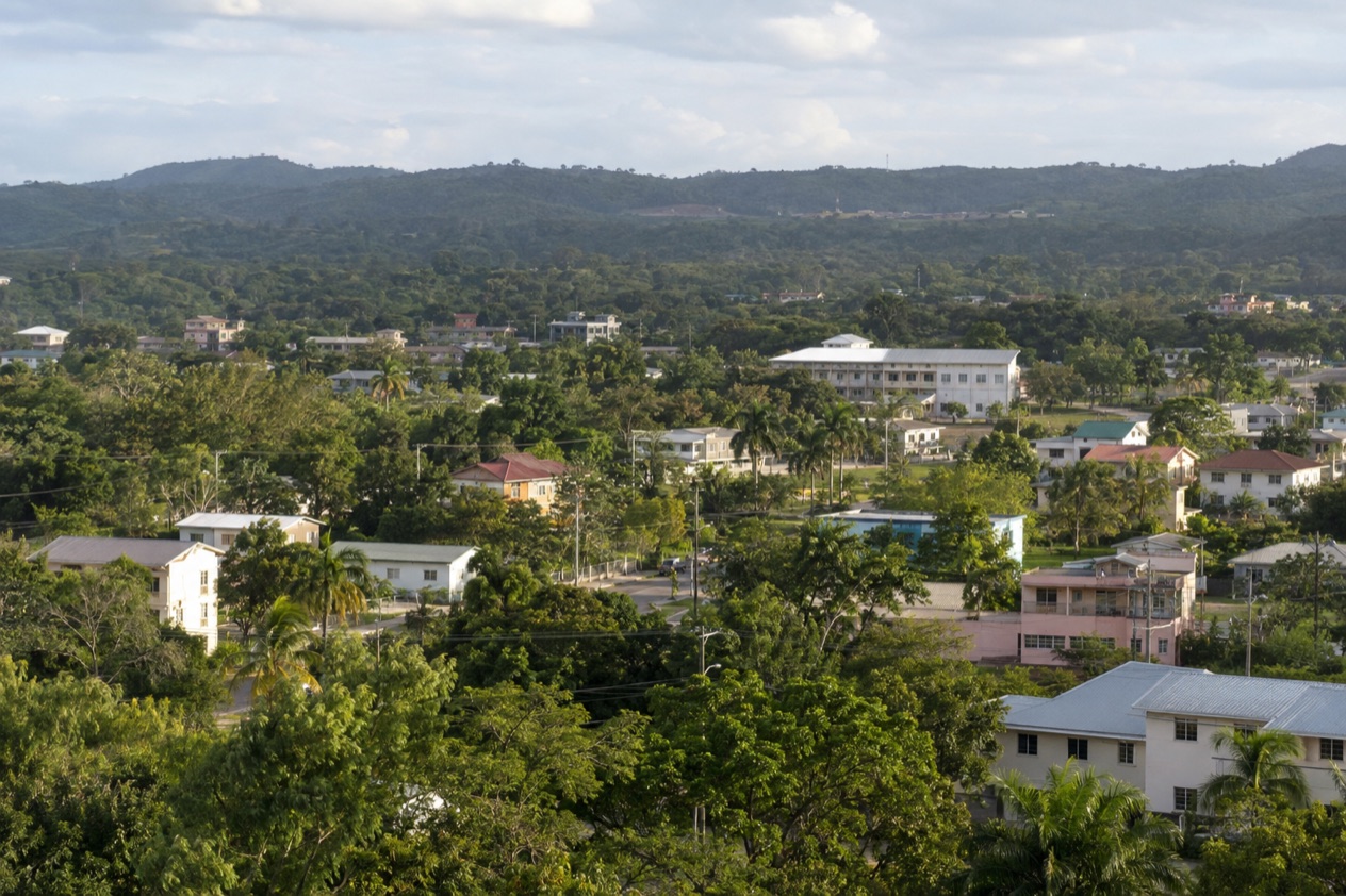
Leaving Belize City early, you pass the swing bridges and the stilted wooden houses, and the city thins out into pine, savanna and low green hills. Belmopan sits at the end of that road, a small capital of government buildings, quiet streets and wide lawns, built in the 1960s after a hurricane flattened much of the old coastal capital. It makes a practical stop and a good base for the caves, rivers and Maya sites of the Cayo District.
How do you get to Belmopan from Belize City?
Belmopan lies about 50 miles inland from Belize City, and you reach it by road, either on a bus that ends at the Belmopan Bus Terminal or in a car you drive yourself or have driven for you. There is no boat and no airstrip involved. The water taxis leaving the Belize Marine Terminal go to the cayes, and the flights from the international airport go to the coast and the south.
What decides the choice is where you are starting and what you want from the day. From the downtown waterfront, the bus is a straightforward way to arrive, and it drops you in the middle of the government campus.
From the international airport in Ladyville, which lies 10 miles outside Belize City, the rental desks in the terminal put a car in your hands on the spot. Someone who wants to stop at a park or a viewpoint on the way will think differently from someone who simply needs to be at an office or a hotel in town.
The landscape changes as you go. Belize City is low, flat and at sea level, while Belmopan stands at 249 feet, a modest rise that already feels different, with more trees, more hills on the horizon and a calmer pace. The road runs through the interior, past small villages, roadside fruit stands and fields, and it is the same corridor that carries travelers toward San Ignacio and the Guatemalan border in the west.
Timing matters in October. The Atlantic hurricane season runs through the end of November, so a long, rainy day on an inland road is a possibility to plan around, and a route with a few indoor stops is easy to build in Belmopan itself.
Ways to get to Belmopan from Belize City
By bus to the Belmopan Bus Terminal
Bus travelers arrive at the Belmopan Bus Terminal, at the corner of Constitution Drive and Bliss Parade, toward the southwest corner of the government campus. It is a central place to step off. The ministries, the National Assembly and the main streets of the town are all around it, so you can start walking as soon as you have your bag.
The ride suits travelers who want to watch the countryside change without having to drive. You see the savanna and the pine stands give way to hills, and you cross the same stretch of road that locals use every day to reach the capital for work and errands. It also suits anyone who plans to continue west, since Belmopan is a natural pause between the coast and the Cayo District.
A useful habit is to work out where you will sleep and eat before you get off, because the terminal sits in an administrative district rather than a tourist strip. Have your lodging address written down, and keep a small bag with you for the day.
By rental car from the airport
Two rental companies keep desks at the Philip Goldson International Airport. Hertz/Safari Belize can be reached at +(501) 225-3300, and Crystal Auto Rental at +(501) 223-1600. For a traveler who lands, collects keys and heads inland, this removes the step of going into Belize City first.
One thing to plan for is the airport access road. Roadwork and dredging are underway there, which means slower traffic, uneven surfaces and workers near the roadway. Drivers are asked to reduce speed, follow the flaggers and watch for dredging equipment. Leave extra time on the way out, particularly if you have a connecting plan in Belmopan.
A car also gives you the freedom to stop where you like on the road south of town, where a national park sits right beside the Hummingbird Highway. It suits travelers who want to combine Belmopan with the Cayo District in one trip, and who are comfortable choosing their own route.
With a driver or a guided outing
Some travelers prefer to hand the road to someone else and arrive rested, especially when the plan includes a cave, a river or a ruin after Belmopan. A driver or a guided outing lets you look out the window instead of at the road, and it lets you decide the stops in advance with the person who knows the way.
What you arrange matters more than how you get there. A day that centers on the Cayo District, with its Maya sites of Caracol, Xunantunich and Cahal Pech, calls for a different plan than a day spent in the capital itself. Settle that first, then choose how to travel.
Options compared
| Option | Starts | Ends | What to know |
|---|---|---|---|
| Bus | Belize City | Belmopan Bus Terminal, Constitution Dr and Bliss Parade | Drops you beside the government campus |
| Rental car | Philip Goldson International Airport, Ladyville | Wherever you choose in Belmopan | Roadwork on the airport access road means slower traffic and flaggers |
| Water taxi (not for Belmopan) | Belize Marine Terminal, North Front Street | San Pedro, Caye Caulker or Chetumal | Serves the coast and the cayes, not the interior |
Read side by side, the options come down to what you want to do at either end. The bus ends in the heart of Belmopan, while a rental car ends wherever you point it, including a park or a village farther on. The water taxi row is there because the terminal on North Front Street is one of the first things people see in Belize City, and it leads to the cayes rather than the capital.
If you are flying in and the capital is your first stop, the airport desks make the rental route the natural one. If you are already downtown and have no plan beyond the town itself, the bus does the job. Anyone building a longer loop through the west, with sites and caves in the Cayo District, will find that a car or a driver gives the most room to stop.
Making a day of it
Belmopan rewards a slow look. It was founded after Hurricane Hattie struck in 1961, when the storm damaged over 70 percent of the buildings in Belize City and left more than 10,000 people homeless.
The government proposed a new capital farther from the sea, and Belmopan became the capital of Belize, closer to the geographic center of the country. You see that history in the planned layout, the low government buildings and the lawns, and in how different the town feels from the old port.
St. Herman’s Blue Hole National Park
The park lies twelve miles southeast of Belmopan, on the right side of the Hummingbird Highway. It protects 575 acres of forest rich with wildlife and unusual geological features. It was first declared Blue Hole National Park on November 23, 1986, and renamed in 2005 to avoid confusion with the Blue Hole Natural Monument at sea.
This is a green, shaded stop that contrasts sharply with the open sea of the coast. Come for the forest, the birds and the sense of being under a canopy rather than on a beach. It suits a traveler with a car or a driver, since it sits right beside the highway.
The Cayo District and its Maya sites
Belmopan itself is in the Cayo District, which spreads across the west of Belize and borders Guatemala. Its capital is San Ignacio. The district holds a cluster of pre-Columbian Maya sites: Caracol, Xunantunich, Cahal Pech, Baking Pot, Lower Dover and El Pilar. Each has its own character, from hilltop plazas to quiet forest groups of mounds.
Seeing even one of these sites changes the shape of a trip, and Belmopan makes a sensible place to sleep before or after. If you have only one day, pick a single site or park rather than trying to see several, and leave time to eat in town.
Around town
In town, look for the National Assembly building, whose design draws on Maya temple architecture, and walk the wide streets of the government campus. Belmopan also draws many residents from neighboring Central American countries, so you may find Spanish spoken as often as English and Salvadoran or Guatemalan dishes alongside rice and beans.
The U.S. Embassy is at #4 Floral Park Road, and its hours are posted in the table for anyone who needs to visit in person.
| Site | Open |
|---|---|
| U.S. Embassy, #4 Floral Park Road | Monday to Thursday 7:30am to 5:15pm, Friday 7:30am to 12:30pm, closed Saturday and Sunday |
As for when to leave, an early start from Belize City gives you the most daylight at the other end, whether you plan a park, a ruin or a long lunch in the capital. Bring layers, a water bottle and a small day bag, and keep your plans for one or two stops rather than five.
Good to know before you go
The U.S. State Department rates Belize Level 2, “Exercise increased caution”, because of crime, and says the south side of Belize City has historically had the highest concentration of violent crime.
Belmopan is a quiet town, and a small amount of cash in Belize dollars or U.S. dollars is useful for snacks and short stops. The Atlantic hurricane season runs from June 1 to November 30, so a rainy spell in October can change a day’s plan. Keep a flexible schedule and an indoor option in reserve.
U.S. citizens with an emergency in Belize can call the U.S. Embassy in Belmopan at (+501) 822-4011, including outside office hours. For the road itself, follow the flaggers on the airport access road, leave extra time for it, and keep your lodging address handy on arrival.
Sources
- Philip S. W. Goldson International Airport (Belize), Travel and ground transportation (https://www.pgiabelize.com/passenger-info/travel-ground-transporation/), checked October 11, 2026
- Philip S. W. Goldson International Airport (Belize), FAQ (https://www.pgiabelize.com/about-us/faq/), checked October 11, 2026
- San Pedro Belize Express Water Taxi, FAQ (https://belizewatertaxi.com/information/faq/), checked October 11, 2026
- San Pedro Belize Express Water Taxi, Schedule (https://belizewatertaxi.com/schedule/), checked October 11, 2026
- Tropic Air, Belize International Airport (https://www.tropicair.com/belize-international-airport-bze/), checked October 11, 2026
- Maya Island Air, International flights (https://www.mayaislandair.com/belize-international-flights/), checked October 11, 2026
- Wikipedia, Belmopan (https://en.wikipedia.org/wiki/Belmopan), checked October 11, 2026
- Wikivoyage, Belmopan (https://en.wikivoyage.org/wiki/Belmopan), checked October 11, 2026
- Wikipedia, Cayo District (https://en.wikipedia.org/wiki/Cayo_District), checked October 11, 2026
- Wikipedia, Hurricane Hattie (https://en.wikipedia.org/wiki/Hurricane_Hattie), checked October 11, 2026
- U.S. Embassy in Belize (https://bz.usembassy.gov/), checked October 11, 2026
- Belize Audubon Society, St. Herman's Blue Hole National Park (https://belizeaudubon.org/shbh/), checked October 11, 2026
- Great-circle distance computed from the GPS coordinates of the two places, October 10, 2026
- U.S. Department of State, Belize Travel Advisory, Level 2, March 11, 2026 (https://travel.state.gov/), checked October 11, 2026
- NOAA National Hurricane Center, Climatology (https://www.nhc.noaa.gov/climo/), checked October 11, 2026
To plan your stay
- Best Time to Visit Belmopan: Dry Season, Weather by Month and Festivals
- Things to Do in Belmopan: St. Herman's Blue Hole, Maya Ruins, Belizean Food and Day Trips
- Where to Stay in Belmopan: Government Campus, Floral Park Road and Cayo District Lodges
- Belmopan in January: George Price Day, Weather and Things to Do