
Somewhere in the middle of the week, the sandy lanes of Caye Caulker are behind you and the stone plazas of the Cayo hills are still ahead. You are on a boat crossing flat, turquoise water toward San Pedro, with the reef somewhere off to the east. The route runs from the small cayes to the green interior, with the reef and Maya ruins as its two halves.
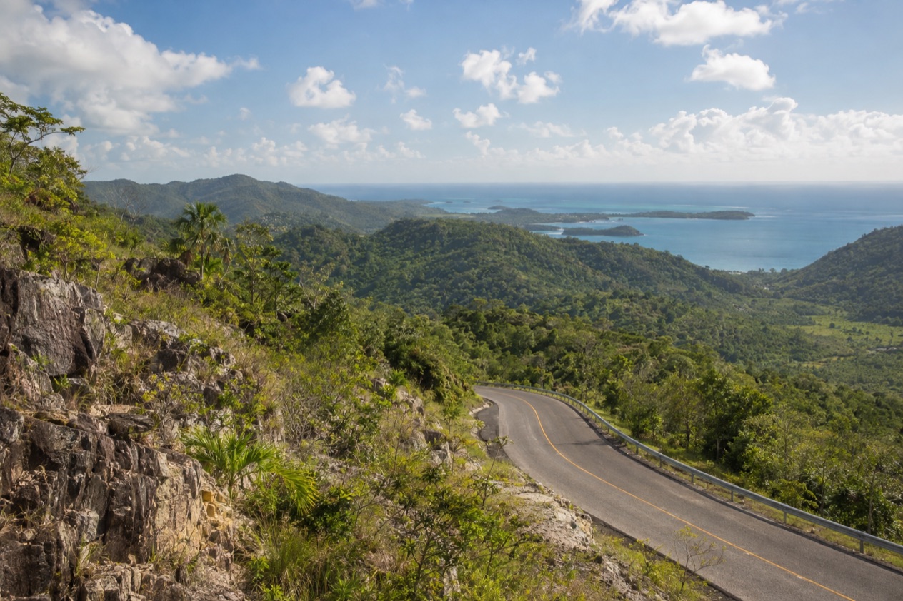
Is 7 Days enough for Belize?
Yes, for a traveler who wants a first look at both the sea and the forest and is happy to leave the rest for another visit. A week is enough to sleep on two islands, spend real time around the barrier reef and settle for a few nights in the western hills. It is not enough to cover the whole country, and that is a good reason to choose a route and keep to it.
The route below starts and ends at the Philip S. W. Goldson International Airport in Ladyville, the only international airport in Belize. From there it goes to Caye Caulker, then to San Pedro on Ambergris Caye, then inland to San Ignacio in the Cayo District. Each stop is a different Belize. The cayes are low, sandy and sea-facing. The Cayo District is hilly, wooded and dotted with ancient Maya sites.
Belize is small, and the barrier reef alone runs for about 200 miles, the longest in the western hemisphere. The reef is a World Heritage Site, and it is the reason the first four days are spent on the water. That much sea time leaves the southern coast, the far north and the offshore atolls for another trip.
Placencia, Hopkins and Dangriga on the southern coast, Corozal and Sarteneja in the north, and the Great Blue Hole are all real options, but each adds a leg and takes time from the rest. Squeezing them in turns a week into a series of transfers. This itinerary prefers three bases and unhurried days, which suits couples, friends and families who would rather unpack rarely.
One more thing shapes the plan. Belize is a country of short distances but not of fast ones. Some legs go by air, some by sea and some by road, and each has its own rhythm. The route keeps the legs few and puts the longer ones at the edges of the trip, so that the middle days are for being somewhere rather than getting there.
The itinerary stage by stage
Days 1 and 2: Caye Caulker
Land at the airport in Ladyville and head for Caye Caulker, a small island roughly 20 miles north-northeast of Belize City and about a mile west of the barrier reef. The boat from Belize City takes about 45 minutes. San Pedro Belize Express, which runs boats on this coast, accepts Visa, Mastercard and Discover for walk-in purchases at its terminals. If you land late, simply spend the evening settling in.
Sleep in the village itself, where guesthouses, small hotels and beach bars sit within a few sandy streets of one another. Caye Caulker is about five miles long, and the pace is set by people on foot and by bicycle.
On day 2, walk to the Split, the channel that cuts the island in two. Hurricane Hattie opened it in 1961, and today it is where people sit, swim in their own judgment and watch the water.
The island also sits inside the Caye Caulker Marine and Forest Reserve, established in April 1998. Hol Chan Marine Reserve lies close by, covering reef, seagrass beds and mangrove forest, and it is the natural reef outing from this base. Spend the evening over a plate of grilled fish or lobster in season, then walk back along the lanes.
Days 3 and 4: San Pedro and Ambergris Caye
On day 3, a boat carries you from Caye Caulker to San Pedro in about 30 minutes. San Pedro is the town on the southern part of Ambergris Caye, the largest of the several hundred cayes in the northern waters of Belize. It was granted township status on November 27, 1984, and it has grown into a busy waterfront town of docks, beach bars and restaurants.
Ambergris Caye is long and narrow, about 25 miles from north to south and about a mile wide, so the whole island feels like a thin strip between the lagoon and the reef. Stay in or near town, where you can reach restaurants without a long trip, or stay a little further along the shore. Several resorts are on the island, among them Matachica and Victoria House.
Use day 4 for the reef. Hol Chan Marine Reserve lies close to Ambergris Caye and covers about 18 square kilometers of coral reef, seagrass and mangrove. Spend the rest of the day on the beach or in town, and eat by the water. Fresh ceviche, conch and grilled snapper are the dishes you will see on most menus along the shore.
Days 5 to 7: San Ignacio and the Cayo District
On day 5, leave the sea behind. From San Pedro, go to Belize City by boat (about 1 hour 30 minutes) or by air (about 20 minutes), then continue west by road. San Ignacio stands on the Macal River in western Belize, about 63 miles west of Belize City, and it is the capital of the Cayo District. Together with Santa Elena, it forms a twin town of about 21,000 people.
Sleep in town or in one of the lodges of the Cayo District, such as Chaa Creek, Blancaneaux Lodge or Ka’ana. The change is sharp, from sand and salt to river valleys, hills and old stone. Day 6 is for the Maya sites. Cahal Pech stands near San Ignacio and shows evidence of habitation going back to 1200 BCE, which makes it one of the oldest recognizably Maya sites in western Belize.
Xunantunich sits on a ridge above the Mopan River, about 70 miles west of Belize City and a little over half a mile from the Guatemala border. Visit it on the same day or on day 5, depending on your arrival. For these sites, admission fees are payable at the gate.
On day 7, head back toward the airport in Ladyville by road for your flight home. The airport is about a 30-minute drive from the center of Belize City, which is useful to know if you pass through the city on the way.
Getting between stops
| Leg | How | Time |
|---|---|---|
| Belize City to Caye Caulker | Boat | About 45 minutes |
| Caye Caulker to San Pedro | Boat | About 30 minutes |
| Belize City to San Pedro | Boat | About 1 hour 30 minutes |
| Belize City to San Pedro | Flight | About 20 minutes |
| Airport (Ladyville) to Belize City center | Road | About 30 minutes |
| Belmopan to San Ignacio | Bus | About 1 hour |
The route is built around the sea at first, so the early legs are boat rides between the cayes. Ambergris Caye lies about 43 miles off the coast, and the Belize City crossing is the longest of the sea legs. The hop from Caye Caulker to San Pedro is the shortest.
For the air option, Maya Island Air flies from the Philip S. W. Goldson International Airport to San Pedro, Caye Caulker, Corozal, Dangriga, Placencia, Punta Gorda and other destinations in Belize. Its terminal at the airport can be reached at 501-225-2219 or 501-225-3347. Tropic Air also serves Dangriga, with flights to Belize City, Placencia and Punta Gorda.
The inland leg goes by road. San Ignacio is about 63 miles west of Belize City and about 22 miles west of Belmopan, the capital, which sits 50 miles inland from Belize City.
A bus covers the 26 miles between Belmopan and San Ignacio in about one hour. Belize City to San Ignacio is a single run along the same road corridor, and the sea legs and the road leg should be planned as separate days.
International flights reach Belize on a handful of carriers. American Airlines flies to Charlotte, Dallas, Miami and Los Angeles, and Alaska Airlines flies to Seattle and Los Angeles. Tropic Air also runs scheduled flights from the airport to San Salvador, San Pedro Sula, Roatán and Cancún.
What to book before your 7 Days in Belize
Settle the entry papers first. U.S. citizens need a U.S. passport valid for the length of their stay, proof of an onward or return ticket, and enough funds to cover the whole stay. Then lock in the international flights and decide how you will cover the sea legs and the airport transfer. After that, the rest of the week can stay open.
Adapting the route
Belize has a rainy season from June to November and a dry season from January to May. In Belize City, January highs average in the low 80s Fahrenheit and July highs in the upper 80s. January also brings about ten days with some rain, so the dry season is not rain-free. July brings a few more rainy days and noticeably warmer nights.
The Atlantic hurricane season runs from June 1 to November 30, and it overlaps the rainy season. If you travel in those months, keep the dates of the sea legs loose and treat the cayes as the part of the plan most likely to change. The Split on Caye Caulker is itself a reminder of what a storm can do, and Belize City was the capital until Hurricane Hattie in 1961, after which the government moved to Belmopan.
A shorter trip
With five days, drop San Pedro and spend two nights on Caye Caulker and three in San Ignacio. You keep one sea base, with the reserve and the Split, and one inland base, with Cahal Pech and Xunantunich. The route loses one boat leg and the longest of the transfers.
Another way to cut is to stay on the water. Spend all five days on Caye Caulker and San Pedro, using the boat between them. That makes a quiet beach trip, but it gives up the Maya sites completely.
A longer trip or a different base
With nine or ten days, add the southern coast. Maya Island Air flies from the international airport to Placencia and to Dangriga, which serves Hopkins. Placencia is a small village at the tip of its peninsula, and its Sidewalk, a concrete pedestrian path lined with businesses, runs most of the length of the village to the shore.
Nearby Seine Bight is a mostly Garifuna village, and Hopkins and Dangriga are Garifuna communities too, so this stretch shows another side of Belizean culture. Cockscomb Basin Wildlife Sanctuary, off the Southern Highway about 20 miles south of Dangriga, is recognized as the world’s first jaguar preserve. Gladden Spit and Silk Cayes Marine Reserve lies 22 miles off the coast of Placencia.
In the north, Corozal Town lies on the Caribbean about 84 miles north of Belize City, and Sarteneja is a fishing village at the mouth of the Bay of Chetumal. Both are far from the main tourist route and suit a traveler who wants a quieter week.
Families and slower travelers
A family does well with fewer moves. Stay four nights on one caye and three in San Ignacio, and skip the second island. Caye Caulker is a village with sandy lanes and a pace that suits children, and San Ignacio has a main hospital, La Loma Luz in Santa Elena, which is useful to know when traveling with the young.
For a slower trip of any kind, keep the legs to three and fill the days between them with walks, meals and time at the water’s edge. The route works because its stops are different from one another, not because it sees everything.
Good to know before you go
The U.S. State Department rates Belize Level 2, “Exercise increased caution”, because of crime, and says the south side of Belize City has historically had the highest concentration of violent crime.
The currency is the Belize dollar, and San Pedro Belize Express accepts Visa, Mastercard and Discover at its terminals. Keep copies of your travel documents apart from the originals. The U.S. Embassy is in Belmopan, at #4 Floral Park Road, open Monday through Thursday and until mid-day on Friday. Hurricane season runs from June 1 to November 30, so keep the sea legs flexible if you travel in those months.
Sources
- Wikipedia, Tourism in Belize (https://en.wikipedia.org/wiki/Tourism_in_Belize), checked October 11, 2026
- Wikipedia, Geography of Belize (https://en.wikipedia.org/wiki/Geography_of_Belize), checked October 11, 2026
- Tropic Air, Belize International Airport (https://www.tropicair.com/belize-international-airport-bze/), checked October 11, 2026
- San Pedro Belize Express Water Taxi, FAQ (https://belizewatertaxi.com/information/faq/), checked October 11, 2026
- Maya Island Air, International flights (https://www.mayaislandair.com/belize-international-flights/), checked October 11, 2026
- Wikipedia, Ambergris Caye (https://en.wikipedia.org/wiki/Ambergris_Caye), checked October 11, 2026
- Wikipedia, San Pedro Town (https://en.wikipedia.org/wiki/San_Pedro_Town), checked October 11, 2026
- Wikivoyage, Ambergris Caye (https://en.wikivoyage.org/wiki/Ambergris_Caye), checked October 11, 2026
- Wikivoyage, San Pedro (Belize) (https://en.wikivoyage.org/wiki/San_Pedro_(Belize)), checked October 11, 2026
- Wikipedia, Hol Chan Marine Reserve (https://en.wikipedia.org/wiki/Hol_Chan_Marine_Reserve), checked October 11, 2026
- Wikipedia, Caye Caulker (https://en.wikipedia.org/wiki/Caye_Caulker), checked October 11, 2026
- Wikivoyage, Caye Caulker (https://en.wikivoyage.org/wiki/Caye_Caulker), checked October 11, 2026
- Belize Fisheries Department, Caye Caulker Marine Reserve (https://fisheries.gov.bz/ccmr/), checked October 11, 2026
- Caye Caulker Village Council, Traffic (https://www.cayecaulkervillagecouncil.org/traffic), checked October 11, 2026
- Caye Caulker Village Council, About (https://www.cayecaulkervillagecouncil.org/about), checked October 11, 2026
- Wikipedia, Belize City (https://en.wikipedia.org/wiki/Belize_City), checked October 11, 2026
- Wikivoyage, Belize City (https://en.wikivoyage.org/wiki/Belize_City), checked October 11, 2026
- Wikipedia, Belize District (https://en.wikipedia.org/wiki/Belize_District), checked October 11, 2026
- Wikivoyage, Belize District (https://en.wikivoyage.org/wiki/Belize_District), checked October 11, 2026
- Wikipedia, Philip S. W. Goldson International Airport (https://en.wikipedia.org/wiki/Philip_S._W._Goldson_International_Airport), checked October 11, 2026
- Wikipedia, Placencia (https://en.wikipedia.org/wiki/Placencia), checked October 11, 2026
- Wikivoyage, Placencia (https://en.wikivoyage.org/wiki/Placencia), checked October 11, 2026
- Wikipedia, Seine Bight (https://en.wikipedia.org/wiki/Seine_Bight), checked October 11, 2026
- Belize Fisheries Department, Gladden Spit and Silk Cayes Marine Reserve (https://fisheries.gov.bz/gsscmr/), checked October 11, 2026
- Wikipedia, Gladden Spit and Silk Cayes Marine Reserve (https://en.wikipedia.org/wiki/Gladden_Spit_and_Silk_Cayes_Marine_Reserve), checked October 11, 2026
- Wikipedia, San Ignacio, Belize (https://en.wikipedia.org/wiki/San_Ignacio,_Belize), checked October 11, 2026
- Wikivoyage, San Ignacio (Belize) (https://en.wikivoyage.org/wiki/San_Ignacio_(Belize)), checked October 11, 2026
- Wikipedia, Cayo District (https://en.wikipedia.org/wiki/Cayo_District), checked October 11, 2026
- Wikipedia, Xunantunich (https://en.wikipedia.org/wiki/Xunantunich), checked October 11, 2026
- Wikipedia, Cahal Pech (https://en.wikipedia.org/wiki/Cahal_Pech), checked October 11, 2026
- Wikipedia, Hopkins, Belize (https://en.wikipedia.org/wiki/Hopkins,_Belize), checked October 11, 2026
- Wikipedia, Dangriga (https://en.wikipedia.org/wiki/Dangriga), checked October 11, 2026
- Wikivoyage, Dangriga (https://en.wikivoyage.org/wiki/Dangriga), checked October 11, 2026
- Wikipedia, Cockscomb Basin Wildlife Sanctuary (https://en.wikipedia.org/wiki/Cockscomb_Basin_Wildlife_Sanctuary), checked October 11, 2026
- Belize Audubon Society, Cockscomb Basin Wildlife Sanctuary (https://belizeaudubon.org/cbws/), checked October 11, 2026
- Wikipedia, Belmopan (https://en.wikipedia.org/wiki/Belmopan), checked October 11, 2026
- Wikivoyage, Belmopan (https://en.wikivoyage.org/wiki/Belmopan), checked October 11, 2026
- Wikipedia, Hurricane Hattie (https://en.wikipedia.org/wiki/Hurricane_Hattie), checked October 11, 2026
- U.S. Embassy in Belize (https://bz.usembassy.gov/), checked October 11, 2026
- Wikipedia, Corozal Town (https://en.wikipedia.org/wiki/Corozal_Town), checked October 11, 2026
- Wikivoyage, Corozal (https://en.wikivoyage.org/wiki/Corozal), checked October 11, 2026
- Wikipedia, Corozal District (https://en.wikipedia.org/wiki/Corozal_District), checked October 11, 2026
- Wikipedia, Sarteneja (https://en.wikipedia.org/wiki/Sarteneja), checked October 11, 2026
- Wikivoyage, Sarteneja (https://en.wikivoyage.org/wiki/Sarteneja), checked October 11, 2026
- NOAA NCEI, GHCN-Daily station BHM00078583 (Philip S. W. Goldson International Airport, Belize City), normals 1991-2020 computed from the daily record (https://www.ncei.noaa.gov/access/services/data/v1?dataset=daily-summaries&stations=BHM00078583), checked October 11, 2026
- U.S. Department of State, Belize Travel Information, Entry and exit requirements (https://travel.state.gov/), checked October 11, 2026
- U.S. Department of State, Belize Travel Advisory, Level 2, March 11, 2026 (https://travel.state.gov/), checked October 11, 2026
- NOAA National Hurricane Center, Climatology (https://www.nhc.noaa.gov/climo/), checked October 11, 2026