
Somewhere in the middle of the trip you are standing on a wooden dock on Caye Caulker at the end of the day, with a rum punch sweating in your hand and the sky going orange over the water on the western side of the island. A few days later you will be inland among Maya stone, and later still on a sand street in a Garifuna village. This ten-day route runs from the reef islands to the Cayo hills and then down to the Placencia coast, for first-time visitors who want water, ruins and rainforest in one trip.
Is 10 Days enough for Belize?
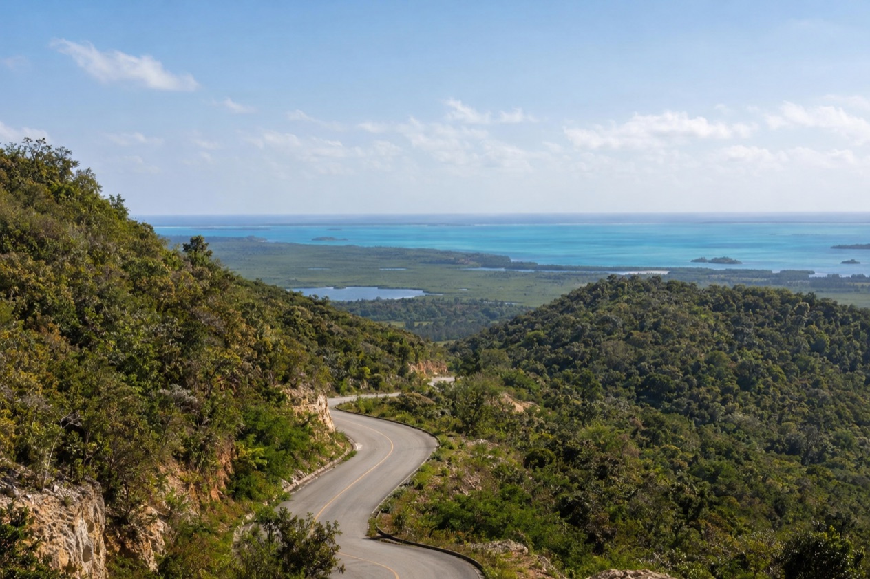
Ten days is enough for a first trip that takes in three very different Belizes: the islands on the barrier reef, the Maya country of the west and the Garifuna south coast. It is not enough to see everything, and the route works best if you accept that from the start. Belize is small, but its coast, its reef and its interior pull in different directions, and each stop here gets a few unhurried days instead of a quick look.
The reef is the reason many people come. The Belize Barrier Reef is the second largest in the world and a World Heritage Site, and it is the longest in the western hemisphere, running for about 200 miles.
The cayes on this route, Caye Caulker and Ambergris Caye, sit along it, and Caye Caulker lies a mile west of the reef itself. Hol Chan Marine Reserve, close to both islands, protects coral, seagrass beds and mangrove forest.
Inland, the Cayo District borders Guatemala and holds San Ignacio, a river town on the Macal. The ruins of Xunantunich and Cahal Pech are close enough to town to anchor two full days. The south then offers something quieter: Placencia on its narrow peninsula, Garifuna villages, and Cockscomb Basin Wildlife Sanctuary, recognized as the world’s first jaguar preserve.
What the route leaves for another trip is a long list, and that is part of the appeal of coming back. The Great Blue Hole, a protected natural monument in Belize District, sits out among the offshore atolls, and so do Turneffe Atoll, Lighthouse Reef and Glover’s Reef.
The north is left out too: Corozal Town near the Mexican border, and Sarteneja, the largest fishing community in the country. Caracol, Lamanai and the far south around Punta Gorda also wait.
The pace matters as much as the stops. Three nights on one island, three in the hills and three on the south coast mean you unpack only three times. The island stage runs on boats, the Cayo stage on short outings from a single base, and the southern stage lets you finish somewhere unhurried before the flight home from Belize City.
The itinerary stage by stage
Days 1 to 2: Belize City and Caye Caulker
Your flight lands at Philip S. W. Goldson International Airport in Ladyville, the only international airport in the country and about a half hour by road from the center of Belize City. The city itself sits at the mouth of Haulover Creek on the Caribbean coast.
It is the largest city in Belize and was the capital until a hurricane in 1961 pushed the government inland to Belmopan. Most travelers pass through quickly, and on this route you do the same, taking a boat from the city out to Caye Caulker.
Caye Caulker Village is a sand-street island town with low wooden houses painted in sherbet colors and more bicycles and golf-cart-free lanes than cars. Day 2 is for the island itself.
Walk to the Split, the channel cut through the island by Hurricane Hattie in 1961, and watch the water move between the two halves. In the evening, grills set up along the main street cook lobster when it is in season, fish and chicken, with rice and beans and fry jacks at breakfast.
The island is also protected water. Sleep in the village, and keep the second afternoon unplanned: the island rewards a hammock and a slow walk to the northern end.
Days 3 to 4: San Pedro and Ambergris Caye
A boat links Caye Caulker with San Pedro, the town on the southern part of Ambergris Caye. This is the largest caye in Belize, and it feels different from Caye Caulker: longer, busier, with more restaurants, beach bars and golf carts along the waterfront. San Pedro was granted township status in 1984, and the town has grown around fishing, then around the reef.
Spend Day 3 on the reef side of the island. Hol Chan Marine Reserve lies close to Ambergris Caye and Caye Caulker, a protected stretch of coral, seagrass and mangrove, and it is the natural reason to be on the water here. Back in town, the evening belongs to the beachfront: ceviche, grilled snapper, conch fritters and a cold Belikin beer at a table with sand underfoot.
Day 4 can stay loose, with a walk or ride along the island and a long lunch. Ambergris Caye is long and narrow, and the quieter stretches lie away from the center of town. Sleep in or near San Pedro, because the next day you leave the water behind and head for the hills.
Days 5 to 7: San Ignacio and the Cayo District
The move from the cayes to Cayo is a change of world: from sea level and sand to green hills, rivers and limestone. San Ignacio sits on the banks of the Macal River in the west of the country, and together with neighboring Santa Elena it forms a twin town with a lively market and a main street of cafés, craft shops and small restaurants. Stay in town or in one of the lodges in the surrounding Cayo hills.
Xunantunich is the outing for Day 6. The Maya site stands on a ridge above the Mopan River, under a mile from the Guatemala border, and you walk through plazas where the stone buildings rise above the forest. Cahal Pech, near San Ignacio, is the other site on this stage, with evidence of habitation going back to 1200 BCE. It makes a quieter visit and shows how old Maya settlement in western Belize really is.
Days 5 and 7 are for the town and the river country around it. Walk the market, eat stew chicken or a plate of rice and beans, and watch the Macal from a table beside the water. On Day 7 you leave Cayo for the south, so keep the morning free.
Days 8 to 10: Placencia, the Garifuna coast and home
Placencia is a small village at the southern tip of the Placencia Peninsula in the Stann Creek District. Its main street is The Sidewalk, a concrete pedestrian path that runs most of the village and ends at the sea, lined with restaurants, shops and small guesthouses.
In the evenings, you walk it from end to end without needing a car. North of the village, Seine Bight is a Garifuna community on the same peninsula, and drumming and cassava bread are part of its culture.
Day 9 is for the Stann Creek District’s other attractions. Cockscomb Basin Wildlife Sanctuary lies off the Southern Highway, south of Dangriga, a forested sanctuary where jaguars live but are famously hard to spot. Hopkins and Dangriga are the Garifuna towns in the district, and Dangriga is its capital. Offshore from Placencia, Gladden Spit and Silk Cayes Marine Reserve protects waters off the coast.
On Day 10 you return to Belize City and the international airport for your flight home. Maya Island Air links Placencia with the airport, and Dangriga also has flights to Belize City from Maya Island Air and Tropic Air. Keep the last morning for a final walk along The Sidewalk and breakfast by the sea.
Getting between stops
| Leg | How | Time |
|---|---|---|
| Airport to Belize City center | By road | About 30 minutes |
| Belize City to Caye Caulker | Boat | About 45 minutes |
| Caye Caulker to San Pedro | Boat | About 30 minutes |
| Belize City to San Pedro | Boat | About 1 hour 30 minutes |
| Belize City to Ambergris Caye | Flight | About 20 minutes |
The cayes are reached by boat from Belize City, and the boats also link the islands with each other. San Pedro Belize Express accepts Visa, Mastercard and Discover for walk-in purchases at its terminals. A flight to Ambergris Caye is a separate option, and Maya Island Air also flies from the airport to Caye Caulker and San Pedro.
The move from the cayes to San Ignacio is by air, by sea and by road, since the town lies inland. San Ignacio is about 63 miles west of Belize City and 22 miles west of Belmopan, and a bus takes an hour between San Ignacio and Belmopan. The leg to the south coast is by road or by air, and nothing in this itinerary needs more than a plan for each step.
For the final stage, Maya Island Air connects the international airport with Dangriga, Placencia and Punta Gorda. Tropic Air also serves Dangriga, with flights to Belize City, Placencia and Punta Gorda. The Maya Island Air terminal at the airport can be reached at 501-225-2219 or 501-225-3347, and the last leg of the trip ends at the same airport where it began.
What to book before your 10 Days in Belize
Settle the entry papers first. Then fix the flights, since the international airport in Ladyville is the only one, and decide which water taxi operator you will use for the cayes, such as San Pedro Belize Express. Keep the rest of the days open.
Adapting the route
Belize has a rainy season from June to November and a dry season from January to May, and the Atlantic hurricane season runs from June 1 to November 30. A trip in October falls inside both.
In Belize City, January brings highs in the low 80s Fahrenheit, while July highs average in the upper 80s, with rain days in every month. For a rainy-season trip, build in slack: a spare day at either end gives you room for a delayed boat or flight.
For a shorter trip, drop one stage. Seven days could cover the cayes and Cayo, or Cayo and the south, with fewer moves. A weekend-length version would settle on one island and take a single outing to the reef. Cutting the south loses Placencia and Cockscomb, while cutting Cayo loses the Maya sites.
For a longer trip, add the places the route skips. The north offers Corozal Town on the Caribbean and Sarteneja, a fishing village at the mouth of the Bay of Chetumal that lives mainly from fishing, away from the main tourist crowds. Further out lie the atolls: Turneffe, Lighthouse Reef, Glover’s Reef and the Great Blue Hole.
With children, the route’s strength is its variety: boat rides, a car-free sand village, a river town and the Sidewalk in Placencia. Keep the days with water and the days with ruins separate, and leave one open afternoon in each stage. A slower trip works best by merging stages, for example five nights on Caye Caulker and in San Pedro, and five in Cayo and the south.
Good to know before you go
The U.S. State Department rates Belize Level 2, “Exercise increased caution”, because of crime, and says the south side of Belize City has historically had the highest concentration of violent crime.
Cards are accepted at the San Pedro Belize Express terminals, and the cayes, Cayo and the south coast each work on their own rhythm. The hurricane season runs until the end of November, so a trip in autumn needs flexible plans.
If you enter Belize by land, different fees apply depending on whether your stay is less than or more than 24 hours. The route in this itinerary starts and ends at the international airport in Ladyville.
Sources
- Wikipedia, Tourism in Belize (https://en.wikipedia.org/wiki/Tourism_in_Belize), checked October 11, 2026
- Wikipedia, Geography of Belize (https://en.wikipedia.org/wiki/Geography_of_Belize), checked October 11, 2026
- Tropic Air, Belize International Airport (https://www.tropicair.com/belize-international-airport-bze/), checked October 11, 2026
- San Pedro Belize Express Water Taxi, FAQ (https://belizewatertaxi.com/information/faq/), checked October 11, 2026
- Maya Island Air, International flights (https://www.mayaislandair.com/belize-international-flights/), checked October 11, 2026
- Wikipedia, Ambergris Caye (https://en.wikipedia.org/wiki/Ambergris_Caye), checked October 11, 2026
- Wikipedia, San Pedro Town (https://en.wikipedia.org/wiki/San_Pedro_Town), checked October 11, 2026
- Wikivoyage, Ambergris Caye (https://en.wikivoyage.org/wiki/Ambergris_Caye), checked October 11, 2026
- Wikivoyage, San Pedro (Belize) (https://en.wikivoyage.org/wiki/San_Pedro_(Belize)), checked October 11, 2026
- Wikipedia, Hol Chan Marine Reserve (https://en.wikipedia.org/wiki/Hol_Chan_Marine_Reserve), checked October 11, 2026
- Wikipedia, Caye Caulker (https://en.wikipedia.org/wiki/Caye_Caulker), checked October 11, 2026
- Wikivoyage, Caye Caulker (https://en.wikivoyage.org/wiki/Caye_Caulker), checked October 11, 2026
- Belize Fisheries Department, Caye Caulker Marine Reserve (https://fisheries.gov.bz/ccmr/), checked October 11, 2026
- Caye Caulker Village Council, Traffic (https://www.cayecaulkervillagecouncil.org/traffic), checked October 11, 2026
- Caye Caulker Village Council, About (https://www.cayecaulkervillagecouncil.org/about), checked October 11, 2026
- Wikipedia, Belize City (https://en.wikipedia.org/wiki/Belize_City), checked October 11, 2026
- Wikivoyage, Belize City (https://en.wikivoyage.org/wiki/Belize_City), checked October 11, 2026
- Wikipedia, Belize District (https://en.wikipedia.org/wiki/Belize_District), checked October 11, 2026
- Wikivoyage, Belize District (https://en.wikivoyage.org/wiki/Belize_District), checked October 11, 2026
- Wikipedia, Philip S. W. Goldson International Airport (https://en.wikipedia.org/wiki/Philip_S._W._Goldson_International_Airport), checked October 11, 2026
- Wikipedia, Placencia (https://en.wikipedia.org/wiki/Placencia), checked October 11, 2026
- Wikivoyage, Placencia (https://en.wikivoyage.org/wiki/Placencia), checked October 11, 2026
- Wikipedia, Seine Bight (https://en.wikipedia.org/wiki/Seine_Bight), checked October 11, 2026
- Belize Fisheries Department, Gladden Spit and Silk Cayes Marine Reserve (https://fisheries.gov.bz/gsscmr/), checked October 11, 2026
- Wikipedia, Gladden Spit and Silk Cayes Marine Reserve (https://en.wikipedia.org/wiki/Gladden_Spit_and_Silk_Cayes_Marine_Reserve), checked October 11, 2026
- Wikipedia, San Ignacio, Belize (https://en.wikipedia.org/wiki/San_Ignacio,_Belize), checked October 11, 2026
- Wikivoyage, San Ignacio (Belize) (https://en.wikivoyage.org/wiki/San_Ignacio_(Belize)), checked October 11, 2026
- Wikipedia, Cayo District (https://en.wikipedia.org/wiki/Cayo_District), checked October 11, 2026
- Wikipedia, Xunantunich (https://en.wikipedia.org/wiki/Xunantunich), checked October 11, 2026
- Wikipedia, Cahal Pech (https://en.wikipedia.org/wiki/Cahal_Pech), checked October 11, 2026
- Wikipedia, Hopkins, Belize (https://en.wikipedia.org/wiki/Hopkins,_Belize), checked October 11, 2026
- Wikipedia, Dangriga (https://en.wikipedia.org/wiki/Dangriga), checked October 11, 2026
- Wikivoyage, Dangriga (https://en.wikivoyage.org/wiki/Dangriga), checked October 11, 2026
- Wikipedia, Cockscomb Basin Wildlife Sanctuary (https://en.wikipedia.org/wiki/Cockscomb_Basin_Wildlife_Sanctuary), checked October 11, 2026
- Belize Audubon Society, Cockscomb Basin Wildlife Sanctuary (https://belizeaudubon.org/cbws/), checked October 11, 2026
- Wikipedia, Belmopan (https://en.wikipedia.org/wiki/Belmopan), checked October 11, 2026
- Wikivoyage, Belmopan (https://en.wikivoyage.org/wiki/Belmopan), checked October 11, 2026
- Wikipedia, Hurricane Hattie (https://en.wikipedia.org/wiki/Hurricane_Hattie), checked October 11, 2026
- U.S. Embassy in Belize (https://bz.usembassy.gov/), checked October 11, 2026
- Wikipedia, Corozal Town (https://en.wikipedia.org/wiki/Corozal_Town), checked October 11, 2026
- Wikivoyage, Corozal (https://en.wikivoyage.org/wiki/Corozal), checked October 11, 2026
- Wikipedia, Corozal District (https://en.wikipedia.org/wiki/Corozal_District), checked October 11, 2026
- Wikipedia, Sarteneja (https://en.wikipedia.org/wiki/Sarteneja), checked October 11, 2026
- Wikivoyage, Sarteneja (https://en.wikivoyage.org/wiki/Sarteneja), checked October 11, 2026
- NOAA NCEI, GHCN-Daily station BHM00078583 (Philip S. W. Goldson International Airport, Belize City), normals 1991-2020 computed from the daily record (https://www.ncei.noaa.gov/access/services/data/v1?dataset=daily-summaries&stations=BHM00078583), checked October 11, 2026
- U.S. Department of State, Belize Travel Information, Entry and exit requirements (https://travel.state.gov/), checked October 11, 2026
- U.S. Department of State, Belize Travel Advisory, Level 2, March 11, 2026 (https://travel.state.gov/), checked October 11, 2026
- NOAA National Hurricane Center, Climatology (https://www.nhc.noaa.gov/climo/), checked October 11, 2026