
Halfway through the trip, you are walking the concrete Sidewalk in Placencia with sand still in your sandals, past small restaurants and dive shops, until the path simply stops at the sea. Behind you are the boat rides between the cayes, the reef just off the island and the colorful docks of the north. The route runs from Belize City out to the cayes and then down the coast to the Placencia peninsula, which leaves each stop room to breathe.
Is 5 Days enough for Belize?
Five days is enough for a first taste of Belize if you choose a coast and let the rest wait, and this route chooses the water: two cayes in the north, a marine reserve between them and one village in the south. It suits travelers who want to wake up near the reef, eat by the sea and not repack their bags every night. It does not try to cover the whole country.
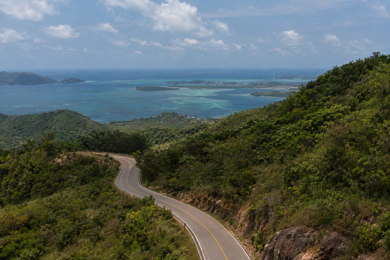
What the route gives you is a real feel for the barrier reef, which is the second largest in the world and a World Heritage Site. Along the coast it stretches for about 200 miles and takes in cayes, atolls and islands from Ambergris Caye to Glover’s Reef. You will see only a slice of it, but it is the slice that sits closest to the mainland and the airport.
The plan moves in three steps. First comes Caye Caulker, a small island with sandy lanes and a relaxed pace. Then San Pedro on Ambergris Caye, the largest caye in Belize, together with the Hol Chan Marine Reserve, which lies close to both islands. Last come Placencia and its peninsula in the Stann Creek District, where Garifuna villages and a long beach take over from the northern cayes.
What is left for another trip is the inland half of the country. The Cayo District around San Ignacio has the Maya sites of Xunantunich and Cahal Pech, and the jaguar country of Cockscomb Basin lies in the south.
The far north, with Corozal Town and the fishing village of Sarteneja, is also left out. The outer reef is skipped too. The Great Blue Hole, a protected natural monument in the Belize District, and the atolls such as Lighthouse Reef and Turneffe are not part of these five days.
There is a trade-off in this choice. Five days on the coast means you see the reef, the cayes and a Garifuna-influenced village, but you do not see the rainforest, the caves or the ruins.
If those matter most to you, the section on adapting the route shows how to swap a stage. If the sea is the reason you are going, the plan as written stays simple, with two flights in or out of Belize City and every other move made by boat or by a short air link.
It also helps that the stops are small. Caye Caulker is about 5 miles long, and Placencia is a village of roughly 1,600 people. You are not racing through big towns, so a day with nothing planned still has plenty in it: a long breakfast, a walk to the end of a dock, a seat at a beach bar. Those pauses are part of what the route is for.
The itinerary stage by stage
Days 1 and 2: Caye Caulker
You land at the Philip S. W. Goldson International Airport in Ladyville, the country’s only international airport, about 30 minutes by road from the center of Belize City. From the city, the boat ride to Caye Caulker takes approximately 45 minutes, so the first evening can already be spent on the island. Sleep in the village itself, where guesthouses and small hotels sit along sandy streets, close to the water on both sides.
Day 2 belongs to the island. Walk to the Split, the channel cut through the island by Hurricane Hattie in 1961, and spend time on the docks around it. The barrier reef lies about a mile east of Caye Caulker, which is why the island has long been a base for reef outings. The Caye Caulker Marine and Forest Reserve, established in April 1998, protects the waters around it.
Eat where the island eats: grilled fish, lobster when it is in season, rice and beans, and fry jacks at breakfast. Streets are sand, not asphalt, and the pace follows.
Day 3: San Pedro and Hol Chan
From Caye Caulker, the boat to San Pedro takes approximately 30 minutes. San Pedro is the town at the southern end of Ambergris Caye, about 25 miles long and a mile wide, and it feels larger and busier than Caye Caulker, with more restaurants, shops and beach clubs along the shore. Drop your bags and look around the waterfront before anything else.
The reason to spend a day here is Hol Chan Marine Reserve, which lies close to both Ambergris Caye and Caye Caulker. It covers about 4,448 acres of coral reef, seagrass beds and mangrove forest, so a single outing takes you across three very different habitats. The reserve is the day’s main event, and the rest of the day is for the town: a late lunch, a walk on the beach and dinner by the water.
Sleep in San Pedro, because the next move is a flight south from here. The Maya Island Air connections from the international airport include both San Pedro and Placencia, which makes the hop between the northern cayes and the southern coast a matter of air, not a long overland trip.
Days 4 and 5: Placencia and the way home
Placencia sits at the southern tip of its peninsula in the Stann Creek District, and the feel changes at once: a village instead of a tourist town, with the Sidewalk running most of its length, lined with small businesses and ending at the seashore. Stay in or near the village. The beach is on one side and the lagoon on the other, and the Sidewalk is the place to walk after dinner.
Day 4 can go two ways. Stay on land and walk the peninsula north to Seine Bight, a Garifuna village 2.5 miles south of Maya Beach Village, where the drumming and cassava bread of Garifuna culture are part of daily life. Or go to sea: Gladden Spit and Silk Cayes Marine Reserve lies 22 miles off the coast of Placencia and covers about 25,980 acres of ocean and reef.
Day 5 is the departure. Maya Island Air flies between Placencia and the international airport, and from there American Airlines serves Charlotte, Dallas, Miami and Los Angeles, while Alaska Airlines serves Seattle and Los Angeles. Keep the last day free of plans so a flight change does not cost you a tour.
Getting between stops
| Leg | How | Time |
|---|---|---|
| Belize City airport (Ladyville) to Belize City center | Road | About 30 minutes |
| Belize City to Caye Caulker | Boat | About 45 minutes |
| Caye Caulker to San Pedro | Boat | About 30 minutes |
| Belize City to San Pedro (direct) | Boat | About 1 hour 30 minutes |
| Belize City to San Pedro (direct) | Flight | About 20 minutes |
The southern leg is different. From San Pedro to Placencia, you go through the Philip S. W. Goldson International Airport, where Maya Island Air offers connecting flights to both places. The route does not rely on a road link for that leg.
Two airlines serve the island hops. Maya Island Air flies from the international airport to Corozal, Caye Caulker, Dangriga (Hopkins), Kanantik, San Pedro, Savannah, Placencia and Punta Gorda. Tropic Air also flies the domestic links and, from Belize City, runs international flights to San Salvador, San Pedro Sula, Roatán and Cancún. Dangriga’s airstrip is served by both airlines with flights to Belize City, Placencia and Punta Gorda.
The boats are run by water taxi operators. San Pedro Belize Express takes most major credit cards (Visa, Mastercard, Discover) for walk-in purchases at its terminals. Because the Caye Caulker and San Pedro legs are both by sea, the same operator can serve both, and the direct Belize City to San Pedro boat is the alternative to stopping at Caye Caulker first.
As for the road, the airport is in Ladyville, about 10 miles from Belize City, and the drive between them is the only road stretch in this plan. Inland, the Cayo District has its own road links to the west, but they are not part of this route.
What to book before your 5 Days in Belize
Then the flights, since Maya Island Air and Tropic Air both serve the domestic links, and the water taxi operators for the cayes.
Adapting the route
With fewer days, drop Placencia and keep the cayes: two nights on Caye Caulker and one in San Pedro with the Hol Chan outing makes a compact coastal trip that never leaves the Belize District. It also removes the flight south, which means one less connection to manage on the way out.
With more days, the south and west both open up. From Placencia the Stann Creek District has Dangriga, a Garifuna town at the mouth of the North Stann Creek River, and Hopkins, where 70.2% of residents were Garifuna at the 2010 census. About 20 miles south of Dangriga on the Southern Highway lies Cockscomb Basin Wildlife Sanctuary, recognized as the world’s first jaguar preserve.
A different second half swaps the south for Cayo. San Ignacio sits on the banks of the Macal River, about 63 miles west of Belize City, and is the capital of the Cayo District.
Nearby are Cahal Pech, with evidence of habitation dating back to 1200 BCE, and Xunantunich, on a ridge above the Mopan River about a mile from the Guatemala border. This is a different trip, with rainforest and Maya ruins in place of reef and beach.
Seasons matter on the coast. Belize has a rainy season from June to November and a dry season from January to May.
In Belize City, January highs average 83.2°F with about ten days of rain, while July highs reach the upper 80s and the rain days climb a little higher. The Atlantic hurricane season runs from June 1 to November 30, so a trip in those months should leave room in the plan for a changed boat or flight.
Storms have shaped the coast. Hurricane Hattie struck in 1961 and reached Category 5 intensity, and in Belize City it damaged over 70% of the buildings. It also split Caye Caulker in two, and the Split you walk to on day 2 is the result. The same storm led the government to move the capital to Belmopan.
Spend more time at the villages and less at the reef if the children are young. The Sidewalk in Placencia is pedestrian-only, which suits a stroll with a stroller or a child on foot.
For a slower trip, give each stage an extra night and cut one. Two nights on Caye Caulker and two in Placencia, with San Pedro and Hol Chan as a single day trip between them, leaves room for long meals and unscheduled hours. In the spring months, whale sharks sometimes gather off the Placencia coast around Gladden Spit, a chance rather than a promise, and a reason to plan the southern stage with some slack.
Good to know before you go
The U.S. State Department rates Belize Level 2, “Exercise increased caution”, because of crime, and says the south side of Belize City has historically had the highest concentration of violent crime.
Credit cards work at the San Pedro Belize Express terminals for walk-in boat tickets, and the plan keeps its stops to places where the next move is by boat or air. Belize City is the largest city and the gateway, with a population of 63,999 at the 2022 census.
The Atlantic hurricane season runs from June 1 to November 30, and a trip that falls in those months is worth building with a free day at each end. Belmopan, not Belize City, is now the capital.
Sources
- Wikipedia, Tourism in Belize (https://en.wikipedia.org/wiki/Tourism_in_Belize), checked October 11, 2026
- Wikipedia, Geography of Belize (https://en.wikipedia.org/wiki/Geography_of_Belize), checked October 11, 2026
- Tropic Air, Belize International Airport (https://www.tropicair.com/belize-international-airport-bze/), checked October 11, 2026
- San Pedro Belize Express Water Taxi, FAQ (https://belizewatertaxi.com/information/faq/), checked October 11, 2026
- Maya Island Air, International flights (https://www.mayaislandair.com/belize-international-flights/), checked October 11, 2026
- Wikipedia, Ambergris Caye (https://en.wikipedia.org/wiki/Ambergris_Caye), checked October 11, 2026
- Wikipedia, San Pedro Town (https://en.wikipedia.org/wiki/San_Pedro_Town), checked October 11, 2026
- Wikivoyage, Ambergris Caye (https://en.wikivoyage.org/wiki/Ambergris_Caye), checked October 11, 2026
- Wikivoyage, San Pedro (Belize) (https://en.wikivoyage.org/wiki/San_Pedro_(Belize)), checked October 11, 2026
- Wikipedia, Hol Chan Marine Reserve (https://en.wikipedia.org/wiki/Hol_Chan_Marine_Reserve), checked October 11, 2026
- Wikipedia, Caye Caulker (https://en.wikipedia.org/wiki/Caye_Caulker), checked October 11, 2026
- Wikivoyage, Caye Caulker (https://en.wikivoyage.org/wiki/Caye_Caulker), checked October 11, 2026
- Belize Fisheries Department, Caye Caulker Marine Reserve (https://fisheries.gov.bz/ccmr/), checked October 11, 2026
- Caye Caulker Village Council, Traffic (https://www.cayecaulkervillagecouncil.org/traffic), checked October 11, 2026
- Caye Caulker Village Council, About (https://www.cayecaulkervillagecouncil.org/about), checked October 11, 2026
- Wikipedia, Belize City (https://en.wikipedia.org/wiki/Belize_City), checked October 11, 2026
- Wikivoyage, Belize City (https://en.wikivoyage.org/wiki/Belize_City), checked October 11, 2026
- Wikipedia, Belize District (https://en.wikipedia.org/wiki/Belize_District), checked October 11, 2026
- Wikivoyage, Belize District (https://en.wikivoyage.org/wiki/Belize_District), checked October 11, 2026
- Wikipedia, Philip S. W. Goldson International Airport (https://en.wikipedia.org/wiki/Philip_S._W._Goldson_International_Airport), checked October 11, 2026
- Wikipedia, Placencia (https://en.wikipedia.org/wiki/Placencia), checked October 11, 2026
- Wikivoyage, Placencia (https://en.wikivoyage.org/wiki/Placencia), checked October 11, 2026
- Wikipedia, Seine Bight (https://en.wikipedia.org/wiki/Seine_Bight), checked October 11, 2026
- Belize Fisheries Department, Gladden Spit and Silk Cayes Marine Reserve (https://fisheries.gov.bz/gsscmr/), checked October 11, 2026
- Wikipedia, Gladden Spit and Silk Cayes Marine Reserve (https://en.wikipedia.org/wiki/Gladden_Spit_and_Silk_Cayes_Marine_Reserve), checked October 11, 2026
- Wikipedia, San Ignacio, Belize (https://en.wikipedia.org/wiki/San_Ignacio,_Belize), checked October 11, 2026
- Wikivoyage, San Ignacio (Belize) (https://en.wikivoyage.org/wiki/San_Ignacio_(Belize)), checked October 11, 2026
- Wikipedia, Cayo District (https://en.wikipedia.org/wiki/Cayo_District), checked October 11, 2026
- Wikipedia, Xunantunich (https://en.wikipedia.org/wiki/Xunantunich), checked October 11, 2026
- Wikipedia, Cahal Pech (https://en.wikipedia.org/wiki/Cahal_Pech), checked October 11, 2026
- Wikipedia, Hopkins, Belize (https://en.wikipedia.org/wiki/Hopkins,_Belize), checked October 11, 2026
- Wikipedia, Dangriga (https://en.wikipedia.org/wiki/Dangriga), checked October 11, 2026
- Wikivoyage, Dangriga (https://en.wikivoyage.org/wiki/Dangriga), checked October 11, 2026
- Wikipedia, Cockscomb Basin Wildlife Sanctuary (https://en.wikipedia.org/wiki/Cockscomb_Basin_Wildlife_Sanctuary), checked October 11, 2026
- Belize Audubon Society, Cockscomb Basin Wildlife Sanctuary (https://belizeaudubon.org/cbws/), checked October 11, 2026
- Wikipedia, Belmopan (https://en.wikipedia.org/wiki/Belmopan), checked October 11, 2026
- Wikivoyage, Belmopan (https://en.wikivoyage.org/wiki/Belmopan), checked October 11, 2026
- Wikipedia, Hurricane Hattie (https://en.wikipedia.org/wiki/Hurricane_Hattie), checked October 11, 2026
- U.S. Embassy in Belize (https://bz.usembassy.gov/), checked October 11, 2026
- Wikipedia, Corozal Town (https://en.wikipedia.org/wiki/Corozal_Town), checked October 11, 2026
- Wikivoyage, Corozal (https://en.wikivoyage.org/wiki/Corozal), checked October 11, 2026
- Wikipedia, Corozal District (https://en.wikipedia.org/wiki/Corozal_District), checked October 11, 2026
- Wikipedia, Sarteneja (https://en.wikipedia.org/wiki/Sarteneja), checked October 11, 2026
- Wikivoyage, Sarteneja (https://en.wikivoyage.org/wiki/Sarteneja), checked October 11, 2026
- NOAA NCEI, GHCN-Daily station BHM00078583 (Philip S. W. Goldson International Airport, Belize City), normals 1991-2020 computed from the daily record (https://www.ncei.noaa.gov/access/services/data/v1?dataset=daily-summaries&stations=BHM00078583), checked October 11, 2026
- U.S. Department of State, Belize Travel Information, Entry and exit requirements (https://travel.state.gov/), checked October 11, 2026
- U.S. Department of State, Belize Travel Advisory, Level 2, March 11, 2026 (https://travel.state.gov/), checked October 11, 2026
- NOAA National Hurricane Center, Climatology (https://www.nhc.noaa.gov/climo/), checked October 11, 2026