
Somewhere on the road between the coast and the Cayo hills, a traveler glances at a map and realizes the biggest city they flew into is not the seat of government. Belize keeps a few surprises like that, and the short answers are these: the capital is Belmopan, the language is English, the money is the Belize dollar, and the country is small enough to hold a long reef, rainforest and Maya ruins at once.
What is the capital of Belize?
The capital of Belize is Belmopan, a small inland city, while the largest city is Belize City on the coast. Visitors often assume the two are the same, since Belize City holds the country’s only international airport, the Philip S. W. Goldson International Airport, and has long been the port of the country.
Belmopan sits 50 miles inland from the Caribbean Sea and about 249 feet above sea level, which gives it a green, hill-country setting far from the coastal breeze. It is served by the Hector Silva Airstrip, a domestic airport in the northwest of the city.
Why the capital moved inland
The move has a clear cause. After Hurricane Hattie in 1961 destroyed approximately 75% of the houses and business places in low-lying and coastal Belize City, the government proposed to build a new capital city. Belmopan is the result, a planned town set back from the water.
Belize City is therefore the former capital, and it is still where many trips begin. Its southern neighbor in the story, Belmopan, is where the ministries and the legislature now work.
What to see in Belmopan
The National Assembly Building is the landmark. It is designed to resemble a Pre-Columbian Maya temple, and its grey stone and broad steps reflect the nation’s cultural heritage. Seen from the street, it makes clear that the capital was imagined as a statement about where the country comes from.
The city also has a student side. The University of Belize campus here has colleges of Education and Arts, Management and Social Sciences, Science and Technology, and Nursing and Allied Health, so the cafés and streets carry a quiet campus rhythm rather than a resort one.
Capitals of the neighbors
Capitals around the region often double as the biggest city. Guatemala City is both the capital and the most populous city of Guatemala, home to La Aurora International Airport. Kingston plays that role in Jamaica, and San José does in Costa Rica. Belize splits the job between Belmopan and Belize City, which is part of why the country feels so different from its neighbors.
What is Belize like in numbers?
Belize is small and thinly settled: the 2022 census counted 397,483 people, spread over an area of 22,970 square kilometers (8,867 square miles). The country sits on the Yucatán Peninsula at 17°15′ north and 88°45′ west, and it is the only country in Central America without a Pacific coastline.
| Item | Detail |
|---|---|
| Capital | Belmopan |
| Largest city | Belize City |
| Population (2022 census) | 397,483 |
| Area | 22,970 sq km (8,867 sq mi) |
| Official language | English |
| Currency | Belize dollar (BZD), pegged at BZ$2 = US$1 |
| Time zone | Central Standard Time (UTC−06:00) year-round |
| Independence | 21 September 1981, from the United Kingdom |
The reef and the cayes
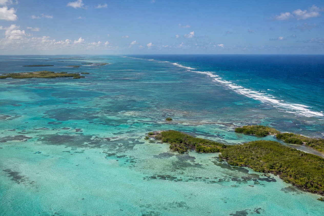
The Belize Barrier Reef stretches approximately 200 miles, the longest in the western hemisphere. It takes in many coral reefs, cayes and islands, among them Ambergris Caye, Lighthouse Reef, Glover’s Reef and the Turneffe Islands. The Great Blue Hole, a feature of karst topography, belongs to this seascape.
Hundreds of small islands called cayes are popular recreation areas for urban Belizeans, especially during school vacations and Easter. That habit gives the coast a local holiday feel at those times, not only a visitor one.
Climate in brief
Belize has a tropical climate, with a rainy season from June to November and a dry season from January to May. On the coast, average temperatures run from the mid-70s°F in January to the low 80s°F in July, so warmth is a given all year.
Rain varies a great deal by region. The north and west receive far less than the extreme south, where the dry season is shorter and normally lasts only from February to April. Inland, Belmopan has a lengthy wet season that runs from May through January, and its monthly temperatures stay fairly constant through the year.
A mix of peoples
Belizean culture blends Kriol, Maya, East Indian, Garinagu (Garifuna), Mestizo and Mennonite influences, among others. You hear it in the music: Punta is the most popular genre of Garifuna music and has become the most popular in all of Belize, Paranda is a slower variant, and Brukdown grew from the songs and dances of loggers.
Details show the mix too. An international cross-country cycling race is held every Easter weekend, and ice hockey is played in the Western Cayo District among the Mennonite population.
What should visitors know first?
The first thing to know is that English is the official language and the money is the Belize dollar, tied at two to one against the U.S. dollar. That makes arrival simple for American travelers, and the rest is a matter of knowing how the country is arranged.
Language on the ground
Belize is the only Central American country where English is official, and it is the main language of public education, government and most media. English is the major language in the Belize District, in the capital district of Cayo and in the southernmost district of Toledo.
Elsewhere the picture shifts. Spanish is the most used language in the frontier districts of Orange Walk and Corozal, and Creole is the main language in the Stann Creek district. In northern towns such as Corozal and San Pedro you may hear Kitchen Spanish, an intermediate form of Spanish mixed with Belizean Creole.
Mennonite colonies speak German, mostly Plautdietsch in daily life, with a minority of about 10 percent speaking Pennsylvania German. Around 16,100 people speak Garifuna. Schools teach children when it is appropriate to use Creole, but lessons are not taught in it.
Money
The official value of the Belize dollar is pegged at BZ$2 = US$1, so prices quoted in either currency convert easily in your head. The Central Bank of Belize was established on January 1, 1982, not long after independence on 21 September 1981.
Time and seasons
Belize keeps Central Standard Time all year, with no clock change. Hurricanes are the main natural hazard, mostly in the late Atlantic season from September to December, along with coastal flooding, especially in the south. The Atlantic hurricane season itself runs from June 1 to November 30.
Heritage you can visit
Altun Ha is an archaeological site that preserves remnants of Maya culture, one of several in the country. The National Assembly Building in Belmopan echoes the same heritage in its design, so the Maya past appears both in the ruins and in the modern capital.
Good to know before you go
The U.S. State Department rates Belize Level 2, “Exercise increased caution”, because of crime, and says the south side of Belize City has historically had the highest concentration of violent crime.
Money is straightforward, since the Belize dollar is pegged to the U.S. dollar at two to one. Keep the seasons in mind when you plan, because the rainy months and the late hurricane season overlap with the stretch from September to November. The south is the wettest part of the country and the north and west the driest. Belize City holds the only international airport, and Belmopan, the capital, lies inland among green hills.
Sources
- Wikipedia, Belize (https://en.wikipedia.org/wiki/Belize), checked October 11, 2026
- Wikipedia, Geography of Belize (https://en.wikipedia.org/wiki/Geography_of_Belize), checked October 11, 2026
- Wikipedia, Languages of Belize (https://en.wikipedia.org/wiki/Languages_of_Belize), checked October 11, 2026
- Wikipedia, Culture of Belize (https://en.wikipedia.org/wiki/Culture_of_Belize), checked October 11, 2026
- Wikipedia, Belmopan (https://en.wikipedia.org/wiki/Belmopan), checked October 11, 2026
- Wikipedia, Guatemala (https://en.wikipedia.org/wiki/Guatemala), checked October 11, 2026
- Wikipedia, Jamaica (https://en.wikipedia.org/wiki/Jamaica), checked October 11, 2026
- Wikipedia, Mexico (https://en.wikipedia.org/wiki/Mexico), checked October 11, 2026
- Wikipedia, Costa Rica (https://en.wikipedia.org/wiki/Costa_Rica), checked October 11, 2026
- Wikipedia, The Bahamas (https://en.wikipedia.org/wiki/The_Bahamas), checked October 11, 2026
- Wikivoyage, Guatemala (https://en.wikivoyage.org/wiki/Guatemala), checked October 11, 2026
- U.S. Department of State, Belize Travel Advisory, Level 2, March 11, 2026 (https://travel.state.gov/), checked October 11, 2026
- NOAA National Hurricane Center, Climatology (https://www.nhc.noaa.gov/climo/), checked October 11, 2026