
Early in the morning in Patillas, fishing boats come in along the shore while the first coffee is poured in the kitchens around the plaza, and the green hills behind town catch the light before the beaches do. The town sits on the Caribbean side of the southeast, with the sea in front and the mountains of Carite rising at its back. It suits travelers who like unhurried days, local food and a coast that has not been polished for crowds.
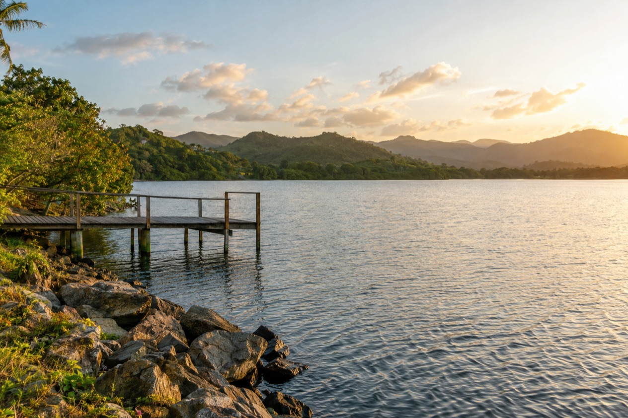
Where is Patillas and what is it like?
Patillas is a small beach town on the southeastern coast of Puerto Rico, south of San Lorenzo and west of Yabucoa and Maunabo, with the Caribbean on one side and forested hills on the other. It is not a resort. It is a working municipality where fishing, farming and family life set the rhythm, and where visitors are a pleasant surprise rather than the main business.
The character of the place comes from that double face. Down at the water you find long, mostly quiet stretches of shore, fishermen’s landings and the kind of open-air seafood stands that fill up on weekends.
Drive a short way inland and the road climbs into cooler, shadier country, with rivers, a reservoir and old coffee-and-fruit farmland. Mornings tend to be bright and hot, and afternoon clouds often build over the mountains.
The town center is compact and easy to read. A plaza with its church anchors the streets, and the pace is that of a place where people still greet each other by name. Evenings are for sitting outside, for a cold drink, for a game of dominoes on a porch, and for listening to the coquí frogs once the light goes.
Patillas is nicknamed the Emerald of the South, and the hills in the wetter months explain why. It is a good fit if you want beaches without a scene, natural water spots in the hills, and a stay that feels local.
It is a poor fit if you want nightclubs, big hotels or a long list of tour operators, since the appeal here is quiet and space. Nearby Ponce, the island’s second city, supplies the museums and the urban energy when you want them.
The municipality counts a large number of beaches, 28 in all, though many are small, local and unsigned, reached down side roads and known mostly by neighbors. That is part of the fun. You can spend a long weekend here and still leave a few shores unvisited.
What is there to do in Patillas?
The big reasons to come are the beaches, the natural water spots in the hills, the mountain forest and the town’s festivals. What sets Patillas apart from its neighbors is how much of this sits close together and how few people are usually in it. You can pass from a sea breeze to a shaded forest road in a short drive.
Beaches along the southeastern coast
Escondida Beach, Guardarraya Beach and Villa Pesquera Beach are among the places people name first. Escondida means hidden, and it lives up to the name with a quieter, tucked-away feel. Guardarraya is a broad, open shore where you can walk a long way along the sand under the palms. Villa Pesquera is a fishing community, so the scene is boats, nets and simple seafood kitchens as much as sunbathing.
The Caribbean here can be gentle on one day and lively on the next, and conditions differ from beach to beach. Inches Beach is considered dangerous, so do not assume it is safe for swimming.
Where a flag, a sign or a lifeguard is present, follow it. Bring shade, because many of these shores have little of it, and plan to arrive in the morning when the light is soft and the sand is not yet scorching.
Charco Azul, Los Tres Chorros and Charco de la Vuelta
In the hills, the rivers form the spots that give Patillas its second personality. Charco Azul is known for the blue-green color of its pool among the rocks and trees.
Los Tres Chorros takes its name from three streams of water falling together, and Charco de la Vuelta is another river spot where the water bends through the greenery. They are places to see, to photograph and to sit beside while the forest hums around you.
They suit people who like green scenery. Rain upstream changes the look and the force of any river, so a spot that looks mild in a dry week can look very different after a storm. Wear shoes with grip, since rocks near water are slick, and carry a small bag for a towel and a snack. Pair a morning here with a seafood lunch near the coast.
Carite State Forest, Guavate Forest and Lago de Patillas
Carite State Forest is the cool, green backdrop of the municipality, a mountain forest of tall trees, ferns and winding roads where the air feels lighter than on the coast. Guavate Forest, in the same range, is a short step toward the mountain communities famous for roast pork, the lechon asado that people drive up the hills to eat on weekends. Lago de Patillas is the reservoir lake, a calm sheet of water with hills reflected in it.
This is the part of Patillas for slow drives, lookouts and picnics, and for anyone who wants a break from the heat on the coast. Mountain weather changes quickly, with mist in the morning and showers in the afternoon, so go early and keep a light rain layer in the car. A gray sky makes the forest greener, but mountain weather can change quickly.
Festivals in town
The town’s calendar adds another reason to plan a visit. In August, the Fiestas Patronales de San Benito Abad bring parades, games, artisans, amusement rides, regional food and live entertainment to the streets.
The Emerald of the South Carnival arrives in May, the Southeast Marathon in November, and the Wheat Flour Festival and a Christmas parade in December. Each one gives the plaza a crowd and a soundtrack that you will not find on an ordinary day.
How many days do you need in Patillas?
A long weekend is the right length for Patillas, with a week making sense if you want to use it as a quiet base for the whole southeast. The town rewards slowness, so the question is less how much you can see and more how much you want to unhurriedly do.
With two or three days, you can fit the essentials. Spend one morning on a beach such as Escondida or Guardarraya, have a seafood lunch near a fishing landing, and give the late afternoon to the town center.
Use another day for the hills, starting with a river spot like Charco Azul or Los Tres Chorros, continuing to Carite State Forest, and ending with a drive along the edge of Lago de Patillas. That is a full, satisfying visit and leaves room for a long dinner.
A day in the middle of a longer stay can be a lazy one. Start with coffee in the plaza, walk the streets, take a short drive to a beach you have not tried, and return to the same shade at the same hour. The more beaches you sample, the more you notice how each has its own mood, from a family cookout shore to a nearly empty strip with only a few fishermen.
With four or five days, add day trips. Ponce is the obvious one, with its historic center around Plaza Las Delicias, the red-and-black striped Parque de Bombas firehouse and the Ponce Museum of Art.
Up on a hill above the city sits Castillo Serralles, a mansion of the 1930s, and down by the sea is La Guancha, the boardwalk where families stroll in the evening. To the east lie Yabucoa and Maunabo, small towns that continue the same unhurried coast, and the mountain road toward Guavate is a good half-day for lunch.
If your visit lands on a festival, protect one evening for it. The August patron saint festival and the carnival in May are the moments when the plaza is at its liveliest, and an evening of food stands, music and people-watching can be the highlight of the trip. A week suits those who like to read, hike a little, eat well and move at the pace of the town.
Where to stay in Patillas
Each suits a different kind of traveler, and Patillas is small enough that none of them is far from the others. Lodging here tends toward small, local and informal rather than large and branded, which is part of the charm.
The town center suits people who like to walk to a morning coffee, a bakery and the plaza. You hear church bells, see the daily routine and can have a simple dinner without moving the car. It is a good option for travelers who want to feel the community and who do not need the sea at the doorstep. Evenings are quiet, so it also suits those who like early nights.
Staying near the coast puts you close to the beaches and the fishing landings. You wake to the sound of the sea, can step out for an early walk on the sand, and are close to the seafood kitchens at Villa Pesquera.
It suits couples, families who live on the beach and anyone who wants the water to be the center of the day. The trade-off is that you are a short drive from the hills and the town amenities, so a car is handy.
The hills toward Carite State Forest and Lago de Patillas offer the coolest nights and the greenest views. They suit hikers, birdwatchers, photographers and travelers escaping the heat. Mornings can be misty, evenings are fresher than on the shore, and the roads are winding, so you will want to arrive in daylight.
Some visitors prefer to stay in Ponce and visit Patillas for the day. That makes sense if you want restaurants, museums and a livelier evening, with Patillas as the beach-and-forest outing.
But if your goal is quiet, a night or two in Patillas itself gives you the early light on the water and the empty evening streets that day-trippers miss. During festival weekends, especially the patron saint festival in August, rooms and rentals fill with families, so look early.
How do you get to Patillas and get around?
Most visitors reach Patillas by road from San Juan, about 60 miles away, in a drive of roughly an hour and a half. The route crosses the island toward the southeast, and the final stretch moves from highway into smaller roads with hills and curves. Plan the drive in daylight if you can, so you see the landscape change from the northern plains to the green southern slopes.
By air, the nearest airport with major commercial service is Luis Muñoz Marín International Airport in Carolina, the island’s main gateway and where most flights from the mainland arrive. Mercedita Airport in Ponce handles limited commercial service; Luis Muñoz Marín in Carolina remains the main gateway. Coming from Ponce, Highway 53 and Highway 3 provide access to Patillas, so the south coast and the southeast are linked by a straightforward drive.
Once you are there, the town center is small enough to explore on foot. You can wander from the plaza to nearby streets, stop for a coffee or a snack and take in the architecture and the atmosphere without any plan. The beaches, river spots and mountain forest are spread over the municipality, however, and are best reached by car, which also lets you choose your own hours and avoid the midday heat.
A day’s driving here has its own pleasures. Mountain roads curve around hillsides, small stands appear at junctions, and each turn can bring a view of the Caribbean. Allow extra time for slow stretches, especially after rain, and keep an eye on the fuel gauge before heading into the hills. Pair a morning on the coast with an afternoon at Carite, and finish with dinner back in town.
If you plan to visit Ponce, its historic center and landmarks make a possible excursion by the same highways. The same goes for the neighboring towns of the southeast, which are arranged along one connected coast. Treat the map as a loop, with Patillas as the quiet center.
When is the best time to visit Patillas?
December through April is a good stretch for most visitors because it is generally drier. Days are hot and humid, as everywhere in Puerto Rico, but trade winds help, the skies are often bright and the hill roads are easier to drive. The Wheat Flour Festival and the Christmas parade in December give the plaza a seasonal glow, and the sea stays warm all year, so winter is no obstacle to the beach.
May through November is the wetter season, with more clouds and showers, particularly in the afternoon and in the mountains. That is also when the hills turn their deepest green, though heavy rain can change river conditions quickly. The Emerald of the South Carnival in May opens the season with parades and music, and the patron saint festival in August is the town’s biggest party, so those weeks are the busiest in the plaza.
The Atlantic hurricane season runs from June 1 to November 30, with its peak around September 10 and most activity between mid-August and mid-October. A trip in these months can be lovely and quiet, but follow the National Hurricane Center and local official alerts, since forecasts change fast. The Southeast Marathon in November brings runners and visitors at the very end of the season.
For a first visit, pick late winter or early spring, when the weather is dry and the beaches inviting, or choose August if the festival is your reason to come. Weekends are livelier than weekdays all year, as families from nearby towns head for the shore and the seafood stands, so a midweek visit gives you the beaches almost to yourself.
Good to know before you go
U.S. citizens need no passport and no visa to visit Puerto Rico, and the currency is the U.S. dollar. English and Spanish are both official, and a few words of Spanish, such as a simple buenos días in the plaza, are always appreciated.
Bring sunscreen, a hat, water and a light rain layer, keep valuables out of sight in parked cars, and check conditions at any beach before you go in, following any flag or sign you find. During hurricane season, keep an eye on official alerts before and during your trip.
Sources
- Wikipedia, Patillas (https://en.wikipedia.org/wiki/Patillas,_Puerto_Rico), checked October 8, 2026
- Wikipedia, Mercedita Airport (Ponce) (https://en.wikipedia.org/wiki/Mercedita_Airport), checked October 8, 2026
- NOAA National Hurricane Center, Climatology (https://www.nhc.noaa.gov/climo/), checked October 8, 2026
To plan your stay
- Best Time to Visit Puerto Rico: Dry Season, Hurricane Season, Beaches and Festivals
- Where to Stay in Puerto Rico: San Juan, Rincon, Vieques and the Best Areas for Your Trip
- Getting Around Puerto Rico: Rental Cars, Tolls, Carros Publicos and Ferries to Culebra and Vieques
- Know Before You Go to Puerto Rico: ID, Money, Getting Around and Local Customs