
Somewhere along the highway out of San Juan, with the mountains rising ahead and the radio playing salsa, most travelers realize that Puerto Rico is an island made for the road. A car is the simplest way to see most of it, while the metro, the shared vans and the ferries cover specific needs. The small islands of Culebra and Vieques add a boat or a short flight to the plan.
How do you get around Puerto Rico?
Most visitors get around Puerto Rico by car, because the island has an extensive road network and its best beaches, mountain towns and rain forest trails sit well outside the cities. The island has paved roads running to almost every corner, including tolled freeways called autopistas. Some routes even carry Interstate numbers, though they connect to nothing on the mainland, which makes for a good trivia moment as you cruise along.
Flying in is straightforward. Luis Muñoz Marín International Airport in San Juan is the busiest on the island, with direct connections to many mainland cities, the Caribbean, Latin America, Canada and Spain. Flights from the mainland are domestic for Americans.
Driving and the AutoExpreso toll system
The one thing to sort out before you drive is tolls. AutoExpreso is the electronic system used on the island’s tollways, and it has been the exclusive form of payment on most of them since 2012, so cash is no longer accepted at the booths. Your E-ZPass or SunPass from home will not work here, because AutoExpreso does not talk to those systems.
In practice this means thinking about the toll question when you pick up the car. Ask the rental company how it handles AutoExpreso, since that is the system you will be driving under on any autopista, and you will not be fumbling for coins on a highway ramp. Ask the rental company how it handles AutoExpreso before deciding whether to use the autopistas.
The scenic alternative: PR-1
If you are not in a hurry, PR-1 is the old road between San Juan and Ponce. It is now used mostly by people who live along it, and it works as a scenic route that passes through small towns, bakeries, roadside fruit stands and kiosks. Driving it turns a transfer into part of the vacation.
The faster autopistas are better when you have a ferry to catch or a long distance to cover in a day. A common approach is to take the highway for the long stretch and drop onto the older roads for the last part, where the towns and the views are. Leave extra time for mountain roads, which twist and slow down quickly.
Other ways to move around
In the capital, you can often manage without a car at all. Old San Juan is a place to walk, while the Tren Urbano serves parts of the San Juan Metropolitan Area and a ferry links San Juan and Cataño. Many travelers split the trip: a few days in the city without a car, then a rental for the beaches, rain forest and the south and west coasts.
The carros publicos, ferries and flights to the small islands fill in the rest.
Is there public transportation in Puerto Rico?
Yes, but it is limited and works best in and around San Juan, with a different, informal system serving the rest of the island. The two main options are the Tren Urbano metro and the carros publicos, and a few boat links add some variety. It will not take you everywhere you want to go, which is why many visitors still rent a car.
Tren Urbano in the San Juan area
The Tren Urbano is a metro system with 16 stations along 10.7 miles of line, serving the San Juan Metropolitan Area, including Bayamón and Guaynabo. It is a practical way to cross the metro area without sitting in traffic, and it suits travelers staying in the city who want to reach neighborhoods beyond the old town.
It is a commuter line rather than a sightseeing route, so think of it as a way to get from one part of the metro area to another. Beaches, the rain forest and the coast beyond the city are not on it. Bayamón once had a tourist railroad, El Parque del Tren, which was demolished to make way for the metro.
Carros publicos: the island’s shared vans and cars
The carros publicos are a jitney-style taxi system that provides local and islandwide transportation. Over 3,000 vehicles cover almost 500 routes, so they reach far beyond what the metro does. They run along fixed routes between towns and are part of daily life for many Puerto Ricans.
For a visitor, they are an adventure more than a convenience. They suit travelers with time, a little Spanish and a flexible plan, and who like to travel as locals do. If you have a tight schedule or a long list of beaches and trailheads, a rental car is the more predictable choice.
Boats and ferries on the main island
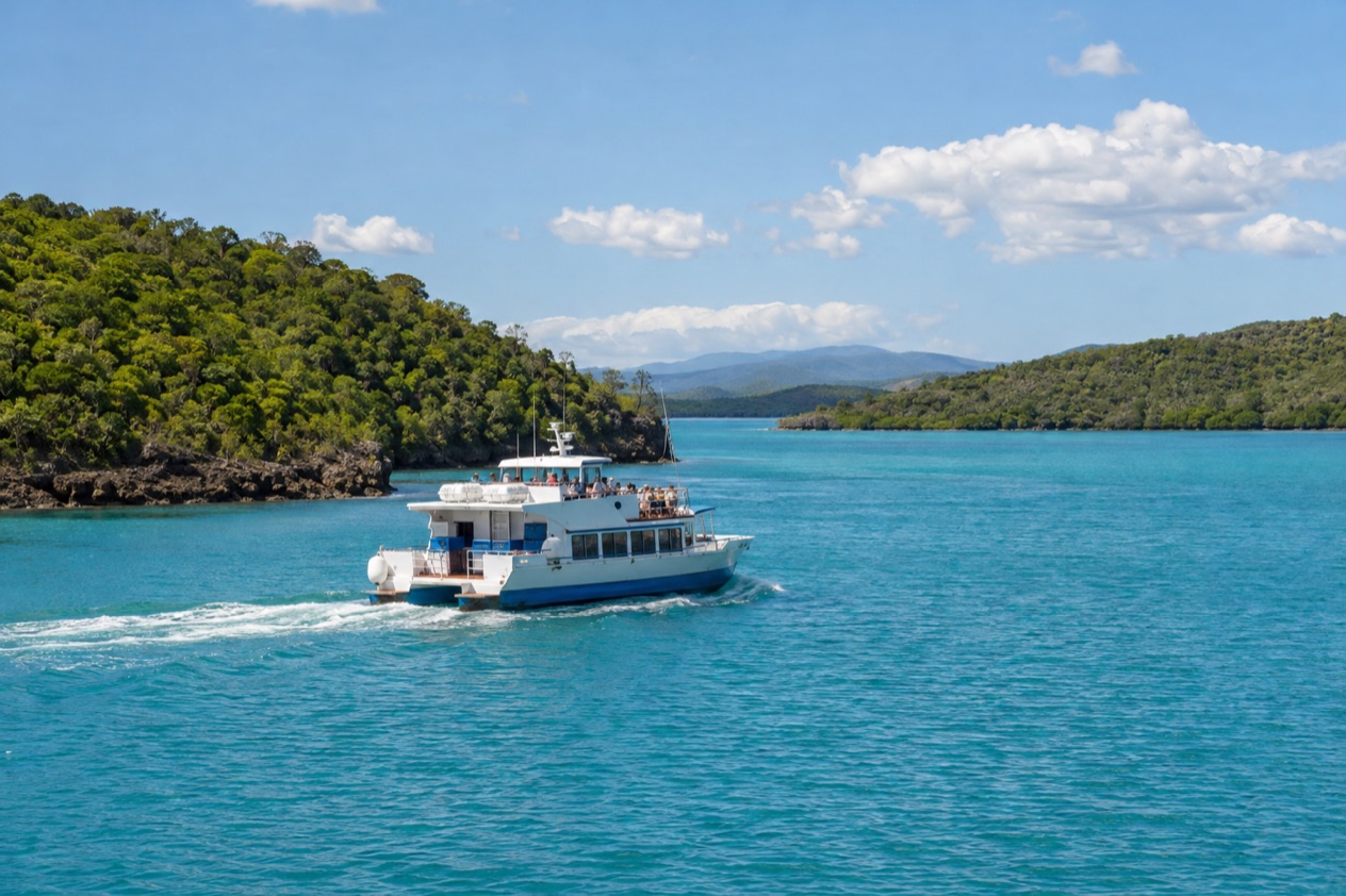
A ferry links San Juan and Cataño across the bay, a short ride that gives you a view of the old city walls and the harbor. On the south coast, a ferry runs between Ponce and Caja de Muertos, an island that is a popular outing from the city.
San Juan Port, with facilities in Old San Juan, the Pan American Port Terminal and Puerto Nuevo Bay, is the main port of the island. The Port of Ponce is the second largest and handles cruise ships as well as cargo. The Port of Mayagüez is the third largest, and it is also home to the passenger ferry to the Dominican Republic.
How do you get to the islands of Culebra and Vieques?
Culebra and Vieques are accessible via a ferry out of Ceiba or a flight, as both islands maintain their own airports. Ferries operate on the Ceiba-Culebra and Ceiba-Vieques routes, and the town of Ceiba, on the northeast coast, is the jumping-off point for both.
Getting to Ceiba
Ceiba sits on the northeast coast, south of Fajardo and north of Naguabo, about an hour’s drive from San Juan. The old Roosevelt Roads Naval Station, which closed in 2004, was once here, and the town now has José Aponte de la Torre Airport with mostly domestic flights.
If you have time before a boat, Ceiba has more to offer than a parking lot. Playa Los Machos, the mangroves at Medio Mundo y Daguao and Charco Frío y Las Tinajas are all in the municipality. The patron saint festival, in June, brings parades, artisans, regional food and live music.
Culebra
Culebra lies about 17 miles northeast of the main island and is small, roughly 7 by 5 miles. It is known for Flamenco Beach, where two old Sherman tanks used for target practice sit rusting near the sand, and for Tortuga Beach on Culebrita, protected by the national wildlife refuge.
The island is arid, with no rivers or streams, and its fresh water arrives by undersea pipeline from the main island via Vieques. Feral chickens roam freely across much of it, and leatherback, green and hawksbill turtles use its beaches for nesting. Seabirds return to the sanctuaries here each year, in one of the oldest bird refuges on U.S. territory.
Vieques
Vieques is about 8 miles east of the main island and stretches roughly 20 miles long. Its east end holds some of its best known beaches, including Caracas Beach and Blue Beach. Some of that land is open to the public, but much remains closed because of contamination or unexploded ordnance.
The island’s other draw is Mosquito Bay, also called Puerto Mosquito, named the brightest bioluminescent bay in the world by Guinness World Records in 2006. The glow is a chance rather than a promise. Culebra lies about 9 miles northeast of Vieques, but the usual way to reach either island is from Ceiba.
Good to know before you go
Payments are in U.S. dollars, and on the road the one thing that surprises visitors is the toll system, since cash is not taken on most tollways. The Atlantic hurricane season runs from June 1 to November 30, with the peak around the second week of September, so if you travel in those months, follow the National Hurricane Center and local official alerts, especially if ferries or flights are part of your plan. Ferries and small-island flights can be affected when the weather turns, so leave a little slack around those days.
Sources
- Wikipedia, Transportation in Puerto Rico (https://en.wikipedia.org/wiki/Transportation_in_Puerto_Rico), checked October 8, 2026
- Wikipedia, AutoExpreso tolls (https://en.wikipedia.org/wiki/AutoExpreso), checked October 8, 2026
- Wikipedia, Ceiba (https://en.wikipedia.org/wiki/Ceiba,_Puerto_Rico), checked October 8, 2026
- Wikipedia, Culebra (https://en.wikipedia.org/wiki/Culebra,_Puerto_Rico), checked October 8, 2026
- Wikipedia, Vieques (https://en.wikipedia.org/wiki/Vieques,_Puerto_Rico), checked October 8, 2026
- NOAA National Hurricane Center, Climatology (https://www.nhc.noaa.gov/climo/), checked October 8, 2026
To plan your stay
- Best Time to Visit Puerto Rico: Dry Season, Hurricane Season, Beaches and Festivals
- Things to Do in Puerto Rico: Old San Juan, Beaches, Bioluminescent Bays and Island Food
- Where to Stay in Puerto Rico: San Juan, Rincon, Vieques and the Best Areas for Your Trip
- Know Before You Go to Puerto Rico: ID, Money, Getting Around and Local Customs