
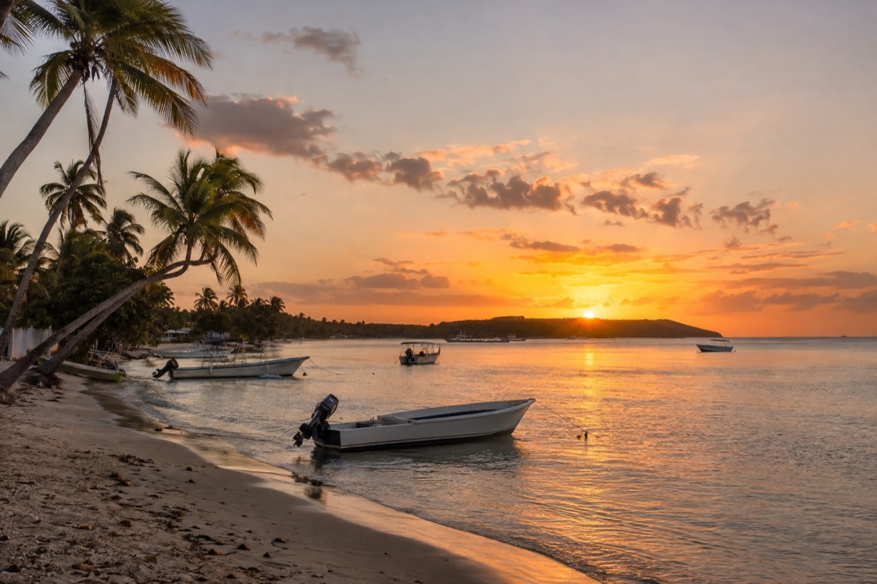
The first thing you notice in Boqueron is the sound: music drifting from open-air bars, pans clattering in seafood kitchens, and a crowd strolling the center in flip-flops with a cold drink in hand. Then the bay opens up, bright and wide, with fishing boats and the long public beach curving beside the village. This is the lively side of Cabo Rojo, on Puerto Rico’s southwest coast, and it suits anyone who wants a beach day that ends with fresh seafood and a late evening out.
Is visiting Boqueron, Cabo Rojo worth it?
Yes, especially if you like your beach time mixed with good food, people-watching and a bit of nature on the side. Boqueron is one of the main attractions of the southwestern part of the island, and it works for couples, groups of friends and families who want a village they can walk around without much planning.
What sets it apart from other coastal stops nearby is how much happens within a short stroll. The beach, the restaurants and the bars of El Poblado sit close together, so you can go from sand to a plate of fried seafood to a drink at sunset without getting back in a car.
Weekends feel like a street party, with the center closed to cars and the pace slowing to a walk. Add the bird-rich salt flats and the lighthouse cliffs a short way off, and a single base covers beach, food, wildlife and views.
It is less suited to travelers who want a silent, empty shore or an early night on a Saturday. The village is at its busiest when Puerto Ricans arrive for the weekend, and the energy runs late. If that sounds like fun, the place delivers. If not, a weekday visit gives a very different, calmer village.
What to see at Boqueron, Cabo Rojo
El Poblado, the village center
El Poblado is the heart of Boqueron and the reason many people come. Small restaurants and open-air bars line the streets, and the menus lean heavily on seafood: fried fish, conch salad, shrimp, and the raw oysters and clams that street-side stands have long been known for. Stalls sell frituras such as alcapurrias (fritters made from grated root vegetables and filled with meat) and pinchos (grilled skewers) when you want something quick.
Cars are not permitted in the center on weekends, so the streets turn into a pedestrian zone. That makes an evening stroll easy and pleasant, with music from several bars overlapping. The village is also known as LGBT friendly, and a growing Pride Parade takes place each year in June. A parador, a countryside-style inn, sits in the village if you want to stay within walking distance of everything.
Balneario de Boqueron
The public beach is managed by the Puerto Rican government and was awarded Blue Flag status by the Foundation for Environmental Education, a mark tied to water quality and beach management. It is a long, flat stretch of sand backed by trees, with shade, picnic spots and a relaxed, family-friendly feel during the day.
Conditions change from day to day, so look at the sea before you go in, and follow any flag, sign or lifeguard instruction you find on the beach. In the late afternoon, locals gather under the trees, and the light over the bay turns golden. It is a good place for a long, unhurried afternoon with a book.
Cabo Rojo Salt Flats and the wildlife refuge
Part of the Cabo Rojo National Wildlife Refuge, the Salt Flats Unit is a wide landscape of shallow pools, pink-tinged water and mangrove edges where shorebirds feed. It was the first site in the Caribbean designated by the Western Hemisphere Shorebird Reserve Network, and it is the only place on the island where Snowy Plover nests have been recorded. It also stands as a migration stopover between North and South America.
An observation tower gives you a view across the pools, and three trails wander through mangrove forest that includes all four mangrove species found in Puerto Rico. Bring binoculars if you have them. Birders also hope for the endangered yellow-shouldered blackbird in the wider refuge.
Los Morrillos Lighthouse and the salt mines
El Faro de Los Morrillos was built in 1881 and stands on limestone cliffs about 200 feet above the sea. The white tower and the sheer, pale rock below make it one of the most photographed sights in the region. This is where the name Cabo Rojo, red cape, makes sense: the cliffs and the salt flats take on reddish tones, especially in late-day light.
The salt mines nearby are reported to be the oldest industry in the New World, worked continuously since the time of the Taínos. Pair the lighthouse with the salt flats for a half day that feels very different from the village beach: wind, open horizons, and the sound of waves below the cliffs.
Hours, tickets and rules
The refuge’s Salt Flats Unit keeps daytime hours. The observation tower is open most of the week, and the interpretive center opens on fewer days, so plan the nature stop for a daytime slot and keep the evening for the village.
| Site | Open |
|---|---|
| Salt Flats Unit observation tower, Cabo Rojo National Wildlife Refuge | Monday to Saturday, 8:00 AM to 3:30 PM |
| Salt Flats Interpretive Center | Wednesday to Saturday, 8:00 AM to 3:30 PM |
The main road to the refuge headquarters is temporarily closed, but visitors are invited to the Salt Flats Unit instead. The Centro Interpretativo Las Salinas de Cabo Rojo don Efren Perez Rivera offers free guided tours of the local area. In El Poblado, cars are not permitted in the center on weekends. The beach is a public one run by the Puerto Rican government.
How to get to Boqueron, Cabo Rojo
Boqueron sits on Boqueron Bay in the municipality of Cabo Rojo, on the southwest coast of the island, and the nearest airport with international destinations is Rafael Hernandez Airport in Aguadilla, about forty-five minutes away. That makes the northwest corner of Puerto Rico the easiest gateway for a trip focused on this area, particularly if you are combining it with Rincon or other west-coast towns.
Because the village is a barrio of Cabo Rojo, it also makes sense as a base for the rest of the municipality. The fishing village of Puerto Real and the string of seafood restaurants in Joyuda are both part of the same coast, and the town of Cabo Rojo itself, with its main square and its church built between 1773 and 1783, sits close by. Seeing them all in one trip is easy once you are in the area.
Once in Boqueron, plan to arrive and then walk. The center is closed to cars on weekends, so you will leave your vehicle outside the pedestrian zone and explore on foot, which suits the compact layout of the village. If you stay at the parador or elsewhere in El Poblado, the beach, the restaurants and the bars are all within an easy walk.
For the salt flats and the lighthouse, you will head out of the village toward the southwestern tip of the municipality, where the landscape turns drier and more open. The scenery changes quickly from the bay’s palm-lined shore to scrubby cliffs and pale salt pans, and that shift is part of the pleasure of the drive.
When to visit Boqueron, Cabo Rojo
For a beach day, the drier months from about December to April are the most dependable, with plenty of sun and the usual trade winds. The southwest is among the drier parts of the island, which helps. Summer is hotter and more humid, with afternoon showers possible, though it brings a lively holiday mood to the village.
Time of day matters as much as month. Mornings are best for the salt flats and the refuge, when birds are active, the air is cooler and the tower and center are open. The middle of the day suits the beach shade or a long seafood lunch, and late afternoon is the moment for the lighthouse cliffs, when the red tones of the rock deepen. Evenings belong to El Poblado.
Weekends bring crowds and music, and the pedestrian-only center is at its liveliest then. Weekdays are quieter, better for a calm beach day and easier conversations at restaurant tables. June is the month of the village’s Pride Parade, and September brings the Fiestas Patronales de San Miguel Arcangel in Cabo Rojo, with parades, games, regional food and live entertainment.
Keep the hurricane calendar in mind when planning. The Atlantic season runs from June 1 to November 30, with the peak on September 10 and most activity between mid-August and mid-October. Outside those months the odds of a storm disrupting a trip are lower, but forecasts change quickly. Follow the National Hurricane Center and local official alerts if you travel in season.
Tips for your visit
Pack for sun and sand: sunscreen, a hat, a swimsuit, a light cover-up for restaurants and sandals you can walk the village in all evening. Bring binoculars and a water bottle for the salt flats. A small dry bag helps if you plan to move between the beach and the bars.
A good day here has a slow arc. Return to El Poblado when the lights come on. Allow a full day for that circuit, or split it across two days if you like long lunches and lingering evenings.
Nearby, you can add the fishing village of Puerto Real and the seafood restaurants of Joyuda, as well as Laguna Rincon, which lies within Boqueron. The Boqueron State Forest is one of seven state forests managed by the Department of Natural and Environmental Resources. Cabo Rojo as a whole counts a great many beaches, 127 in all, including Playa Sucia, so beach-hoppers have plenty to explore.
Families will find the public beach easy to spend a day on, with shade and space for picnics. The walkable center helps anyone who prefers not to drive at night.
Good to know before you go
Puerto Rico uses the U.S. dollar, and U.S. citizens need no passport and no visa. Boqueron is a social, nightlife-oriented village, so use the same habits you would in any busy beach town: keep valuables out of sight on the sand and keep an eye on your drinks and belongings. Come with an easy plan and leave room for a long dinner, because the best part of Boqueron is often the unplanned hour that follows it.
Sources
- Wikipedia, Boquerón (https://en.wikipedia.org/wiki/Boquerón,_Cabo_Rojo,_Puerto_Rico), checked October 8, 2026
- Wikipedia, Cabo Rojo (https://en.wikipedia.org/wiki/Cabo_Rojo,_Puerto_Rico), checked October 8, 2026
- U.S. Fish and Wildlife Service, Cabo Rojo National Wildlife Refuge (https://www.fws.gov/refuge/cabo-rojo), checked October 8, 2026
- NOAA National Hurricane Center, Climatology (https://www.nhc.noaa.gov/climo/), checked October 8, 2026
To plan your stay
- Best Time to Visit Puerto Rico: Dry Season, Hurricane Season, Beaches and Festivals
- Where to Stay in Puerto Rico: San Juan, Rincon, Vieques and the Best Areas for Your Trip
- Getting Around Puerto Rico: Rental Cars, Tolls, Carros Publicos and Ferries to Culebra and Vieques
- Know Before You Go to Puerto Rico: ID, Money, Getting Around and Local Customs