
Somewhere between a caldera lake in Hokkaido and a sandbar off Shodo Island, a trip to Japan stops being about cities and starts being about landscape. Japan’s national parks are the frame around many of those places, from the volcanic country around Fuji to the highlands of Daisetsuzan. They are zoned, partly private lands rather than single fenced reserves, and that shapes how you plan a visit.
Which national parks does Japan have?
Japan has a growing list of national parks, which grew from three at the start to well over thirty, and the most recent addition came in Hokkaido. Together they take in mountains, volcanoes, island seas and forests, and each one is designated by the national government as a place to protect and to visit.
The first three parks
The system began in March 1934 with Setonaikai, Unzen and Kirishima. The three are very different places. Setonaikai is the Seto Inland Sea with its scattered islands, Unzen is a volcanic area in Nagasaki Prefecture, and Kirishima is a volcanic range.
That first group also tells you something about the idea behind the parks. They were chosen as representative landscapes, a sea, a volcano and a mountain range, rather than as a single showpiece.
How the count has grown
By April 2014, Japan had 31 national parks covering a little over five percent of the land area. The list kept growing after that. On June 25, 2024, Hidaka-sanmyaku Erimo Quasi-National Park was redesignated as Hidakasanmyaku-Erimo-Tokachi National Park, which made it the 35th.
The step from quasi-national park to national park matters, because Japan keeps two tiers. Quasi-national parks sit one rank below, and a redesignation lifts a place into the first tier. Hokkaido, already home to several of the older parks, gained another this way.
Ogasawara and the map
One park is easy to miss on a map of the system. Ogasawara National Park is not visible on the map of Japan’s national parks, so a map is a poor way to count the list. Treat it as a reminder that the parks include places far from the main islands, and read the park list itself rather than only the map.
Which are best known?
Five parks stand out in the record for their size, their region and their age: Akan Mashu, Daisetsuzan, Setonaikai, Nikko and Fuji-Hakone-Izu. Two lie in Hokkaido, two in the Kanto region, and Setonaikai stretches across four regions at once.
| Park | Established | Region | Area (hectares) | Area (acres) |
|---|---|---|---|---|
| Akan Mashu | 1934 | Hokkaido | 90,481 | 223,580 |
| Daisetsuzan | 1934 | Hokkaido | 226,764 | 560,350 |
| Setonaikai | 1934 | Kinki, Chugoku, Shikoku, Kyushu | 67,242 | 166,160 |
| Nikko | 1934 | Kanto | 114,908 | 283,940 |
| Fuji-Hakone-Izu | 1936 | Kanto | 121,695 | 300,710 |
The Hokkaido parks: Akan Mashu and Daisetsuzan
Daisetsuzan is the larger of the two Hokkaido parks in the table, and the size shows in the way it is described as a mountain park rather than a single destination. Akan Mashu is smaller and is the one tied to lake country. Both belong to the first wave of designations.
Elsewhere on the island, other landscapes sit apart from these two parks. Drift ice cruises operate from Abashiri, and Hell Valley (Jigokudani) is in Noboribetsu. These are places to pair with a Hokkaido route, though the parks themselves are the structure around which a longer visit to the island is easy to build.
Nikko and Fuji-Hakone-Izu in the Kanto region
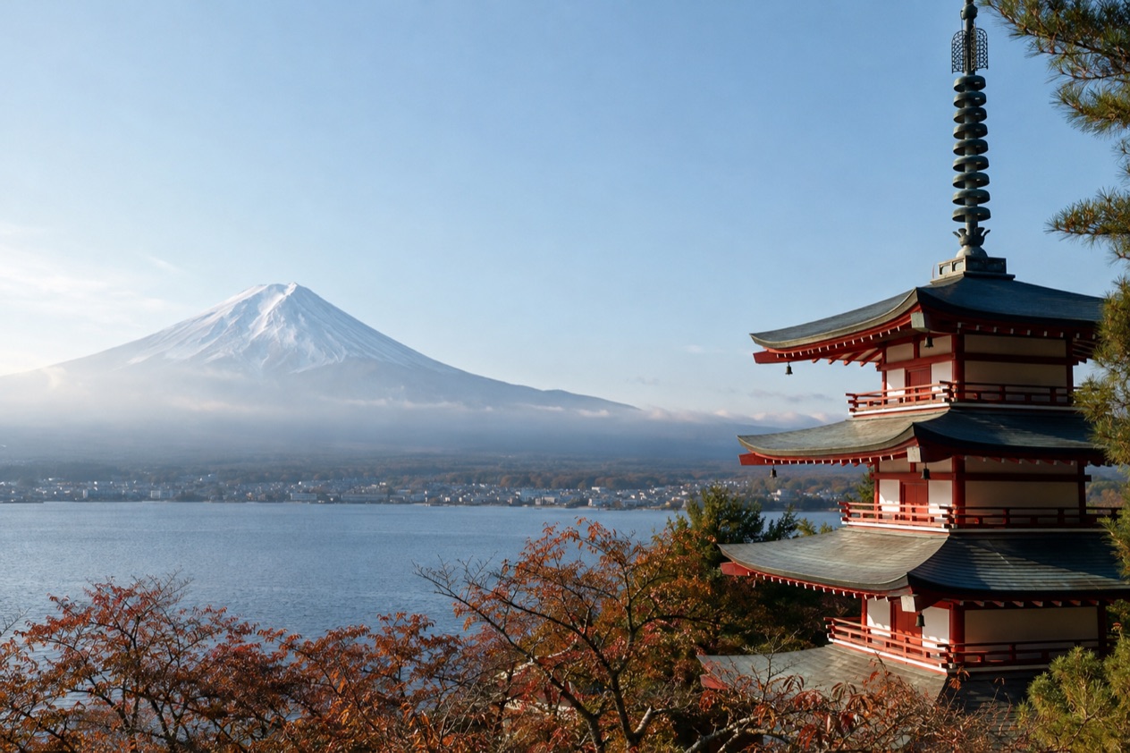
Nikko and Fuji-Hakone-Izu are both in the Kanto region, and between them they cover a large stretch of mountain, lake and volcanic land. Nikko dates to the first designations, while Fuji-Hakone-Izu followed two years later. Fuji-Hakone-Izu is the larger of the two.
Their names point to places that many itineraries are organized around: Nikko, Hakone and the area around Mount Fuji. A park is a wider unit than any of those towns, so the name on a map covers more ground than the trailhead or the village you book.
Setonaikai, the park that spans four regions
Setonaikai spans the Kinki, Chugoku, Shikoku and Kyushu regions, so it has no single home base. It is the Seto Inland Sea as a park, a landscape of water and islands rather than one mountain or one lake.
Shodo Island, with the Angel Road sandbar in Tonosho, Kagawa Prefecture, belongs to the same inland sea world. Whether a given sight sits inside the park boundary is a separate question, and Angel Road is best read simply as a place on the island.
Other natural sights across Japan
Not every landscape worth a detour is part of the parks list. The Tottori Sand Dunes are in Tottori Prefecture, in the Chugoku region. The Zao Snow Monsters occur in Zao, Yamagata Prefecture, and the Tateyama Snow Walls are in Tateyama, Toyama Prefecture.
The Mount Unzen Disaster Memorial is in Shimabara, Nagasaki Prefecture, a reminder that a volcano is a living landscape as well as a view. Each of these is tied to one prefecture, and none of them is a stand-in for another place.
How do you visit them?
You visit Japan’s national parks by treating each one as a zoned area with its own rules, not as a gated attraction with a single entrance. Each national and quasi-national park is divided into ordinary, special and marine park zones, and the zone you are in decides how much access and use is allowed.
What the zones mean on the ground
These restrict access and use in order to preserve the land, so the closer a place is to the special protection end, the tighter the limits.
Ordinary zones sit at the other end and are less restricted. Marine park zones cover the sea. For a traveler, the practical meaning is that two spots inside the same park can have quite different rules, and the sign at the site, not the park name, is what governs it.
A park of mixed ownership
The state owns only about half of the land in Japan’s national and quasi-national parks. The rest belongs to others, so villages, farms, hot spring towns and private holdings sit inside park boundaries.
That explains why a park can feel like a patchwork. A road, an inn and a trailhead may all share the same designation. Planning around a base town and the places near it works better than looking for a single gate.
Planning by region
Because the parks are spread across regions, it helps to plan by region. Hokkaido holds the large parks of Akan Mashu and Daisetsuzan. The Kanto region holds Nikko and Fuji-Hakone-Izu. Setonaikai crosses four regions, so it can join a Kansai, Shikoku or Kyushu route.
Matching a park to the region you are already crossing keeps the plan realistic. The JNTO sights above, from Abashiri to Tottori, can fill gaps between the parks in the same way.
Good to know before you go
Read the zone rules at each site and follow them, since they exist to protect the land. Expect that a park may include villages and private property, so respect those boundaries as you would anywhere. Seasonal sights such as the Zao Snow Monsters, the Tateyama Snow Walls and the drift ice at Abashiri belong to winter and spring in the places that host them, so match the season to the sight before you build a route around it.
Sources
- Japan National Tourism Organization, natural wonders (https://www.japan.travel/en/things-to-do/attraction/natural-wonder/), checked October 11, 2026
- Wikipedia, List of national parks of Japan (https://en.wikipedia.org/wiki/List_of_national_parks_of_Japan), checked October 11, 2026
To plan your stay
- Best Time to Visit Japan: Cherry Blossoms, Autumn Colors, Weather and Festivals
- Where to Stay in Japan: Ryokan, Temple Stays, Capsule Hotels and the Best Cities to Base In
- Sending Luggage from the Airport in Japan: Hands-Free Travel, Hotel Delivery and Coin Lockers
- Know Before You Go to Japan: Entry, Money, Etiquette and Getting Around